
 _    __ _  __ __        ____   _
| |  / /(_)/ // /____ _ / __ \ (_)_____ ____   _____ __  __ ____ ___
| | / // // // // __ `// /_/ // // ___// __ \ / ___// / / // __ `__ \
| |/ // // // // /_/ // ____// // /   / /_/ // /   / /_/ // / / / / /
|___//_//_//_/ \__,_//_/    /_//_/    \____//_/    \__,_//_/ /_/ /_/
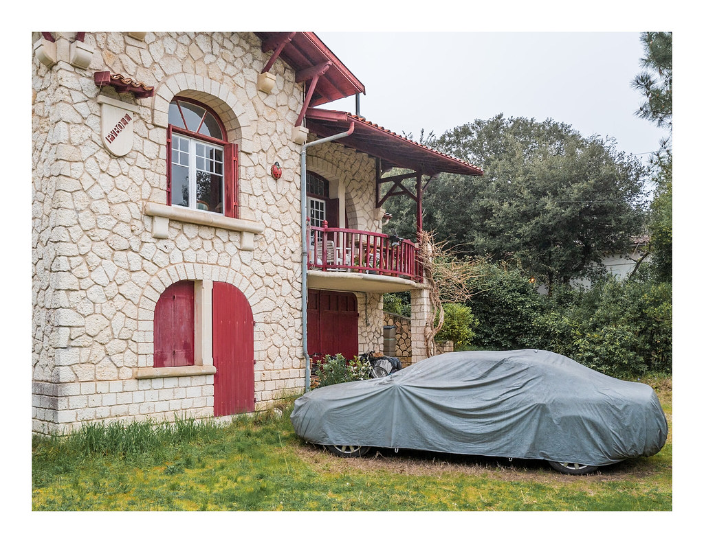
La Villa Pirorum de Saint-Palais sur Mer : La nouvelle résidence des Villepreux !
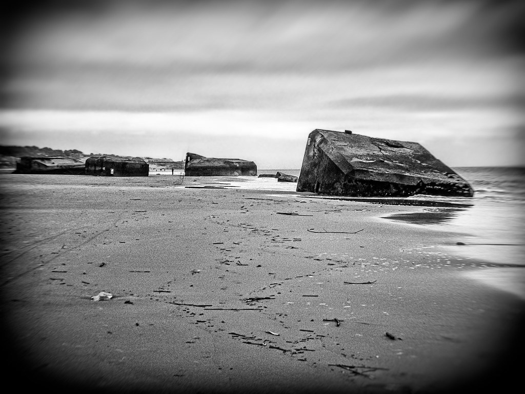
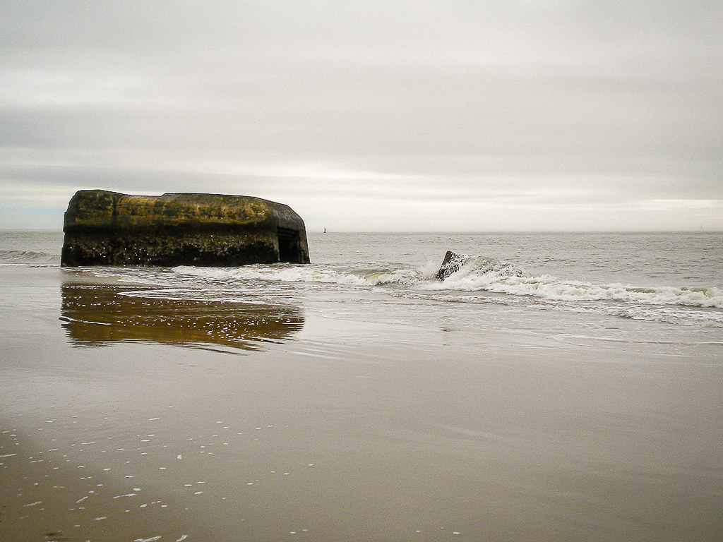
Live cam sur la plage du Bureau ! A 50m de la maison ! Voir en plein écran !
Les photos de la communauté.


<div class="mw-content-ltr mw-parser-output" lang="fr" dir="ltr"><div class="bandeau-container metadata homonymie hatnote"><div class="bandeau-cell bandeau-icone" style="display:table-cell;padding-right:0.5em"><span class="noviewer" typeof="mw:File"><a target="_blank" href="https://fr.wikipedia.org/wiki/Aide:Homonymie" title="Aide:Homonymie"><img alt="Page d’aide sur l’homonymie" src="//upload.wikimedia.org/wikipedia/commons/thumb/a/a9/Logo_disambig.svg/20px-Logo_disambig.svg.png" decoding="async" width="20" height="15" class="mw-file-element" srcset="//upload.wikimedia.org/wikipedia/commons/thumb/a/a9/Logo_disambig.svg/30px-Logo_disambig.svg.png 1.5x, //upload.wikimedia.org/wikipedia/commons/thumb/a/a9/Logo_disambig.svg/40px-Logo_disambig.svg.png 2x" data-file-width="512" data-file-height="375" /></a></span></div><div class="bandeau-cell" style="display:table-cell;padding-right:0.5em">
<p>Pour les articles homonymes, voir <a target="_blank" href="https://fr.wikipedia.org/wiki/Saint-Palais" class="mw-disambig" title="Saint-Palais">Saint-Palais</a>.
</p>
</div></div>
<div class="bandeau-container metadata homonymie hatnote"><div class="bandeau-cell bandeau-icone" style="display:table-cell;padding-right:0.5em"><span class="noviewer" typeof="mw:File"><a target="_blank" href="https://fr.wikipedia.org/wiki/Aide:Homonymie" title="Aide:Homonymie"><img alt="Page d’aide sur l’homonymie" src="//upload.wikimedia.org/wikipedia/commons/thumb/6/6f/Confusion_colour.svg/20px-Confusion_colour.svg.png" decoding="async" width="20" height="15" class="mw-file-element" srcset="//upload.wikimedia.org/wikipedia/commons/thumb/6/6f/Confusion_colour.svg/30px-Confusion_colour.svg.png 1.5x, //upload.wikimedia.org/wikipedia/commons/thumb/6/6f/Confusion_colour.svg/40px-Confusion_colour.svg.png 2x" data-file-width="260" data-file-height="200" /></a></span></div><div class="bandeau-cell" style="display:table-cell;padding-right:0.5em">
<p>Ne doit pas être confondu avec <a target="_blank" href="https://fr.wikipedia.org/wiki/Palais_de_la_Mer" title="Palais de la Mer">Palais de la Mer</a>.
</p>
</div></div>
<p class="mw-empty-elt">
</p>
<table class="infobox_v2 infobox--frwiki noarchive">
<tbody><tr>
<td colspan="2" class="entete entete map" style="background-color:#DDFFDD;color:black;">Saint-Palais-sur-Mer<style data-mw-deduplicate="TemplateStyles:r151886662">.mw-parser-output .entete.map{background-image:url("//upload.wikimedia.org/wikipedia/commons/7/7a/Picto_infobox_map.png")}</style>
</td></tr>
<tr><td colspan="2" style="text-align:center; line-height: 1.5em;"><span typeof="mw:File/Frameless"><a target="_blank" href="https://fr.wikipedia.org/wiki/Fichier:Saint-Palais-sur-Mer_Carrelets_remis_%C3%A0_neuf_2014.jpg" class="mw-file-description"><img alt="Saint-Palais-sur-Mer" src="//upload.wikimedia.org/wikipedia/commons/thumb/8/80/Saint-Palais-sur-Mer_Carrelets_remis_%C3%A0_neuf_2014.jpg/280px-Saint-Palais-sur-Mer_Carrelets_remis_%C3%A0_neuf_2014.jpg" decoding="async" width="280" height="185" class="mw-file-element" srcset="//upload.wikimedia.org/wikipedia/commons/thumb/8/80/Saint-Palais-sur-Mer_Carrelets_remis_%C3%A0_neuf_2014.jpg/420px-Saint-Palais-sur-Mer_Carrelets_remis_%C3%A0_neuf_2014.jpg 1.5x, //upload.wikimedia.org/wikipedia/commons/thumb/8/80/Saint-Palais-sur-Mer_Carrelets_remis_%C3%A0_neuf_2014.jpg/560px-Saint-Palais-sur-Mer_Carrelets_remis_%C3%A0_neuf_2014.jpg 2x" data-file-width="4928" data-file-height="3264" /></a></span>
</td></tr>
<tr>
<td colspan="2" align="center"><span typeof="mw:File"><a target="_blank" href="https://fr.wikipedia.org/wiki/Fichier:Blason_ville_fr_Saint-Palais-sur-Mer_(Charente-Maritime).svg" class="mw-file-description" title="Blason de Saint-Palais-sur-Mer"><img alt="Blason de Saint-Palais-sur-Mer" src="//upload.wikimedia.org/wikipedia/commons/thumb/2/24/Blason_ville_fr_Saint-Palais-sur-Mer_%28Charente-Maritime%29.svg/65px-Blason_ville_fr_Saint-Palais-sur-Mer_%28Charente-Maritime%29.svg.png" decoding="async" width="65" height="72" class="mw-file-element" srcset="//upload.wikimedia.org/wikipedia/commons/thumb/2/24/Blason_ville_fr_Saint-Palais-sur-Mer_%28Charente-Maritime%29.svg/98px-Blason_ville_fr_Saint-Palais-sur-Mer_%28Charente-Maritime%29.svg.png 1.5x, //upload.wikimedia.org/wikipedia/commons/thumb/2/24/Blason_ville_fr_Saint-Palais-sur-Mer_%28Charente-Maritime%29.svg/130px-Blason_ville_fr_Saint-Palais-sur-Mer_%28Charente-Maritime%29.svg.png 2x" data-file-width="600" data-file-height="660" /></a></span><br /><small><a class="mw-selflink-fragment" target="_blank" href="#Héraldique">Blason</a>
</small></td>
</tr><tr>
<th colspan="2" style="padding:4px; text-align:center; background-color:#DDFFDD; color:#000000">Administration</th></tr>
<tr>
<th scope="row"><a target="_blank" href="https://fr.wikipedia.org/wiki/Liste_des_pays_du_monde" title="Liste des pays du monde">Pays</a>
</th>
<td><span class="datasortkey" data-sort-value="France"><span class="flagicon"><span class="mw-image-border noviewer" typeof="mw:File"><a target="_blank" href="https://fr.wikipedia.org/wiki/Fichier:Flag_of_France.svg" class="mw-file-description" title="Drapeau de la France"><img alt="Drapeau de la France" src="//upload.wikimedia.org/wikipedia/commons/thumb/c/c3/Flag_of_France.svg/20px-Flag_of_France.svg.png" decoding="async" width="20" height="13" class="mw-file-element" srcset="//upload.wikimedia.org/wikipedia/commons/thumb/c/c3/Flag_of_France.svg/30px-Flag_of_France.svg.png 1.5x, //upload.wikimedia.org/wikipedia/commons/thumb/c/c3/Flag_of_France.svg/40px-Flag_of_France.svg.png 2x" data-file-width="900" data-file-height="600" /></a></span> </span><a target="_blank" href="https://fr.wikipedia.org/wiki/France" title="France">France</a></span>
</td>
</tr>
<tr>
<th scope="row"><a target="_blank" href="https://fr.wikipedia.org/wiki/R%C3%A9gion_fran%C3%A7aise" title="Région française">Région</a>
</th>
<td><a target="_blank" href="https://fr.wikipedia.org/wiki/Nouvelle-Aquitaine" title="Nouvelle-Aquitaine">Nouvelle-Aquitaine</a>
</td>
</tr>
<tr>
<th scope="row"><a target="_blank" href="https://fr.wikipedia.org/wiki/D%C3%A9partement_fran%C3%A7ais" title="Département français">Département</a>
</th>
<td><a target="_blank" href="https://fr.wikipedia.org/wiki/Charente-Maritime" title="Charente-Maritime">Charente-Maritime</a>
</td>
</tr>
<tr>
<th scope="row"><a target="_blank" href="https://fr.wikipedia.org/wiki/Arrondissement_fran%C3%A7ais" title="Arrondissement français">Arrondissement</a>
</th>
<td><a target="_blank" href="https://fr.wikipedia.org/wiki/Arrondissement_de_Rochefort" title="Arrondissement de Rochefort">Rochefort</a>
</td>
</tr>
<tr>
<th scope="row"><a target="_blank" href="https://fr.wikipedia.org/wiki/Intercommunalit%C3%A9_en_France" title="Intercommunalité en France">Intercommunalité</a>
</th>
<td><a target="_blank" href="https://fr.wikipedia.org/wiki/Communaut%C3%A9_d%27agglom%C3%A9ration_Royan_Atlantique" title="Communauté d'agglomération Royan Atlantique">Communauté d'agglomération Royan Atlantique</a>
</td>
</tr>
<tr>
<th scope="row"><a target="_blank" href="https://fr.wikipedia.org/wiki/Maire_(France)" title="Maire (France)">Maire</a> <br /><a target="_blank" href="https://fr.wikipedia.org/wiki/Mandat_politique" title="Mandat politique">Mandat</a>
</th>
<td>Claude Baudin <br /><a target="_blank" href="https://fr.wikipedia.org/wiki/%C3%89lections_municipales_de_2020_en_Charente-Maritime" title="Élections municipales de 2020 en Charente-Maritime">2020</a>-2026
</td>
</tr>
<tr>
<th scope="row"><a target="_blank" href="https://fr.wikipedia.org/wiki/Code_postal_en_France" title="Code postal en France">Code postal</a>
</th>
<td>17420
</td>
</tr>
<tr>
<th scope="row"><a target="_blank" href="https://fr.wikipedia.org/wiki/Code_officiel_g%C3%A9ographique#Code_commune" title="Code officiel géographique">Code commune</a>
</th>
<td>17380
</td>
</tr>
<tr>
<th colspan="2" style="padding:4px; text-align:center; background-color:#DDFFDD; color:#000000">Démographie</th></tr>
<tr>
<th scope="row"><a target="_blank" href="https://fr.wikipedia.org/wiki/Gentil%C3%A9" title="Gentilé">Gentilé</a>
</th>
<td>Saint-Palaisiens
</td>
</tr>
<tr>
<th scope="row"><a target="_blank" href="https://fr.wikipedia.org/wiki/Recensement_de_la_population_en_France" title="Recensement de la population en France">Population<br />municipale</a>
</th>
<td>3 918 <abbr class="abbr" title="habitant">hab.</abbr> <small>(2021 <span class="noviewer" typeof="mw:File"><span title="en augmentation de 1,11 % par rapport à 2015"><img alt="en augmentation de 1,11 % par rapport à 2015" src="//upload.wikimedia.org/wikipedia/commons/thumb/b/b0/Increase2.svg/11px-Increase2.svg.png" decoding="async" width="11" height="11" class="mw-file-element" srcset="//upload.wikimedia.org/wikipedia/commons/thumb/b/b0/Increase2.svg/17px-Increase2.svg.png 1.5x, //upload.wikimedia.org/wikipedia/commons/thumb/b/b0/Increase2.svg/22px-Increase2.svg.png 2x" data-file-width="300" data-file-height="300" /></span></span>en augmentation de 1,11 % par rapport à 2015)</small>
</td>
</tr>
<tr>
<th scope="row" style="vertical-align: bottom"><a target="_blank" href="https://fr.wikipedia.org/wiki/Densit%C3%A9_de_population" title="Densité de population">Densité</a></th>
<td>250 <abbr class="abbr" title="habitant par kilomètre carré">hab./km<sup>2</sup></abbr></td></tr>
<tr>
<th colspan="2" style="padding:4px; text-align:center; background-color:#DDFFDD; color:#000000">Géographie</th></tr>
<tr>
<th scope="row"><a target="_blank" href="https://fr.wikipedia.org/wiki/Coordonn%C3%A9es_g%C3%A9ographiques" title="Coordonnées géographiques">Coordonnées</a> </th><td><a class="mw-kartographer-maplink" data-mw-kartographer="maplink" data-style="osm-intl" target="_blank" href="https://fr.wikipedia.org/wiki/Sp%C3%A9cial:Map/9/45.6438888889/-1.08694444444/fr" data-zoom="9" data-lat="45.6438888889" data-lon="-1.08694444444" data-overlays="["_4d533af498b9b516cf39cda59b0cae6877934706"]">45° 38′ 38″ nord, 1° 05′ 13″ ouest</a> </td></tr>
<tr>
<th scope="row"><a target="_blank" href="https://fr.wikipedia.org/wiki/Altitude" title="Altitude">Altitude</a>
</th>
<td>Min. 0 <abbr class="abbr" title="mètre">m</abbr><br />Max. 50 <abbr class="abbr" title="mètre">m</abbr>
</td>
</tr>
<tr>
<th scope="row"><a target="_blank" href="https://fr.wikipedia.org/wiki/Aire_(g%C3%A9om%C3%A9trie)#Superficie" title="Aire (géométrie)">Superficie</a>
</th>
<td>15,69 <abbr class="abbr" title="kilomètre carré">km<sup>2</sup></abbr>
</td>
</tr>
<tr>
<th scope="row">Type
</th>
<td>Commune urbaine
</td>
</tr>
<tr>
<th scope="row"><a target="_blank" href="https://fr.wikipedia.org/wiki/Unit%C3%A9_urbaine_en_France" title="Unité urbaine en France">Unité urbaine</a>
</th>
<td><a target="_blank" href="https://fr.wikipedia.org/wiki/Unit%C3%A9_urbaine_de_Royan" title="Unité urbaine de Royan">Royan</a> <br /><small>(<a target="_blank" href="https://fr.wikipedia.org/wiki/Banlieue" title="Banlieue">banlieue</a>)</small>
</td>
</tr>
<tr>
<th scope="row"><a target="_blank" href="https://fr.wikipedia.org/wiki/Aire_d%27attraction_d%27une_ville" title="Aire d'attraction d'une ville">Aire d'attraction</a>
</th>
<td><a target="_blank" href="https://fr.wikipedia.org/wiki/Aire_d%27attraction_de_Royan" title="Aire d'attraction de Royan">Royan</a><br /><small>(commune de la couronne)</small>
</td>
</tr>
<tr>
<th colspan="2" style="padding:4px; text-align:center; background-color:#DDFFDD; color:#000000">Élections</th></tr>
<tr>
<th scope="row"><a target="_blank" href="https://fr.wikipedia.org/wiki/%C3%89lections_d%C3%A9partementales_en_France" title="Élections départementales en France">Départementales</a>
</th>
<td><a target="_blank" href="https://fr.wikipedia.org/wiki/Canton_de_La_Tremblade" class="mw-redirect" title="Canton de La Tremblade">Canton de La Tremblade</a>
</td>
</tr>
<tr>
<th scope="row"><a target="_blank" href="https://fr.wikipedia.org/wiki/%C3%89lections_l%C3%A9gislatives_en_France" title="Élections législatives en France">Législatives</a>
</th>
<td><a target="_blank" href="https://fr.wikipedia.org/wiki/Cinqui%C3%A8me_circonscription_de_la_Charente-Maritime" title="Cinquième circonscription de la Charente-Maritime">Cinquième circonscription</a>
</td>
</tr>
<tr>
<th colspan="2" style="padding:4px; text-align:center; background-color:#DDFFDD; color:#000000">Localisation</th></tr>
<tr>
<td colspan="2"> <div class="img_toggle" style="text-align:center;">
<div class="geobox">
<div><small>Géolocalisation sur la carte : <a target="_blank" href="https://fr.wikipedia.org/wiki/France" title="France">France</a></small></div>
<table class="DebutCarte" style="width:auto; margin:0; border:none; border-spacing:0; padding:0; text-align:center;">
<tbody><tr><td style="border:none; padding:0"><div style="position:relative;;"><span class="noviewer notpageimage" typeof="mw:File"><a target="_blank" href="https://fr.wikipedia.org/wiki/Fichier:France_relief_location_map.jpg" class="mw-file-description" title="Voir sur la carte topographique de France"><img alt="Voir sur la carte topographique de France" src="//upload.wikimedia.org/wikipedia/commons/thumb/f/f7/France_relief_location_map.jpg/280px-France_relief_location_map.jpg" decoding="async" width="280" height="269" class="mw-file-element" srcset="//upload.wikimedia.org/wikipedia/commons/thumb/f/f7/France_relief_location_map.jpg/420px-France_relief_location_map.jpg 1.5x, //upload.wikimedia.org/wikipedia/commons/thumb/f/f7/France_relief_location_map.jpg/560px-France_relief_location_map.jpg 2x" data-file-width="2000" data-file-height="1922" /></a></span>
<div style="position:absolute;top:calc(55.772486772384% - 8px);left:calc(29.829465541516% - 8px);line-height:0;background-color:transparent;"><span class="noviewer" typeof="mw:File"><a target="_blank" href="https://fr.wikipedia.org/wiki/Fichier:City_locator_14.svg" class="mw-file-description"><img src="//upload.wikimedia.org/wikipedia/commons/thumb/5/5d/City_locator_14.svg/16px-City_locator_14.svg.png" decoding="async" width="16" height="16" class="mw-file-element" srcset="//upload.wikimedia.org/wikipedia/commons/thumb/5/5d/City_locator_14.svg/24px-City_locator_14.svg.png 1.5x, //upload.wikimedia.org/wikipedia/commons/thumb/5/5d/City_locator_14.svg/32px-City_locator_14.svg.png 2x" data-file-width="16" data-file-height="16" /></a></span></div><div style="position:absolute;font-size:90%;bottom:calc(100% - 55.772486772384% + 0.5em);left:calc(29.829465541516% + 0.5em);text-align:left;"><span class="toponyme">Saint-Palais-sur-Mer</span></div>
</div></td></tr></tbody></table>
</div><div class="geobox">
<div><small>Géolocalisation sur la carte : <a target="_blank" href="https://fr.wikipedia.org/wiki/France" title="France">France</a></small></div>
<table class="DebutCarte" style="width:auto; margin:0; border:none; border-spacing:0; padding:0; text-align:center;">
<tbody><tr><td style="border:none; padding:0"><div style="position:relative;;"><span class="noviewer notpageimage" typeof="mw:File"><a target="_blank" href="https://fr.wikipedia.org/wiki/Fichier:France_location_map-Regions_and_departements-2016.svg" class="mw-file-description" title="Voir sur la carte administrative de France"><img alt="Voir sur la carte administrative de France" src="//upload.wikimedia.org/wikipedia/commons/thumb/e/e9/France_location_map-Regions_and_departements-2016.svg/280px-France_location_map-Regions_and_departements-2016.svg.png" decoding="async" width="280" height="269" class="mw-file-element" srcset="//upload.wikimedia.org/wikipedia/commons/thumb/e/e9/France_location_map-Regions_and_departements-2016.svg/420px-France_location_map-Regions_and_departements-2016.svg.png 1.5x, //upload.wikimedia.org/wikipedia/commons/thumb/e/e9/France_location_map-Regions_and_departements-2016.svg/560px-France_location_map-Regions_and_departements-2016.svg.png 2x" data-file-width="2000" data-file-height="1922" /></a></span>
<div style="position:absolute;top:calc(55.772486772384% - 8px);left:calc(29.829465541516% - 8px);line-height:0;background-color:transparent;"><span class="noviewer" typeof="mw:File"><a target="_blank" href="https://fr.wikipedia.org/wiki/Fichier:City_locator_14.svg" class="mw-file-description"><img src="//upload.wikimedia.org/wikipedia/commons/thumb/5/5d/City_locator_14.svg/16px-City_locator_14.svg.png" decoding="async" width="16" height="16" class="mw-file-element" srcset="//upload.wikimedia.org/wikipedia/commons/thumb/5/5d/City_locator_14.svg/24px-City_locator_14.svg.png 1.5x, //upload.wikimedia.org/wikipedia/commons/thumb/5/5d/City_locator_14.svg/32px-City_locator_14.svg.png 2x" data-file-width="16" data-file-height="16" /></a></span></div><div style="position:absolute;font-size:90%;bottom:calc(100% - 55.772486772384% + 0.5em);left:calc(29.829465541516% + 0.5em);text-align:left;"><span class="toponyme">Saint-Palais-sur-Mer</span></div>
</div></td></tr></tbody></table>
</div><div class="geobox">
<div><small>Géolocalisation sur la carte : <a target="_blank" href="https://fr.wikipedia.org/wiki/Charente-Maritime" title="Charente-Maritime">Charente-Maritime</a></small></div>
<table class="DebutCarte" style="width:auto; margin:0; border:none; border-spacing:0; padding:0; text-align:center;">
<tbody><tr><td style="border:none; padding:0"><div style="position:relative;;"><span class="noviewer notpageimage" typeof="mw:File"><a target="_blank" href="https://fr.wikipedia.org/wiki/Fichier:Charente-Maritime_department_relief_location_map.jpg" class="mw-file-description" title="Voir sur la carte topographique de la Charente-Maritime"><img alt="Voir sur la carte topographique de la Charente-Maritime" src="//upload.wikimedia.org/wikipedia/commons/thumb/4/41/Charente-Maritime_department_relief_location_map.jpg/280px-Charente-Maritime_department_relief_location_map.jpg" decoding="async" width="280" height="336" class="mw-file-element" srcset="//upload.wikimedia.org/wikipedia/commons/thumb/4/41/Charente-Maritime_department_relief_location_map.jpg/420px-Charente-Maritime_department_relief_location_map.jpg 1.5x, //upload.wikimedia.org/wikipedia/commons/thumb/4/41/Charente-Maritime_department_relief_location_map.jpg/560px-Charente-Maritime_department_relief_location_map.jpg 2x" data-file-width="942" data-file-height="1132" /></a></span>
<div style="position:absolute;top:calc(56.569200778947% - 8px);left:calc(31.650326797647% - 8px);line-height:0;background-color:transparent;"><span class="noviewer" typeof="mw:File"><a target="_blank" href="https://fr.wikipedia.org/wiki/Fichier:City_locator_14.svg" class="mw-file-description"><img src="//upload.wikimedia.org/wikipedia/commons/thumb/5/5d/City_locator_14.svg/16px-City_locator_14.svg.png" decoding="async" width="16" height="16" class="mw-file-element" srcset="//upload.wikimedia.org/wikipedia/commons/thumb/5/5d/City_locator_14.svg/24px-City_locator_14.svg.png 1.5x, //upload.wikimedia.org/wikipedia/commons/thumb/5/5d/City_locator_14.svg/32px-City_locator_14.svg.png 2x" data-file-width="16" data-file-height="16" /></a></span></div><div style="position:absolute;font-size:90%;bottom:calc(100% - 56.569200778947% + 0.5em);left:calc(31.650326797647% + 0.5em);text-align:left;"><span class="toponyme">Saint-Palais-sur-Mer</span></div>
</div></td></tr></tbody></table>
</div><div class="geobox">
<div><small>Géolocalisation sur la carte : <a target="_blank" href="https://fr.wikipedia.org/wiki/Nouvelle-Aquitaine" title="Nouvelle-Aquitaine">Nouvelle-Aquitaine</a></small></div>
<table class="DebutCarte" style="width:auto; margin:0; border:none; border-spacing:0; padding:0; text-align:center;">
<tbody><tr><td style="border:none; padding:0"><div style="position:relative;;"><span class="noviewer notpageimage" typeof="mw:File"><a target="_blank" href="https://fr.wikipedia.org/wiki/Fichier:Aquitaine-Limousin-Poitou-Charentes_region_location_map.svg" class="mw-file-description" title="Voir sur la carte administrative de Nouvelle-Aquitaine"><img alt="Voir sur la carte administrative de Nouvelle-Aquitaine" src="//upload.wikimedia.org/wikipedia/commons/thumb/4/4a/Aquitaine-Limousin-Poitou-Charentes_region_location_map.svg/280px-Aquitaine-Limousin-Poitou-Charentes_region_location_map.svg.png" decoding="async" width="280" height="394" class="mw-file-element" srcset="//upload.wikimedia.org/wikipedia/commons/thumb/4/4a/Aquitaine-Limousin-Poitou-Charentes_region_location_map.svg/420px-Aquitaine-Limousin-Poitou-Charentes_region_location_map.svg.png 1.5x, //upload.wikimedia.org/wikipedia/commons/thumb/4/4a/Aquitaine-Limousin-Poitou-Charentes_region_location_map.svg/560px-Aquitaine-Limousin-Poitou-Charentes_region_location_map.svg.png 2x" data-file-width="722" data-file-height="1017" /></a></span>
<div style="position:absolute;top:calc(35.819752554383% - 8px);left:calc(18.070932850637% - 8px);line-height:0;background-color:transparent;"><span class="noviewer" typeof="mw:File"><a target="_blank" href="https://fr.wikipedia.org/wiki/Fichier:City_locator_14.svg" class="mw-file-description"><img src="//upload.wikimedia.org/wikipedia/commons/thumb/5/5d/City_locator_14.svg/16px-City_locator_14.svg.png" decoding="async" width="16" height="16" class="mw-file-element" srcset="//upload.wikimedia.org/wikipedia/commons/thumb/5/5d/City_locator_14.svg/24px-City_locator_14.svg.png 1.5x, //upload.wikimedia.org/wikipedia/commons/thumb/5/5d/City_locator_14.svg/32px-City_locator_14.svg.png 2x" data-file-width="16" data-file-height="16" /></a></span></div><div style="position:absolute;font-size:90%;bottom:calc(100% - 35.819752554383% + 0.5em);left:calc(18.070932850637% + 0.5em);text-align:left;"><span class="toponyme">Saint-Palais-sur-Mer</span></div>
</div></td></tr></tbody></table>
</div>
</div>
</td></tr>
<tr>
<th colspan="2" style="padding:4px; text-align:center; background-color:#DDFFDD; color:#000000">Liens</th></tr>
<tr>
<th scope="row"><a target="_blank" href="https://fr.wikipedia.org/wiki/Site_web" title="Site web">Site web</a>
</th>
<td><a rel="nofollow" class="external text" target="_blank" href="http://www.stpalaissurmer.fr/">www.stpalaissurmer.fr</a>
</td>
</tr>
<tr>
<td colspan="2" style="text-align:center;background-color:left;"><div class="references-small decimal" style="">
</div></td>
</tr><tr>
<td class="navigation-only" colspan="2" style="border-top: 2px #DDFFDD solid; font-size: 80%; background:inherit; text-align: right;"><span class="plainlinks" style="float:left;"><a class="external text" target="_blank" href="https://fr.wikipedia.org/w/index.php?title=Saint-Palais-sur-Mer&action=edit&section=0"><span style="color:#555;">modifier</span></a></span> <span typeof="mw:File"><a target="_blank" href="https://fr.wikipedia.org/wiki/Mod%C3%A8le:Infobox_Commune_de_France" title="Consultez la documentation du modèle"><img alt="Consultez la documentation du modèle" src="//upload.wikimedia.org/wikipedia/commons/thumb/3/38/Info_Simple.svg/12px-Info_Simple.svg.png" decoding="async" width="12" height="12" class="mw-file-element" srcset="//upload.wikimedia.org/wikipedia/commons/thumb/3/38/Info_Simple.svg/18px-Info_Simple.svg.png 1.5x, //upload.wikimedia.org/wikipedia/commons/thumb/3/38/Info_Simple.svg/24px-Info_Simple.svg.png 2x" data-file-width="512" data-file-height="512" /></a></span></td>
</tr>
</tbody></table>
<p><b>Saint-Palais-sur-Mer</b> (<a target="_blank" href="https://fr.wikipedia.org/wiki/Aide:Alphabet_phon%C3%A9tique_international" title="Aide:Alphabet phonétique international">prononcé</a> <span title="Alphabet phonétique international" class="API" style="font-family:'DejaVu Sans','Doulos SIL','Lucida Grande','Segoe UI','Arial Unicode MS','Adobe Pi Std','Lucida Sans Unicode','Chrysanthi Unicode',Code2000,Gentium,GentiumAlt,'TITUS Cyberbit Basic','Bitstream Vera Sans','Bitstream Cyberbit','Hiragino Kaku Gothic Pro','Matrix Unicode',sans-serif;"><a target="_blank" href="https://fr.wikipedia.org/wiki/Alphabet_phon%C3%A9tique_international" title="Alphabet phonétique international"><span class="nowrap">[sɛ̃.pa.lɛ.syʁ.mɛʁ]</span></a></span>) est une <a target="_blank" href="https://fr.wikipedia.org/wiki/Commune_(France)" title="Commune (France)">commune</a> du Sud-Ouest de la <a target="_blank" href="https://fr.wikipedia.org/wiki/France" title="France">France</a>, située dans le <a target="_blank" href="https://fr.wikipedia.org/wiki/D%C3%A9partement_fran%C3%A7ais" title="Département français">département</a> de la <a target="_blank" href="https://fr.wikipedia.org/wiki/Charente-Maritime" title="Charente-Maritime">Charente-Maritime</a>, en <a target="_blank" href="https://fr.wikipedia.org/wiki/R%C3%A9gion_fran%C3%A7aise" title="Région française">région</a> <a target="_blank" href="https://fr.wikipedia.org/wiki/Nouvelle-Aquitaine" title="Nouvelle-Aquitaine">Nouvelle-Aquitaine</a>. Ses habitants <a target="_blank" href="https://fr.wikipedia.org/wiki/Gentil%C3%A9" title="Gentilé">sont appelés</a> les <i>Saint-Palaisiens</i> et les <i>Saint-Palaisiennes</i><sup id="cite_ref-1" class="reference"><a target="_blank" href="#cite_note-1"><span class="cite_crochet">[</span>1<span class="cite_crochet">]</span></a></sup>.
</p><p><a target="_blank" href="https://fr.wikipedia.org/wiki/Station_baln%C3%A9aire" title="Station balnéaire">Station balnéaire</a> ayant pris son essor à la fin du <abbr class="abbr" title="19ᵉ siècle"><span class="romain">XIX</span><sup style="font-size:72%">e</sup></abbr> siècle, Saint-Palais-sur-Mer est une commune résidentielle de la proche banlieue ouest de <a target="_blank" href="https://fr.wikipedia.org/wiki/Royan" title="Royan">Royan</a>, la deuxième plus grande ville du <a target="_blank" href="https://fr.wikipedia.org/wiki/Canton_de_La_Tremblade" class="mw-redirect" title="Canton de La Tremblade">canton de La Tremblade</a>. Située à l'embouchure de l'<a target="_blank" href="https://fr.wikipedia.org/wiki/Estuaire_de_la_Gironde" title="Estuaire de la Gironde">estuaire de la Gironde</a>, face à l'<a target="_blank" href="https://fr.wikipedia.org/wiki/Oc%C3%A9an_Atlantique" title="Océan Atlantique">océan Atlantique</a>, sur la <a target="_blank" href="https://fr.wikipedia.org/wiki/C%C3%B4te_de_Beaut%C3%A9" title="Côte de Beauté">côte de Beauté</a>, elle appartient géographiquement au <a target="_blank" href="https://fr.wikipedia.org/wiki/Royannais_(r%C3%A9gion_naturelle)" title="Royannais (région naturelle)">Royannais</a> et à la <a target="_blank" href="https://fr.wikipedia.org/wiki/Presqu%27%C3%AEle_d%27Arvert" title="Presqu'île d'Arvert">presqu'île d'Arvert</a>. Elle conserve de nombreux témoignages de l'architecture balnéaire de la « Belle Époque » aux « Années Folles » (villas, chalets, castels et autres « folies » aux styles variés), au cœur d'une forêt de pins faisant partie de la <a target="_blank" href="https://fr.wikipedia.org/wiki/For%C3%AAt_domaniale_de_la_Coubre" title="Forêt domaniale de la Coubre">forêt domaniale de la Coubre</a> ou de la <a target="_blank" href="https://fr.wikipedia.org/wiki/For%C3%AAt_des_Combots_d%27Ansoine" title="Forêt des Combots d'Ansoine">forêt des Combots d'Ansoine</a>. Son centre-ville, constitué d'immeubles modernes, se structure autour d'une place centrale, bordée de boutiques et de restaurants, et d'un parc de 16 hectares agrémenté d'un lac artificiel et d'infrastructures de loisirs.
</p><p>Le littoral accueille cinq plages, de tailles variées, reliées entre elles par un sentier de promenade aménagé (sentier des Douaniers) d'où peuvent être observées des formations rocheuses pittoresques, tel le <a target="_blank" href="https://fr.wikipedia.org/wiki/Pont_du_Diable_(Saint-Palais-sur-Mer)" title="Pont du Diable (Saint-Palais-sur-Mer)">Pont du Diable</a> ou le Puits de l'Auture. Au nord de la commune, le site de la <a target="_blank" href="https://fr.wikipedia.org/wiki/Grande-C%C3%B4te_(France)" title="Grande-Côte (France)">Grande-Côte</a> est formé d'une grande plage rectiligne qui évoque la <a target="_blank" href="https://fr.wikipedia.org/wiki/C%C3%B4te_sauvage_de_la_presqu%27%C3%AEle_d%27Arvert" class="mw-redirect" title="Côte sauvage de la presqu'île d'Arvert">côte sauvage</a> ou les plages de la <a target="_blank" href="https://fr.wikipedia.org/wiki/C%C3%B4te_d%27Argent" title="Côte d'Argent">côte d'Argent</a>. Un pôle touristique (boutiques, bars, restaurants) a été aménagé à proximité, tirant profit d'une situation de <i>balcon</i> sur l'océan.
</p><p>La ville de Saint-Palais-sur-Mer appartient au secteur Ouest de la <a target="_blank" href="https://fr.wikipedia.org/wiki/Communaut%C3%A9_d%27agglom%C3%A9ration_Royan_Atlantique" title="Communauté d'agglomération Royan Atlantique">communauté d'agglomération Royan Atlantique</a>, structure intercommunale regroupant 81 896 habitants (2014)<sup id="cite_ref-2" class="reference"><a target="_blank" href="#cite_note-2"><span class="cite_crochet">[</span>2<span class="cite_crochet">]</span></a></sup>. Elle est connue localement pour sa vie nocturne, qui en fait un des lieux de prédilection de la jeunesse royannaise, ainsi que pour son festival de <a target="_blank" href="https://fr.wikipedia.org/wiki/Rock_progressif" title="Rock progressif">rock progressif</a>, le <a target="_blank" href="https://fr.wikipedia.org/wiki/Festival_Crescendo" title="Festival Crescendo">festival Crescendo</a>, qui se tient chaque année au mois d'août depuis 1999.
</p>
<meta property="mw:PageProp/toc" />
<span id="G.C3.A9ographie"></span><span class="mw-headline" id="Géographie">Géographie</span><span class="mw-editsection"><span class="mw-editsection-bracket">[</span><a target="_blank" href="https://fr.wikipedia.org/w/index.php?title=Saint-Palais-sur-Mer&veaction=edit&section=1" title="Modifier la section : Géographie" class="mw-editsection-visualeditor"><span>modifier</span></a><span class="mw-editsection-divider"> | </span><a target="_blank" href="https://fr.wikipedia.org/w/index.php?title=Saint-Palais-sur-Mer&action=edit&section=1" title="Modifier le code source de la section : Géographie"><span>modifier le code</span></a><span class="mw-editsection-bracket">]</span></span></h3>
<span id="Pr.C3.A9sentation"></span><span class="mw-headline" id="Présentation">Présentation</span><span class="mw-editsection"><span class="mw-editsection-bracket">[</span><a target="_blank" href="https://fr.wikipedia.org/w/index.php?title=Saint-Palais-sur-Mer&veaction=edit&section=2" title="Modifier la section : Présentation" class="mw-editsection-visualeditor"><span>modifier</span></a><span class="mw-editsection-divider"> | </span><a target="_blank" href="https://fr.wikipedia.org/w/index.php?title=Saint-Palais-sur-Mer&action=edit&section=2" title="Modifier le code source de la section : Présentation"><span>modifier le code</span></a><span class="mw-editsection-bracket">]</span></span></h4>
<div class="bandeau-container bandeau-section metadata bandeau-niveau-information"><div class="bandeau-cell bandeau-icone-css loupe">Article connexe : <a target="_blank" href="https://fr.wikipedia.org/wiki/G%C3%A9ographie_de_la_Charente-Maritime" title="Géographie de la Charente-Maritime">Géographie de la Charente-Maritime</a>.</div></div>
<figure class="mw-default-size" typeof="mw:File/Thumb"><a target="_blank" href="https://fr.wikipedia.org/wiki/Fichier:Charente-Maritime-saint-palais.svg" class="mw-file-description"><img alt="Carte de la commune de Saint-Palais-sur-Mer au sein de la Charente-Maritime" src="//upload.wikimedia.org/wikipedia/commons/thumb/d/dd/Charente-Maritime-saint-palais.svg/170px-Charente-Maritime-saint-palais.svg.png" decoding="async" width="170" height="204" class="mw-file-element" srcset="//upload.wikimedia.org/wikipedia/commons/thumb/d/dd/Charente-Maritime-saint-palais.svg/255px-Charente-Maritime-saint-palais.svg.png 1.5x, //upload.wikimedia.org/wikipedia/commons/thumb/d/dd/Charente-Maritime-saint-palais.svg/340px-Charente-Maritime-saint-palais.svg.png 2x" data-file-width="942" data-file-height="1132" /></a><figcaption>Position de Saint-Palais-sur-Mer en Charente-Maritime.</figcaption></figure>
<p>La commune de Saint-Palais-sur-Mer se situe dans le sud-ouest du département de la <a target="_blank" href="https://fr.wikipedia.org/wiki/Charente-Maritime" title="Charente-Maritime">Charente-Maritime</a>, dans l'ancienne province de la <a target="_blank" href="https://fr.wikipedia.org/wiki/Saintonge" title="Saintonge">Saintonge</a>. Appartenant au <a target="_blank" href="https://fr.wikipedia.org/wiki/Midi_de_la_France" title="Midi de la France">Midi atlantique</a><sup id="cite_ref-3" class="reference"><a target="_blank" href="#cite_note-3"><span class="cite_crochet">[</span>3<span class="cite_crochet">]</span></a></sup>, elle peut être rattachée à deux grands ensembles géographiques, le <a target="_blank" href="https://fr.wikipedia.org/wiki/Grand_Ouest_fran%C3%A7ais" title="Grand Ouest français">Grand Ouest français</a> et le <a target="_blank" href="https://fr.wikipedia.org/wiki/Grand_Sud-Ouest_fran%C3%A7ais" title="Grand Sud-Ouest français">Grand Sud-Ouest français</a>. C'est une ville et <a target="_blank" href="https://fr.wikipedia.org/wiki/Station_baln%C3%A9aire" title="Station balnéaire">station balnéaire</a> de l'agglomération royannaise, sur la <a target="_blank" href="https://fr.wikipedia.org/wiki/C%C3%B4te_de_Beaut%C3%A9" title="Côte de Beauté">côte de Beauté</a>. Bien qu'appartenant à la grande banlieue résidentielle de <a target="_blank" href="https://fr.wikipedia.org/wiki/Royan" title="Royan">Royan</a>, elle conserve une identité propre. Elle appartient au <a target="_blank" href="https://fr.wikipedia.org/wiki/Canton_de_La_Tremblade" class="mw-redirect" title="Canton de La Tremblade">canton de La Tremblade</a> (dont elle est la deuxième ville par le nombre d'habitants) et à l'<a target="_blank" href="https://fr.wikipedia.org/wiki/Arrondissement_de_Rochefort" title="Arrondissement de Rochefort">arrondissement de Rochefort</a>.
</p><p>Distante d'à peine 5 kilomètres du centre-ville de Royan<sup id="cite_ref-4" class="reference"><a target="_blank" href="#cite_note-4"><span class="cite_crochet">[</span>4<span class="cite_crochet">]</span></a></sup>, elle est située à environ 34 kilomètres de <a target="_blank" href="https://fr.wikipedia.org/wiki/Rochefort_(Charente-Maritime)" title="Rochefort (Charente-Maritime)">Rochefort</a><sup id="cite_ref-5" class="reference"><a target="_blank" href="#cite_note-5"><span class="cite_crochet">[</span>5<span class="cite_crochet">]</span></a></sup>, 36 kilomètres de <a target="_blank" href="https://fr.wikipedia.org/wiki/Saintes" title="Saintes">Saintes</a><sup id="cite_ref-6" class="reference"><a target="_blank" href="#cite_note-6"><span class="cite_crochet">[</span>6<span class="cite_crochet">]</span></a></sup>, 58 kilomètres de <a target="_blank" href="https://fr.wikipedia.org/wiki/La_Rochelle" title="La Rochelle">La Rochelle</a><sup id="cite_ref-7" class="reference"><a target="_blank" href="#cite_note-7"><span class="cite_crochet">[</span>7<span class="cite_crochet">]</span></a></sup> et 97 kilomètres de <a target="_blank" href="https://fr.wikipedia.org/wiki/Bordeaux" title="Bordeaux">Bordeaux</a><sup id="cite_ref-8" class="reference"><a target="_blank" href="#cite_note-8"><span class="cite_crochet">[</span>8<span class="cite_crochet">]</span></a></sup>.
</p>
<figure class="mw-default-size" typeof="mw:File/Thumb"><a target="_blank" href="https://fr.wikipedia.org/wiki/Fichier:L%27oc%C3%A9an_%C3%A0_Saint-Palais.jpg" class="mw-file-description"><img src="//upload.wikimedia.org/wikipedia/commons/thumb/d/da/L%27oc%C3%A9an_%C3%A0_Saint-Palais.jpg/220px-L%27oc%C3%A9an_%C3%A0_Saint-Palais.jpg" decoding="async" width="220" height="165" class="mw-file-element" srcset="//upload.wikimedia.org/wikipedia/commons/thumb/d/da/L%27oc%C3%A9an_%C3%A0_Saint-Palais.jpg/330px-L%27oc%C3%A9an_%C3%A0_Saint-Palais.jpg 1.5x, //upload.wikimedia.org/wikipedia/commons/thumb/d/da/L%27oc%C3%A9an_%C3%A0_Saint-Palais.jpg/440px-L%27oc%C3%A9an_%C3%A0_Saint-Palais.jpg 2x" data-file-width="3648" data-file-height="2736" /></a><figcaption>La corniche du Platin forme un véritable <i>balcon</i> sur l'<a target="_blank" href="https://fr.wikipedia.org/wiki/Oc%C3%A9an_Atlantique" title="Océan Atlantique">Océan Atlantique</a> et l'<a target="_blank" href="https://fr.wikipedia.org/wiki/Estuaire_de_la_Gironde" title="Estuaire de la Gironde">embouchure de la Gironde</a>.</figcaption></figure>
<p>La commune de Saint-Palais-sur-Mer s'étend dans la partie méridionale de la <a target="_blank" href="https://fr.wikipedia.org/wiki/Presqu%27%C3%AEle_d%27Arvert" title="Presqu'île d'Arvert">presqu'île d'Arvert</a>, occupant une superficie de <span title="15 690 000 m² ou 15,69 km²" style="cursor:help">1 569</span> hectares, dont 64 % sont des espaces naturels (52 % de forêts et de milieux semi-naturels et 12 % de territoires agricoles) et 36 % des espaces urbanisés<sup id="cite_ref-9" class="reference"><a target="_blank" href="#cite_note-9"><span class="cite_crochet">[</span>9<span class="cite_crochet">]</span></a></sup>. Les forêts occupent une grande partie du territoire communal, notamment la <a target="_blank" href="https://fr.wikipedia.org/wiki/For%C3%AAt_des_Combots_d%27Ansoine" title="Forêt des Combots d'Ansoine">forêt des Combots d'Ansoine</a>, vaste pinède acquise par le <a target="_blank" href="https://fr.wikipedia.org/wiki/Conservatoire_du_Littoral" class="mw-redirect" title="Conservatoire du Littoral">Conservatoire du Littoral</a> en 1978 et gérée par l'<a target="_blank" href="https://fr.wikipedia.org/wiki/Office_national_des_for%C3%AAts" title="Office national des forêts">ONF</a><sup id="cite_ref-10" class="reference"><a target="_blank" href="#cite_note-10"><span class="cite_crochet">[</span>10<span class="cite_crochet">]</span></a></sup>, ou encore la <a target="_blank" href="https://fr.wikipedia.org/wiki/For%C3%AAt_domaniale_de_la_Coubre" title="Forêt domaniale de la Coubre">forêt domaniale de la Coubre</a>. Plus au nord, près du quartier de Courlay, le bois de la Chevaille est essentiellement constitué de feuillus.
</p><p>Le littoral est formé pour une grande part d'une alternance de promontoires rocheux (du nord au sud : esplanade du Concié, corniche de Terre-Nègre, corniche du Platin et corniche de Nauzan) et de conches (terme local désignant certains types de plages, de par leur forme incurvée rappelant ces coquillages) de sable fin. Des formations géologiques ciselées par l'érosion marine se distinguent çà et là : les plus célèbres sont le <a target="_blank" href="https://fr.wikipedia.org/wiki/Pont_du_Diable_(Charente-Maritime)" class="mw-redirect" title="Pont du Diable (Charente-Maritime)">pont du Diable</a>, aux formes torturées, la roche au Moine ou le puits de l'Auture, et peuvent être observées depuis le sentier des Douaniers, véritable <i>balcon</i> sur l'océan. On dénombre quatre conches, qui sont, du nord au sud : la plage du Concié, la plus petite, la plage du Platin, la plage du Bureau<sup id="cite_ref-11" class="reference"><a target="_blank" href="#cite_note-11"><span class="cite_crochet">[</span>11<span class="cite_crochet">]</span></a></sup> (dite aussi de Saint-Palais, et située en centre-ville) et la plage de Nauzan.
</p><p>Dans sa partie la plus septentrionale, la côte change radicalement, évoquant davantage les paysages de la <a target="_blank" href="https://fr.wikipedia.org/wiki/C%C3%B4te_d%27Argent" title="Côte d'Argent">côte d'Argent</a> ou de la <a target="_blank" href="https://fr.wikipedia.org/wiki/C%C3%B4te_sauvage_de_la_presqu%27%C3%AEle_d%27Arvert" class="mw-redirect" title="Côte sauvage de la presqu'île d'Arvert">côte sauvage</a> toutes proches. Les falaises laissent la place à une cinquième plage, au tracé rectiligne, et s'étendant sur près de 15 kilomètres : la plage de la <a target="_blank" href="https://fr.wikipedia.org/wiki/Grande-C%C3%B4te_(France)" title="Grande-Côte (France)">Grande-Côte</a>, ourlée d'un <a target="_blank" href="https://fr.wikipedia.org/wiki/Cordon_dunaire" class="mw-redirect" title="Cordon dunaire">cordon dunaire</a> planté de pins et de chênes verts, prémices de la forêt domaniale de La Coubre.
</p>
<span id="G.C3.A9ologie"></span><span class="mw-headline" id="Géologie">Géologie</span><span class="mw-editsection"><span class="mw-editsection-bracket">[</span><a target="_blank" href="https://fr.wikipedia.org/w/index.php?title=Saint-Palais-sur-Mer&veaction=edit&section=3" title="Modifier la section : Géologie" class="mw-editsection-visualeditor"><span>modifier</span></a><span class="mw-editsection-divider"> | </span><a target="_blank" href="https://fr.wikipedia.org/w/index.php?title=Saint-Palais-sur-Mer&action=edit&section=3" title="Modifier le code source de la section : Géologie"><span>modifier le code</span></a><span class="mw-editsection-bracket">]</span></span></h4>
<div class="bandeau-container bandeau-section metadata bandeau-niveau-information"><div class="bandeau-cell bandeau-icone-css loupe">Article connexe : <a target="_blank" href="https://fr.wikipedia.org/wiki/G%C3%A9ologie_de_la_Charente-Maritime" title="Géologie de la Charente-Maritime">Géologie de la Charente-Maritime</a>.</div></div>
<p>Le profil géologique de la commune est essentiellement composé de terrains <a target="_blank" href="https://fr.wikipedia.org/wiki/Cr%C3%A9tac%C3%A9" title="Crétacé">crétacé</a> correspondant à l'<a target="_blank" href="https://fr.wikipedia.org/wiki/%C3%89tage_stratigraphique" class="mw-redirect" title="Étage stratigraphique">étage stratigraphique</a> <a target="_blank" href="https://fr.wikipedia.org/wiki/Maastrichien" class="mw-redirect" title="Maastrichien">maastrichien</a> (entre -70,6 ± 0,6 et -65,5 ± 0,3 <a target="_blank" href="https://fr.wikipedia.org/wiki/Million_d%27ann%C3%A9es" title="Million d'années">Ma</a>). Au nord de la commune (Grande-Côte et Platin), ceux-ci sont presque entièrement recouverts par un massif dunaire quaternaire, semblable aux formations aquitaines toutes proches. Sur le littoral, de la corniche de Terre-Nègre à celle du Platin, la mer nummulitique a laissé d'importants dépôts détritiques.
</p>
<span class="mw-headline" id="Hydrographie">Hydrographie</span><span class="mw-editsection"><span class="mw-editsection-bracket">[</span><a target="_blank" href="https://fr.wikipedia.org/w/index.php?title=Saint-Palais-sur-Mer&veaction=edit&section=4" title="Modifier la section : Hydrographie" class="mw-editsection-visualeditor"><span>modifier</span></a><span class="mw-editsection-divider"> | </span><a target="_blank" href="https://fr.wikipedia.org/w/index.php?title=Saint-Palais-sur-Mer&action=edit&section=4" title="Modifier le code source de la section : Hydrographie"><span>modifier le code</span></a><span class="mw-editsection-bracket">]</span></span></h4>
<p>L'<a target="_blank" href="https://fr.wikipedia.org/wiki/Estuaire_de_la_Gironde" title="Estuaire de la Gironde">estuaire de la Gironde</a> borde la commune sur son flanc extrême-oriental, tandis que l'<a target="_blank" href="https://fr.wikipedia.org/wiki/Oc%C3%A9an_Atlantique" title="Océan Atlantique">océan Atlantique</a> baigne l'essentiel du littoral. À l'extrême-nord de la commune, au-delà du quartier de <i>Courlay</i>, se trouve une zone marécageuse qui marque le début des <a target="_blank" href="https://fr.wikipedia.org/wiki/Marais_de_Saint-Augustin" title="Marais de Saint-Augustin">marais de Saint-Augustin</a>. On y trouve quelques minces cours d'eau, comme le ruisseau du Pérat (ou Peyrat).
</p>
<span class="mw-headline" id="Climat">Climat</span><span class="mw-editsection"><span class="mw-editsection-bracket">[</span><a target="_blank" href="https://fr.wikipedia.org/w/index.php?title=Saint-Palais-sur-Mer&veaction=edit&section=5" title="Modifier la section : Climat" class="mw-editsection-visualeditor"><span>modifier</span></a><span class="mw-editsection-divider"> | </span><a target="_blank" href="https://fr.wikipedia.org/w/index.php?title=Saint-Palais-sur-Mer&action=edit&section=5" title="Modifier le code source de la section : Climat"><span>modifier le code</span></a><span class="mw-editsection-bracket">]</span></span></h4>
<div class="bandeau-container bandeau-section metadata bandeau-niveau-information"><div class="bandeau-cell bandeau-icone-css loupe">Article connexe : <a target="_blank" href="https://fr.wikipedia.org/wiki/Climat_de_la_Charente-Maritime" title="Climat de la Charente-Maritime">Climat de la Charente-Maritime</a>.</div></div>
<p>Le climat est de type <a target="_blank" href="https://fr.wikipedia.org/wiki/Climat_oc%C3%A9anique" title="Climat océanique">océanique</a> aquitain : la <a target="_blank" href="https://fr.wikipedia.org/wiki/Pluviom%C3%A9trie" title="Pluviométrie">pluviométrie</a> est relativement élevée en automne et en hiver et les hivers sont doux. L'été reste tempéré grâce à la <a target="_blank" href="https://fr.wikipedia.org/wiki/R%C3%A9gime_de_brise" title="Régime de brise">brise marine</a>. Deux vents venant de l'océan, le noroît et le suroît, soufflent sur les côtes du département. L'<a target="_blank" href="https://fr.wikipedia.org/wiki/Ensoleillement" title="Ensoleillement">ensoleillement</a> de la côte charentaise est très important : avec 2 250 heures par an, il est comparable à celui que connaît une partie de la côte méditerranéenne<sup id="cite_ref-12" class="reference"><a target="_blank" href="#cite_note-12"><span class="cite_crochet">[</span>12<span class="cite_crochet">]</span></a></sup>.
</p>
<figure class="mw-default-size" typeof="mw:File/Thumb"><a target="_blank" href="https://fr.wikipedia.org/wiki/Fichier:Sentier_%C3%A0_Saint-Palais.jpg" class="mw-file-description"><img src="//upload.wikimedia.org/wikipedia/commons/thumb/0/04/Sentier_%C3%A0_Saint-Palais.jpg/220px-Sentier_%C3%A0_Saint-Palais.jpg" decoding="async" width="220" height="165" class="mw-file-element" srcset="//upload.wikimedia.org/wikipedia/commons/thumb/0/04/Sentier_%C3%A0_Saint-Palais.jpg/330px-Sentier_%C3%A0_Saint-Palais.jpg 1.5x, //upload.wikimedia.org/wikipedia/commons/thumb/0/04/Sentier_%C3%A0_Saint-Palais.jpg/440px-Sentier_%C3%A0_Saint-Palais.jpg 2x" data-file-width="3648" data-file-height="2736" /></a><figcaption>L'<a target="_blank" href="https://fr.wikipedia.org/wiki/Estuaire_de_la_Gironde" title="Estuaire de la Gironde">embouchure de la Gironde</a> depuis le sentier des Douaniers.</figcaption></figure>
<p>Les relevés de la <a target="_blank" href="https://fr.wikipedia.org/wiki/Station_m%C3%A9t%C3%A9orologique" title="Station météorologique">station météorologique</a> de La Rochelle entre <a target="_blank" href="https://fr.wikipedia.org/wiki/1946" title="1946">1946</a> et <a target="_blank" href="https://fr.wikipedia.org/wiki/2000" title="2000">2000</a> permettent de déterminer quelques dates majeures au point de vue climatique en <a target="_blank" href="https://fr.wikipedia.org/wiki/Charente-Maritime" title="Charente-Maritime">Charente-Maritime</a> : ainsi, au cours de ce laps de temps, la température la plus froide est relevée le <time class="nowrap" datetime="1956-02-15" data-sort-value="1956-02-15">15 février 1956</time> : <span title="7,5 °F ou 259,6 K" style="cursor:help">−13,6</span> <abbr class="abbr" title="degré Celsius">°C</abbr>. <br />Un pic de température (dépassé seulement au cours de la <a target="_blank" href="https://fr.wikipedia.org/wiki/Canicule_de_2003" class="mw-redirect" title="Canicule de 2003">canicule de 2003</a>) est atteint le <time class="nowrap" datetime="1982-07-08" data-sort-value="1982-07-08">8 juillet 1982</time> avec près de <span title="102,2 °F ou 312,2 K" style="cursor:help">39</span> <abbr class="abbr" title="degré Celsius">°C</abbr> à l'ombre. <br />Si <a target="_blank" href="https://fr.wikipedia.org/wiki/1953" title="1953">1953</a> est considérée comme l'année la plus sèche, <a target="_blank" href="https://fr.wikipedia.org/wiki/2000" title="2000">2000</a> est au contraire la plus pluvieuse<sup id="cite_ref-13" class="reference"><a target="_blank" href="#cite_note-13"><span class="cite_crochet">[</span>13<span class="cite_crochet">]</span></a></sup>.
</p><p>La <a target="_blank" href="https://fr.wikipedia.org/wiki/Charente-Maritime" title="Charente-Maritime">Charente-Maritime</a> est le département français qui a été le plus durement touché par la <a target="_blank" href="https://fr.wikipedia.org/wiki/Temp%C3%AAte_Martin" title="Tempête Martin">tempête Martin</a> du <time class="nowrap" datetime="1999-12-27" data-sort-value="1999-12-27">27 décembre 1999</time>. Les records nationaux de vents enregistrés ont été atteints avec <span title="55,000 044 m/s" style="cursor:help">198</span> <abbr class="abbr" title="kilomètre par heure">km/h</abbr> sur l'<a target="_blank" href="https://fr.wikipedia.org/wiki/%C3%8Ele_d%27Ol%C3%A9ron" title="Île d'Oléron">île d'Oléron</a> et <span title="53,888 932 m/s" style="cursor:help">194</span> <abbr class="abbr" title="kilomètre par heure">km/h</abbr> à <a target="_blank" href="https://fr.wikipedia.org/wiki/Royan" title="Royan">Royan</a>.
</p><p>Dans la nuit du 23 au <time class="nowrap" datetime="2009-01-24" data-sort-value="2009-01-24">24 janvier 2009</time>, la région est frappée par la <a target="_blank" href="https://fr.wikipedia.org/wiki/Temp%C3%AAte_Klaus" title="Tempête Klaus">tempête Klaus</a>. Malgré des rafales de vent dépassant les <span title="33,333 36 m/s" style="cursor:help">120</span> <abbr class="abbr" title="kilomètre par heure">km/h</abbr>, les dégâts relevés dans la commune demeurent relativement minimes au regard de la situation dans le <a target="_blank" href="https://fr.wikipedia.org/wiki/M%C3%A9doc" title="Médoc">Médoc</a> tout proche<sup id="cite_ref-14" class="reference"><a target="_blank" href="#cite_note-14"><span class="cite_crochet">[</span>14<span class="cite_crochet">]</span></a></sup>.
</p><p>Les côtes charentaises et vendéennes sont de nouveau durement éprouvées par la <a target="_blank" href="https://fr.wikipedia.org/wiki/Temp%C3%AAte_Xynthia" title="Tempête Xynthia">tempête Xynthia</a> qui traverse la région dans la nuit du <time class="nowrap" datetime="02-28" data-sort-value="02-28">28 février</time> au <time class="nowrap" datetime="2010-03-01" data-sort-value="2010-03-01"><abbr class="abbr" title="premier">1<sup>er</sup></abbr> mars 2010</time>. Des bourrasques de près de <span title="38,888 92 m/s" style="cursor:help">140</span> <abbr class="abbr" title="kilomètre par heure">km/h</abbr> touchent la ville voisine de Royan<sup id="cite_ref-15" class="reference"><a target="_blank" href="#cite_note-15"><span class="cite_crochet">[</span>15<span class="cite_crochet">]</span></a></sup>. La commune relève de nombreux dégâts matériels (toitures endommagées, arbres déracinés, mobilier urbain arraché) sans qu'aucune victime ne soit cependant à déplorer.
</p>
<span id="Donn.C3.A9es_g.C3.A9n.C3.A9rales"></span><span class="mw-headline" id="Données_générales">Données générales</span><span class="mw-editsection"><span class="mw-editsection-bracket">[</span><a target="_blank" href="https://fr.wikipedia.org/w/index.php?title=Saint-Palais-sur-Mer&veaction=edit&section=6" title="Modifier la section : Données générales" class="mw-editsection-visualeditor"><span>modifier</span></a><span class="mw-editsection-divider"> | </span><a target="_blank" href="https://fr.wikipedia.org/w/index.php?title=Saint-Palais-sur-Mer&action=edit&section=6" title="Modifier le code source de la section : Données générales"><span>modifier le code</span></a><span class="mw-editsection-bracket">]</span></span></h5>
<table class="wikitable sortable centre" style="text-align:center; background: #FFFFFF; color:#000000;">
<caption>Données climatiques à La Rochelle</caption>
<tbody><tr><th scope="col" class="unsortable">Mois</th>
<th scope="col" class="unsortable"><abbr title="janvier">jan.</abbr></th>
<th scope="col" class="unsortable"><abbr title="février">fév.</abbr></th>
<th scope="col" class="unsortable">mars</th>
<th scope="col" class="unsortable">avril</th>
<th scope="col" class="unsortable">mai</th>
<th scope="col" class="unsortable">juin</th>
<th scope="col" class="unsortable"><abbr title="juillet">jui.</abbr></th>
<th scope="col" class="unsortable">août</th>
<th scope="col" class="unsortable"><abbr title="septembre">sep.</abbr></th>
<th scope="col" class="unsortable"><abbr title="octobre">oct.</abbr></th>
<th scope="col" class="unsortable"><abbr title="novembre">nov.</abbr></th>
<th scope="col" class="unsortable"><abbr title="décembre">déc.</abbr></th>
<th scope="col" class="unsortable">année</th>
</tr><tr>
<th scope="row" style="text-align:left;">Température minimale moyenne (<a target="_blank" href="https://fr.wikipedia.org/wiki/Degr%C3%A9_Celsius" title="Degré Celsius">°C</a>)</th>
<td style="background-color:#FFFFFF">3,4</td>
<td style="background-color:#FFFFFF">2,8</td>
<td style="background-color:#FFFFC0">5,4</td>
<td style="background-color:#FFFFC0">7,4</td>
<td style="background-color:#FFFFC0">10,7</td>
<td style="background-color:#FFFF80">13,7</td>
<td style="background-color:#FFFF80">15,8</td>
<td style="background-color:#FFFF80">15,7</td>
<td style="background-color:#FFFF80">13,7</td>
<td style="background-color:#FFFFC0">10,5</td>
<td style="background-color:#FFFFC0">6,3</td>
<td style="background-color:#FFFFFF">3,9</td>
<td><b>9,2</b></td>
</tr>
<tr>
<th scope="row" style="text-align:left;">Température moyenne (°C)</th>
<td style="background-color:#FFFFC0">5,9</td>
<td style="background-color:#FFFFC0">6,9</td>
<td style="background-color:#FFFFC0">8,7</td>
<td style="background-color:#FFFFC0">11,1</td>
<td style="background-color:#FFFF80">14,3</td>
<td style="background-color:#FFFF80">17,5</td>
<td style="background-color:#FFFF80">19,8</td>
<td style="background-color:#FFFF80">19,6</td>
<td style="background-color:#FFFF80">17,8</td>
<td style="background-color:#FFFF80">14,2</td>
<td style="background-color:#FFFFC0">9,4</td>
<td style="background-color:#FFFFC0">6,6</td>
<td><b>12,7</b></td>
</tr>
<tr>
<th scope="row" style="text-align:left;">Température maximale moyenne (°C)</th>
<td style="background-color:#FFFFC0">8,5</td>
<td style="background-color:#FFFFC0">9,9</td>
<td style="background-color:#FFFFC0">12,1</td>
<td style="background-color:#FFFF80">14,7</td>
<td style="background-color:#FFFF80">17,9</td>
<td style="background-color:#FFC040">21,3</td>
<td style="background-color:#FFC040">23,8</td>
<td style="background-color:#FFC040">23,5</td>
<td style="background-color:#FFC040">21,8</td>
<td style="background-color:#FFFF80">18</td>
<td style="background-color:#FFFF80">12,6</td>
<td style="background-color:#FFFFC0">9,2</td>
<td><b>16,1</b></td>
</tr>
<tr>
<th scope="row" style="text-align:left;">Ensoleillement (<a target="_blank" href="https://fr.wikipedia.org/wiki/Heure" title="Heure">h</a>)</th>
<td style="background-color:#FFFFC0">84</td>
<td style="background-color:#FFFF80">111</td>
<td style="background-color:#FFC040">174</td>
<td style="background-color:#FFC040">212</td>
<td style="background-color:#FF8000">239</td>
<td style="background-color:#FF8000">272</td>
<td style="background-color:#FF8000">305</td>
<td style="background-color:#FF8000">277</td>
<td style="background-color:#FFC040">218</td>
<td style="background-color:#FFC040">167</td>
<td style="background-color:#FFFF80">107</td>
<td style="background-color:#FFFFC0">85</td>
<td><b>2 250</b></td>
</tr>
<tr>
<th scope="row" style="text-align:left;">Précipitations (<a target="_blank" href="https://fr.wikipedia.org/wiki/Millim%C3%A8tre" title="Millimètre">mm</a>)</th>
<td style="background-color:#DCF0FF">82,5</td>
<td style="background-color:#DCF0FF">66,1</td>
<td style="background-color:#DCF0FF">57</td>
<td style="background-color:#DCF0FF">52,7</td>
<td style="background-color:#DCF0FF">61,1</td>
<td style="background-color:#FFFFFF">42,9</td>
<td style="background-color:#FFFFFF">35,1</td>
<td style="background-color:#FFFFFF">46,4</td>
<td style="background-color:#DCF0FF">56,5</td>
<td style="background-color:#DCF0FF">81,6</td>
<td style="background-color:#DCF0FF">91,8</td>
<td style="background-color:#DCF0FF">81,8</td>
<td><b>755,3</b></td>
</tr>
</tbody></table><div style="margin-top: -1em; text-align:center; font-size:85%">Source : Climatologie mensuelle à la station départementale de <a target="_blank" href="https://fr.wikipedia.org/wiki/La_Rochelle" title="La Rochelle">La Rochelle</a> de 1961 à 1990<sup id="cite_ref-16" class="reference"><a target="_blank" href="#cite_note-16"><span class="cite_crochet">[</span>16<span class="cite_crochet">]</span></a></sup>.</div>
<p><br />
</p>
<table class="wikitable centre" style="text-align:right">
<caption class="hidden">Comparaison des données météorologiques de Saint-Palais-sur-Mer<sup id="cite_ref-17" class="reference"><a target="_blank" href="#cite_note-17"><span class="cite_crochet">[</span>17<span class="cite_crochet">]</span></a></sup> avec les données nationales
</caption>
<tbody><tr>
<th scope="col" style="background:#DFD">Ville
</th>
<th scope="col" width="100" style="background-color:#DFD">Ensoleillement<br /><span typeof="mw:File"><span><img alt="" src="//upload.wikimedia.org/wikipedia/commons/thumb/e/e2/Weather-clear.svg/20px-Weather-clear.svg.png" decoding="async" width="20" height="20" class="mw-file-element" srcset="//upload.wikimedia.org/wikipedia/commons/thumb/e/e2/Weather-clear.svg/30px-Weather-clear.svg.png 1.5x, //upload.wikimedia.org/wikipedia/commons/thumb/e/e2/Weather-clear.svg/40px-Weather-clear.svg.png 2x" data-file-width="48" data-file-height="48" /></span></span> (h/an)
</th>
<th scope="col" width="100" style="background:#DFD">Pluie<br /><span typeof="mw:File"><span><img alt="" src="//upload.wikimedia.org/wikipedia/commons/thumb/4/45/Weather-overcast-rare-showers.svg/20px-Weather-overcast-rare-showers.svg.png" decoding="async" width="20" height="20" class="mw-file-element" srcset="//upload.wikimedia.org/wikipedia/commons/thumb/4/45/Weather-overcast-rare-showers.svg/30px-Weather-overcast-rare-showers.svg.png 1.5x, //upload.wikimedia.org/wikipedia/commons/thumb/4/45/Weather-overcast-rare-showers.svg/40px-Weather-overcast-rare-showers.svg.png 2x" data-file-width="48" data-file-height="48" /></span></span> (mm/an)</th>
<th scope="col" width="100" style="background:#DFD">Neige<br /><span typeof="mw:File"><span><img alt="" src="//upload.wikimedia.org/wikipedia/commons/thumb/8/84/Weather-snow.svg/20px-Weather-snow.svg.png" decoding="async" width="20" height="20" class="mw-file-element" srcset="//upload.wikimedia.org/wikipedia/commons/thumb/8/84/Weather-snow.svg/30px-Weather-snow.svg.png 1.5x, //upload.wikimedia.org/wikipedia/commons/thumb/8/84/Weather-snow.svg/40px-Weather-snow.svg.png 2x" data-file-width="48" data-file-height="48" /></span></span> (j/an)</th>
<th scope="col" width="100" style="background:#DFD">Orage<br /><span typeof="mw:File"><span><img alt="" src="//upload.wikimedia.org/wikipedia/commons/thumb/d/d5/Weather-violent-storm.svg/20px-Weather-violent-storm.svg.png" decoding="async" width="20" height="20" class="mw-file-element" srcset="//upload.wikimedia.org/wikipedia/commons/thumb/d/d5/Weather-violent-storm.svg/30px-Weather-violent-storm.svg.png 1.5x, //upload.wikimedia.org/wikipedia/commons/thumb/d/d5/Weather-violent-storm.svg/40px-Weather-violent-storm.svg.png 2x" data-file-width="48" data-file-height="48" /></span></span> (j/an)</th>
<th scope="col" width="100" style="background:#DFD">Brouillard<br /><span typeof="mw:File"><span><img alt="" src="//upload.wikimedia.org/wikipedia/commons/thumb/1/16/Weather-day-more-fog.svg/20px-Weather-day-more-fog.svg.png" decoding="async" width="20" height="20" class="mw-file-element" srcset="//upload.wikimedia.org/wikipedia/commons/thumb/1/16/Weather-day-more-fog.svg/30px-Weather-day-more-fog.svg.png 1.5x, //upload.wikimedia.org/wikipedia/commons/thumb/1/16/Weather-day-more-fog.svg/40px-Weather-day-more-fog.svg.png 2x" data-file-width="48" data-file-height="48" /></span></span> (j/an)
</th></tr>
<tr>
<th scope="row"><a target="_blank" href="https://fr.wikipedia.org/wiki/M%C3%A9diane_(statistiques)" title="Médiane (statistiques)">Médiane</a> nationale
</th>
<td>1 852</td>
<td>835</td>
<td>16</td>
<td>25</td>
<td>50
</td></tr>
<tr style="background: #D1E8FF">
<th scope="row" style="background:#D1E8FF">Saint-Palais-sur-Mer<sup id="cite_ref-17" class="reference"><a target="_blank" href="#cite_note-17"><span class="cite_crochet">[</span>17<span class="cite_crochet">]</span></a></sup>
</th>
<td><b>2 250</b></td>
<td><b>755</b></td>
<td><b>4</b></td>
<td><b>13</b></td>
<td><b>26</b>
</td></tr>
<tr>
<th scope="row"><a target="_blank" href="https://fr.wikipedia.org/wiki/Paris" title="Paris">Paris</a>
</th>
<td>1 662</td>
<td>637</td>
<td>12</td>
<td>17</td>
<td>8
</td></tr>
<tr>
<th scope="row"><a target="_blank" href="https://fr.wikipedia.org/wiki/Nice" title="Nice">Nice</a>
</th>
<td>2 724</td>
<td>733</td>
<td>1</td>
<td>27</td>
<td>1
</td></tr>
<tr>
<th scope="row"><a target="_blank" href="https://fr.wikipedia.org/wiki/Strasbourg" title="Strasbourg">Strasbourg</a>
</th>
<td>1 693</td>
<td>665</td>
<td>26</td>
<td>28</td>
<td>51
</td></tr>
<tr>
<th scope="row"><a target="_blank" href="https://fr.wikipedia.org/wiki/Brest" title="Brest">Brest</a>
</th>
<td>1 530</td>
<td>1 210</td>
<td>7</td>
<td>12</td>
<td>76
</td></tr>
<tr>
<th scope="row"><a target="_blank" href="https://fr.wikipedia.org/wiki/Bordeaux" title="Bordeaux">Bordeaux</a>
</th>
<td>2 035</td>
<td>944</td>
<td>3</td>
<td>31</td>
<td>69
</td></tr></tbody></table>
<span id="Quartiers.2C_hameaux_et_lieux-dits"></span><span class="mw-headline" id="Quartiers,_hameaux_et_lieux-dits">Quartiers, hameaux et lieux-dits</span><span class="mw-editsection"><span class="mw-editsection-bracket">[</span><a target="_blank" href="https://fr.wikipedia.org/w/index.php?title=Saint-Palais-sur-Mer&veaction=edit&section=7" title="Modifier la section : Quartiers, hameaux et lieux-dits" class="mw-editsection-visualeditor"><span>modifier</span></a><span class="mw-editsection-divider"> | </span><a target="_blank" href="https://fr.wikipedia.org/w/index.php?title=Saint-Palais-sur-Mer&action=edit&section=7" title="Modifier le code source de la section : Quartiers, hameaux et lieux-dits"><span>modifier le code</span></a><span class="mw-editsection-bracket">]</span></span></h4>
<figure class="mw-default-size" typeof="mw:File/Thumb"><a target="_blank" href="https://fr.wikipedia.org/wiki/Fichier:SPSM20.jpg" class="mw-file-description"><img src="//upload.wikimedia.org/wikipedia/commons/thumb/2/23/SPSM20.jpg/220px-SPSM20.jpg" decoding="async" width="220" height="165" class="mw-file-element" srcset="//upload.wikimedia.org/wikipedia/commons/thumb/2/23/SPSM20.jpg/330px-SPSM20.jpg 1.5x, //upload.wikimedia.org/wikipedia/commons/thumb/2/23/SPSM20.jpg/440px-SPSM20.jpg 2x" data-file-width="2048" data-file-height="1536" /></a><figcaption>Immeubles du centre-ville, non loin des halles.</figcaption></figure>
<p>La commune est divisée en plusieurs quartiers, répartis autour du site de l'ancien village de <i>Saint-Palais-de-Bren</i>, qui abrite l'ancienne église paroissiale. L'actuel centre-ville fut constitué un peu plus au sud, afin d'être situé au plus près des plages. Il s'est développé à partir de la fin du <a target="_blank" href="https://fr.wikipedia.org/wiki/XIXe_si%C3%A8cle" title="XIXe siècle"><abbr class="abbr" title="19ᵉ siècle"><span class="romain">XIX</span><sup style="font-size:72%">e</sup></abbr> siècle</a>, mais fut considérablement modifié dans les années 1960, avec la construction de la place Centrale, ou <i>place du Commerce</i>, bordée de galeries marchandes et d'immeubles d'habitation de style moderniste, mais également avec l'aménagement du parc <i>Raymond-Vignes</i> et la rénovation de l’<i>avenue de la République</i>, principal axe commerçant de la cité.
</p><p>À l'est de la ville, au milieu des pins, se trouve le quartier résidentiel de <i>Nauzan</i>, qui marque la limite de la commune avec <a target="_blank" href="https://fr.wikipedia.org/wiki/Vaux-sur-Mer" title="Vaux-sur-Mer">Vaux-sur-Mer</a>, autre composante de l'agglomération royannaise.
</p><p>À l'extrême nord de la commune, on trouve le quartier de <i>Courlay</i>, qui abrite le <a target="_blank" href="https://fr.wikipedia.org/wiki/Temple" title="Temple">temple</a> protestant ainsi que la médiathèque. Une zone commerciale y a également été établie, non loin de la <a target="_blank" href="https://fr.wikipedia.org/wiki/Rocade_de_Royan" title="Rocade de Royan">rocade</a>. La partie occidentale de la commune abrite les quartiers résidentiels du <i>Platin</i>, de <i>Puyraveau</i> et de la <i>Grande-Côte</i>, où l'on peut admirer de nombreux témoignages de l'architecture balnéaire.
</p>
<span class="mw-headline" id="Communes_limitrophes">Communes limitrophes</span><span class="mw-editsection"><span class="mw-editsection-bracket">[</span><a target="_blank" href="https://fr.wikipedia.org/w/index.php?title=Saint-Palais-sur-Mer&veaction=edit&section=8" title="Modifier la section : Communes limitrophes" class="mw-editsection-visualeditor"><span>modifier</span></a><span class="mw-editsection-divider"> | </span><a target="_blank" href="https://fr.wikipedia.org/w/index.php?title=Saint-Palais-sur-Mer&action=edit&section=8" title="Modifier le code source de la section : Communes limitrophes"><span>modifier le code</span></a><span class="mw-editsection-bracket">]</span></span></h4>
<p>La commune est mitoyenne de <a target="_blank" href="https://fr.wikipedia.org/wiki/Vaux-sur-Mer" title="Vaux-sur-Mer">Vaux-sur-Mer</a>, qui se situe à 3 kilomètres à l'est du centre-ville, et des <a target="_blank" href="https://fr.wikipedia.org/wiki/Les_Mathes" title="Les Mathes">Mathes</a>, commune balnéaire avec <i>la Palmyre</i> située à 10 kilomètres à l'ouest. Au nord, le territoire communal est bordé par les communes de <a target="_blank" href="https://fr.wikipedia.org/wiki/Saint-Augustin_(Charente-Maritime)" title="Saint-Augustin (Charente-Maritime)">Saint-Augustin</a>, village situé à 6 kilomètres du centre-ville, et de <a target="_blank" href="https://fr.wikipedia.org/wiki/Breuillet_(Charente-Maritime)" title="Breuillet (Charente-Maritime)">Breuillet</a>, à 7,5 kilomètres.
</p><p>Sur l'autre rive de l'<a target="_blank" href="https://fr.wikipedia.org/wiki/Estuaire" title="Estuaire">estuaire</a> se trouve la commune du <a target="_blank" href="https://fr.wikipedia.org/wiki/Le_Verdon-sur-Mer" title="Le Verdon-sur-Mer">Verdon</a>, dans le département de la <a target="_blank" href="https://fr.wikipedia.org/wiki/Gironde_(d%C3%A9partement)" title="Gironde (département)">Gironde</a>, qui se trouve à 9 kilomètres en empruntant le bac, à <a target="_blank" href="https://fr.wikipedia.org/wiki/Royan" title="Royan">Royan</a><sup id="cite_ref-18" class="reference"><a target="_blank" href="#cite_note-18"><span class="cite_crochet">[</span>18<span class="cite_crochet">]</span></a></sup>.
</p>
<div style="overflow:hidden;padding: 1px;background:transparent;">
<table align="center" style="background-color:#FCFCFC; box-shadow: 0 0 .2em #999; border-radius: .2em; padding: .5em 1em .5em 1em;text-align:center; width:55%">
<caption style="margin:2px auto 0px">Communes limitrophes de <b>Saint-Palais-sur-Mer</b><sup id="cite_ref-ign_19-0" class="reference"><a target="_blank" href="#cite_note-ign-19"><span class="cite_crochet">[</span>19<span class="cite_crochet">]</span></a></sup>
</caption>
<tbody><tr>
<td width="33%">
</td>
<td width="33%"><a target="_blank" href="https://fr.wikipedia.org/wiki/Saint-Augustin_(Charente-Maritime)" title="Saint-Augustin (Charente-Maritime)">Saint-Augustin</a>
</td>
<td width="33%"><a target="_blank" href="https://fr.wikipedia.org/wiki/Breuillet_(Charente-Maritime)" title="Breuillet (Charente-Maritime)">Breuillet</a>
</td></tr>
<tr>
<td><a target="_blank" href="https://fr.wikipedia.org/wiki/Les_Mathes" title="Les Mathes">Les Mathes</a>
</td>
<td><span typeof="mw:File"><span title="Saint-Palais-sur-Mer"><img alt="Saint-Palais-sur-Mer" src="//upload.wikimedia.org/wikipedia/commons/thumb/7/79/Brosen_windrose-fr.svg/80px-Brosen_windrose-fr.svg.png" decoding="async" width="80" height="80" class="mw-file-element" srcset="//upload.wikimedia.org/wikipedia/commons/thumb/7/79/Brosen_windrose-fr.svg/120px-Brosen_windrose-fr.svg.png 1.5x, //upload.wikimedia.org/wikipedia/commons/thumb/7/79/Brosen_windrose-fr.svg/160px-Brosen_windrose-fr.svg.png 2x" data-file-width="600" data-file-height="600" /></span></span>
</td>
<td><a target="_blank" href="https://fr.wikipedia.org/wiki/Vaux-sur-Mer" title="Vaux-sur-Mer">Vaux-sur-Mer</a>
</td></tr>
<tr>
<td>
</td>
<td><i><a target="_blank" href="https://fr.wikipedia.org/wiki/Oc%C3%A9an_Atlantique" title="Océan Atlantique">Océan Atlantique</a></i>
</td>
<td>
</td></tr></tbody></table></div>
<span class="mw-headline" id="Voies_de_communication_et_transports">Voies de communication et transports</span><span class="mw-editsection"><span class="mw-editsection-bracket">[</span><a target="_blank" href="https://fr.wikipedia.org/w/index.php?title=Saint-Palais-sur-Mer&veaction=edit&section=9" title="Modifier la section : Voies de communication et transports" class="mw-editsection-visualeditor"><span>modifier</span></a><span class="mw-editsection-divider"> | </span><a target="_blank" href="https://fr.wikipedia.org/w/index.php?title=Saint-Palais-sur-Mer&action=edit&section=9" title="Modifier le code source de la section : Voies de communication et transports"><span>modifier le code</span></a><span class="mw-editsection-bracket">]</span></span></h4>
<div class="bandeau-container bandeau-section metadata bandeau-niveau-information"><div class="bandeau-cell bandeau-icone-css loupe">Article connexe : <a target="_blank" href="https://fr.wikipedia.org/wiki/Transports_dans_la_Charente-Maritime" title="Transports dans la Charente-Maritime">Transports dans la Charente-Maritime</a>.</div></div>
<span id="Voies_routi.C3.A8res"></span><span class="mw-headline" id="Voies_routières">Voies routières</span><span class="mw-editsection"><span class="mw-editsection-bracket">[</span><a target="_blank" href="https://fr.wikipedia.org/w/index.php?title=Saint-Palais-sur-Mer&veaction=edit&section=10" title="Modifier la section : Voies routières" class="mw-editsection-visualeditor"><span>modifier</span></a><span class="mw-editsection-divider"> | </span><a target="_blank" href="https://fr.wikipedia.org/w/index.php?title=Saint-Palais-sur-Mer&action=edit&section=10" title="Modifier le code source de la section : Voies routières"><span>modifier le code</span></a><span class="mw-editsection-bracket">]</span></span></h5>
<p>La ville est entièrement ceinturée par la <a target="_blank" href="https://fr.wikipedia.org/wiki/Rocade_de_Royan" title="Rocade de Royan">rocade de Royan</a> (D 25), qui dessert Royan et plusieurs communes périphériques. Elle est reliée à plusieurs axes routiers importants, permettant de rejoindre les principales villes de la région. Ainsi, la <a target="_blank" href="https://fr.wikipedia.org/wiki/Route_nationale_733" title="Route nationale 733">D733</a> est la principale voie d'accès vers <a target="_blank" href="https://fr.wikipedia.org/wiki/Rochefort_(Charente-Maritime)" title="Rochefort (Charente-Maritime)">Rochefort</a>, et au-delà, vers la préfecture départementale, <a target="_blank" href="https://fr.wikipedia.org/wiki/La_Rochelle" title="La Rochelle">La Rochelle</a>. De même, la <a target="_blank" href="https://fr.wikipedia.org/wiki/Route_nationale_150_(France)" title="Route nationale 150 (France)">RN 150</a> est l'axe principal reliant l'agglomération royannaise à la ville de <a target="_blank" href="https://fr.wikipedia.org/wiki/Saintes" title="Saintes">Saintes</a>, où se trouve un accès à l'<a target="_blank" href="https://fr.wikipedia.org/wiki/Autoroute_fran%C3%A7aise_A10" class="mw-redirect" title="Autoroute française A10">autoroute A10</a>, qui dessert <a target="_blank" href="https://fr.wikipedia.org/wiki/Bordeaux" title="Bordeaux">Bordeaux</a> et <a target="_blank" href="https://fr.wikipedia.org/wiki/Paris" title="Paris">Paris</a>.
</p>
<span class="mw-headline" id="Pistes_cyclables">Pistes cyclables</span><span class="mw-editsection"><span class="mw-editsection-bracket">[</span><a target="_blank" href="https://fr.wikipedia.org/w/index.php?title=Saint-Palais-sur-Mer&veaction=edit&section=11" title="Modifier la section : Pistes cyclables" class="mw-editsection-visualeditor"><span>modifier</span></a><span class="mw-editsection-divider"> | </span><a target="_blank" href="https://fr.wikipedia.org/w/index.php?title=Saint-Palais-sur-Mer&action=edit&section=11" title="Modifier le code source de la section : Pistes cyclables"><span>modifier le code</span></a><span class="mw-editsection-bracket">]</span></span></h5>
<p>La ville est traversée par la <a target="_blank" href="https://fr.wikipedia.org/wiki/V%C3%A9loroute" title="Véloroute">véloroute</a> <a target="_blank" href="https://fr.wikipedia.org/wiki/EuroVelo_1" title="EuroVelo 1">EuroVelo 1</a> (également connue dans sa partie française sous le nom de « Vélodyssée ») qui relie la <a target="_blank" href="https://fr.wikipedia.org/wiki/Norv%C3%A8ge" title="Norvège">Norvège</a> au <a target="_blank" href="https://fr.wikipedia.org/wiki/Portugal" title="Portugal">Portugal</a>. Sa partie allant de Saint-Palais-sur-Mer (<a target="_blank" href="https://fr.wikipedia.org/wiki/Grande-C%C3%B4te_(France)" title="Grande-Côte (France)">La Grande-Côte</a>) à <a target="_blank" href="https://fr.wikipedia.org/wiki/La_Tremblade" title="La Tremblade">La Tremblade</a> (<a target="_blank" href="https://fr.wikipedia.org/wiki/Ronce-les-Bains" title="Ronce-les-Bains">Ronce-les-Bains</a>) est aménagée en <a target="_blank" href="https://fr.wikipedia.org/wiki/Voie_verte" title="Voie verte">voie verte</a>, en <a target="_blank" href="https://fr.wikipedia.org/wiki/Site_propre" class="mw-redirect" title="Site propre">site propre</a>, sur près de trente kilomètres : la <a target="_blank" href="https://fr.wikipedia.org/wiki/Voie_verte_de_Ronce-les-Bains_%C3%A0_Saint-Palais-sur-Mer" title="Voie verte de Ronce-les-Bains à Saint-Palais-sur-Mer">voie verte de Ronce-les-Bains à Saint-Palais-sur-Mer</a>.
</p>
<span class="mw-headline" id="Voies_ferroviaires">Voies ferroviaires</span><span class="mw-editsection"><span class="mw-editsection-bracket">[</span><a target="_blank" href="https://fr.wikipedia.org/w/index.php?title=Saint-Palais-sur-Mer&veaction=edit&section=12" title="Modifier la section : Voies ferroviaires" class="mw-editsection-visualeditor"><span>modifier</span></a><span class="mw-editsection-divider"> | </span><a target="_blank" href="https://fr.wikipedia.org/w/index.php?title=Saint-Palais-sur-Mer&action=edit&section=12" title="Modifier le code source de la section : Voies ferroviaires"><span>modifier le code</span></a><span class="mw-editsection-bracket">]</span></span></h5>
<p>La ville de Saint-Palais-sur-Mer est également accessible par train, via la <a target="_blank" href="https://fr.wikipedia.org/wiki/Gare_de_Royan" title="Gare de Royan">gare SNCF de Royan</a>, qui accueille les <a target="_blank" href="https://fr.wikipedia.org/wiki/TER_Nouvelle-Aquitaine" title="TER Nouvelle-Aquitaine">TER Nouvelle-Aquitaine</a><sup id="cite_ref-20" class="reference"><a target="_blank" href="#cite_note-20"><span class="cite_crochet">[</span>20<span class="cite_crochet">]</span></a></sup>.
</p>
<span id="Transports_a.C3.A9riens"></span><span class="mw-headline" id="Transports_aériens">Transports aériens</span><span class="mw-editsection"><span class="mw-editsection-bracket">[</span><a target="_blank" href="https://fr.wikipedia.org/w/index.php?title=Saint-Palais-sur-Mer&veaction=edit&section=13" title="Modifier la section : Transports aériens" class="mw-editsection-visualeditor"><span>modifier</span></a><span class="mw-editsection-divider"> | </span><a target="_blank" href="https://fr.wikipedia.org/w/index.php?title=Saint-Palais-sur-Mer&action=edit&section=13" title="Modifier le code source de la section : Transports aériens"><span>modifier le code</span></a><span class="mw-editsection-bracket">]</span></span></h5>
<p>La commune ne possède pas d'aéroport : les liaisons aériennes s'effectuent à partir des aéroports de <a target="_blank" href="https://fr.wikipedia.org/wiki/A%C3%A9roport_de_La_Rochelle_-_%C3%AEle_de_R%C3%A9" class="mw-redirect" title="Aéroport de La Rochelle - île de Ré">La Rochelle-Île de Ré</a><sup id="cite_ref-21" class="reference"><a target="_blank" href="#cite_note-21"><span class="cite_crochet">[</span>21<span class="cite_crochet">]</span></a></sup>, à 70 kilomètres de Saint-Palais, ou de l'<a target="_blank" href="https://fr.wikipedia.org/wiki/A%C3%A9roport_de_Bordeaux-M%C3%A9rignac" title="Aéroport de Bordeaux-Mérignac">aéroport de Bordeaux-Mérignac</a><sup id="cite_ref-22" class="reference"><a target="_blank" href="#cite_note-22"><span class="cite_crochet">[</span>22<span class="cite_crochet">]</span></a></sup>, à 100 kilomètres au sud-est de la ville. L'<a target="_blank" href="https://fr.wikipedia.org/wiki/A%C3%A9roport_de_Rochefort-Saint-Agnant" class="mw-redirect" title="Aéroport de Rochefort-Saint-Agnant">aéroport de Rochefort-Saint-Agnant</a>, à 40 kilomètres au nord, accueille des liaisons charters, principalement vers les <a target="_blank" href="https://fr.wikipedia.org/wiki/%C3%8Eles_Britanniques" title="Îles Britanniques">îles Britanniques</a>.
</p><p>L'<a target="_blank" href="https://fr.wikipedia.org/wiki/A%C3%A9rodrome_de_Royan-M%C3%A9dis" title="Aérodrome de Royan-Médis">aérodrome de Royan-Médis</a>, à une dizaine de kilomètres, est réservé à l'aviation légère.
</p>
<span class="mw-headline" id="Urbanisme">Urbanisme</span><span class="mw-editsection"><span class="mw-editsection-bracket">[</span><a target="_blank" href="https://fr.wikipedia.org/w/index.php?title=Saint-Palais-sur-Mer&veaction=edit&section=14" title="Modifier la section : Urbanisme" class="mw-editsection-visualeditor"><span>modifier</span></a><span class="mw-editsection-divider"> | </span><a target="_blank" href="https://fr.wikipedia.org/w/index.php?title=Saint-Palais-sur-Mer&action=edit&section=14" title="Modifier le code source de la section : Urbanisme"><span>modifier le code</span></a><span class="mw-editsection-bracket">]</span></span></h3>
<span class="mw-headline" id="Typologie">Typologie</span><span class="mw-editsection"><span class="mw-editsection-bracket">[</span><a target="_blank" href="https://fr.wikipedia.org/w/index.php?title=Saint-Palais-sur-Mer&veaction=edit&section=15" title="Modifier la section : Typologie" class="mw-editsection-visualeditor"><span>modifier</span></a><span class="mw-editsection-divider"> | </span><a target="_blank" href="https://fr.wikipedia.org/w/index.php?title=Saint-Palais-sur-Mer&action=edit&section=15" title="Modifier le code source de la section : Typologie"><span>modifier le code</span></a><span class="mw-editsection-bracket">]</span></span></h4>
<p>Saint-Palais-sur-Mer est une commune urbaine<sup id="cite_ref-23" class="reference"><a target="_blank" href="#cite_note-23"><span class="cite_crochet">[</span>Note 1<span class="cite_crochet">]</span></a></sup><sup class="reference cite_virgule">,</sup><sup id="cite_ref-24" class="reference"><a target="_blank" href="#cite_note-24"><span class="cite_crochet">[</span>23<span class="cite_crochet">]</span></a></sup>. Elle fait en effet partie des communes denses ou de densité intermédiaire, au sens de la grille communale de densité de l'<a target="_blank" href="https://fr.wikipedia.org/wiki/Institut_national_de_la_statistique_et_des_%C3%A9tudes_%C3%A9conomiques" title="Institut national de la statistique et des études économiques">Insee</a><sup id="cite_ref-25" class="reference"><a target="_blank" href="#cite_note-25"><span class="cite_crochet">[</span>24<span class="cite_crochet">]</span></a></sup><sup class="reference cite_virgule">,</sup><sup id="cite_ref-26" class="reference"><a target="_blank" href="#cite_note-26"><span class="cite_crochet">[</span>25<span class="cite_crochet">]</span></a></sup>.
Elle appartient à l'<a target="_blank" href="https://fr.wikipedia.org/wiki/Unit%C3%A9_urbaine" class="mw-redirect" title="Unité urbaine">unité urbaine</a> de <a target="_blank" href="https://fr.wikipedia.org/wiki/Unit%C3%A9_urbaine_de_Royan" title="Unité urbaine de Royan">Royan</a>, une agglomération intra-départementale regroupant 7 communes<sup id="cite_ref-27" class="reference"><a target="_blank" href="#cite_note-27"><span class="cite_crochet">[</span>26<span class="cite_crochet">]</span></a></sup> et 40 122 habitants en 2021, dont elle est une commune de la <a target="_blank" href="https://fr.wikipedia.org/wiki/Banlieue" title="Banlieue">banlieue</a><sup id="cite_ref-UU2020_28-0" class="reference"><a target="_blank" href="#cite_note-UU2020-28"><span class="cite_crochet">[</span>27<span class="cite_crochet">]</span></a></sup><sup class="reference cite_virgule">,</sup><sup id="cite_ref-UU20202b_29-0" class="reference"><a target="_blank" href="#cite_note-UU20202b-29"><span class="cite_crochet">[</span>28<span class="cite_crochet">]</span></a></sup>.
</p><p>Par ailleurs la commune fait partie de l'<a target="_blank" href="https://fr.wikipedia.org/wiki/Aire_d%27attraction_de_Royan" title="Aire d'attraction de Royan">aire d'attraction de Royan</a>, dont elle est une commune de la couronne<sup id="cite_ref-30" class="reference"><a target="_blank" href="#cite_note-30"><span class="cite_crochet">[</span>Note 2<span class="cite_crochet">]</span></a></sup>. Cette aire, qui regroupe 26 communes, est catégorisée dans les aires de 50 000 à moins de 200 000 habitants<sup id="cite_ref-AAV2020_31-0" class="reference"><a target="_blank" href="#cite_note-AAV2020-31"><span class="cite_crochet">[</span>29<span class="cite_crochet">]</span></a></sup><sup class="reference cite_virgule">,</sup><sup id="cite_ref-AAV20202b_32-0" class="reference"><a target="_blank" href="#cite_note-AAV20202b-32"><span class="cite_crochet">[</span>30<span class="cite_crochet">]</span></a></sup>.
</p><p>La commune, bordée par l'<a target="_blank" href="https://fr.wikipedia.org/wiki/Oc%C3%A9an_Atlantique" title="Océan Atlantique">océan Atlantique</a>, est également une commune littorale au sens de la loi du <time class="nowrap" datetime="1986-01-03" data-sort-value="1986-01-03">3 janvier 1986</time>, dite <a target="_blank" href="https://fr.wikipedia.org/wiki/Loi_littoral" title="Loi littoral">loi littoral</a><sup id="cite_ref-33" class="reference"><a target="_blank" href="#cite_note-33"><span class="cite_crochet">[</span>31<span class="cite_crochet">]</span></a></sup>. Des dispositions spécifiques d’urbanisme s’y appliquent dès lors afin de préserver les espaces naturels, les sites, les paysages et l’<a target="_blank" href="https://fr.wikipedia.org/wiki/%C3%89cologie" title="Écologie">équilibre écologique</a> du <a target="_blank" href="https://fr.wikipedia.org/wiki/Littoral" title="Littoral">littoral</a>, comme le principe d'inconstructibilité, en dehors des espaces urbanisés, sur la bande littorale des 100 mètres, ou plus si le <a target="_blank" href="https://fr.wikipedia.org/wiki/Plan_local_d%E2%80%99urbanisme" class="mw-redirect" title="Plan local d’urbanisme">plan local d’urbanisme</a> le prévoit<sup id="cite_ref-34" class="reference"><a target="_blank" href="#cite_note-34"><span class="cite_crochet">[</span>32<span class="cite_crochet">]</span></a></sup><sup class="reference cite_virgule">,</sup><sup id="cite_ref-35" class="reference"><a target="_blank" href="#cite_note-35"><span class="cite_crochet">[</span>33<span class="cite_crochet">]</span></a></sup>.
</p>
<span class="mw-headline" id="Occupation_des_sols">Occupation des sols</span><span class="mw-editsection"><span class="mw-editsection-bracket">[</span><a target="_blank" href="https://fr.wikipedia.org/w/index.php?title=Saint-Palais-sur-Mer&veaction=edit&section=16" title="Modifier la section : Occupation des sols" class="mw-editsection-visualeditor"><span>modifier</span></a><span class="mw-editsection-divider"> | </span><a target="_blank" href="https://fr.wikipedia.org/w/index.php?title=Saint-Palais-sur-Mer&action=edit&section=16" title="Modifier le code source de la section : Occupation des sols"><span>modifier le code</span></a><span class="mw-editsection-bracket">]</span></span></h4>
<p>L'occupation des sols de la commune, telle qu'elle ressort de la <a target="_blank" href="https://fr.wikipedia.org/wiki/Base_de_donn%C3%A9es" title="Base de données">base de données</a> <a target="_blank" href="https://fr.wikipedia.org/wiki/Europe" title="Europe">européenne</a> d’occupation <a target="_blank" href="https://fr.wikipedia.org/wiki/Biophysique" title="Biophysique">biophysique</a> des sols <a target="_blank" href="https://fr.wikipedia.org/wiki/Corine_Land_Cover" title="Corine Land Cover">Corine Land Cover</a> (CLC), est marquée par l'importance des forêts et milieux semi-naturels (51,4 % en 2018), une proportion sensiblement équivalente à celle de 1990 (51,7 %). La répartition détaillée en 2018 est la suivante :
forêts (49,6 %), zones urbanisées (35,5 %), espaces verts artificialisés, non agricoles (6,2 %), zones agricoles hétérogènes (6,1 %), espaces ouverts, sans ou avec peu de végétation (1,8 %), eaux maritimes (0,4 %), zones humides côtières (0,2 %), <a target="_blank" href="https://fr.wikipedia.org/wiki/Terres_arables" class="mw-redirect" title="Terres arables">terres arables</a> (0,1 %), prairies (0,1 %)<sup id="cite_ref-CLC_36-0" class="reference"><a target="_blank" href="#cite_note-CLC-36"><span class="cite_crochet">[</span>34<span class="cite_crochet">]</span></a></sup>. L'évolution de l’occupation des sols de la commune et de ses infrastructures peut être observée sur les différentes représentations cartographiques du territoire : la <a target="_blank" href="https://fr.wikipedia.org/wiki/Carte_de_Cassini" title="Carte de Cassini">carte de Cassini</a> (<abbr class="abbr" title="18ᵉ siècle"><span class="romain">XVIII</span><sup style="font-size:72%">e</sup></abbr> siècle), la <a target="_blank" href="https://fr.wikipedia.org/wiki/Carte_d%27%C3%A9tat-major" title="Carte d'état-major">carte d'état-major</a> (1820-1866) et les cartes ou photos aériennes de l'<a target="_blank" href="https://fr.wikipedia.org/wiki/Institut_national_de_l%27information_g%C3%A9ographique_et_foresti%C3%A8re" title="Institut national de l'information géographique et forestière">IGN</a> pour la période actuelle (1950 à aujourd'hui)<sup id="cite_ref-37" class="reference"><a target="_blank" href="#cite_note-37"><span class="cite_crochet">[</span>Carte 1<span class="cite_crochet">]</span></a></sup>.
</p>
<figure class="mw-default-size mw-halign-center" typeof="mw:File/Thumb"><a target="_blank" href="https://fr.wikipedia.org/wiki/Fichier:17380-Saint-Palais-sur-Mer-Sols.png" class="mw-file-description"><img alt="Carte en couleurs présentant l'occupation des sols." src="//upload.wikimedia.org/wikipedia/commons/thumb/f/f2/17380-Saint-Palais-sur-Mer-Sols.png/310px-17380-Saint-Palais-sur-Mer-Sols.png" decoding="async" width="310" height="246" class="mw-file-element" srcset="//upload.wikimedia.org/wikipedia/commons/thumb/f/f2/17380-Saint-Palais-sur-Mer-Sols.png/465px-17380-Saint-Palais-sur-Mer-Sols.png 1.5x, //upload.wikimedia.org/wikipedia/commons/thumb/f/f2/17380-Saint-Palais-sur-Mer-Sols.png/620px-17380-Saint-Palais-sur-Mer-Sols.png 2x" data-file-width="3270" data-file-height="2598" /></a><figcaption>Carte des infrastructures et de l'occupation des sols de la commune en 2018 (<a target="_blank" href="https://fr.wikipedia.org/wiki/Corine_Land_Cover" title="Corine Land Cover">CLC</a>).</figcaption></figure>
<span class="mw-headline" id="Risques_majeurs">Risques majeurs</span><span class="mw-editsection"><span class="mw-editsection-bracket">[</span><a target="_blank" href="https://fr.wikipedia.org/w/index.php?title=Saint-Palais-sur-Mer&veaction=edit&section=17" title="Modifier la section : Risques majeurs" class="mw-editsection-visualeditor"><span>modifier</span></a><span class="mw-editsection-divider"> | </span><a target="_blank" href="https://fr.wikipedia.org/w/index.php?title=Saint-Palais-sur-Mer&action=edit&section=17" title="Modifier le code source de la section : Risques majeurs"><span>modifier le code</span></a><span class="mw-editsection-bracket">]</span></span></h4>
<p>Le territoire de la commune de Saint-Palais-sur-Mer est vulnérable à différents <a target="_blank" href="https://fr.wikipedia.org/wiki/Al%C3%A9a_naturel" title="Aléa naturel">aléas naturels</a> : <a target="_blank" href="https://fr.wikipedia.org/wiki/M%C3%A9t%C3%A9orologie" title="Météorologie">météorologiques</a> (<a target="_blank" href="https://fr.wikipedia.org/wiki/Temp%C3%AAte" title="Tempête">tempête</a>, <a target="_blank" href="https://fr.wikipedia.org/wiki/Orage" title="Orage">orage</a>, <a target="_blank" href="https://fr.wikipedia.org/wiki/Neige" title="Neige">neige</a>, grand froid, <a target="_blank" href="https://fr.wikipedia.org/wiki/Canicule_en_France" title="Canicule en France">canicule</a> ou <a target="_blank" href="https://fr.wikipedia.org/wiki/S%C3%A9cheresse_en_France" title="Sécheresse en France">sécheresse</a>), <a target="_blank" href="https://fr.wikipedia.org/wiki/Inondation_en_France" title="Inondation en France">inondations</a>, <a target="_blank" href="https://fr.wikipedia.org/wiki/Feu_de_for%C3%AAt" title="Feu de forêt">feux de forêts</a>, mouvements de terrains et <a target="_blank" href="https://fr.wikipedia.org/wiki/Risque_sismique_dans_la_Charente-Maritime" class="mw-redirect" title="Risque sismique dans la Charente-Maritime">séisme</a> (sismicité faible). Il est également exposé à un <a target="_blank" href="https://fr.wikipedia.org/wiki/Risque#Dans_l'industrie" title="Risque">risque technologique</a>, le <a target="_blank" href="https://fr.wikipedia.org/wiki/Transport_de_mati%C3%A8res_dangereuses" title="Transport de matières dangereuses">transport de matières dangereuses</a><sup id="cite_ref-Géorisques_38-0" class="reference"><a target="_blank" href="#cite_note-Géorisques-38"><span class="cite_crochet">[</span>35<span class="cite_crochet">]</span></a></sup>. Un site publié par le <a target="_blank" href="https://fr.wikipedia.org/wiki/Bureau_de_recherches_g%C3%A9ologiques_et_mini%C3%A8res" title="Bureau de recherches géologiques et minières">BRGM</a> permet d'évaluer simplement et rapidement les risques d'un bien localisé soit par son adresse soit par le numéro de sa parcelle<sup id="cite_ref-39" class="reference"><a target="_blank" href="#cite_note-39"><span class="cite_crochet">[</span>36<span class="cite_crochet">]</span></a></sup>.
</p>
<span class="mw-headline" id="Risques_naturels">Risques naturels</span><span class="mw-editsection"><span class="mw-editsection-bracket">[</span><a target="_blank" href="https://fr.wikipedia.org/w/index.php?title=Saint-Palais-sur-Mer&veaction=edit&section=18" title="Modifier la section : Risques naturels" class="mw-editsection-visualeditor"><span>modifier</span></a><span class="mw-editsection-divider"> | </span><a target="_blank" href="https://fr.wikipedia.org/w/index.php?title=Saint-Palais-sur-Mer&action=edit&section=18" title="Modifier le code source de la section : Risques naturels"><span>modifier le code</span></a><span class="mw-editsection-bracket">]</span></span></h5>
<p>La commune fait partie du <a target="_blank" href="https://fr.wikipedia.org/wiki/Territoire_%C3%A0_risques_importants_d%27inondation" title="Territoire à risques importants d'inondation">territoire à risques importants d'inondation</a> (TRI) du littoral charentais-maritime, regroupant <span class="nowrap">40 communes</span> concernées par un risque de <a target="_blank" href="https://fr.wikipedia.org/wiki/Submersion_marine" title="Submersion marine">submersion marine</a> de la zone côtière, un des <span class="nowrap">21 TRI</span> qui ont été arrêtés fin 2012 sur le <a target="_blank" href="https://fr.wikipedia.org/wiki/Bassin_Adour-Garonne" title="Bassin Adour-Garonne">bassin Adour-Garonne</a> et confirmé en 2018 lors du second cycle de la <a target="_blank" href="https://fr.wikipedia.org/wiki/Directive_inondation" title="Directive inondation">Directive inondation</a>, mais annulé en 2020<sup id="cite_ref-40" class="reference"><a target="_blank" href="#cite_note-40"><span class="cite_crochet">[</span>37<span class="cite_crochet">]</span></a></sup>. Les submersions marines les plus marquantes des <a target="_blank" href="https://fr.wikipedia.org/wiki/XXe_si%C3%A8cle" title="XXe siècle"><abbr class="abbr" title="20ᵉ siècle"><span class="romain">XX</span><sup style="font-size:72%">e</sup></abbr></a> et <a target="_blank" href="https://fr.wikipedia.org/wiki/XXIe_si%C3%A8cle" title="XXIe siècle"><abbr class="abbr" title="21ᵉ siècle"><span class="romain">XXI</span><sup style="font-size:72%">e</sup></abbr></a> siècles antérieures à 2019 sont celles liées à la tempête du <time class="nowrap" datetime="1924-02-09" data-sort-value="1924-02-09">9 février 1924</time>, à la tempête du <time class="nowrap" datetime="1957-02-15" data-sort-value="1957-02-15">15 février 1957</time>, aux tempêtes <a target="_blank" href="https://fr.wikipedia.org/wiki/Temp%C3%AAte_Lothar" title="Tempête Lothar">Lothar</a> et <a target="_blank" href="https://fr.wikipedia.org/wiki/Temp%C3%AAte_Martin" title="Tempête Martin">Martin</a> des 26 et <time class="nowrap" datetime="1999-12-27" data-sort-value="1999-12-27">27 décembre 1999</time> et à la <a target="_blank" href="https://fr.wikipedia.org/wiki/Temp%C3%AAte_Xynthia" title="Tempête Xynthia">tempête Xynthia</a> des 27 et <time class="nowrap" datetime="2010-02-28" data-sort-value="2010-02-28">28 février 2010</time>. D’une violence exceptionnelle, la tempête Xynthia a fortement endommagé le littoral de la Charente Maritime : douze personnes ont perdu la vie (essentiellement par noyade), des centaines de familles ont dû être relogées, et, sur un linéaire de l’ordre de 400 <abbr class="abbr" title="kilomètre">km</abbr> de côte et de 225 <abbr class="abbr" title="kilomètre">km</abbr> de défenses contre la mer, environ la moitié de ces ouvrages a subi des dommages plus ou moins importants. C’est environ 5 000 à 6 000 bâtiments qui ont été submergés et <span title="400 000 000 m² ou 400 km²" style="cursor:help">40 000</span> <abbr class="abbr" title="hectare">ha</abbr> de terres agricoles<sup id="cite_ref-41" class="reference"><a target="_blank" href="#cite_note-41"><span class="cite_crochet">[</span>38<span class="cite_crochet">]</span></a></sup>. La commune a été reconnue en <a target="_blank" href="https://fr.wikipedia.org/wiki/%C3%89tat_de_catastrophe_naturelle" title="État de catastrophe naturelle">état de catastrophe naturelle</a> au titre des dommages causés par les inondations et <a target="_blank" href="https://fr.wikipedia.org/wiki/Coul%C3%A9e_de_boue" title="Coulée de boue">coulées de boue</a> survenues en 1982, 1999, 2010 et 2020<sup id="cite_ref-42" class="reference"><a target="_blank" href="#cite_note-42"><span class="cite_crochet">[</span>39<span class="cite_crochet">]</span></a></sup><sup class="reference cite_virgule">,</sup><sup id="cite_ref-Géorisques_38-1" class="reference"><a target="_blank" href="#cite_note-Géorisques-38"><span class="cite_crochet">[</span>35<span class="cite_crochet">]</span></a></sup>.
</p><p>Saint-Palais-sur-Mer est exposée au risque de feu de forêt du fait de la présence sur son territoire du <a target="_blank" href="https://fr.wikipedia.org/wiki/For%C3%AAt" title="Forêt">massif</a> de la presqu’île d’Arvert, un massif classé à risque dans le plan départemental de <a target="_blank" href="https://fr.wikipedia.org/wiki/D%C3%A9fense_de_la_for%C3%AAt_fran%C3%A7aise_contre_les_incendies" title="Défense de la forêt française contre les incendies">protection des forêts contre les incendies</a> (PDPFCI), élaboré pour la période 2017-2026 et qui fait suite à un plan 2007-2016<sup id="cite_ref-Feux_43-0" class="reference"><a target="_blank" href="#cite_note-Feux-43"><span class="cite_crochet">[</span>40<span class="cite_crochet">]</span></a></sup>. Les mesures individuelles de prévention contre les incendies sont précisées par divers arrêtés préfectoraux et s’appliquent dans les zones exposées aux incendies de forêt et à moins de 200 mètres de celles-ci. L’article L.131-1 du <a target="_blank" href="https://fr.wikipedia.org/wiki/Code_forestier_(France)" title="Code forestier (France)">code forestier</a> et l’arrêté du <time class="nowrap" datetime="2020-12-02" data-sort-value="2020-12-02">2 décembre 2020</time> règlementent l'emploi du feu en interdisant notamment d’apporter du feu, de fumer et de jeter des mégots de cigarette dans les espaces sensibles et sur les voies qui les traversent sous peine de sanctions<sup id="cite_ref-44" class="reference"><a target="_blank" href="#cite_note-44"><span class="cite_crochet">[</span>41<span class="cite_crochet">]</span></a></sup>. Un autre arrêté du <time class="nowrap" datetime="2020-12-02" data-sort-value="2020-12-02">2 décembre 2020</time> rend le débroussaillement obligatoire, incombant au propriétaire ou ayant droit<sup id="cite_ref-45" class="reference"><a target="_blank" href="#cite_note-45"><span class="cite_crochet">[</span>Note 3<span class="cite_crochet">]</span></a></sup><sup class="reference cite_virgule">,</sup><sup id="cite_ref-Feux_43-1" class="reference"><a target="_blank" href="#cite_note-Feux-43"><span class="cite_crochet">[</span>40<span class="cite_crochet">]</span></a></sup><sup class="reference cite_virgule">,</sup><sup id="cite_ref-46" class="reference"><a target="_blank" href="#cite_note-46"><span class="cite_crochet">[</span>42<span class="cite_crochet">]</span></a></sup><sup class="reference cite_virgule">,</sup><sup id="cite_ref-47" class="reference"><a target="_blank" href="#cite_note-47"><span class="cite_crochet">[</span>43<span class="cite_crochet">]</span></a></sup>.
</p>
<figure class="mw-default-size" typeof="mw:File/Thumb"><a target="_blank" href="https://fr.wikipedia.org/wiki/Fichier:17380-Saint-Palais-sur-Mer-argile.jpg" class="mw-file-description"><img src="//upload.wikimedia.org/wikipedia/commons/thumb/2/28/17380-Saint-Palais-sur-Mer-argile.jpg/260px-17380-Saint-Palais-sur-Mer-argile.jpg" decoding="async" width="260" height="211" class="mw-file-element" srcset="//upload.wikimedia.org/wikipedia/commons/thumb/2/28/17380-Saint-Palais-sur-Mer-argile.jpg/390px-17380-Saint-Palais-sur-Mer-argile.jpg 1.5x, //upload.wikimedia.org/wikipedia/commons/thumb/2/28/17380-Saint-Palais-sur-Mer-argile.jpg/520px-17380-Saint-Palais-sur-Mer-argile.jpg 2x" data-file-width="3057" data-file-height="2480" /></a><figcaption>Carte des zones d'aléa retrait-gonflement des sols argileux de Saint-Palais-sur-Mer.</figcaption></figure>
<p>Les mouvements de terrains susceptibles de se produire sur la commune sont des affaissements et effondrements liés aux cavités souterraines (hors mines) et des tassements différentiels<sup id="cite_ref-48" class="reference"><a target="_blank" href="#cite_note-48"><span class="cite_crochet">[</span>44<span class="cite_crochet">]</span></a></sup>. Par ailleurs, afin de mieux appréhender le risque d’affaissement de terrain, l'inventaire national des <a target="_blank" href="https://fr.wikipedia.org/wiki/Cavit%C3%A9_souterraine" title="Cavité souterraine">cavités souterraines</a> permet de localiser celles situées sur la commune<sup id="cite_ref-ECS_49-0" class="reference"><a target="_blank" href="#cite_note-ECS-49"><span class="cite_crochet">[</span>45<span class="cite_crochet">]</span></a></sup>.
</p><p>Le <a target="_blank" href="https://fr.wikipedia.org/wiki/Retrait-gonflement_des_argiles" title="Retrait-gonflement des argiles">retrait-gonflement des sols argileux</a> est susceptible d'engendrer des <a target="_blank" href="https://fr.wikipedia.org/wiki/Endommagement" title="Endommagement">dommages</a> importants aux bâtiments en cas d’alternance de périodes de <a target="_blank" href="https://fr.wikipedia.org/wiki/S%C3%A9cheresse_en_France" title="Sécheresse en France">sécheresse</a> et de pluie. 38,4 % de la superficie communale est en aléa moyen ou fort (54,2 % au niveau départemental et 48,5 % au niveau national). Sur les 4 980 bâtiments dénombrés sur la commune en 2019, 4 077 sont en aléa moyen ou fort, soit 82 %, à comparer aux 57 % au niveau départemental et 54 % au niveau national. Une cartographie de l'exposition du territoire national au <a target="_blank" href="https://fr.wikipedia.org/wiki/Retrait-gonflement_des_argiles" title="Retrait-gonflement des argiles">retrait gonflement des sols argileux</a> est disponible sur le site du <a target="_blank" href="https://fr.wikipedia.org/wiki/Bureau_de_recherches_g%C3%A9ologiques_et_mini%C3%A8res" title="Bureau de recherches géologiques et minières">BRGM</a><sup id="cite_ref-50" class="reference"><a target="_blank" href="#cite_note-50"><span class="cite_crochet">[</span>46<span class="cite_crochet">]</span></a></sup><sup class="reference cite_virgule">,</sup><sup id="cite_ref-51" class="reference"><a target="_blank" href="#cite_note-51"><span class="cite_crochet">[</span>Carte 2<span class="cite_crochet">]</span></a></sup>.
</p><p>Par ailleurs, afin de mieux appréhender le risque d’affaissement de terrain, l'inventaire national des <a target="_blank" href="https://fr.wikipedia.org/wiki/Cavit%C3%A9_souterraine" title="Cavité souterraine">cavités souterraines</a> permet de localiser celles situées sur la commune<sup id="cite_ref-ECS_49-1" class="reference"><a target="_blank" href="#cite_note-ECS-49"><span class="cite_crochet">[</span>45<span class="cite_crochet">]</span></a></sup>.
</p><p>Concernant les mouvements de terrains, la commune a été reconnue en état de catastrophe naturelle au titre des dommages causés par la sécheresse en 1989, 1991, 1996, 2003, 2005, 2011 et 2017 et par des mouvements de terrain en 1999 et 2010<sup id="cite_ref-Géorisques_38-2" class="reference"><a target="_blank" href="#cite_note-Géorisques-38"><span class="cite_crochet">[</span>35<span class="cite_crochet">]</span></a></sup>.
</p>
<span class="mw-headline" id="Risques_technologiques">Risques technologiques</span><span class="mw-editsection"><span class="mw-editsection-bracket">[</span><a target="_blank" href="https://fr.wikipedia.org/w/index.php?title=Saint-Palais-sur-Mer&veaction=edit&section=19" title="Modifier la section : Risques technologiques" class="mw-editsection-visualeditor"><span>modifier</span></a><span class="mw-editsection-divider"> | </span><a target="_blank" href="https://fr.wikipedia.org/w/index.php?title=Saint-Palais-sur-Mer&action=edit&section=19" title="Modifier le code source de la section : Risques technologiques"><span>modifier le code</span></a><span class="mw-editsection-bracket">]</span></span></h5>
<p>Le risque de <a target="_blank" href="https://fr.wikipedia.org/wiki/Transport_de_mati%C3%A8res_dangereuses" title="Transport de matières dangereuses">transport de matières dangereuses</a> sur la commune est lié à sa traversée par une ou des infrastructures routières ou ferroviaires importantes ou la présence d'une canalisation de transport d'<a target="_blank" href="https://fr.wikipedia.org/wiki/Hydrocarbure" title="Hydrocarbure">hydrocarbures</a>. Un accident se produisant sur de telles infrastructures est susceptible d’avoir des effets graves sur les biens, les personnes ou l'environnement, selon la nature du matériau transporté. Des dispositions d’urbanisme peuvent être préconisées en conséquence<sup id="cite_ref-52" class="reference"><a target="_blank" href="#cite_note-52"><span class="cite_crochet">[</span>47<span class="cite_crochet">]</span></a></sup>.
</p>
<span class="mw-headline" id="Toponymie">Toponymie</span><span class="mw-editsection"><span class="mw-editsection-bracket">[</span><a target="_blank" href="https://fr.wikipedia.org/w/index.php?title=Saint-Palais-sur-Mer&veaction=edit&section=20" title="Modifier la section : Toponymie" class="mw-editsection-visualeditor"><span>modifier</span></a><span class="mw-editsection-divider"> | </span><a target="_blank" href="https://fr.wikipedia.org/w/index.php?title=Saint-Palais-sur-Mer&action=edit&section=20" title="Modifier le code source de la section : Toponymie"><span>modifier le code</span></a><span class="mw-editsection-bracket">]</span></span></h3>
<p>La <a target="_blank" href="https://fr.wikipedia.org/wiki/Commune_(France)" title="Commune (France)">commune</a> tire son nom de <a target="_blank" href="https://fr.wikipedia.org/wiki/Pallais_de_Saintes" title="Pallais de Saintes">saint Pallais</a> (<i>sanctus Palladius</i>), évêque de <a target="_blank" href="https://fr.wikipedia.org/wiki/Saintes" title="Saintes">Saintes</a> au <abbr class="abbr" title="6ᵉ siècle"><span class="romain">VI</span><sup style="font-size:72%">e</sup></abbr> siècle.
</p><p>La ville est connue à l'origine comme <i>Saint-Pallais-de-Bren</i> (ou <i>Saint-Palais-de-Bren</i>), sans doute de l'anthroponyme <i>Brennos</i> ou <i>Brennus</i>. Pendant la Révolution, de <a target="_blank" href="https://fr.wikipedia.org/wiki/1791" title="1791">1791</a> à <a target="_blank" href="https://fr.wikipedia.org/wiki/1793" title="1793">1793</a>, la ville porta furtivement le nom de <i>Chaumières-sur-mer</i>, avant de retrouver son nom d'origine<sup id="cite_ref-53" class="reference"><a target="_blank" href="#cite_note-53"><span class="cite_crochet">[</span>48<span class="cite_crochet">]</span></a></sup>.<br />Le bourg abrita un bureau de la ferme générale (les percepteurs d'impôts de l'époque) dès 1729<sup id="cite_ref-54" class="reference"><a target="_blank" href="#cite_note-54"><span class="cite_crochet">[</span>49<span class="cite_crochet">]</span></a></sup>, qui surveillait tout l'estuaire, et devint officiellement <i>Bureau-les-Bains</i> en <a target="_blank" href="https://fr.wikipedia.org/wiki/1840" title="1840">1840</a>, à la suite de l'installation d'un bureau de <a target="_blank" href="https://fr.wikipedia.org/wiki/Douane" title="Douane">douane</a>.
</p><p>Ce n'est qu'en <a target="_blank" href="https://fr.wikipedia.org/wiki/1911" title="1911">1911</a> que la commune choisit de prendre son nom actuel, <i>Saint-Palais-sur-Mer</i>.
</p>
<span class="mw-headline" id="Histoire">Histoire</span><span class="mw-editsection"><span class="mw-editsection-bracket">[</span><a target="_blank" href="https://fr.wikipedia.org/w/index.php?title=Saint-Palais-sur-Mer&veaction=edit&section=21" title="Modifier la section : Histoire" class="mw-editsection-visualeditor"><span>modifier</span></a><span class="mw-editsection-divider"> | </span><a target="_blank" href="https://fr.wikipedia.org/w/index.php?title=Saint-Palais-sur-Mer&action=edit&section=21" title="Modifier le code source de la section : Histoire"><span>modifier le code</span></a><span class="mw-editsection-bracket">]</span></span></h3>
<div class="bandeau-container bandeau-section metadata bandeau-niveau-information"><div class="bandeau-cell bandeau-icone-css loupe">Article connexe : <a target="_blank" href="https://fr.wikipedia.org/wiki/Histoire_de_la_Charente-Maritime" title="Histoire de la Charente-Maritime">Histoire de la Charente-Maritime</a>.</div></div>
<span id="Les_origines_de_la_cit.C3.A9"></span><span class="mw-headline" id="Les_origines_de_la_cité">Les origines de la cité</span><span class="mw-editsection"><span class="mw-editsection-bracket">[</span><a target="_blank" href="https://fr.wikipedia.org/w/index.php?title=Saint-Palais-sur-Mer&veaction=edit&section=22" title="Modifier la section : Les origines de la cité" class="mw-editsection-visualeditor"><span>modifier</span></a><span class="mw-editsection-divider"> | </span><a target="_blank" href="https://fr.wikipedia.org/w/index.php?title=Saint-Palais-sur-Mer&action=edit&section=22" title="Modifier le code source de la section : Les origines de la cité"><span>modifier le code</span></a><span class="mw-editsection-bracket">]</span></span></h4>
<figure class="mw-default-size" typeof="mw:File/Thumb"><a target="_blank" href="https://fr.wikipedia.org/wiki/Fichier:Stpal_villa-2.jpg" class="mw-file-description"><img src="//upload.wikimedia.org/wikipedia/commons/thumb/6/61/Stpal_villa-2.jpg/170px-Stpal_villa-2.jpg" decoding="async" width="170" height="259" class="mw-file-element" srcset="//upload.wikimedia.org/wikipedia/commons/thumb/6/61/Stpal_villa-2.jpg/255px-Stpal_villa-2.jpg 1.5x, //upload.wikimedia.org/wikipedia/commons/thumb/6/61/Stpal_villa-2.jpg/340px-Stpal_villa-2.jpg 2x" data-file-width="914" data-file-height="1390" /></a><figcaption>Villa à Saint-Palais-sur-Mer.</figcaption></figure>
<figure class="mw-default-size" typeof="mw:File/Thumb"><a target="_blank" href="https://fr.wikipedia.org/wiki/Fichier:Les-carrelets-de-Saint-Palais-sur-Mer-France-DSC_5021.jpg" class="mw-file-description"><img src="//upload.wikimedia.org/wikipedia/commons/thumb/7/79/Les-carrelets-de-Saint-Palais-sur-Mer-France-DSC_5021.jpg/220px-Les-carrelets-de-Saint-Palais-sur-Mer-France-DSC_5021.jpg" decoding="async" width="220" height="147" class="mw-file-element" srcset="//upload.wikimedia.org/wikipedia/commons/thumb/7/79/Les-carrelets-de-Saint-Palais-sur-Mer-France-DSC_5021.jpg/330px-Les-carrelets-de-Saint-Palais-sur-Mer-France-DSC_5021.jpg 1.5x, //upload.wikimedia.org/wikipedia/commons/thumb/7/79/Les-carrelets-de-Saint-Palais-sur-Mer-France-DSC_5021.jpg/440px-Les-carrelets-de-Saint-Palais-sur-Mer-France-DSC_5021.jpg 2x" data-file-width="6000" data-file-height="4000" /></a><figcaption>Les premiers pontons de <a target="_blank" href="https://fr.wikipedia.org/wiki/P%C3%AAche_au_carrelet" title="Pêche au carrelet">pêche au carrelet</a> sont installés sur la côte au <abbr class="abbr" title="19ᵉ siècle"><span class="romain">XIX</span><sup style="font-size:72%">e</sup></abbr> siècle.</figcaption></figure>
<p>Si le site de l'actuelle commune de Saint-Palais semble avoir été occupé de longue date, ce qu'attestent les vestiges de souterrains datant du <a target="_blank" href="https://fr.wikipedia.org/wiki/N%C3%A9olithique" title="Néolithique">néolithique</a> et servant de refuges aux Hommes à la fin de la préhistoire découverts sur la commune<sup id="cite_ref-55" class="reference"><a target="_blank" href="#cite_note-55"><span class="cite_crochet">[</span>50<span class="cite_crochet">]</span></a></sup> ainsi que quelques vestiges d'époque <a target="_blank" href="https://fr.wikipedia.org/wiki/Gallo-romaine" class="mw-redirect" title="Gallo-romaine">gallo-romaine</a> retrouvés lors de la construction de la station d'épuration, ce n'est qu'à partir du <a target="_blank" href="https://fr.wikipedia.org/wiki/XIe_si%C3%A8cle" title="XIe siècle"><abbr class="abbr" title="11ᵉ siècle"><span class="romain">XI</span><sup style="font-size:72%">e</sup></abbr> siècle</a> que l'on trouve une première trace écrite de la ville, à travers la mention de l'église Saint-Pallais (<i>Sanctus Palladius</i>), siège d'une paroisse dépendante de l'abbaye de <i>Vaux</i><sup id="cite_ref-56" class="reference"><a target="_blank" href="#cite_note-56"><span class="cite_crochet">[</span>51<span class="cite_crochet">]</span></a></sup>. À cette époque, Saint-Palais-de-Bren (son nom d'alors) forme un habitat épars, composé de plusieurs hameaux, répartis tant en bord de mer, au milieu des dunes, que dans l'intérieur des terres. Au nord de l'actuelle commune, dans la forêt des <i>Combots</i>, semble avoir existé une paroisse indépendante, formant un village fortifié baptisé <i>Anchoine</i> ou <i>Anchoisne</i>, dont l'ingénieur <a target="_blank" href="https://fr.wikipedia.org/wiki/Claude_Masse_(ing%C3%A9nieur)" title="Claude Masse (ingénieur)">Claude Masse</a> décrira les vestiges au <a target="_blank" href="https://fr.wikipedia.org/wiki/XVIIIe_si%C3%A8cle" title="XVIIIe siècle"><abbr class="abbr" title="18ᵉ siècle"><span class="romain">XVIII</span><sup style="font-size:72%">e</sup></abbr> siècle</a><sup id="cite_ref-Nappée_57-0" class="reference"><a target="_blank" href="#cite_note-Nappée-57"><span class="cite_crochet">[</span>52<span class="cite_crochet">]</span></a></sup>. Ce village aurait été recouvert par les sables, à l'instar du village de <a target="_blank" href="https://fr.wikipedia.org/wiki/Notre-Dame-de-Buze" title="Notre-Dame-de-Buze">Notre-Dame-de-Buze</a>, à quelques kilomètres au nord. Le village devient une seigneurie au <a target="_blank" href="https://fr.wikipedia.org/wiki/XIVe_si%C3%A8cle" title="XIVe siècle"><abbr class="abbr" title="14ᵉ siècle"><span class="romain">XIV</span><sup style="font-size:72%">e</sup></abbr> siècle</a><sup id="cite_ref-Nappée_57-1" class="reference"><a target="_blank" href="#cite_note-Nappée-57"><span class="cite_crochet">[</span>52<span class="cite_crochet">]</span></a></sup> : quelques traces du logis noble, en particulier une tour et quelques murs, furent conservés et incorporés à une construction au début du <a target="_blank" href="https://fr.wikipedia.org/wiki/XIXe_si%C3%A8cle" title="XIXe siècle"><abbr class="abbr" title="19ᵉ siècle"><span class="romain">XIX</span><sup style="font-size:72%">e</sup></abbr> siècle</a>.
</p>
<span id="Du_village_de_p.C3.AAcheur_.C3.A0_la_folie_des_bains_de_mer"></span><span class="mw-headline" id="Du_village_de_pêcheur_à_la_folie_des_bains_de_mer">Du village de pêcheur à la folie des bains de mer</span><span class="mw-editsection"><span class="mw-editsection-bracket">[</span><a target="_blank" href="https://fr.wikipedia.org/w/index.php?title=Saint-Palais-sur-Mer&veaction=edit&section=23" title="Modifier la section : Du village de pêcheur à la folie des bains de mer" class="mw-editsection-visualeditor"><span>modifier</span></a><span class="mw-editsection-divider"> | </span><a target="_blank" href="https://fr.wikipedia.org/w/index.php?title=Saint-Palais-sur-Mer&action=edit&section=23" title="Modifier le code source de la section : Du village de pêcheur à la folie des bains de mer"><span>modifier le code</span></a><span class="mw-editsection-bracket">]</span></span></h4>
<figure class="mw-default-size" typeof="mw:File/Thumb"><a target="_blank" href="https://fr.wikipedia.org/wiki/Fichier:Armand_Guillaumin_-_Saint-Palais,_la_Pointe_de_la_Douane,_ao%C3%BBt_92,_10_heures_du_matin_-_PPP586_-_Mus%C3%A9e_des_Beaux-Arts_de_la_ville_de_Paris.jpg" class="mw-file-description"><img src="//upload.wikimedia.org/wikipedia/commons/thumb/8/85/Armand_Guillaumin_-_Saint-Palais%2C_la_Pointe_de_la_Douane%2C_ao%C3%BBt_92%2C_10_heures_du_matin_-_PPP586_-_Mus%C3%A9e_des_Beaux-Arts_de_la_ville_de_Paris.jpg/220px-Armand_Guillaumin_-_Saint-Palais%2C_la_Pointe_de_la_Douane%2C_ao%C3%BBt_92%2C_10_heures_du_matin_-_PPP586_-_Mus%C3%A9e_des_Beaux-Arts_de_la_ville_de_Paris.jpg" decoding="async" width="220" height="177" class="mw-file-element" srcset="//upload.wikimedia.org/wikipedia/commons/thumb/8/85/Armand_Guillaumin_-_Saint-Palais%2C_la_Pointe_de_la_Douane%2C_ao%C3%BBt_92%2C_10_heures_du_matin_-_PPP586_-_Mus%C3%A9e_des_Beaux-Arts_de_la_ville_de_Paris.jpg/330px-Armand_Guillaumin_-_Saint-Palais%2C_la_Pointe_de_la_Douane%2C_ao%C3%BBt_92%2C_10_heures_du_matin_-_PPP586_-_Mus%C3%A9e_des_Beaux-Arts_de_la_ville_de_Paris.jpg 1.5x, //upload.wikimedia.org/wikipedia/commons/thumb/8/85/Armand_Guillaumin_-_Saint-Palais%2C_la_Pointe_de_la_Douane%2C_ao%C3%BBt_92%2C_10_heures_du_matin_-_PPP586_-_Mus%C3%A9e_des_Beaux-Arts_de_la_ville_de_Paris.jpg/440px-Armand_Guillaumin_-_Saint-Palais%2C_la_Pointe_de_la_Douane%2C_ao%C3%BBt_92%2C_10_heures_du_matin_-_PPP586_-_Mus%C3%A9e_des_Beaux-Arts_de_la_ville_de_Paris.jpg 2x" data-file-width="5256" data-file-height="4239" /></a><figcaption><center><i>Saint-Palais, la Pointe de la Douane, août 92, 10 heures du matin</i><br /><a target="_blank" href="https://fr.wikipedia.org/wiki/Armand_Guillaumin" title="Armand Guillaumin">Armand Guillaumin</a>, 1892<br /><a target="_blank" href="https://fr.wikipedia.org/wiki/Petit_Palais" title="Petit Palais">Petit Palais</a>, Paris</center></figcaption></figure>
<p>Comme dans une grande partie de la <a target="_blank" href="https://fr.wikipedia.org/wiki/Presqu%27%C3%AEle_d%27Arvert" title="Presqu'île d'Arvert">presqu'île d'Arvert</a>, la religion réformée devient prépondérante à Saint-Palais, et dès <a target="_blank" href="https://fr.wikipedia.org/wiki/1682" title="1682">1682</a>, une enquête révèle que plus des 2/3 des foyers de la paroisse adhèrent au <a target="_blank" href="https://fr.wikipedia.org/wiki/Protestantisme" title="Protestantisme">protestantisme</a>. Il faudra pourtant attendre <a target="_blank" href="https://fr.wikipedia.org/wiki/1752" title="1752">1752</a> pour que soit élevé le premier temple, à l'écart du bourg, non sans de grandes difficultés. Le village devient une station de pilotage, tandis que la pêche se développe. De nombreux phares et balises sont édifiés sur le territoire de la paroisse, tel le phare de <i>Terre-nègre</i>, datant de <a target="_blank" href="https://fr.wikipedia.org/wiki/1770" title="1770">1770</a>, tandis que l'on plante de nombreux arbres pour tenter de fixer les dunes, toujours très dangereuses dans la région, et dont on dit « qu'elles marchent » en <a target="_blank" href="https://fr.wikipedia.org/wiki/Presqu%27%C3%AEle_d%27Arvert" title="Presqu'île d'Arvert">Arvert</a>, comme pour mieux signifier qu'elles peuvent engloutir des habitations et des terres en très peu de temps. Néanmoins, au début du <a target="_blank" href="https://fr.wikipedia.org/wiki/XIXe_si%C3%A8cle" title="XIXe siècle"><abbr class="abbr" title="19ᵉ siècle"><span class="romain">XIX</span><sup style="font-size:72%">e</sup></abbr> siècle</a>, une partie du village est désertée à cause de cette menace, et il faudra attendre un décret <a target="_blank" href="https://fr.wikipedia.org/wiki/Imp%C3%A9rial" class="mw-redirect" title="Impérial">impérial</a>, publié en <a target="_blank" href="https://fr.wikipedia.org/wiki/1810" title="1810">1810</a>, puis une campagne accrue de plantation de pins maritimes, entre <a target="_blank" href="https://fr.wikipedia.org/wiki/1824" title="1824">1824</a> et <a target="_blank" href="https://fr.wikipedia.org/wiki/1830" title="1830">1830</a>, pour que le dépeuplement de la commune cesse enfin. Dans la seconde moitié du siècle, l'engouement des bains de mer transforme la commune, qui était jusque-là un simple village tourné vers la pêche, siège d'un bureau des douanes depuis <a target="_blank" href="https://fr.wikipedia.org/wiki/1840" title="1840">1840</a>. Ce bureau de douanes donnera par ailleurs son nom à la commune, rebaptisée <i>Bureau-les-Bains</i>. Les plages sont aménagées et les premières villas balnéaires construites<sup id="cite_ref-Nappée_57-2" class="reference"><a target="_blank" href="#cite_note-Nappée-57"><span class="cite_crochet">[</span>52<span class="cite_crochet">]</span></a></sup>.
</p>
<span id="Naissance_d.27une_ville_:_les_Ann.C3.A9es_folles"></span><span class="mw-headline" id="Naissance_d'une_ville_:_les_Années_folles">Naissance d'une ville : les Années folles</span><span class="mw-editsection"><span class="mw-editsection-bracket">[</span><a target="_blank" href="https://fr.wikipedia.org/w/index.php?title=Saint-Palais-sur-Mer&veaction=edit&section=24" title="Modifier la section : Naissance d'une ville : les Années folles" class="mw-editsection-visualeditor"><span>modifier</span></a><span class="mw-editsection-divider"> | </span><a target="_blank" href="https://fr.wikipedia.org/w/index.php?title=Saint-Palais-sur-Mer&action=edit&section=24" title="Modifier le code source de la section : Naissance d'une ville : les Années folles"><span>modifier le code</span></a><span class="mw-editsection-bracket">]</span></span></h4>
<p>Bénéficiant de la renommée de la ville mondaine de <a target="_blank" href="https://fr.wikipedia.org/wiki/Royan" title="Royan">Royan</a>, distante de quelques kilomètres, le village connaît une explosion démographique. À partir de 1880 environ, et en l'espace de quelques années, le village paisible deviendra une <a target="_blank" href="https://fr.wikipedia.org/wiki/Station_baln%C3%A9aire" title="Station balnéaire">station balnéaire</a> à part entière, attirant de plus en plus de monde, et nécessitant de plus en plus d'aménagements. En 1897, la ville, jusque-là relativement enclavée, est reliée à Royan par le <a target="_blank" href="https://fr.wikipedia.org/wiki/Tramway_de_Royan" title="Tramway de Royan">tramway</a><sup id="cite_ref-Nappée_57-3" class="reference"><a target="_blank" href="#cite_note-Nappée-57"><span class="cite_crochet">[</span>52<span class="cite_crochet">]</span></a></sup>. Des commerces sont implantés, des routes tracées. Les domaines vendent plusieurs parcelles comme le "Bois du Roy" (1898), loti par l'entrepreneur bordelais Simon Paquet. Comme à Royan, des « <a target="_blank" href="https://fr.wikipedia.org/wiki/Folie_(maison_de_plaisance)" title="Folie (maison de plaisance)">folies</a> » architecturales sont réalisées, comme l'on peut encore le voir avec la <i>villa Primavera</i>, véritable palais néo-roman. Les libéralités de son promoteur, Louis-Jean d'Auby, permettent de construire de grandes halles en 1905, et une nouvelle église, plus vaste, est bâtie en 1909. Un casino est ouvert à <i>La Grande Côte</i>. En 1911 enfin, la commune prend officiellement le nom de <i>Saint-Palais-sur-Mer</i>.
</p><p>La ville accueillera jusqu'à la <a target="_blank" href="https://fr.wikipedia.org/wiki/Seconde_Guerre_mondiale" title="Seconde Guerre mondiale">Seconde Guerre mondiale</a> des personnalités importantes du monde politique, des artistes et des vedettes de cinéma. <a target="_blank" href="https://fr.wikipedia.org/wiki/Trotsky" class="mw-redirect" title="Trotsky">Trotsky</a>, alors en exil, se réfugiera à Saint-Palais quelque temps avant de partir au Mexique : il y aurait rencontré <a target="_blank" href="https://fr.wikipedia.org/wiki/Andr%C3%A9_Malraux" title="André Malraux">André Malraux</a> à plusieurs reprises.
</p><p>En 1924 se produira un raz de marée qui marquera les esprits du temps : le niveau de la mer serait monté de 5 mètres, causant de terribles dégâts aux infrastructures de la commune. Il s'agit probablement d'une tempête hivernale qui a affecté toute la côte.
</p>
<span id="Les_ann.C3.A9es_noires"></span><span class="mw-headline" id="Les_années_noires">Les années noires</span><span class="mw-editsection"><span class="mw-editsection-bracket">[</span><a target="_blank" href="https://fr.wikipedia.org/w/index.php?title=Saint-Palais-sur-Mer&veaction=edit&section=25" title="Modifier la section : Les années noires" class="mw-editsection-visualeditor"><span>modifier</span></a><span class="mw-editsection-divider"> | </span><a target="_blank" href="https://fr.wikipedia.org/w/index.php?title=Saint-Palais-sur-Mer&action=edit&section=25" title="Modifier le code source de la section : Les années noires"><span>modifier le code</span></a><span class="mw-editsection-bracket">]</span></span></h4>
<p>Un autre raz de marée, bien plus terrible, submergera la ville en <a target="_blank" href="https://fr.wikipedia.org/wiki/1940" title="1940">1940</a>, avec l'occupation de Saint-Palais par les troupes nazies. L'occupant fortifie la commune. Sur l'ordre direct de <a target="_blank" href="https://fr.wikipedia.org/wiki/Hitler" class="mw-redirect" title="Hitler">Hitler</a>, l'<a target="_blank" href="https://fr.wikipedia.org/wiki/Organisation_Todt" title="Organisation Todt">organisation Todt</a> se charge de la construction de nombreux <a target="_blank" href="https://fr.wikipedia.org/wiki/Casemate#Blockhaus" title="Casemate">blockhaus</a><sup id="cite_ref-Nappée_57-4" class="reference"><a target="_blank" href="#cite_note-Nappée-57"><span class="cite_crochet">[</span>52<span class="cite_crochet">]</span></a></sup>, dont on peut voir plusieurs vestiges, notamment près de la <i>Grande-côte</i>, tandis que le clocher de l'ancienne église est utilisé comme <a target="_blank" href="https://fr.wikipedia.org/wiki/Tour_de_guet" class="mw-redirect" title="Tour de guet">tour de guet</a><sup id="cite_ref-58" class="reference"><a target="_blank" href="#cite_note-58"><span class="cite_crochet">[</span>53<span class="cite_crochet">]</span></a></sup>. Néanmoins, la ville souffrira peu des bombardements alliés et des combats de la <a target="_blank" href="https://fr.wikipedia.org/wiki/Lib%C3%A9ration_(histoire)" class="mw-redirect" title="Libération (histoire)">Libération</a>, au contraire de son infortunée voisine, Royan<sup id="cite_ref-59" class="reference"><a target="_blank" href="#cite_note-59"><span class="cite_crochet">[</span>54<span class="cite_crochet">]</span></a></sup>.
</p>
<span class="mw-headline" id="Le_renouveau">Le renouveau</span><span class="mw-editsection"><span class="mw-editsection-bracket">[</span><a target="_blank" href="https://fr.wikipedia.org/w/index.php?title=Saint-Palais-sur-Mer&veaction=edit&section=26" title="Modifier la section : Le renouveau" class="mw-editsection-visualeditor"><span>modifier</span></a><span class="mw-editsection-divider"> | </span><a target="_blank" href="https://fr.wikipedia.org/w/index.php?title=Saint-Palais-sur-Mer&action=edit&section=26" title="Modifier le code source de la section : Le renouveau"><span>modifier le code</span></a><span class="mw-editsection-bracket">]</span></span></h4>
<p>À partir des années 1960 est mis en place un grand projet immobilier qui transformera le centre-ville en profondeur, et qui suscitera maintes polémiques. Décision est prise d'abattre les halles, la salle des fêtes et la quasi-totalité des commerces de l'avenue de la République, pour les remplacer par des immeubles modernistes, donnant son aspect actuel au centre de la cité.
</p><p>La ville est aujourd'hui une <a target="_blank" href="https://fr.wikipedia.org/wiki/Station_baln%C3%A9aire" title="Station balnéaire">station balnéaire</a> intégrée à l'agglomération royannaise, appréciée pour ses plages, sa vie nocturne, due à la présence d'une discothèque<sup id="cite_ref-60" class="reference"><a target="_blank" href="#cite_note-60"><span class="cite_crochet">[</span>55<span class="cite_crochet">]</span></a></sup> et de plusieurs bars d'ambiance, ainsi que pour son <a target="_blank" href="https://fr.wikipedia.org/wiki/Jardin_public" title="Jardin public">jardin public</a>, le parc <i>Raymond Vignes</i>.
</p>
<ul class="gallery mw-gallery-packed">
<li class="gallerybox" style="width: 162px">
<div class="thumb" style="width: 160px;"><span typeof="mw:File"><a target="_blank" href="https://fr.wikipedia.org/wiki/Fichier:STPL6.jpg" class="mw-file-description" title="Centre-ville."><img alt="Centre-ville." src="//upload.wikimedia.org/wikipedia/commons/thumb/1/1d/STPL6.jpg/240px-STPL6.jpg" decoding="async" width="160" height="120" class="mw-file-element" srcset="//upload.wikimedia.org/wikipedia/commons/thumb/1/1d/STPL6.jpg/360px-STPL6.jpg 1.5x, //upload.wikimedia.org/wikipedia/commons/thumb/1/1d/STPL6.jpg/480px-STPL6.jpg 2x" data-file-width="2048" data-file-height="1536" /></a></span></div>
<div class="gallerytext">Centre-ville.</div>
</li>
<li class="gallerybox" style="width: 162px">
<div class="thumb" style="width: 160px;"><span typeof="mw:File"><a target="_blank" href="https://fr.wikipedia.org/wiki/Fichier:STPL7.jpg" class="mw-file-description" title="La place centrale de Saint-Palais."><img alt="La place centrale de Saint-Palais." src="//upload.wikimedia.org/wikipedia/commons/thumb/9/94/STPL7.jpg/240px-STPL7.jpg" decoding="async" width="160" height="120" class="mw-file-element" srcset="//upload.wikimedia.org/wikipedia/commons/thumb/9/94/STPL7.jpg/360px-STPL7.jpg 1.5x, //upload.wikimedia.org/wikipedia/commons/thumb/9/94/STPL7.jpg/480px-STPL7.jpg 2x" data-file-width="2048" data-file-height="1536" /></a></span></div>
<div class="gallerytext">La place centrale de Saint-Palais.</div>
</li>
<li class="gallerybox" style="width: 162px">
<div class="thumb" style="width: 160px;"><span typeof="mw:File"><a target="_blank" href="https://fr.wikipedia.org/wiki/Fichier:STPL8.jpg" class="mw-file-description" title="Les fontaines sur la place centrale."><img alt="Les fontaines sur la place centrale." src="//upload.wikimedia.org/wikipedia/commons/thumb/1/1c/STPL8.jpg/240px-STPL8.jpg" decoding="async" width="160" height="120" class="mw-file-element" srcset="//upload.wikimedia.org/wikipedia/commons/thumb/1/1c/STPL8.jpg/360px-STPL8.jpg 1.5x, //upload.wikimedia.org/wikipedia/commons/thumb/1/1c/STPL8.jpg/480px-STPL8.jpg 2x" data-file-width="2048" data-file-height="1536" /></a></span></div>
<div class="gallerytext">Les fontaines sur la place centrale.</div>
</li>
<li class="gallerybox" style="width: 162px">
<div class="thumb" style="width: 160px;"><span typeof="mw:File"><a target="_blank" href="https://fr.wikipedia.org/wiki/Fichier:STPL9.jpg" class="mw-file-description" title="L'avenue de la République, artère commerçante du centre-ville."><img alt="L'avenue de la République, artère commerçante du centre-ville." src="//upload.wikimedia.org/wikipedia/commons/thumb/b/b1/STPL9.jpg/240px-STPL9.jpg" decoding="async" width="160" height="120" class="mw-file-element" srcset="//upload.wikimedia.org/wikipedia/commons/thumb/b/b1/STPL9.jpg/360px-STPL9.jpg 1.5x, //upload.wikimedia.org/wikipedia/commons/thumb/b/b1/STPL9.jpg/480px-STPL9.jpg 2x" data-file-width="2048" data-file-height="1536" /></a></span></div>
<div class="gallerytext">L'avenue de la République, artère commerçante du centre-ville.</div>
</li>
</ul>
<span class="mw-headline" id="Politique_et_administration">Politique et administration</span><span class="mw-editsection"><span class="mw-editsection-bracket">[</span><a target="_blank" href="https://fr.wikipedia.org/w/index.php?title=Saint-Palais-sur-Mer&veaction=edit&section=27" title="Modifier la section : Politique et administration" class="mw-editsection-visualeditor"><span>modifier</span></a><span class="mw-editsection-divider"> | </span><a target="_blank" href="https://fr.wikipedia.org/w/index.php?title=Saint-Palais-sur-Mer&action=edit&section=27" title="Modifier le code source de la section : Politique et administration"><span>modifier le code</span></a><span class="mw-editsection-bracket">]</span></span></h3>
<div class="bandeau-container bandeau-section metadata bandeau-niveau-information"><div class="bandeau-cell bandeau-icone-css loupe">Articles connexes : <a target="_blank" href="https://fr.wikipedia.org/wiki/Administration_de_la_Charente-Maritime" title="Administration de la Charente-Maritime">Administration de la Charente-Maritime</a> et <a target="_blank" href="https://fr.wikipedia.org/wiki/Histoire_des_maires_de_France" title="Histoire des maires de France">Histoire des maires de France</a>.</div></div>
<span class="mw-headline" id="Administration_municipale">Administration municipale</span><span class="mw-editsection"><span class="mw-editsection-bracket">[</span><a target="_blank" href="https://fr.wikipedia.org/w/index.php?title=Saint-Palais-sur-Mer&veaction=edit&section=28" title="Modifier la section : Administration municipale" class="mw-editsection-visualeditor"><span>modifier</span></a><span class="mw-editsection-divider"> | </span><a target="_blank" href="https://fr.wikipedia.org/w/index.php?title=Saint-Palais-sur-Mer&action=edit&section=28" title="Modifier le code source de la section : Administration municipale"><span>modifier le code</span></a><span class="mw-editsection-bracket">]</span></span></h4>
<p>De <a target="_blank" href="https://fr.wikipedia.org/wiki/1789" title="1789">1789</a> à <a target="_blank" href="https://fr.wikipedia.org/wiki/1799" title="1799">1799</a>, en vertu de la loi du <time class="nowrap" datetime="1789-12-14" data-sort-value="1789-12-14">14 décembre 1789</time>, les agents municipaux (maires) sont élus au suffrage direct pour 2 ans et rééligibles, par les citoyens actifs de la commune âgés d'au moins 25 ans, contribuables payant une contribution au moins égale à 3 journées de travail dans la commune. Sont éligibles ceux qui paient un impôt équivalent au moins à dix journées de travail.
</p>
<figure class="mw-default-size" typeof="mw:File/Thumb"><a target="_blank" href="https://fr.wikipedia.org/wiki/Fichier:St_Palais7.jpg" class="mw-file-description"><img src="//upload.wikimedia.org/wikipedia/commons/thumb/5/5d/St_Palais7.jpg/220px-St_Palais7.jpg" decoding="async" width="220" height="165" class="mw-file-element" srcset="//upload.wikimedia.org/wikipedia/commons/thumb/5/5d/St_Palais7.jpg/330px-St_Palais7.jpg 1.5x, //upload.wikimedia.org/wikipedia/commons/thumb/5/5d/St_Palais7.jpg/440px-St_Palais7.jpg 2x" data-file-width="2048" data-file-height="1536" /></a><figcaption>L'hôtel de ville de Saint-Palais-sur-Mer.</figcaption></figure>
<p>De <a target="_blank" href="https://fr.wikipedia.org/wiki/1799" title="1799">1799</a> à <a target="_blank" href="https://fr.wikipedia.org/wiki/1848" title="1848">1848</a>, La constitution du 22 frimaire an VIII (<time class="nowrap" datetime="1799-12-13" data-sort-value="1799-12-13">13 décembre 1799</time>) revient sur l’élection du maire, les maires sont nommés par le <a target="_blank" href="https://fr.wikipedia.org/wiki/Pr%C3%A9fet_(France)" title="Préfet (France)">préfet</a> pour les communes de moins de 5 000 habitants. La Restauration instaure la nomination des maires et des conseillers municipaux. Après les lois organiques 1831, les maires sont nommés (par le roi pour les communes de plus de 3 000 habitants, par le préfet pour les plus petites), mais les conseillers municipaux sont élus au suffrage censitaire pour six ans.
</p><p>Du <time class="nowrap" datetime="1848-07-03" data-sort-value="1848-07-03">3 juillet 1848</time> à <a target="_blank" href="https://fr.wikipedia.org/wiki/1851" title="1851">1851</a>, les maires sont élus par le conseil municipal pour les communes de moins de 6 000 habitants.
</p><p>De <a target="_blank" href="https://fr.wikipedia.org/wiki/1851" title="1851">1851</a> à <a target="_blank" href="https://fr.wikipedia.org/wiki/1871" title="1871">1871</a>, les maires sont nommés par le préfet, pour les communes de moins de 3 000 habitants et pour 5 ans à partir de <a target="_blank" href="https://fr.wikipedia.org/wiki/1855" title="1855">1855</a>. Après 1871, les maires sont de nouveau élus, sauf dans les chefs-lieux (de départements, d'arrondissements ou de cantons).
</p><p>Ce n'est que le <time class="nowrap" datetime="1882-03-28" data-sort-value="1882-03-28">28 mars 1882</time>, qu'une loi sur l’organisation municipale (encore en vigueur) est votée, et qui régit le principe de l'élection du maire et des adjoints par le conseil municipal, quelle que soit l'importance de la commune (sauf pour Paris). La loi du <time class="nowrap" datetime="1884-04-05" data-sort-value="1884-04-05">5 avril 1884</time> fixe le mandat à quatre ans, durée portée le <time class="nowrap" datetime="1929-04-10" data-sort-value="1929-04-10">10 avril 1929</time> à six ans<sup id="cite_ref-61" class="reference"><a target="_blank" href="#cite_note-61"><span class="cite_crochet">[</span>56<span class="cite_crochet">]</span></a></sup>.
De par sa taille, la commune dispose d'un conseil municipal de 27 membres (article L2121-2 du <a target="_blank" href="https://fr.wikipedia.org/wiki/Code_g%C3%A9n%C3%A9ral_des_collectivit%C3%A9s_territoriales" title="Code général des collectivités territoriales">Code général des collectivités territoriales</a><sup id="cite_ref-62" class="reference"><a target="_blank" href="#cite_note-62"><span class="cite_crochet">[</span>57<span class="cite_crochet">]</span></a></sup>).
</p><p>Les Saint-Palaisiens ont été obligés de revoter le <time class="nowrap" datetime="2008-08-02" data-sort-value="2008-08-02">2 août 2008</time> à la suite de l'annulation par le tribunal de Poitiers du second tour des élections municipales de mars <a target="_blank" href="https://fr.wikipedia.org/wiki/2008" title="2008">2008</a><sup class="need_ref_tag" style="padding-left:2px;"><a target="_blank" href="https://fr.wikipedia.org/wiki/Aide:Pr%C3%A9ciser_un_fait" title="Aide:Préciser un fait">[pourquoi ?]</a></sup>.
</p>
<span id="Tendances_politiques_et_r.C3.A9sultats"></span><span class="mw-headline" id="Tendances_politiques_et_résultats">Tendances politiques et résultats</span><span class="mw-editsection"><span class="mw-editsection-bracket">[</span><a target="_blank" href="https://fr.wikipedia.org/w/index.php?title=Saint-Palais-sur-Mer&veaction=edit&section=29" title="Modifier la section : Tendances politiques et résultats" class="mw-editsection-visualeditor"><span>modifier</span></a><span class="mw-editsection-divider"> | </span><a target="_blank" href="https://fr.wikipedia.org/w/index.php?title=Saint-Palais-sur-Mer&action=edit&section=29" title="Modifier le code source de la section : Tendances politiques et résultats"><span>modifier le code</span></a><span class="mw-editsection-bracket">]</span></span></h4>
<div class="bandeau-container bandeau-section metadata bandeau-niveau-information"><div class="bandeau-cell bandeau-icone-css loupe">Article connexe : <a target="_blank" href="https://fr.wikipedia.org/wiki/%C3%89lections_municipales_de_2014_en_Charente-Maritime" title="Élections municipales de 2014 en Charente-Maritime">Élections municipales de 2014 en Charente-Maritime</a>.</div></div>
<div class="bandeau-container bandeau-section metadata bandeau-niveau-information"><div class="bandeau-cell bandeau-icone"><span class="mw-valign-text-top noviewer" typeof="mw:File"><a target="_blank" href="https://fr.wikipedia.org/wiki/Fichier:Fairytale_warning.png" class="mw-file-description"><img alt="" src="//upload.wikimedia.org/wikipedia/commons/thumb/8/87/Fairytale_warning.png/17px-Fairytale_warning.png" decoding="async" width="17" height="17" class="mw-file-element" srcset="//upload.wikimedia.org/wikipedia/commons/thumb/8/87/Fairytale_warning.png/26px-Fairytale_warning.png 1.5x, //upload.wikimedia.org/wikipedia/commons/thumb/8/87/Fairytale_warning.png/34px-Fairytale_warning.png 2x" data-file-width="64" data-file-height="64" /></a></span></div><div class="bandeau-cell">Cette section est vide, insuffisamment détaillée ou incomplète. <a target="_blank" href="https://fr.wikipedia.org/wiki/Sp%C3%A9cial:EditPage/Saint-Palais-sur-Mer" title="Spécial:EditPage/Saint-Palais-sur-Mer">Votre aide</a> est la bienvenue ! <a target="_blank" href="https://fr.wikipedia.org/wiki/Aide:Comment_modifier_une_page" title="Aide:Comment modifier une page">Comment faire ?</a></div></div>
<span class="mw-headline" id="Liste_des_maires">Liste des maires</span><span class="mw-editsection"><span class="mw-editsection-bracket">[</span><a target="_blank" href="https://fr.wikipedia.org/w/index.php?title=Saint-Palais-sur-Mer&veaction=edit&section=30" title="Modifier la section : Liste des maires" class="mw-editsection-visualeditor"><span>modifier</span></a><span class="mw-editsection-divider"> | </span><a target="_blank" href="https://fr.wikipedia.org/w/index.php?title=Saint-Palais-sur-Mer&action=edit&section=30" title="Modifier le code source de la section : Liste des maires"><span>modifier le code</span></a><span class="mw-editsection-bracket">]</span></span></h4>
<style data-mw-deduplicate="TemplateStyles:r208754936">.mw-parser-output .communes th[scope=col]{background-color:#ddffdd}.mw-parser-output .localites th[scope=col]{background-color:#ffffbb}.mw-parser-output .intercommunalites th[scope=col]{background-color:#ffe2bf}.mw-parser-output .cantons th[scope=col]{background-color:#ece5ca}.mw-parser-output .arrondissements th[scope=col]{background-color:#e1e1e1}.mw-parser-output .departements th[scope=col]{background-color:#f6f3dd}.mw-parser-output .regions th[scope=col]{background-color:#bbdefd}</style><div class="overflow" style="overflow:hidden;">
<table class="wikitable centre communes">
<caption>Liste des maires successifs
</caption>
<tbody><tr>
<th scope="col" colspan="2">Période
</th>
<th scope="col">Identité
</th>
<th scope="col">Étiquette
</th>
<th scope="col">Qualité
</th></tr>
<tr>
<td colspan="5" align="center" bgcolor="">
<div class="NavFrame" style="margin:auto; clear:both; margin-bottom:1em; width:100%; border-style:solid; border-color: #AAA; background-color: #FFF;" title="[afficher]/[masquer]">
<div class="NavHead" style="text-align:center; min-height:1.6em; background-color: #ddffdd; color:black;">Liste des maires de 1797 à 2001</div>
<div class="NavContent" style="margin:0; background:white; display:block; text-align:left;">
<link rel="mw-deduplicated-inline-style" target="_blank" href="mw-data:TemplateStyles:r208754936"><div class="overflow" style="overflow:hidden;">
<table class="wikitable centre communes">
<caption>
</caption>
<tbody><tr>
<th scope="col" colspan="2">Période
</th>
<th scope="col">Identité
</th>
<th scope="col">Étiquette
</th>
<th scope="col">Qualité
</th></tr>
<tr style="vertical-align: top">
<td>1790
</td>
<td>1792
</td>
<td>Augreaux
</td>
<td style="text-align: center"> 
</td>
<td> 
</td></tr>
<tr style="vertical-align: top">
<td>1792
</td>
<td>1793
</td>
<td>Pelletie
</td>
<td style="text-align: center"> 
</td>
<td> 
</td></tr>
<tr style="vertical-align: top">
<td>1793
</td>
<td>1795
</td>
<td>Simon Augraud
</td>
<td style="text-align: center"> 
</td>
<td> 
</td></tr>
<tr style="vertical-align: top">
<td>1795
</td>
<td>1797
</td>
<td>Ellie Seguin
</td>
<td style="text-align: center"> 
</td>
<td> 
</td></tr>
<tr style="vertical-align: top">
<td>1797
</td>
<td>1803
</td>
<td>Ellie Vollet
</td>
<td style="text-align: center"> 
</td>
<td> 
</td></tr>
<tr style="vertical-align: top">
<td>1803
</td>
<td>1807
</td>
<td>Couvidou
</td>
<td style="text-align: center"> 
</td>
<td> 
</td></tr>
<tr style="vertical-align: top">
<td>1807
</td>
<td>1807
</td>
<td>Chauvin
</td>
<td style="text-align: center"> 
</td>
<td> 
</td></tr>
<tr style="vertical-align: top">
<td>1807
</td>
<td>1813
</td>
<td>Louis Ancelin de Saint-Quentin
</td>
<td style="text-align: center"> 
</td>
<td> 
</td></tr>
<tr style="vertical-align: top">
<td>1813
</td>
<td>1815
</td>
<td>Ellie Seguin
</td>
<td style="text-align: center"> 
</td>
<td> 
</td></tr>
<tr style="vertical-align: top">
<td>1815
</td>
<td>1816
</td>
<td>Pierre Volette
</td>
<td style="text-align: center"> 
</td>
<td> 
</td></tr>
<tr style="vertical-align: top">
<td>1816
</td>
<td>1831
</td>
<td>Pierre Chauvin
</td>
<td style="text-align: center"> 
</td>
<td> 
</td></tr>
<tr style="vertical-align: top">
<td>1831
</td>
<td>1841
</td>
<td>Jean Bonamy
</td>
<td style="text-align: center"> 
</td>
<td> 
</td></tr>
<tr style="vertical-align: top">
<td>1841
</td>
<td>1852
</td>
<td>Jean (Fils) Bonamy
</td>
<td style="text-align: center"> 
</td>
<td> 
</td></tr>
<tr style="vertical-align: top">
<td>1852
</td>
<td>1858
</td>
<td>Daniel Morin
</td>
<td style="text-align: center"> 
</td>
<td> 
</td></tr>
<tr style="vertical-align: top">
<td>1858
</td>
<td>1860
</td>
<td>Frédéric Pilloton
</td>
<td style="text-align: center"> 
</td>
<td> 
</td></tr>
<tr style="vertical-align: top">
<td>1860
</td>
<td>1864
</td>
<td>Jean-Honoré Bonamy
</td>
<td style="text-align: center"> 
</td>
<td> 
</td></tr>
<tr style="vertical-align: top">
<td>1864
</td>
<td>1873
</td>
<td>Frédéric Lys
</td>
<td style="text-align: center"> 
</td>
<td> 
</td></tr>
<tr style="vertical-align: top">
<td>1873
</td>
<td>1873
</td>
<td>Aimé Sallaud
</td>
<td style="text-align: center"> 
</td>
<td> 
</td></tr>
<tr style="vertical-align: top">
<td>1873
</td>
<td>1876
</td>
<td>Alexis Peravaud
</td>
<td style="text-align: center"> 
</td>
<td> 
</td></tr>
<tr style="vertical-align: top">
<td>1876
</td>
<td>1877
</td>
<td>Edmond Bonamy
</td>
<td style="text-align: center"> 
</td>
<td> 
</td></tr>
<tr style="vertical-align: top">
<td>1877
</td>
<td>1878
</td>
<td>Frédéric Cousin
</td>
<td style="text-align: center"> 
</td>
<td> 
</td></tr>
<tr style="vertical-align: top">
<td>1878
</td>
<td>1881
</td>
<td>Alexis Peravaud
</td>
<td style="text-align: center"> 
</td>
<td> 
</td></tr>
<tr style="vertical-align: top">
<td>1881
</td>
<td>1884
</td>
<td>Adolphe Baron
</td>
<td style="text-align: center"> 
</td>
<td> 
</td></tr>
<tr style="vertical-align: top">
<td>1884
</td>
<td>1886
</td>
<td>Frédéric Renaud
</td>
<td style="text-align: center"> 
</td>
<td> 
</td></tr>
<tr style="vertical-align: top">
<td>1886
</td>
<td>1904
</td>
<td>Chéri Talonneaud
</td>
<td style="text-align: center"> 
</td>
<td> 
</td></tr>
<tr style="vertical-align: top">
<td>1904
</td>
<td>1908
</td>
<td>Edmond Bonneaud
</td>
<td style="text-align: center"> 
</td>
<td> 
</td></tr>
<tr style="vertical-align: top">
<td>1908
</td>
<td>1912
</td>
<td>Jemmy Bonamy
</td>
<td style="text-align: center"> 
</td>
<td> 
</td></tr>
<tr style="vertical-align: top">
<td>1912
</td>
<td>1919
</td>
<td>Fernand Honoré Mouchet
</td>
<td style="text-align: center"> 
</td>
<td>Notaire
</td></tr>
<tr style="vertical-align: top">
<td>1919
</td>
<td>1935
</td>
<td>Emile Giraud
</td>
<td style="text-align: center"> 
</td>
<td> 
</td></tr>
<tr style="vertical-align: top">
<td>1935
</td>
<td>1935
</td>
<td>Amédée Gouin
</td>
<td style="text-align: center"> 
</td>
<td> 
</td></tr>
<tr style="vertical-align: top">
<td>1935
</td>
<td>1945
</td>
<td>Théodore Theas
</td>
<td style="text-align: center"> 
</td>
<td> 
</td></tr>
<tr style="vertical-align: top">
<td>1945
</td>
<td>1949
</td>
<td>Pierre Bosc
</td>
<td style="text-align: center"> 
</td>
<td> 
</td></tr>
<tr style="vertical-align: top">
<td>1949
</td>
<td>1959
</td>
<td>Henri Samuel Besse
</td>
<td style="text-align: center"> 
</td>
<td> 
</td></tr>
<tr style="vertical-align: top">
<td>1959
</td>
<td>1965
</td>
<td>Lucien Robin
</td>
<td style="text-align: center"> 
</td>
<td> 
</td></tr>
<tr style="vertical-align: top">
<td>1965
</td>
<td>1971
</td>
<td>René Barreaud
</td>
<td style="text-align: center"> 
</td>
<td> 
</td></tr>
<tr style="vertical-align: top">
<td>1971
</td>
<td>1989
</td>
<td>Raymond Vignes
</td>
<td style="text-align: center"> 
</td>
<td> 
</td></tr>
<tr style="vertical-align: top">
<td>1989
</td>
<td>1992
</td>
<td>Jacques Deschamps
</td>
<td style="text-align: center"> 
</td>
<td> 
</td></tr>
<tr style="vertical-align: top">
<td>1992
</td>
<td>2001
</td>
<td>Henry Bugnet
</td>
<td style="text-align: center"> 
</td>
<td> 
</td></tr></tbody></table></div></div>
<div class="NavEnd"> </div>
</div>
</td></tr>
<tr style="vertical-align: top">
<td>2001
</td>
<td>2008
</td>
<td>Hervé Hüe
</td>
<td style="text-align: center"><a target="_blank" href="https://fr.wikipedia.org/wiki/Sans_%C3%A9tiquette" class="mw-redirect" title="Sans étiquette">SE</a>
</td>
<td>Vice-président de la communauté d'agglomération
</td></tr>
<tr style="vertical-align: top">
<td>2008
</td>
<td>En cours
</td>
<td>Claude Baudin
</td>
<td style="text-align: center"><a target="_blank" href="https://fr.wikipedia.org/wiki/Divers_droite" title="Divers droite">DVD</a><sup id="cite_ref-63" class="reference"><a target="_blank" href="#cite_note-63"><span class="cite_crochet">[</span>58<span class="cite_crochet">]</span></a></sup>
</td>
<td>Retraité<br />Vice-président de la CARA chargé des transports
</td></tr>
<tr>
<td colspan="5" align="center"><small><i>Les données manquantes sont à compléter.</i></small>
</td></tr></tbody></table></div>
<span id="R.C3.A9gion"></span><span class="mw-headline" id="Région">Région</span><span class="mw-editsection"><span class="mw-editsection-bracket">[</span><a target="_blank" href="https://fr.wikipedia.org/w/index.php?title=Saint-Palais-sur-Mer&veaction=edit&section=31" title="Modifier la section : Région" class="mw-editsection-visualeditor"><span>modifier</span></a><span class="mw-editsection-divider"> | </span><a target="_blank" href="https://fr.wikipedia.org/w/index.php?title=Saint-Palais-sur-Mer&action=edit&section=31" title="Modifier le code source de la section : Région"><span>modifier le code</span></a><span class="mw-editsection-bracket">]</span></span></h4>
<p>À la suite de la <a target="_blank" href="https://fr.wikipedia.org/wiki/Loi_relative_%C3%A0_la_d%C3%A9limitation_des_r%C3%A9gions,_aux_%C3%A9lections_r%C3%A9gionales_et_d%C3%A9partementales_et_modifiant_le_calendrier_%C3%A9lectoral" title="Loi relative à la délimitation des régions, aux élections régionales et départementales et modifiant le calendrier électoral">réforme administrative de 2014</a> ramenant le nombre de <a target="_blank" href="https://fr.wikipedia.org/wiki/R%C3%A9gion_fran%C3%A7aise" title="Région française">régions de France métropolitaine</a> de 22 à 13, la commune appartient depuis le <time class="nowrap" datetime="2016-01-01" data-sort-value="2016-01-01"><abbr class="abbr" title="premier">1<sup>er</sup></abbr> janvier 2016</time> à la région <a target="_blank" href="https://fr.wikipedia.org/wiki/Nouvelle-Aquitaine" title="Nouvelle-Aquitaine">Nouvelle-Aquitaine</a>, dont la capitale est <a target="_blank" href="https://fr.wikipedia.org/wiki/Bordeaux" title="Bordeaux">Bordeaux</a>. De 1972 au <time class="nowrap" datetime="2015-12-31" data-sort-value="2015-12-31">31 décembre 2015</time>, elle a appartenu à la région <a target="_blank" href="https://fr.wikipedia.org/wiki/Poitou-Charentes" title="Poitou-Charentes">Poitou-Charentes</a>, dont le chef-lieu était <a target="_blank" href="https://fr.wikipedia.org/wiki/Poitiers" title="Poitiers">Poitiers</a>.
</p>
<span class="mw-headline" id="Canton">Canton</span><span class="mw-editsection"><span class="mw-editsection-bracket">[</span><a target="_blank" href="https://fr.wikipedia.org/w/index.php?title=Saint-Palais-sur-Mer&veaction=edit&section=32" title="Modifier la section : Canton" class="mw-editsection-visualeditor"><span>modifier</span></a><span class="mw-editsection-divider"> | </span><a target="_blank" href="https://fr.wikipedia.org/w/index.php?title=Saint-Palais-sur-Mer&action=edit&section=32" title="Modifier le code source de la section : Canton"><span>modifier le code</span></a><span class="mw-editsection-bracket">]</span></span></h4>
<p>La commune de Saint-Palais-sur-Mer est une des neuf communes composant le <a target="_blank" href="https://fr.wikipedia.org/wiki/Canton_de_La_Tremblade" class="mw-redirect" title="Canton de La Tremblade">canton de La Tremblade</a>, dont elle est la deuxième commune la plus peuplée derrière <a target="_blank" href="https://fr.wikipedia.org/wiki/La_Tremblade" title="La Tremblade">La Tremblade</a>. Avant le mois de <time class="nowrap" datetime="2015-03" data-sort-value="2015-03">mars 2015</time>, elle appartenait au <a target="_blank" href="https://fr.wikipedia.org/wiki/Canton_de_Royan-Ouest" title="Canton de Royan-Ouest">canton de Royan-Ouest</a>.
</p>
<span id="Intercommunalit.C3.A9"></span><span class="mw-headline" id="Intercommunalité">Intercommunalité</span><span class="mw-editsection"><span class="mw-editsection-bracket">[</span><a target="_blank" href="https://fr.wikipedia.org/w/index.php?title=Saint-Palais-sur-Mer&veaction=edit&section=33" title="Modifier la section : Intercommunalité" class="mw-editsection-visualeditor"><span>modifier</span></a><span class="mw-editsection-divider"> | </span><a target="_blank" href="https://fr.wikipedia.org/w/index.php?title=Saint-Palais-sur-Mer&action=edit&section=33" title="Modifier le code source de la section : Intercommunalité"><span>modifier le code</span></a><span class="mw-editsection-bracket">]</span></span></h4>
<p>Saint-Palais-sur-mer est une des 33 communes de la <a target="_blank" href="https://fr.wikipedia.org/wiki/Communaut%C3%A9_d%27agglom%C3%A9ration_Royan_Atlantique" title="Communauté d'agglomération Royan Atlantique">Communauté d'agglomération Royan Atlantique</a>.
</p>
<span id="Jumelage_et_coop.C3.A9ration"></span><span class="mw-headline" id="Jumelage_et_coopération">Jumelage et coopération</span><span class="mw-editsection"><span class="mw-editsection-bracket">[</span><a target="_blank" href="https://fr.wikipedia.org/w/index.php?title=Saint-Palais-sur-Mer&veaction=edit&section=34" title="Modifier la section : Jumelage et coopération" class="mw-editsection-visualeditor"><span>modifier</span></a><span class="mw-editsection-divider"> | </span><a target="_blank" href="https://fr.wikipedia.org/w/index.php?title=Saint-Palais-sur-Mer&action=edit&section=34" title="Modifier le code source de la section : Jumelage et coopération"><span>modifier le code</span></a><span class="mw-editsection-bracket">]</span></span></h4>
<div class="bandeau-container bandeau-section metadata bandeau-niveau-information"><div class="bandeau-cell bandeau-icone-css loupe">Article connexe : <a target="_blank" href="https://fr.wikipedia.org/wiki/Jumelage_et_coop%C3%A9ration_de_la_Charente-Maritime" title="Jumelage et coopération de la Charente-Maritime">Jumelage et coopération de la Charente-Maritime</a>.</div></div>
<p><span class="flagicon" data-sort-value=""><span class="mw-image-border noviewer" typeof="mw:File"><a target="_blank" href="https://fr.wikipedia.org/wiki/Fichier:Flag_of_Germany.svg" class="mw-file-description" title="Drapeau de l'Allemagne"><img alt="Drapeau de l'Allemagne" src="//upload.wikimedia.org/wikipedia/commons/thumb/b/ba/Flag_of_Germany.svg/20px-Flag_of_Germany.svg.png" decoding="async" width="20" height="12" class="mw-file-element" srcset="//upload.wikimedia.org/wikipedia/commons/thumb/b/ba/Flag_of_Germany.svg/30px-Flag_of_Germany.svg.png 1.5x, //upload.wikimedia.org/wikipedia/commons/thumb/b/ba/Flag_of_Germany.svg/40px-Flag_of_Germany.svg.png 2x" data-file-width="1000" data-file-height="600" /></a></span></span> <a target="_blank" href="https://fr.wikipedia.org/wiki/Stei%C3%9Flingen" title="Steißlingen">Steißlingen</a> (<a target="_blank" href="https://fr.wikipedia.org/wiki/Allemagne" title="Allemagne">Allemagne</a>) depuis 1992
</p>
<span class="mw-headline" id="Politique_environnementale">Politique environnementale</span><span class="mw-editsection"><span class="mw-editsection-bracket">[</span><a target="_blank" href="https://fr.wikipedia.org/w/index.php?title=Saint-Palais-sur-Mer&veaction=edit&section=35" title="Modifier la section : Politique environnementale" class="mw-editsection-visualeditor"><span>modifier</span></a><span class="mw-editsection-divider"> | </span><a target="_blank" href="https://fr.wikipedia.org/w/index.php?title=Saint-Palais-sur-Mer&action=edit&section=35" title="Modifier le code source de la section : Politique environnementale"><span>modifier le code</span></a><span class="mw-editsection-bracket">]</span></span></h4>
<div class="bandeau-container bandeau-section metadata bandeau-niveau-information"><div class="bandeau-cell bandeau-icone-css loupe">Article connexe : <a target="_blank" href="https://fr.wikipedia.org/wiki/Liste_des_villes_et_villages_fleuris_de_la_Charente-Maritime" title="Liste des villes et villages fleuris de la Charente-Maritime">Liste des villes et villages fleuris de la Charente-Maritime</a>.</div></div>
<p>Dans son palmarès 2023, le <a target="_blank" href="https://fr.wikipedia.org/wiki/Conseil_national_de_villes_et_villages_fleuris" title="Conseil national de villes et villages fleuris">Conseil national de villes et villages fleuris</a> de France a attribué trois fleurs à la commune<sup id="cite_ref-64" class="reference"><a target="_blank" href="#cite_note-64"><span class="cite_crochet">[</span>59<span class="cite_crochet">]</span></a></sup>.
</p>
<span id="D.C3.A9mographie"></span><span class="mw-headline" id="Démographie">Démographie</span><span class="mw-editsection"><span class="mw-editsection-bracket">[</span><a target="_blank" href="https://fr.wikipedia.org/w/index.php?title=Saint-Palais-sur-Mer&veaction=edit&section=36" title="Modifier la section : Démographie" class="mw-editsection-visualeditor"><span>modifier</span></a><span class="mw-editsection-divider"> | </span><a target="_blank" href="https://fr.wikipedia.org/w/index.php?title=Saint-Palais-sur-Mer&action=edit&section=36" title="Modifier le code source de la section : Démographie"><span>modifier le code</span></a><span class="mw-editsection-bracket">]</span></span></h3>
<div class="bandeau-container bandeau-section metadata bandeau-niveau-information"><div class="bandeau-cell bandeau-icone-css loupe">Articles connexes : <a target="_blank" href="https://fr.wikipedia.org/wiki/D%C3%A9mographie_de_la_Charente-Maritime" title="Démographie de la Charente-Maritime">Démographie de la Charente-Maritime</a>, <a target="_blank" href="https://fr.wikipedia.org/wiki/Aire_urbaine_de_Royan" title="Aire urbaine de Royan">Aire urbaine de Royan</a> et <a target="_blank" href="https://fr.wikipedia.org/wiki/Villes_et_urbanisation_de_la_Charente-Maritime" title="Villes et urbanisation de la Charente-Maritime">Villes et urbanisation de la Charente-Maritime</a>.</div></div>
<p>Lors de la saison touristique, en juillet et août, la population totale, incluant les campings, dépasse les 30 000 habitants. Cet accroissement saisonnier de la population a imposé à la commune la construction d'un grand nombre d'infrastructures, notamment la <a target="_blank" href="https://fr.wikipedia.org/wiki/Station_d%27%C3%A9puration" class="mw-redirect" title="Station d'épuration">station d'épuration</a> construite en bordure de la forêt, à proximité du golf.
</p>
<span id=".C3.89volution_de_la_population"></span><span class="mw-headline" id="Évolution_de_la_population">Évolution de la population</span><span class="mw-editsection"><span class="mw-editsection-bracket">[</span><a target="_blank" href="https://fr.wikipedia.org/w/index.php?title=Saint-Palais-sur-Mer&veaction=edit&section=37" title="Modifier la section : Évolution de la population" class="mw-editsection-visualeditor"><span>modifier</span></a><span class="mw-editsection-divider"> | </span><a target="_blank" href="https://fr.wikipedia.org/w/index.php?title=Saint-Palais-sur-Mer&action=edit&section=37" title="Modifier le code source de la section : Évolution de la population"><span>modifier le code</span></a><span class="mw-editsection-bracket">]</span></span></h4>
<p>L'évolution du nombre d'habitants est connue à travers les <a target="_blank" href="https://fr.wikipedia.org/wiki/Recensement_de_la_population" title="Recensement de la population">recensements de la population</a> effectués dans la commune depuis 1793. Pour les communes de moins de 10 000 habitants, une enquête de recensement portant sur toute la population est réalisée tous les cinq ans, les populations légales des années intermédiaires étant quant à elles estimées par interpolation ou extrapolation<sup id="cite_ref-insee_orga_rec_65-0" class="reference"><a target="_blank" href="#cite_note-insee_orga_rec-65"><span class="cite_crochet">[</span>60<span class="cite_crochet">]</span></a></sup>. Pour la commune, le premier recensement exhaustif entrant dans le cadre du nouveau dispositif a été réalisé en 2008<sup id="cite_ref-66" class="reference"><a target="_blank" href="#cite_note-66"><span class="cite_crochet">[</span>61<span class="cite_crochet">]</span></a></sup>.
</p><p>
En 2021, la commune comptait 3 918 habitants<sup id="cite_ref-Pop_mun_2021_67-0" class="reference"><a target="_blank" href="#cite_note-Pop_mun_2021-67"><span class="cite_crochet">[</span>Note 4<span class="cite_crochet">]</span></a></sup>, en augmentation de 1,11 % par rapport à 2015 (<a target="_blank" href="https://fr.wikipedia.org/wiki/Charente-Maritime" title="Charente-Maritime">Charente-Maritime</a> : +3,35 %, <a target="_blank" href="https://fr.wikipedia.org/wiki/D%C3%A9mographie_de_la_France" title="Démographie de la France">France</a> hors <a target="_blank" href="https://fr.wikipedia.org/wiki/Mayotte" title="Mayotte">Mayotte</a> : +1,84 %).</p><div style="overflow:hidden; width: 48em; margin: 0 auto; padding:0 1px; text-align:center; font-family: Liberation Sans, Arial, sans-serif;"><table class="wikitable" style="table-layout:fixed;width:100%;text-align:center;margin-top: 1px; line-height:110%;margin-bottom: 0;font-size:95%;">
<caption style="margin-bottom:10px;">Évolution de la population  <small>[ <a target="_blank" href="https://fr.wikipedia.org/wiki/Module:Donn%C3%A9es/Saint-Palais-sur-Mer/%C3%A9volution_population" title="Module:Données/Saint-Palais-sur-Mer/évolution population">modifier</a> ]</small></caption><tbody><tr>
<th scope="col" style="background-color: #DFD;">1793</th>
<th scope="col" style="background-color: #DFD;">1800</th>
<th scope="col" style="background-color: #DFD;">1806</th>
<th scope="col" style="background-color: #DFD;">1821</th>
<th scope="col" style="background-color: #DFD;">1831</th>
<th scope="col" style="background-color: #DFD;">1836</th>
<th scope="col" style="background-color: #DFD;">1841</th>
<th scope="col" style="background-color: #DFD;">1846</th>
<th scope="col" style="background-color: #DFD;">1851</th>
</tr>
<tr>
<td style="background:#F9F9F9;">748</td><td style="background:#F9F9F9;">720</td><td style="background:#F9F9F9;">741</td><td style="background:#F9F9F9;">729</td><td style="background:#F9F9F9;">760</td><td style="background:#F9F9F9;">762</td><td style="background:#F9F9F9;">781</td><td style="background:#F9F9F9;">807</td><td style="background:#F9F9F9;">802</td></tr>
</tbody></table>
<table class="wikitable" style="table-layout:fixed;width:100%;text-align:center;margin-top:10px; line-height:110%;margin-bottom: 0;font-size:95%;">
<caption class="hidden">Évolution de la population  <small>[ <a target="_blank" href="https://fr.wikipedia.org/wiki/Module:Donn%C3%A9es/Saint-Palais-sur-Mer/%C3%A9volution_population" title="Module:Données/Saint-Palais-sur-Mer/évolution population">modifier</a> ]</small>, suite (1)</caption><tbody><tr>
<th scope="col" style="background-color: #DFD;">1856</th>
<th scope="col" style="background-color: #DFD;">1861</th>
<th scope="col" style="background-color: #DFD;">1866</th>
<th scope="col" style="background-color: #DFD;">1872</th>
<th scope="col" style="background-color: #DFD;">1876</th>
<th scope="col" style="background-color: #DFD;">1881</th>
<th scope="col" style="background-color: #DFD;">1886</th>
<th scope="col" style="background-color: #DFD;">1891</th>
<th scope="col" style="background-color: #DFD;">1896</th>
</tr>
<tr>
<td style="background:#F9F9F9;">810</td><td style="background:#F9F9F9;">815</td><td style="background:#F9F9F9;">763</td><td style="background:#F9F9F9;">798</td><td style="background:#F9F9F9;">756</td><td style="background:#F9F9F9;">791</td><td style="background:#F9F9F9;">824</td><td style="background:#F9F9F9;">797</td><td style="background:#F9F9F9;">820</td></tr>
</tbody></table>
<table class="wikitable" style="table-layout:fixed;width:100%;text-align:center;margin-top:10px; line-height:110%;margin-bottom: 0;font-size:95%;">
<caption class="hidden">Évolution de la population  <small>[ <a target="_blank" href="https://fr.wikipedia.org/wiki/Module:Donn%C3%A9es/Saint-Palais-sur-Mer/%C3%A9volution_population" title="Module:Données/Saint-Palais-sur-Mer/évolution population">modifier</a> ]</small>, suite (2)</caption><tbody><tr>
<th scope="col" style="background-color: #DFD;">1901</th>
<th scope="col" style="background-color: #DFD;">1906</th>
<th scope="col" style="background-color: #DFD;">1911</th>
<th scope="col" style="background-color: #DFD;">1921</th>
<th scope="col" style="background-color: #DFD;">1926</th>
<th scope="col" style="background-color: #DFD;">1931</th>
<th scope="col" style="background-color: #DFD;">1936</th>
<th scope="col" style="background-color: #DFD;">1946</th>
<th scope="col" style="background-color: #DFD;">1954</th>
</tr>
<tr>
<td style="background:#F9F9F9;">895</td><td style="background:#F9F9F9;">930</td><td style="background:#F9F9F9;">1 044</td><td style="background:#F9F9F9;">1 082</td><td style="background:#F9F9F9;">1 164</td><td style="background:#F9F9F9;">1 207</td><td style="background:#F9F9F9;">1 262</td><td style="background:#F9F9F9;">2 479</td><td style="background:#F9F9F9;">2 252</td></tr>
</tbody></table>
<table class="wikitable" style="table-layout:fixed;width:100%;text-align:center;margin-top:10px; line-height:110%;margin-bottom: 0;font-size:95%;">
<caption class="hidden">Évolution de la population  <small>[ <a target="_blank" href="https://fr.wikipedia.org/wiki/Module:Donn%C3%A9es/Saint-Palais-sur-Mer/%C3%A9volution_population" title="Module:Données/Saint-Palais-sur-Mer/évolution population">modifier</a> ]</small>, suite (3)</caption><tbody><tr>
<th scope="col" style="background-color: #DFD;">1962</th>
<th scope="col" style="background-color: #DFD;">1968</th>
<th scope="col" style="background-color: #DFD;">1975</th>
<th scope="col" style="background-color: #DFD;">1982</th>
<th scope="col" style="background-color: #DFD;">1990</th>
<th scope="col" style="background-color: #DFD;">1999</th>
<th scope="col" style="background-color: #DFD;">2006</th>
<th scope="col" style="background-color: #DFD;">2008</th>
<th scope="col" style="background-color: #DFD;">2013</th>
</tr>
<tr>
<td style="background:#F9F9F9;">2 192</td><td style="background:#F9F9F9;">2 209</td><td style="background:#F9F9F9;">2 127</td><td style="background:#F9F9F9;">2 370</td><td style="background:#F9F9F9;">2 736</td><td style="background:#F9F9F9;">3 343</td><td style="background:#F9F9F9;">3 769</td><td style="background:#F9F9F9;">3 890</td><td style="background:#F9F9F9;">3 926</td></tr>
</tbody></table>
<table class="wikitable" style="table-layout:fixed;width:100%;text-align:center;margin-top:10px; line-height:110%;margin-bottom: 0;font-size:95%;">
<caption class="hidden">Évolution de la population  <small>[ <a target="_blank" href="https://fr.wikipedia.org/wiki/Module:Donn%C3%A9es/Saint-Palais-sur-Mer/%C3%A9volution_population" title="Module:Données/Saint-Palais-sur-Mer/évolution population">modifier</a> ]</small>, suite (4)</caption><tbody><tr>
<th scope="col" style="background-color: #DFD;">2018</th>
<th scope="col" style="background-color: #DFD;">2021</th>
<th scope="col" style="background-color: #DFD;">-</th>
<th scope="col" style="background-color: #DFD;">-</th>
<th scope="col" style="background-color: #DFD;">-</th>
<th scope="col" style="background-color: #DFD;">-</th>
<th scope="col" style="background-color: #DFD;">-</th>
<th scope="col" style="background-color: #DFD;">-</th>
<th scope="col" style="background-color: #DFD;">-</th>
</tr>
<tr>
<td style="background:#F9F9F9;">3 905</td><td style="background:#F9F9F9;">3 918</td><td style="background:#F9F9F9;">-</td><td style="background:#F9F9F9;">-</td><td style="background:#F9F9F9;">-</td><td style="background:#F9F9F9;">-</td><td style="background:#F9F9F9;">-</td><td style="background:#F9F9F9;">-</td><td style="background:#F9F9F9;">-</td></tr>
</tbody></table>
<div style="padding: 0.3em; margin: 6px 0; line-height: 150%; font-size: 0.9em; border: 0; border-width: 0;">De 1962 à 1999 : <a target="_blank" href="https://fr.wikipedia.org/wiki/Recensement_de_la_population_en_France#Types_de_population_distingués_par_l'Insee" title="Recensement de la population en France">population sans doubles comptes</a> ; pour les dates suivantes : <a target="_blank" href="https://fr.wikipedia.org/wiki/Recensement_de_la_population_en_France#Décomposition_de_la_population_légale_depuis_2009" title="Recensement de la population en France">population municipale</a>.<br />(Sources : Ldh/<a target="_blank" href="https://fr.wikipedia.org/wiki/%C3%89cole_des_hautes_%C3%A9tudes_en_sciences_sociales" title="École des hautes études en sciences sociales">EHESS</a>/Cassini jusqu'en 1999<sup id="cite_ref-Cassini_68-0" class="reference"><a target="_blank" href="#cite_note-Cassini-68"><span class="cite_crochet">[</span>62<span class="cite_crochet">]</span></a></sup> puis <a target="_blank" href="https://fr.wikipedia.org/wiki/Institut_national_de_la_statistique_et_des_%C3%A9tudes_%C3%A9conomiques" title="Institut national de la statistique et des études économiques">Insee</a> à partir de 2006<sup id="cite_ref-69" class="reference"><a target="_blank" href="#cite_note-69"><span class="cite_crochet">[</span>63<span class="cite_crochet">]</span></a></sup>.)</div></div><div style="text-align: center; margin: 0 auto; overflow: hidden; zoom: 1; width:710px; margin: 0 auto;">
<span><b>Histogramme de l'évolution démographique</b></span><div class="timeline-wrapper"><map name="timeline_7vv2nhlwer52jvum5zxujjp7kn6iz7r"></map><img usemap="#timeline_7vv2nhlwer52jvum5zxujjp7kn6iz7r" src="//upload.wikimedia.org/wikipedia/fr/timeline/7vv2nhlwer52jvum5zxujjp7kn6iz7r.png" /></div></div>
<span id="Pyramide_des_.C3.A2ges"></span><span class="mw-headline" id="Pyramide_des_âges">Pyramide des âges</span><span class="mw-editsection"><span class="mw-editsection-bracket">[</span><a target="_blank" href="https://fr.wikipedia.org/w/index.php?title=Saint-Palais-sur-Mer&veaction=edit&section=38" title="Modifier la section : Pyramide des âges" class="mw-editsection-visualeditor"><span>modifier</span></a><span class="mw-editsection-divider"> | </span><a target="_blank" href="https://fr.wikipedia.org/w/index.php?title=Saint-Palais-sur-Mer&action=edit&section=38" title="Modifier le code source de la section : Pyramide des âges"><span>modifier le code</span></a><span class="mw-editsection-bracket">]</span></span></h4>
<p>La population de la commune est âgée.
En 2018, le taux de personnes d'un âge inférieur à <span class="nowrap">30 ans</span> s'élève à 14,3 %, soit en dessous de la moyenne départementale (29 %). À l'inverse, le taux de personnes d'âge supérieur à <span class="nowrap">60 ans</span> est de 60,5 % la même année, alors qu'il est de 34,9 % au niveau départemental.
</p><p>En 2018, la commune comptait 1 833 hommes pour 2 072 femmes, soit un taux de 53,06 % de femmes, légèrement supérieur au taux départemental (52,15 %).
</p><p>Les pyramides des âges de la commune et du département s'établissent comme suit.
</p>
<div style="width: 50%; float: left; overflow: hidden; margin-left: auto; margin-right: auto; margin-top: 0; margin-bottom: 0; background: none; font-size: 90%; padding: 5px 0;"><table style="width: 100%; background-color: none;"><caption>Pyramide des âges de la commune en 2018 en pourcentage<sup id="cite_ref-70" class="reference"><a target="_blank" href="#cite_note-70"><span class="cite_crochet">[</span>64<span class="cite_crochet">]</span></a></sup></caption><tbody><tr style="text-align: center; background: inherit;"><th scope="col">Hommes</th><th scope="col">Classe d’âge</th><th scope="col">Femmes</th></tr><tr><td style="width: 42.5%;"><div class="barre-age" style="float:right; margin-left:auto; width:3.9256198347107%; height:1.5em; background: #B2E5B2;"></div><div style="float:right; text-align: right; margin:0 0.5em 0 auto">1,9 </div></td><th scope="row" style="width: 15%; text-align: center;"><span style="display: block; width: 100%; overflow: hidden"> 90 ou + </span></th><td style="width: 42.5%;"><div class="barre-age" style="float:left; margin-right:auto; width:7.4380165289256%; height:1.5em; background: #B2E5B2;"></div><div style="float:left; text-align: left; margin:0 auto 0 0.5em">3,6 </div></td></tr><tr><td style="width: 42.5%;"><div class="barre-age" style="float:right; margin-left:auto; width:37.190082644628%; height:1.5em; background: #B2E5B2;"></div><div style="float:right; text-align: right; margin:0 0.5em 0 auto">18,0 </div></td><th scope="row" style="width: 15%; text-align: center;"><span style="display: block; width: 100%; overflow: hidden"> 75-89 ans </span></th><td style="width: 42.5%;"><div class="barre-age" style="float:left; margin-right:auto; width:35.330578512397%; height:1.5em; background: #B2E5B2;"></div><div style="float:left; text-align: left; margin:0 auto 0 0.5em">17,1 </div></td></tr><tr><td style="width: 42.5%;"><div class="barre-age" style="float:right; margin-left:auto; width:84.504132231405%; height:1.5em; background: #B2E5B2;"></div><div style="float:right; text-align: right; margin:0 0.5em 0 auto">40,9 </div></td><th scope="row" style="width: 15%; text-align: center;"><span style="display: block; width: 100%; overflow: hidden"> 60-74 ans </span></th><td style="width: 42.5%;"><div class="barre-age" style="float:left; margin-right:auto; width:82.02479338843%; height:1.5em; background: #B2E5B2;"></div><div style="float:left; text-align: left; margin:0 auto 0 0.5em">39,7 </div></td></tr><tr><td style="width: 42.5%;"><div class="barre-age" style="float:right; margin-left:auto; width:34.297520661157%; height:1.5em; background: #B2E5B2;"></div><div style="float:right; text-align: right; margin:0 0.5em 0 auto">16,6 </div></td><th scope="row" style="width: 15%; text-align: center;"><span style="display: block; width: 100%; overflow: hidden"> 45-59 ans </span></th><td style="width: 42.5%;"><div class="barre-age" style="float:left; margin-right:auto; width:38.429752066116%; height:1.5em; background: #B2E5B2;"></div><div style="float:left; text-align: left; margin:0 auto 0 0.5em">18,6 </div></td></tr><tr><td style="width: 42.5%;"><div class="barre-age" style="float:right; margin-left:auto; width:15.702479338843%; height:1.5em; background: #B2E5B2;"></div><div style="float:right; text-align: right; margin:0 0.5em 0 auto">7,6 </div></td><th scope="row" style="width: 15%; text-align: center;"><span style="display: block; width: 100%; overflow: hidden"> 30-44 ans </span></th><td style="width: 42.5%;"><div class="barre-age" style="float:left; margin-right:auto; width:15.289256198347%; height:1.5em; background: #B2E5B2;"></div><div style="float:left; text-align: left; margin:0 auto 0 0.5em">7,4 </div></td></tr><tr><td style="width: 42.5%;"><div class="barre-age" style="float:right; margin-left:auto; width:17.561983471074%; height:1.5em; background: #B2E5B2;"></div><div style="float:right; text-align: right; margin:0 0.5em 0 auto">8,5 </div></td><th scope="row" style="width: 15%; text-align: center;"><span style="display: block; width: 100%; overflow: hidden"> 15-29 ans </span></th><td style="width: 42.5%;"><div class="barre-age" style="float:left; margin-right:auto; width:13.429752066116%; height:1.5em; background: #B2E5B2;"></div><div style="float:left; text-align: left; margin:0 auto 0 0.5em">6,5 </div></td></tr><tr><td style="width: 42.5%;"><div class="barre-age" style="float:right; margin-left:auto; width:13.429752066116%; height:1.5em; background: #B2E5B2;"></div><div style="float:right; text-align: right; margin:0 0.5em 0 auto">6,5 </div></td><th scope="row" style="width: 15%; text-align: center;"><span style="display: block; width: 100%; overflow: hidden"> 0-14 ans </span></th><td style="width: 42.5%;"><div class="barre-age" style="float:left; margin-right:auto; width:14.876033057851%; height:1.5em; background: #B2E5B2;"></div><div style="float:left; text-align: left; margin:0 auto 0 0.5em">7,2 </div></td></tr></tbody></table></div>
<div style="width: 50%; float: right; overflow: hidden; margin-left: auto; margin-right: auto; margin-top: 0; margin-bottom: 0; background: none; font-size: 90%; padding: 5px 0;"><table style="width: 100%; background-color: none;"><caption>Pyramide des âges du département de la <a target="_blank" href="https://fr.wikipedia.org/wiki/Charente-Maritime" title="Charente-Maritime">Charente-Maritime</a> en 2020 en pourcentage<sup id="cite_ref-71" class="reference"><a target="_blank" href="#cite_note-71"><span class="cite_crochet">[</span>65<span class="cite_crochet">]</span></a></sup></caption><tbody><tr style="text-align: center; background: inherit;"><th scope="col">Hommes</th><th scope="col">Classe d’âge</th><th scope="col">Femmes</th></tr><tr><td style="width: 42.5%;"><div class="barre-age" style="float:right; margin-left:auto; width:2.2727272727273%; height:1.5em; background: #D8D2BC;"></div><div style="float:right; text-align: right; margin:0 0.5em 0 auto">1,1 </div></td><th scope="row" style="width: 15%; text-align: center;"><span style="display: block; width: 100%; overflow: hidden"> 90 ou + </span></th><td style="width: 42.5%;"><div class="barre-age" style="float:left; margin-right:auto; width:5.3719008264463%; height:1.5em; background: #D8D2BC;"></div><div style="float:left; text-align: left; margin:0 auto 0 0.5em">2,6 </div></td></tr><tr><td style="width: 42.5%;"><div class="barre-age" style="float:right; margin-left:auto; width:20.04132231405%; height:1.5em; background: #D8D2BC;"></div><div style="float:right; text-align: right; margin:0 0.5em 0 auto">9,7 </div></td><th scope="row" style="width: 15%; text-align: center;"><span style="display: block; width: 100%; overflow: hidden"> 75-89 ans </span></th><td style="width: 42.5%;"><div class="barre-age" style="float:left; margin-right:auto; width:25.619834710744%; height:1.5em; background: #D8D2BC;"></div><div style="float:left; text-align: left; margin:0 auto 0 0.5em">12,4 </div></td></tr><tr><td style="width: 42.5%;"><div class="barre-age" style="float:right; margin-left:auto; width:45.247933884298%; height:1.5em; background: #D8D2BC;"></div><div style="float:right; text-align: right; margin:0 0.5em 0 auto">21,9 </div></td><th scope="row" style="width: 15%; text-align: center;"><span style="display: block; width: 100%; overflow: hidden"> 60-74 ans </span></th><td style="width: 42.5%;"><div class="barre-age" style="float:left; margin-right:auto; width:47.727272727273%; height:1.5em; background: #D8D2BC;"></div><div style="float:left; text-align: left; margin:0 auto 0 0.5em">23,1 </div></td></tr><tr><td style="width: 42.5%;"><div class="barre-age" style="float:right; margin-left:auto; width:41.735537190083%; height:1.5em; background: #D8D2BC;"></div><div style="float:right; text-align: right; margin:0 0.5em 0 auto">20,2 </div></td><th scope="row" style="width: 15%; text-align: center;"><span style="display: block; width: 100%; overflow: hidden"> 45-59 ans </span></th><td style="width: 42.5%;"><div class="barre-age" style="float:left; margin-right:auto; width:40.909090909091%; height:1.5em; background: #D8D2BC;"></div><div style="float:left; text-align: left; margin:0 auto 0 0.5em">19,8 </div></td></tr><tr><td style="width: 42.5%;"><div class="barre-age" style="float:right; margin-left:auto; width:33.471074380165%; height:1.5em; background: #D8D2BC;"></div><div style="float:right; text-align: right; margin:0 0.5em 0 auto">16,2 </div></td><th scope="row" style="width: 15%; text-align: center;"><span style="display: block; width: 100%; overflow: hidden"> 30-44 ans </span></th><td style="width: 42.5%;"><div class="barre-age" style="float:left; margin-right:auto; width:32.438016528926%; height:1.5em; background: #D8D2BC;"></div><div style="float:left; text-align: left; margin:0 auto 0 0.5em">15,7 </div></td></tr><tr><td style="width: 42.5%;"><div class="barre-age" style="float:right; margin-left:auto; width:31.404958677686%; height:1.5em; background: #D8D2BC;"></div><div style="float:right; text-align: right; margin:0 0.5em 0 auto">15,2 </div></td><th scope="row" style="width: 15%; text-align: center;"><span style="display: block; width: 100%; overflow: hidden"> 15-29 ans </span></th><td style="width: 42.5%;"><div class="barre-age" style="float:left; margin-right:auto; width:26.446280991736%; height:1.5em; background: #D8D2BC;"></div><div style="float:left; text-align: left; margin:0 auto 0 0.5em">12,8 </div></td></tr><tr><td style="width: 42.5%;"><div class="barre-age" style="float:right; margin-left:auto; width:32.231404958678%; height:1.5em; background: #D8D2BC;"></div><div style="float:right; text-align: right; margin:0 0.5em 0 auto">15,6 </div></td><th scope="row" style="width: 15%; text-align: center;"><span style="display: block; width: 100%; overflow: hidden"> 0-14 ans </span></th><td style="width: 42.5%;"><div class="barre-age" style="float:left; margin-right:auto; width:28.305785123967%; height:1.5em; background: #D8D2BC;"></div><div style="float:left; text-align: left; margin:0 auto 0 0.5em">13,7 </div></td></tr></tbody></table></div>
<div class="clear" style="clear:both;"></div>
<span id=".C3.89conomie"></span><span class="mw-headline" id="Économie">Économie</span><span class="mw-editsection"><span class="mw-editsection-bracket">[</span><a target="_blank" href="https://fr.wikipedia.org/w/index.php?title=Saint-Palais-sur-Mer&veaction=edit&section=39" title="Modifier la section : Économie" class="mw-editsection-visualeditor"><span>modifier</span></a><span class="mw-editsection-divider"> | </span><a target="_blank" href="https://fr.wikipedia.org/w/index.php?title=Saint-Palais-sur-Mer&action=edit&section=39" title="Modifier le code source de la section : Économie"><span>modifier le code</span></a><span class="mw-editsection-bracket">]</span></span></h3>
<div class="bandeau-container bandeau-section metadata bandeau-niveau-information"><div class="bandeau-cell bandeau-icone-css loupe">Articles connexes : <a target="_blank" href="https://fr.wikipedia.org/wiki/%C3%89conomie_de_la_Charente-Maritime" title="Économie de la Charente-Maritime">Économie de la Charente-Maritime</a> et <a target="_blank" href="https://fr.wikipedia.org/wiki/Tourisme_en_Charente-Maritime" title="Tourisme en Charente-Maritime">Tourisme en Charente-Maritime</a>.</div></div>
<p>La commune est au cœur d'un <a target="_blank" href="https://fr.wikipedia.org/wiki/Bassin_d%27emploi" title="Bassin d'emploi">bassin d'emploi</a> particulièrement attractif, la zone d'emploi de Royan (issue de la partition de l'ancienne zone d'emploi Saintonge maritime, qui regroupait les régions de <a target="_blank" href="https://fr.wikipedia.org/wiki/Royan" title="Royan">Royan</a> et de <a target="_blank" href="https://fr.wikipedia.org/wiki/Rochefort_(Charente-Maritime)" title="Rochefort (Charente-Maritime)">Rochefort</a>), forte de 27 753 emplois en 2008<sup id="cite_ref-zepcc_72-0" class="reference"><a target="_blank" href="#cite_note-zepcc-72"><span class="cite_crochet">[</span>66<span class="cite_crochet">]</span></a></sup>. La zone d'emploi de Royan est, avec celle de <a target="_blank" href="https://fr.wikipedia.org/wiki/La_Rochelle" title="La Rochelle">La Rochelle</a>, la plus dynamique de l'ex-région <a target="_blank" href="https://fr.wikipedia.org/wiki/Poitou-Charentes" title="Poitou-Charentes">Poitou-Charentes</a>, toutes deux profitant « d'un tissu économique et d'une démographie dynamiques » (Insee)<sup id="cite_ref-zepcc_72-1" class="reference"><a target="_blank" href="#cite_note-zepcc-72"><span class="cite_crochet">[</span>66<span class="cite_crochet">]</span></a></sup>. La croissance y est particulièrement soutenue, du fait du développement des <a target="_blank" href="https://fr.wikipedia.org/wiki/Secteur_tertiaire" title="Secteur tertiaire">activités tertiaires</a>. Saint-Palais-sur-Mer, qui appartient au <a target="_blank" href="https://fr.wikipedia.org/wiki/Bassin_de_vie" title="Bassin de vie">bassin de vie</a> de Royan, partage avec celle-ci une économie basée sur le <a target="_blank" href="https://fr.wikipedia.org/wiki/Tourisme" title="Tourisme">tourisme</a>, essentiellement balnéaire, mais aussi sur les <a target="_blank" href="https://fr.wikipedia.org/wiki/Service_(%C3%A9conomie)" title="Service (économie)">services</a> et le <a target="_blank" href="https://fr.wikipedia.org/wiki/Commerce" title="Commerce">commerce</a>.
</p><p>Les principales industries sont directement liées au tourisme : il s'agit notamment de la discothèque <i>Le Rancho</i>, des différents bars de nuit ainsi que des boutiques du centre-ville. Le centre-commercial <a target="_blank" href="https://fr.wikipedia.org/wiki/Super_U" class="mw-redirect" title="Super U">Super U</a> emploie également plusieurs dizaines de personnes.
</p><p>Le <a target="_blank" href="https://fr.wikipedia.org/wiki/Taux_de_ch%C3%B4mage" title="Taux de chômage">taux de chômage</a> est un peu supérieur à la moyenne nationale, puisqu'il avoisine les 15,7 %, ce qui correspond à peu de chose près à la <i>moyenne départementale</i>, qui était de 15,39 % en 1999<sup id="cite_ref-linternaute.com_73-0" class="reference"><a target="_blank" href="#cite_note-linternaute.com-73"><span class="cite_crochet">[</span>67<span class="cite_crochet">]</span></a></sup>.
</p><p>D'une manière générale, la population est relativement aisée, avec une moyenne de 19 421 <abbr class="abbr" title="euro">€</abbr> par an et par ménage<sup id="cite_ref-linternaute.com_73-1" class="reference"><a target="_blank" href="#cite_note-linternaute.com-73"><span class="cite_crochet">[</span>67<span class="cite_crochet">]</span></a></sup>. Le taux de personnes <a target="_blank" href="https://fr.wikipedia.org/wiki/Propri%C3%A9t%C3%A9" title="Propriété">propriétaires</a> de leur logement est de 72,7 %.
</p>
<ul class="gallery mw-gallery-packed">
<li class="gallerybox" style="width: 162px">
<div class="thumb" style="width: 160px;"><span typeof="mw:File"><a target="_blank" href="https://fr.wikipedia.org/wiki/Fichier:St_Palais3.jpg" class="mw-file-description" title="Avenue de la République."><img alt="Avenue de la République." src="//upload.wikimedia.org/wikipedia/commons/thumb/1/1b/St_Palais3.jpg/240px-St_Palais3.jpg" decoding="async" width="160" height="120" class="mw-file-element" srcset="//upload.wikimedia.org/wikipedia/commons/thumb/1/1b/St_Palais3.jpg/360px-St_Palais3.jpg 1.5x, //upload.wikimedia.org/wikipedia/commons/thumb/1/1b/St_Palais3.jpg/480px-St_Palais3.jpg 2x" data-file-width="2048" data-file-height="1536" /></a></span></div>
<div class="gallerytext">Avenue de la République.</div>
</li>
<li class="gallerybox" style="width: 162px">
<div class="thumb" style="width: 160px;"><span typeof="mw:File"><a target="_blank" href="https://fr.wikipedia.org/wiki/Fichier:St_Palais2.jpg" class="mw-file-description" title="Les galeries marchandes, place Centrale de Saint-Palais."><img alt="Les galeries marchandes, place Centrale de Saint-Palais." src="//upload.wikimedia.org/wikipedia/commons/thumb/f/f2/St_Palais2.jpg/240px-St_Palais2.jpg" decoding="async" width="160" height="120" class="mw-file-element" srcset="//upload.wikimedia.org/wikipedia/commons/thumb/f/f2/St_Palais2.jpg/360px-St_Palais2.jpg 1.5x, //upload.wikimedia.org/wikipedia/commons/thumb/f/f2/St_Palais2.jpg/480px-St_Palais2.jpg 2x" data-file-width="2048" data-file-height="1536" /></a></span></div>
<div class="gallerytext">Les galeries marchandes, place Centrale de Saint-Palais.</div>
</li>
<li class="gallerybox" style="width: 162px">
<div class="thumb" style="width: 160px;"><span typeof="mw:File"><a target="_blank" href="https://fr.wikipedia.org/wiki/Fichier:St_Palais5.jpg" class="mw-file-description" title="Allées arborées en centre-ville."><img alt="Allées arborées en centre-ville." src="//upload.wikimedia.org/wikipedia/commons/thumb/4/41/St_Palais5.jpg/240px-St_Palais5.jpg" decoding="async" width="160" height="120" class="mw-file-element" srcset="//upload.wikimedia.org/wikipedia/commons/thumb/4/41/St_Palais5.jpg/360px-St_Palais5.jpg 1.5x, //upload.wikimedia.org/wikipedia/commons/thumb/4/41/St_Palais5.jpg/480px-St_Palais5.jpg 2x" data-file-width="2048" data-file-height="1536" /></a></span></div>
<div class="gallerytext">Allées arborées en centre-ville.</div>
</li>
<li class="gallerybox" style="width: 162px">
<div class="thumb" style="width: 160px;"><span typeof="mw:File"><a target="_blank" href="https://fr.wikipedia.org/wiki/Fichier:St_Palais4.jpg" class="mw-file-description" title="L'entrée de la ville."><img alt="L'entrée de la ville." src="//upload.wikimedia.org/wikipedia/commons/thumb/a/a7/St_Palais4.jpg/240px-St_Palais4.jpg" decoding="async" width="160" height="120" class="mw-file-element" srcset="//upload.wikimedia.org/wikipedia/commons/thumb/a/a7/St_Palais4.jpg/360px-St_Palais4.jpg 1.5x, //upload.wikimedia.org/wikipedia/commons/thumb/a/a7/St_Palais4.jpg/480px-St_Palais4.jpg 2x" data-file-width="2048" data-file-height="1536" /></a></span></div>
<div class="gallerytext">L'entrée de la ville.</div>
</li>
</ul>
<div class="clear" style="clear:both;"></div>
<span class="mw-headline" id="Culture">Culture</span><span class="mw-editsection"><span class="mw-editsection-bracket">[</span><a target="_blank" href="https://fr.wikipedia.org/w/index.php?title=Saint-Palais-sur-Mer&veaction=edit&section=40" title="Modifier la section : Culture" class="mw-editsection-visualeditor"><span>modifier</span></a><span class="mw-editsection-divider"> | </span><a target="_blank" href="https://fr.wikipedia.org/w/index.php?title=Saint-Palais-sur-Mer&action=edit&section=40" title="Modifier le code source de la section : Culture"><span>modifier le code</span></a><span class="mw-editsection-bracket">]</span></span></h3>
<div class="bandeau-container bandeau-section metadata bandeau-niveau-information"><div class="bandeau-cell bandeau-icone-css loupe">Article connexe : <a target="_blank" href="https://fr.wikipedia.org/wiki/Culture_en_Charente-Maritime" title="Culture en Charente-Maritime">Culture en Charente-Maritime</a>.</div></div>
<span id=".C3.89quipements_culturels"></span><span class="mw-headline" id="Équipements_culturels">Équipements culturels</span><span class="mw-editsection"><span class="mw-editsection-bracket">[</span><a target="_blank" href="https://fr.wikipedia.org/w/index.php?title=Saint-Palais-sur-Mer&veaction=edit&section=41" title="Modifier la section : Équipements culturels" class="mw-editsection-visualeditor"><span>modifier</span></a><span class="mw-editsection-divider"> | </span><a target="_blank" href="https://fr.wikipedia.org/w/index.php?title=Saint-Palais-sur-Mer&action=edit&section=41" title="Modifier le code source de la section : Équipements culturels"><span>modifier le code</span></a><span class="mw-editsection-bracket">]</span></span></h4>
<p>La ville dispose désormais d'une toute nouvelle médiathèque, qui a remplacé l'ancienne bibliothèque municipale, dont les locaux étaient devenus trop exigus.
</p><p>Une salle de cinéma, baptisée <i>Michel Legrand</i> se trouve à proximité de la place centrale et du parc Raymond-Vignes.
</p><p>La commune abrite également une école de théâtre, une école de danse et un conservatoire de musique. Celui-ci dispense des cours répartis en trois cycles : cycle d'éveil, premier cycle et second cycle. Huit professeurs assurent les cours, basés sur une approche des instruments les plus courants, dont le piano, l'orgue, la guitare, le violon, la flûte traversière, l'accordéon, la batterie et les percussions, la trompette, le saxophone, la clarinette ou encore le synthétiseur. Cette école permet également de s'initier au rock, au jazz ou au chant choral<sup id="cite_ref-74" class="reference"><a target="_blank" href="#cite_note-74"><span class="cite_crochet">[</span>68<span class="cite_crochet">]</span></a></sup>.
</p>
<span class="mw-headline" id="Langue_saintongeaise">Langue saintongeaise</span><span class="mw-editsection"><span class="mw-editsection-bracket">[</span><a target="_blank" href="https://fr.wikipedia.org/w/index.php?title=Saint-Palais-sur-Mer&veaction=edit&section=42" title="Modifier la section : Langue saintongeaise" class="mw-editsection-visualeditor"><span>modifier</span></a><span class="mw-editsection-divider"> | </span><a target="_blank" href="https://fr.wikipedia.org/w/index.php?title=Saint-Palais-sur-Mer&action=edit&section=42" title="Modifier le code source de la section : Langue saintongeaise"><span>modifier le code</span></a><span class="mw-editsection-bracket">]</span></span></h4>
<div class="bandeau-container bandeau-section metadata bandeau-niveau-information"><div class="bandeau-cell bandeau-icone-css loupe">Article détaillé : <a target="_blank" href="https://fr.wikipedia.org/wiki/Saintongeais" title="Saintongeais">Saintongeais</a>.</div></div>
<figure class="mw-default-size" typeof="mw:File/Thumb"><a target="_blank" href="https://fr.wikipedia.org/wiki/Fichier:Saintongeais.svg" class="mw-file-description"><img alt="Carte représentant l'aire linguistique du Saintongeais dans les Charentes et le Nord-Gironde" src="//upload.wikimedia.org/wikipedia/commons/thumb/d/da/Saintongeais.svg/170px-Saintongeais.svg.png" decoding="async" width="170" height="153" class="mw-file-element" srcset="//upload.wikimedia.org/wikipedia/commons/thumb/d/da/Saintongeais.svg/255px-Saintongeais.svg.png 1.5x, //upload.wikimedia.org/wikipedia/commons/thumb/d/da/Saintongeais.svg/340px-Saintongeais.svg.png 2x" data-file-width="447" data-file-height="401" /></a><figcaption>Aire linguistique du Saintongeais.</figcaption></figure>
<p>La commune est située dans l'aire linguistique du saintongeais, un dialecte faisant partie de la famille des <a target="_blank" href="https://fr.wikipedia.org/wiki/Langue_d%27o%C3%AFl" title="Langue d'oïl">langues d’oïl</a>, branche des <a target="_blank" href="https://fr.wikipedia.org/wiki/Langues_romanes" title="Langues romanes">langues romanes</a>, qui comprend également le <a target="_blank" href="https://fr.wikipedia.org/wiki/Fran%C3%A7ais" title="Français">français</a>, l’<a target="_blank" href="https://fr.wikipedia.org/wiki/Angevin" title="Angevin">angevin</a> le <a target="_blank" href="https://fr.wikipedia.org/wiki/Picard" title="Picard">picard</a> et le <a target="_blank" href="https://fr.wikipedia.org/wiki/Poitevin_(langue)" title="Poitevin (langue)">poitevin</a> avec lequel il est souvent regroupé dans un domaine plus vaste, le <a target="_blank" href="https://fr.wikipedia.org/wiki/Poitevin-saintongeais" title="Poitevin-saintongeais">poitevin-saintongeais</a>.
</p><p>Le saintongeais (<i>saintonjhais</i>) est la <a target="_blank" href="https://fr.wikipedia.org/wiki/Langue_vernaculaire" title="Langue vernaculaire">langue vernaculaire</a> parlée dans les anciennes provinces d'<a target="_blank" href="https://fr.wikipedia.org/wiki/Aunis" title="Aunis">Aunis</a>, <a target="_blank" href="https://fr.wikipedia.org/wiki/Saintonge" title="Saintonge">Saintonge</a> et <a target="_blank" href="https://fr.wikipedia.org/wiki/Angoumois" title="Angoumois">Angoumois</a>. On l’appelle aussi le charentais ou encore le patois charentais. Les locuteurs sont dits <i>patoisants</i>.
</p><p>La langue saintongeaise présente de nombreux traits communs avec des langues telles que le <a target="_blank" href="https://fr.wikipedia.org/wiki/Fran%C3%A7ais_cadien" class="mw-redirect" title="Français cadien">cadien</a> ou l'<a target="_blank" href="https://fr.wikipedia.org/wiki/Fran%C3%A7ais_acadien" title="Français acadien">acadien</a>, ce qui s'explique par les origines saintongeaises d'une partie des émigrants vers la <a target="_blank" href="https://fr.wikipedia.org/wiki/Nouvelle-France" title="Nouvelle-France">Nouvelle-France</a> au <a target="_blank" href="https://fr.wikipedia.org/wiki/XVIIe_si%C3%A8cle" title="XVIIe siècle"><abbr class="abbr" title="17ᵉ siècle"><span class="romain">XVII</span><sup style="font-size:72%">e</sup></abbr> siècle</a> ; quant au <a target="_blank" href="https://fr.wikipedia.org/wiki/Fran%C3%A7ais_qu%C3%A9b%C3%A9cois" title="Français québécois">québécois</a>, il a été influencé par les parlers tels que le <a target="_blank" href="https://fr.wikipedia.org/wiki/Normand" title="Normand">normand</a>, le <a target="_blank" href="https://fr.wikipedia.org/wiki/Francien" title="Francien">francien</a> et le saintongeais.
</p>
<span class="mw-headline" id="Gastronomie">Gastronomie</span><span class="mw-editsection"><span class="mw-editsection-bracket">[</span><a target="_blank" href="https://fr.wikipedia.org/w/index.php?title=Saint-Palais-sur-Mer&veaction=edit&section=43" title="Modifier la section : Gastronomie" class="mw-editsection-visualeditor"><span>modifier</span></a><span class="mw-editsection-divider"> | </span><a target="_blank" href="https://fr.wikipedia.org/w/index.php?title=Saint-Palais-sur-Mer&action=edit&section=43" title="Modifier le code source de la section : Gastronomie"><span>modifier le code</span></a><span class="mw-editsection-bracket">]</span></span></h4>
<div class="bandeau-container bandeau-section metadata bandeau-niveau-information"><div class="bandeau-cell bandeau-icone-css loupe">Article détaillé : <a target="_blank" href="https://fr.wikipedia.org/wiki/Cuisine_charentaise" title="Cuisine charentaise">Cuisine charentaise</a>.</div></div>
<p>La gastronomie saintongeaise est principalement axée sur trois types de produits : les produits de la terre, les produits de la mer et les produits de la vigne.
</p>
<figure class="mw-default-size" typeof="mw:File/Thumb"><a target="_blank" href="https://fr.wikipedia.org/wiki/Fichier:Cognac_france_map-fr.svg" class="mw-file-description"><img alt="Carte des différentes zones de production du Cognac et du Pineau dans les deux Charentes : Saint-Palais-sur-Mer est en bois ordinaires" src="//upload.wikimedia.org/wikipedia/commons/thumb/6/66/Cognac_france_map-fr.svg/170px-Cognac_france_map-fr.svg.png" decoding="async" width="170" height="145" class="mw-file-element" srcset="//upload.wikimedia.org/wikipedia/commons/thumb/6/66/Cognac_france_map-fr.svg/255px-Cognac_france_map-fr.svg.png 1.5x, //upload.wikimedia.org/wikipedia/commons/thumb/6/66/Cognac_france_map-fr.svg/340px-Cognac_france_map-fr.svg.png 2x" data-file-width="999" data-file-height="850" /></a><figcaption>Zone de production du <a target="_blank" href="https://fr.wikipedia.org/wiki/Cognac_(eau-de-vie)" title="Cognac (eau-de-vie)">cognac</a> et du <a target="_blank" href="https://fr.wikipedia.org/wiki/Pineau_des_Charentes" title="Pineau des Charentes">pineau</a>.</figcaption></figure>
<p>Les préparations à base de viande de porc occupent une place prépondérante dans la cuisine régionale : ainsi des gratons ou des <a target="_blank" href="https://fr.wikipedia.org/wiki/Grillon_(p%C3%A2t%C3%A9)" title="Grillon (pâté)">grillons</a>, sortes de <a target="_blank" href="https://fr.wikipedia.org/wiki/Rillettes" title="Rillettes">rillettes</a> à base de viandes rissolées et confites dans leur graisse, du <a target="_blank" href="https://fr.wikipedia.org/wiki/Gigourit" title="Gigourit">gigourit</a>, un civet mêlant sang, gorge, foie et oignons, ou de la sauce de pire, à base de fressure, d'oignons et de <a target="_blank" href="https://fr.wikipedia.org/wiki/Vin_charentais_(VDP)" class="mw-redirect" title="Vin charentais (VDP)">vin blanc de pays</a><sup id="cite_ref-75" class="reference"><a target="_blank" href="#cite_note-75"><span class="cite_crochet">[</span>69<span class="cite_crochet">]</span></a></sup>.
</p><p>La cuisine saintongeaise intègre tout naturellement de nombreuses recettes à base de <i>cagouilles</i>, le nom local de l'<a target="_blank" href="https://fr.wikipedia.org/wiki/Helix_aspersa_aspersa" title="Helix aspersa aspersa">escargot petit-gris</a>. Animal tutélaire de la Saintonge, il est notamment cuisiné <i>à la charentaise</i>, c'est-à-dire cuit dans un court-bouillon agrémenté de vin blanc, d'ail et de mie de pain.
</p><p>Parmi les autres spécialités locales, il convient de noter également les <a target="_blank" href="https://fr.wikipedia.org/wiki/Civelle" title="Civelle">pibales</a> (<a target="_blank" href="https://fr.wikipedia.org/wiki/Alevin" title="Alevin">alevins</a> d'<a target="_blank" href="https://fr.wikipedia.org/wiki/Anguille" title="Anguille">anguille</a> pêchés dans la Gironde, spécialité des villes de <a target="_blank" href="https://fr.wikipedia.org/wiki/Mortagne-sur-Gironde" title="Mortagne-sur-Gironde">Mortagne</a> et de <a target="_blank" href="https://fr.wikipedia.org/wiki/Blaye" title="Blaye">Blaye</a>), les huîtres de <a target="_blank" href="https://fr.wikipedia.org/wiki/Marennes-Ol%C3%A9ron" class="mw-redirect" title="Marennes-Oléron">Marennes-Oléron</a>, les sardines de Royan, les « <i>thyeusses de gueurnouilles</i> » (<a target="_blank" href="https://fr.wikipedia.org/wiki/Cuisses_de_grenouille" title="Cuisses de grenouille">cuisses de grenouilles</a>) ou encore la <a target="_blank" href="https://fr.wikipedia.org/wiki/Sanquette" title="Sanquette">sanglette</a>, une galette préparée à base de sang de poulet et d'oignons cuits.
</p><p>Les desserts traditionnels sont issus de la cuisine paysanne : <a target="_blank" href="https://fr.wikipedia.org/wiki/Millas_(dessert)" class="mw-redirect" title="Millas (dessert)">millas</a> (gâteau à la farine de maïs, qu'on retrouve dans une grande partie du Sud-Ouest de la France), galette charentaise, au <a target="_blank" href="https://fr.wikipedia.org/wiki/Beurre_de_Charentes-Poitou" class="mw-redirect" title="Beurre de Charentes-Poitou">beurre de Charentes-Poitou</a>, ou encore <a target="_blank" href="https://fr.wikipedia.org/wiki/Merveille_(beignet)" title="Merveille (beignet)">merveilles</a> (beignets).
</p><p>Les vignes de la région servent à la confection d'eaux-de-vie réputées, telles que le <a target="_blank" href="https://fr.wikipedia.org/wiki/Pineau_des_Charentes" title="Pineau des Charentes">pineau des Charentes</a> et plus encore, le <a target="_blank" href="https://fr.wikipedia.org/wiki/Cognac_(eau-de-vie)" title="Cognac (eau-de-vie)">cognac</a>. La commune de Saint-Palais-sur-Mer est ainsi intégralement située dans la zone de production des « bois ordinaires ».
</p>
<span class="mw-headline" id="Patrimoine_communal">Patrimoine communal</span><span class="mw-editsection"><span class="mw-editsection-bracket">[</span><a target="_blank" href="https://fr.wikipedia.org/w/index.php?title=Saint-Palais-sur-Mer&veaction=edit&section=44" title="Modifier la section : Patrimoine communal" class="mw-editsection-visualeditor"><span>modifier</span></a><span class="mw-editsection-divider"> | </span><a target="_blank" href="https://fr.wikipedia.org/w/index.php?title=Saint-Palais-sur-Mer&action=edit&section=44" title="Modifier le code source de la section : Patrimoine communal"><span>modifier le code</span></a><span class="mw-editsection-bracket">]</span></span></h3>
<span class="mw-headline" id="Patrimoine_civil">Patrimoine civil</span><span class="mw-editsection"><span class="mw-editsection-bracket">[</span><a target="_blank" href="https://fr.wikipedia.org/w/index.php?title=Saint-Palais-sur-Mer&veaction=edit&section=45" title="Modifier la section : Patrimoine civil" class="mw-editsection-visualeditor"><span>modifier</span></a><span class="mw-editsection-divider"> | </span><a target="_blank" href="https://fr.wikipedia.org/w/index.php?title=Saint-Palais-sur-Mer&action=edit&section=45" title="Modifier le code source de la section : Patrimoine civil"><span>modifier le code</span></a><span class="mw-editsection-bracket">]</span></span></h4>
<figure class="mw-default-size mw-halign-left" typeof="mw:File/Thumb"><a target="_blank" href="https://fr.wikipedia.org/wiki/Fichier:St_Palais6.jpg" class="mw-file-description"><img src="//upload.wikimedia.org/wikipedia/commons/thumb/6/6b/St_Palais6.jpg/220px-St_Palais6.jpg" decoding="async" width="220" height="165" class="mw-file-element" srcset="//upload.wikimedia.org/wikipedia/commons/thumb/6/6b/St_Palais6.jpg/330px-St_Palais6.jpg 1.5x, //upload.wikimedia.org/wikipedia/commons/thumb/6/6b/St_Palais6.jpg/440px-St_Palais6.jpg 2x" data-file-width="2048" data-file-height="1536" /></a><figcaption>La place du Commerce est une esplanade piétonne située en centre-ville.</figcaption></figure>
<p>L'unique monument civil de la commune antérieur au <a target="_blank" href="https://fr.wikipedia.org/wiki/XIXe_si%C3%A8cle" title="XIXe siècle"><abbr class="abbr" title="19ᵉ siècle"><span class="romain">XIX</span><sup style="font-size:72%">e</sup></abbr> siècle</a> est le <a target="_blank" href="https://fr.wikipedia.org/wiki/Phare_de_Terre-N%C3%A8gre" title="Phare de Terre-Nègre">phare de Terre-Nègre</a><sup id="cite_ref-76" class="reference"><a target="_blank" href="#cite_note-76"><span class="cite_crochet">[</span>70<span class="cite_crochet">]</span></a></sup>. Ce dernier est érigé vers <a target="_blank" href="https://fr.wikipedia.org/wiki/1772" title="1772">1772</a>, sans doute sur les plans de l'architecte bordelais <i>Claude Tardy</i>. Surhaussé dans le courant du <a target="_blank" href="https://fr.wikipedia.org/wiki/XIXe_si%C3%A8cle" title="XIXe siècle"><abbr class="abbr" title="19ᵉ siècle"><span class="romain">XIX</span><sup style="font-size:72%">e</sup></abbr> siècle</a>, il est équipé d'un premier feu en <a target="_blank" href="https://fr.wikipedia.org/wiki/1838" title="1838">1838</a>. Formant une tour-colonne de presque 26 mètres de haut, sa base est masquée par l'ancien logement du gardien.
</p><p>L'ancienne mairie de la commune occupe une position excentrée, dans l'actuel quartier de Courlay. Édifiée en <a target="_blank" href="https://fr.wikipedia.org/wiki/1883" title="1883">1883</a> par l'architecte <i>Léon Senné</i>, elle regroupait à l'origine les services municipaux ainsi que deux salles de classe. Dotée d'une <a target="_blank" href="https://fr.wikipedia.org/wiki/Fa%C3%A7ade_(architecture)" class="mw-redirect" title="Façade (architecture)">façade</a> sur rue de trois travées, elle intègre une horloge prise dans un motif néo-gothique et une <a target="_blank" href="https://fr.wikipedia.org/wiki/Corniche" title="Corniche">corniche</a> à <a target="_blank" href="https://fr.wikipedia.org/wiki/Modillon" title="Modillon">modillons</a>. À la suite du transfert de la mairie en centre-ville, elle accueillit un bureau de poste annexe, fermé aujourd'hui, et un centre culturel.
</p><p>La villa Primavera est une des villas balnéaires les plus célèbres de la <a target="_blank" href="https://fr.wikipedia.org/wiki/C%C3%B4te_de_beaut%C3%A9" class="mw-redirect" title="Côte de beauté">côte de beauté</a>. Construite pour un homme d'affaires parisien, <i>Louis-Jean d'Auby</i>, passionné d'<a target="_blank" href="https://fr.wikipedia.org/wiki/Architecture_romane" title="Architecture romane">architecture romane</a>, elle possède une façade décorée d'<a target="_blank" href="https://fr.wikipedia.org/wiki/Arcature" title="Arcature">arcatures</a> en plein-cintre, de sculptures et de frises inspirées par les églises de la région. La villa renferme une <a target="_blank" href="https://fr.wikipedia.org/wiki/Crypte" title="Crypte">crypte</a> et une salle d'apparat d'inspiration <a target="_blank" href="https://fr.wikipedia.org/wiki/Moyen_%C3%82ge" title="Moyen Âge">médiévale</a> voûtée et dotée de collatéraux.
</p><p>La place du Rhâ est la principale place du centre-ville. Elle est issue d'un remembrement du centre de la cité initié dans les <a target="_blank" href="https://fr.wikipedia.org/wiki/Ann%C3%A9es_1960" title="Années 1960">années 1960</a>. Bordée de galeries marchandes et d'immeubles contemporains, elle est réaménagée en <a target="_blank" href="https://fr.wikipedia.org/wiki/2007" title="2007">2007</a>.
</p>
<div class="clear" style="clear:both;"></div>
<span class="mw-headline" id="Patrimoine_religieux">Patrimoine religieux</span><span class="mw-editsection"><span class="mw-editsection-bracket">[</span><a target="_blank" href="https://fr.wikipedia.org/w/index.php?title=Saint-Palais-sur-Mer&veaction=edit&section=46" title="Modifier la section : Patrimoine religieux" class="mw-editsection-visualeditor"><span>modifier</span></a><span class="mw-editsection-divider"> | </span><a target="_blank" href="https://fr.wikipedia.org/w/index.php?title=Saint-Palais-sur-Mer&action=edit&section=46" title="Modifier le code source de la section : Patrimoine religieux"><span>modifier le code</span></a><span class="mw-editsection-bracket">]</span></span></h4>
<figure class="mw-default-size" typeof="mw:File/Thumb"><a target="_blank" href="https://fr.wikipedia.org/wiki/Fichier:Ancienne_%C3%A9glise_Saint_Pallais.jpg" class="mw-file-description"><img src="//upload.wikimedia.org/wikipedia/commons/thumb/8/89/Ancienne_%C3%A9glise_Saint_Pallais.jpg/170px-Ancienne_%C3%A9glise_Saint_Pallais.jpg" decoding="async" width="170" height="227" class="mw-file-element" srcset="//upload.wikimedia.org/wikipedia/commons/thumb/8/89/Ancienne_%C3%A9glise_Saint_Pallais.jpg/255px-Ancienne_%C3%A9glise_Saint_Pallais.jpg 1.5x, //upload.wikimedia.org/wikipedia/commons/thumb/8/89/Ancienne_%C3%A9glise_Saint_Pallais.jpg/340px-Ancienne_%C3%A9glise_Saint_Pallais.jpg 2x" data-file-width="1536" data-file-height="2048" /></a><figcaption>L'<a target="_blank" href="https://fr.wikipedia.org/wiki/Vieille_%C3%A9glise_de_Saint-Palais-sur-Mer" title="Vieille église de Saint-Palais-sur-Mer">ancienne église Saint-Pallais</a> date du <abbr class="abbr" title="12ᵉ siècle"><span class="romain">XII</span><sup style="font-size:72%">e</sup></abbr> siècle.</figcaption></figure>
<p>Unique témoignage de l'époque médiévale, la <a target="_blank" href="https://fr.wikipedia.org/wiki/Vieille_%C3%A9glise_de_Saint-Palais-sur-Mer" title="Vieille église de Saint-Palais-sur-Mer">vieille-église Saint-Pallais</a> se dresse un peu à l'écart du centre-ville actuel. Édifié dans le courant du <a target="_blank" href="https://fr.wikipedia.org/wiki/XIIe_si%C3%A8cle" title="XIIe siècle"><abbr class="abbr" title="12ᵉ siècle"><span class="romain">XII</span><sup style="font-size:72%">e</sup></abbr> siècle</a>, ce sanctuaire de <a target="_blank" href="https://fr.wikipedia.org/wiki/Style_roman" class="mw-redirect" title="Style roman">style roman</a> reste longtemps l'église paroissiale du village de <i>Saint-Palais-de-Bren</i>, un ensemble hétéroclite de plusieurs hameaux dont la population vit essentiellement de la pêche et du travail de la terre jusqu'au <a target="_blank" href="https://fr.wikipedia.org/wiki/XVIIIe_si%C3%A8cle" title="XVIIIe siècle"><abbr class="abbr" title="18ᵉ siècle"><span class="romain">XVIII</span><sup style="font-size:72%">e</sup></abbr> siècle</a>. Mutilée durant les <a target="_blank" href="https://fr.wikipedia.org/wiki/Guerres_de_religion_(France)" class="mw-redirect" title="Guerres de religion (France)">guerres de religion</a>, envahie par les sables, elle est finalement désacralisée au <a target="_blank" href="https://fr.wikipedia.org/wiki/XIXe_si%C3%A8cle" title="XIXe siècle"><abbr class="abbr" title="19ᵉ siècle"><span class="romain">XIX</span><sup style="font-size:72%">e</sup></abbr> siècle</a>. Dans sa configuration actuelle, l'église conserve un <a target="_blank" href="https://fr.wikipedia.org/wiki/Chevet" class="mw-redirect" title="Chevet">chevet</a> de style roman saintongeais et un clocher couronné d'ardoise, plusieurs fois remanié.
</p><p>À quelques mètres en contrebas, l'<a target="_blank" href="https://fr.wikipedia.org/wiki/%C3%89glise_Saint-Pallais_de_Saint-Palais-sur-Mer" title="Église Saint-Pallais de Saint-Palais-sur-Mer">église Saint-Pallais</a> est un édifice réalisé au début du <a target="_blank" href="https://fr.wikipedia.org/wiki/XXe_si%C3%A8cle" title="XXe siècle"><abbr class="abbr" title="20ᵉ siècle"><span class="romain">XX</span><sup style="font-size:72%">e</sup></abbr> siècle</a> afin de remplacer l'ancien sanctuaire. Son architecture néo-romane s'inspire également des chalets balnéaires alors à la mode dans la station balnéaire. La <a target="_blank" href="https://fr.wikipedia.org/wiki/Fa%C3%A7ade_(architecture)" class="mw-redirect" title="Façade (architecture)">façade</a> comporte un portail en plein cintre à six <a target="_blank" href="https://fr.wikipedia.org/wiki/Voussure" title="Voussure">voussures</a> encadré de deux arcades aveugles, dans un style évoquant le style roman saintongeais.
</p><p>La <a target="_blank" href="https://fr.wikipedia.org/wiki/Chapelle_Notre-Dame-des-Aviateurs" title="Chapelle Notre-Dame-des-Aviateurs">chapelle Notre-Dame-du-Platin</a> est érigée en 1904 par l'industriel <a target="_blank" href="https://fr.wikipedia.org/wiki/Joseph_Odelin" title="Joseph Odelin">Joseph Odelin</a> afin de servir de lieu de culte aux habitants du quartier du Platin, alors en pleine expansion. En <a target="_blank" href="https://fr.wikipedia.org/wiki/1909" title="1909">1909</a>, elle est agrandie et rebaptisée Notre-Dame-des-Aviateurs, un hommage à <a target="_blank" href="https://fr.wikipedia.org/wiki/Louis_Bl%C3%A9riot" title="Louis Blériot">Louis Blériot</a>, célèbre aviateur qui traverse la Manche cette même année. Devenue la sainte-patronne des <a target="_blank" href="https://fr.wikipedia.org/wiki/Pilote_(aviation)" title="Pilote (aviation)">aviateurs</a>, elle est l'objet d'un pèlerinage depuis <a target="_blank" href="https://fr.wikipedia.org/wiki/1919" title="1919">1919</a>. Endommagée en <a target="_blank" href="https://fr.wikipedia.org/wiki/1945" title="1945">1945</a> par les bombardements alliés, elle est reconstruite peu après.
</p>
<figure class="mw-default-size mw-halign-left" typeof="mw:File/Thumb"><a target="_blank" href="https://fr.wikipedia.org/wiki/Fichier:Eglise_de_Saint_Palais_sur_mer.jpg" class="mw-file-description"><img src="//upload.wikimedia.org/wikipedia/commons/thumb/c/cb/Eglise_de_Saint_Palais_sur_mer.jpg/220px-Eglise_de_Saint_Palais_sur_mer.jpg" decoding="async" width="220" height="165" class="mw-file-element" srcset="//upload.wikimedia.org/wikipedia/commons/thumb/c/cb/Eglise_de_Saint_Palais_sur_mer.jpg/330px-Eglise_de_Saint_Palais_sur_mer.jpg 1.5x, //upload.wikimedia.org/wikipedia/commons/thumb/c/cb/Eglise_de_Saint_Palais_sur_mer.jpg/440px-Eglise_de_Saint_Palais_sur_mer.jpg 2x" data-file-width="2048" data-file-height="1536" /></a><figcaption>L'<a target="_blank" href="https://fr.wikipedia.org/wiki/%C3%89glise_Saint-Pallais_de_Saint-Palais-sur-Mer" title="Église Saint-Pallais de Saint-Palais-sur-Mer">église Saint-Pallais</a>, de style néo-roman.</figcaption></figure>
<p>Plus ancien lieu de culte réformé de la commune, le <i>temple de Courlay</i> trouve ses origines dans un premier sanctuaire édifié en <a target="_blank" href="https://fr.wikipedia.org/wiki/1752" title="1752">1752</a>, en dépit des interdits alors en vigueur dans la province. En 1823, l'architecte <i>Félix Garde</i> dresse les plans du nouveau temple, mais se retire moins d'un an plus tard après que le pasteur ne décide de modifier les plans à des fins d'économie.
</p><p>La <i>chapelle de l'Arquebuse</i> est l'ancien temple de l'église réformée évangélique de Saint-Palais-sur-Mer<sup id="cite_ref-77" class="reference"><a target="_blank" href="#cite_note-77"><span class="cite_crochet">[</span>71<span class="cite_crochet">]</span></a></sup>. Construite en <a target="_blank" href="https://fr.wikipedia.org/wiki/1924" title="1924">1924</a> sur un terrain attenant à la villa balnéaire « Louise », la chapelle se compose d'une <a target="_blank" href="https://fr.wikipedia.org/wiki/Nef" title="Nef">nef</a> rectangulaire éclairée par une série de baies ogivales. La façade se distingue par un auvent d'inspiration gothique et par un clocher carré couvert de tuiles romanes. En <a target="_blank" href="https://fr.wikipedia.org/wiki/1970" title="1970">1970</a>, la chapelle est désaffectée et vendue à un collectionneur d'armes qui la transforme en un éphémère « musée de l'Arquebuserie », d'où le nom donné à la chapelle. Le musée ferme ses portes en <a target="_blank" href="https://fr.wikipedia.org/wiki/1973" title="1973">1973</a>. Depuis <a target="_blank" href="https://fr.wikipedia.org/wiki/1996" title="1996">1996</a>, la chapelle est devenue une habitation.
</p><p>L'actuel <i>couvent de Béthanie</i> est édifié à partir de <a target="_blank" href="https://fr.wikipedia.org/wiki/1923" title="1923">1923</a>. Destiné à l'origine à servir d'orphelinat, il devient un centre de vacances puis un entrepôt de l'armée allemande durant l'occupation. Les bâtiments deviennent un couvent confié à l'ordre des <a target="_blank" href="https://fr.wikipedia.org/wiki/S%C5%93urs_dominicaines" title="Sœurs dominicaines">dominicaines</a> en <a target="_blank" href="https://fr.wikipedia.org/wiki/1973" title="1973">1973</a>.
</p>
<div class="clear" style="clear:both;"></div>
<span class="mw-headline" id="Patrimoine_environnemental">Patrimoine environnemental</span><span class="mw-editsection"><span class="mw-editsection-bracket">[</span><a target="_blank" href="https://fr.wikipedia.org/w/index.php?title=Saint-Palais-sur-Mer&veaction=edit&section=47" title="Modifier la section : Patrimoine environnemental" class="mw-editsection-visualeditor"><span>modifier</span></a><span class="mw-editsection-divider"> | </span><a target="_blank" href="https://fr.wikipedia.org/w/index.php?title=Saint-Palais-sur-Mer&action=edit&section=47" title="Modifier le code source de la section : Patrimoine environnemental"><span>modifier le code</span></a><span class="mw-editsection-bracket">]</span></span></h4>
<figure class="mw-default-size mw-halign-left" typeof="mw:File/Thumb"><a target="_blank" href="https://fr.wikipedia.org/wiki/Fichier:W0590-StPalaisSurMer_PtDiable_63990.JPG" class="mw-file-description"><img src="//upload.wikimedia.org/wikipedia/commons/thumb/a/a1/W0590-StPalaisSurMer_PtDiable_63990.JPG/220px-W0590-StPalaisSurMer_PtDiable_63990.JPG" decoding="async" width="220" height="147" class="mw-file-element" srcset="//upload.wikimedia.org/wikipedia/commons/thumb/a/a1/W0590-StPalaisSurMer_PtDiable_63990.JPG/330px-W0590-StPalaisSurMer_PtDiable_63990.JPG 1.5x, //upload.wikimedia.org/wikipedia/commons/thumb/a/a1/W0590-StPalaisSurMer_PtDiable_63990.JPG/440px-W0590-StPalaisSurMer_PtDiable_63990.JPG 2x" data-file-width="4752" data-file-height="3168" /></a><figcaption>Le <i>Pont du Diable</i>, vue générale.</figcaption></figure>
<figure class="mw-default-size" typeof="mw:File/Thumb"><a target="_blank" href="https://fr.wikipedia.org/wiki/Fichier:W0591-StPalaisSurMer_PtDiable_64012.JPG" class="mw-file-description"><img src="//upload.wikimedia.org/wikipedia/commons/thumb/2/23/W0591-StPalaisSurMer_PtDiable_64012.JPG/170px-W0591-StPalaisSurMer_PtDiable_64012.JPG" decoding="async" width="170" height="255" class="mw-file-element" srcset="//upload.wikimedia.org/wikipedia/commons/thumb/2/23/W0591-StPalaisSurMer_PtDiable_64012.JPG/255px-W0591-StPalaisSurMer_PtDiable_64012.JPG 1.5x, //upload.wikimedia.org/wikipedia/commons/thumb/2/23/W0591-StPalaisSurMer_PtDiable_64012.JPG/340px-W0591-StPalaisSurMer_PtDiable_64012.JPG 2x" data-file-width="3168" data-file-height="4752" /></a><figcaption>Le <i>Pont du Diable</i>, vu du sud.</figcaption></figure>
<p>La portion du <a target="_blank" href="https://fr.wikipedia.org/wiki/Sentier_littoral" title="Sentier littoral">sentier des Douaniers</a> qui traverse la commune est marquée par la présence de plusieurs formations géologiques dues à l'érosion. Parmi celles-ci, le <a target="_blank" href="https://fr.wikipedia.org/wiki/Pont_du_Diable_(Saint-Palais-sur-Mer)" title="Pont du Diable (Saint-Palais-sur-Mer)">Pont du Diable</a> désigne un pont naturel creusé par l'océan, tandis que le <i>Puits de l'Auture</i> est une excavation d'où sortent de puissants <a target="_blank" href="https://fr.wikipedia.org/wiki/Geyser" title="Geyser">geysers</a> lors des tempêtes. Au Moyen Âge, il était connu comme <i>Fossa lupatura</i> - ou fosse loubière - car servant de piège à loups au cours des battues du seigneur de Didonne<sup id="cite_ref-78" class="reference"><a target="_blank" href="#cite_note-78"><span class="cite_crochet">[</span>72<span class="cite_crochet">]</span></a></sup>. La portion du sentier des douaniers traversant la commune est une étape du sentier de randonnée <a target="_blank" href="https://fr.wikipedia.org/wiki/GR4" class="mw-redirect" title="GR4">GR4</a><sup id="cite_ref-79" class="reference"><a target="_blank" href="#cite_note-79"><span class="cite_crochet">[</span>73<span class="cite_crochet">]</span></a></sup>.
</p><p>La <i>forêt des combots d'Ansoine</i> désigne la partie orientale de la <a target="_blank" href="https://fr.wikipedia.org/wiki/For%C3%AAt_de_la_Coubre" class="mw-redirect" title="Forêt de la Coubre">forêt domaniale de la Coubre</a>. S'étendant le long de la plage de la grande-côte, elle forme une <a target="_blank" href="https://fr.wikipedia.org/wiki/Zone_naturelle_d%27int%C3%A9r%C3%AAt_%C3%A9cologique,_faunistique_et_floristique" title="Zone naturelle d'intérêt écologique, faunistique et floristique">zone naturelle d'intérêt écologique, faunistique et floristique</a> intégrée dans le réseau <a target="_blank" href="https://fr.wikipedia.org/wiki/Natura_2000" class="mw-redirect" title="Natura 2000">Natura 2000</a>. Propriété du <a target="_blank" href="https://fr.wikipedia.org/wiki/Conservatoire_du_littoral" title="Conservatoire du littoral">Conservatoire du littoral</a>, la gestion de la forêt relève de l'<a target="_blank" href="https://fr.wikipedia.org/wiki/Office_national_des_for%C3%AAts" title="Office national des forêts">Office national des forêts</a><sup id="cite_ref-80" class="reference"><a target="_blank" href="#cite_note-80"><span class="cite_crochet">[</span>74<span class="cite_crochet">]</span></a></sup>.
</p>
<div class="clear" style="clear:both;"></div>
<span class="mw-headline" id="Aux_alentours">Aux alentours</span><span class="mw-editsection"><span class="mw-editsection-bracket">[</span><a target="_blank" href="https://fr.wikipedia.org/w/index.php?title=Saint-Palais-sur-Mer&veaction=edit&section=48" title="Modifier la section : Aux alentours" class="mw-editsection-visualeditor"><span>modifier</span></a><span class="mw-editsection-divider"> | </span><a target="_blank" href="https://fr.wikipedia.org/w/index.php?title=Saint-Palais-sur-Mer&action=edit&section=48" title="Modifier le code source de la section : Aux alentours"><span>modifier le code</span></a><span class="mw-editsection-bracket">]</span></span></h4>
<p>Dans un rayon de trente kilomètres, il est possible de visiter de nombreux lieux dignes d'intérêt, que ce soit sur le plan historique (nombreuses <a target="_blank" href="https://fr.wikipedia.org/wiki/%C3%89glise_(%C3%A9difice)" title="Église (édifice)">églises</a> <a target="_blank" href="https://fr.wikipedia.org/wiki/Architecture_romane" title="Architecture romane">romanes</a>, sites de <a target="_blank" href="https://fr.wikipedia.org/wiki/Mornac_(Charente)" title="Mornac (Charente)">Mornac</a> et de <a target="_blank" href="https://fr.wikipedia.org/wiki/Talmont-sur-Gironde" title="Talmont-sur-Gironde">Talmont</a>, classés parmi les <a target="_blank" href="https://fr.wikipedia.org/wiki/Plus_beaux_villages_de_France" class="mw-redirect" title="Plus beaux villages de France">plus beaux villages de France</a>), architectural (architecture moderniste à <a target="_blank" href="https://fr.wikipedia.org/wiki/Royan" title="Royan">Royan</a>), environnemental (<i><a target="_blank" href="https://fr.wikipedia.org/wiki/For%C3%AAt_domaniale_de_la_Coubre" title="Forêt domaniale de la Coubre">forêt domaniale de la Coubre</a></i>, <i>les jardins du Monde</i> à <a target="_blank" href="https://fr.wikipedia.org/wiki/Royan" title="Royan">Royan</a>) ou artisanal (sites <a target="_blank" href="https://fr.wikipedia.org/wiki/Ostr%C3%A9icole" class="mw-redirect" title="Ostréicole">ostréicoles</a> de l'estuaire de la <a target="_blank" href="https://fr.wikipedia.org/wiki/Seudre" title="Seudre">Seudre</a>, de <a target="_blank" href="https://fr.wikipedia.org/wiki/Marennes_(Charente-Maritime)" title="Marennes (Charente-Maritime)">Marennes</a> et de l'<a target="_blank" href="https://fr.wikipedia.org/wiki/%C3%8Ele_d%27Ol%C3%A9ron" title="Île d'Oléron">île d'Oléron</a>). La commune voisine <a target="_blank" href="https://fr.wikipedia.org/wiki/Les_Mathes" title="Les Mathes">des Mathes</a> est célèbre pour son <a target="_blank" href="https://fr.wikipedia.org/wiki/Zoo_de_la_Palmyre" class="mw-redirect" title="Zoo de la Palmyre">zoo</a>, l'un des plus importants de France, ainsi que pour son <a target="_blank" href="https://fr.wikipedia.org/wiki/Parc_d%27attraction" class="mw-redirect" title="Parc d'attraction">parc d'attraction</a> Lunapark.
</p>
<ul class="gallery mw-gallery-packed">
<li class="gallerybox" style="width: 182.66666666667px">
<div class="thumb" style="width: 180.66666666667px;"><span typeof="mw:File"><a target="_blank" href="https://fr.wikipedia.org/wiki/Fichier:Puits_de_l%27Auture_05069.JPG" class="mw-file-description" title="Le Puits de l'Auture."><img alt="Le Puits de l'Auture." src="//upload.wikimedia.org/wikipedia/commons/thumb/e/ee/Puits_de_l%27Auture_05069.JPG/271px-Puits_de_l%27Auture_05069.JPG" decoding="async" width="181" height="120" class="mw-file-element" srcset="//upload.wikimedia.org/wikipedia/commons/thumb/e/ee/Puits_de_l%27Auture_05069.JPG/407px-Puits_de_l%27Auture_05069.JPG 1.5x, //upload.wikimedia.org/wikipedia/commons/thumb/e/ee/Puits_de_l%27Auture_05069.JPG/542px-Puits_de_l%27Auture_05069.JPG 2x" data-file-width="4912" data-file-height="3264" /></a></span></div>
<div class="gallerytext">Le Puits de l'Auture.</div>
</li>
<li class="gallerybox" style="width: 162.66666666667px">
<div class="thumb" style="width: 160.66666666667px;"><span typeof="mw:File"><a target="_blank" href="https://fr.wikipedia.org/wiki/Fichier:Plage_de_nauzan.jpg" class="mw-file-description" title="La plage de Nauzan."><img alt="La plage de Nauzan." src="//upload.wikimedia.org/wikipedia/commons/thumb/8/8b/Plage_de_nauzan.jpg/241px-Plage_de_nauzan.jpg" decoding="async" width="161" height="120" class="mw-file-element" srcset="//upload.wikimedia.org/wikipedia/commons/thumb/8/8b/Plage_de_nauzan.jpg/361px-Plage_de_nauzan.jpg 1.5x, //upload.wikimedia.org/wikipedia/commons/thumb/8/8b/Plage_de_nauzan.jpg/481px-Plage_de_nauzan.jpg 2x" data-file-width="2288" data-file-height="1712" /></a></span></div>
<div class="gallerytext">La plage de Nauzan.</div>
</li>
<li class="gallerybox" style="width: 162px">
<div class="thumb" style="width: 160px;"><span typeof="mw:File"><a target="_blank" href="https://fr.wikipedia.org/wiki/Fichier:St_Palais8.jpg" class="mw-file-description" title="Le cinéma « Le surf »."><img alt="Le cinéma « Le surf »." src="//upload.wikimedia.org/wikipedia/commons/thumb/f/f5/St_Palais8.jpg/240px-St_Palais8.jpg" decoding="async" width="160" height="120" class="mw-file-element" srcset="//upload.wikimedia.org/wikipedia/commons/thumb/f/f5/St_Palais8.jpg/360px-St_Palais8.jpg 1.5x, //upload.wikimedia.org/wikipedia/commons/thumb/f/f5/St_Palais8.jpg/480px-St_Palais8.jpg 2x" data-file-width="2048" data-file-height="1536" /></a></span></div>
<div class="gallerytext">Le cinéma « Le surf ».</div>
</li>
</ul>
<div class="clear" style="clear:both;"></div>
<span id=".C3.89quipements_et_services"></span><span class="mw-headline" id="Équipements_et_services">Équipements et services</span><span class="mw-editsection"><span class="mw-editsection-bracket">[</span><a target="_blank" href="https://fr.wikipedia.org/w/index.php?title=Saint-Palais-sur-Mer&veaction=edit&section=49" title="Modifier la section : Équipements et services" class="mw-editsection-visualeditor"><span>modifier</span></a><span class="mw-editsection-divider"> | </span><a target="_blank" href="https://fr.wikipedia.org/w/index.php?title=Saint-Palais-sur-Mer&action=edit&section=49" title="Modifier le code source de la section : Équipements et services"><span>modifier le code</span></a><span class="mw-editsection-bracket">]</span></span></h3>
<span class="mw-headline" id="Transports_urbains">Transports urbains</span><span class="mw-editsection"><span class="mw-editsection-bracket">[</span><a target="_blank" href="https://fr.wikipedia.org/w/index.php?title=Saint-Palais-sur-Mer&veaction=edit&section=50" title="Modifier la section : Transports urbains" class="mw-editsection-visualeditor"><span>modifier</span></a><span class="mw-editsection-divider"> | </span><a target="_blank" href="https://fr.wikipedia.org/w/index.php?title=Saint-Palais-sur-Mer&action=edit&section=50" title="Modifier le code source de la section : Transports urbains"><span>modifier le code</span></a><span class="mw-editsection-bracket">]</span></span></h4>
<p>La commune est desservie par le réseau <a target="_blank" href="https://fr.wikipedia.org/wiki/Transports_en_commun_de_Royan" title="Transports en commun de Royan">Cara'Bus</a> de l'agglomération Royan Atlantique. Jusqu'aux années 1940, une ligne de <a target="_blank" href="https://fr.wikipedia.org/wiki/Tramway_de_Royan" title="Tramway de Royan">tramway</a> reliait la Grande Côte via le centre-ville au reste de l'agglomération royannaise.
</p>
<span class="mw-headline" id="Enseignement">Enseignement</span><span class="mw-editsection"><span class="mw-editsection-bracket">[</span><a target="_blank" href="https://fr.wikipedia.org/w/index.php?title=Saint-Palais-sur-Mer&veaction=edit&section=51" title="Modifier la section : Enseignement" class="mw-editsection-visualeditor"><span>modifier</span></a><span class="mw-editsection-divider"> | </span><a target="_blank" href="https://fr.wikipedia.org/w/index.php?title=Saint-Palais-sur-Mer&action=edit&section=51" title="Modifier le code source de la section : Enseignement"><span>modifier le code</span></a><span class="mw-editsection-bracket">]</span></span></h4>
<figure class="mw-default-size" typeof="mw:File/Thumb"><a target="_blank" href="https://fr.wikipedia.org/wiki/Fichier:Ecole_de_Saint-Palais.jpg" class="mw-file-description"><img src="//upload.wikimedia.org/wikipedia/commons/thumb/1/1f/Ecole_de_Saint-Palais.jpg/220px-Ecole_de_Saint-Palais.jpg" decoding="async" width="220" height="165" class="mw-file-element" srcset="//upload.wikimedia.org/wikipedia/commons/thumb/1/1f/Ecole_de_Saint-Palais.jpg/330px-Ecole_de_Saint-Palais.jpg 1.5x, //upload.wikimedia.org/wikipedia/commons/thumb/1/1f/Ecole_de_Saint-Palais.jpg/440px-Ecole_de_Saint-Palais.jpg 2x" data-file-width="2048" data-file-height="1536" /></a><figcaption>Le groupe scolaire Lucien-Robin.</figcaption></figure>
<p>Le groupe scolaire <i>Lucien-Robin</i><sup id="cite_ref-81" class="reference"><a target="_blank" href="#cite_note-81"><span class="cite_crochet">[</span>75<span class="cite_crochet">]</span></a></sup> est composé d'une école maternelle et d'une école primaire<sup id="cite_ref-82" class="reference"><a target="_blank" href="#cite_note-82"><span class="cite_crochet">[</span>76<span class="cite_crochet">]</span></a></sup>. Un service de bus permet aux enfants scolarisés dans un établissement d'enseignement secondaire de rejoindre les <a target="_blank" href="https://fr.wikipedia.org/wiki/Coll%C3%A8ge" title="Collège">collèges</a> et <a target="_blank" href="https://fr.wikipedia.org/wiki/Lyc%C3%A9e_en_France" title="Lycée en France">lycées</a> de l'agglomération, tous localisés à <a target="_blank" href="https://fr.wikipedia.org/wiki/Royan" title="Royan">Royan</a>.
</p><p>Un <a target="_blank" href="https://fr.wikipedia.org/wiki/Centre_de_loisirs" class="mw-redirect" title="Centre de loisirs">centre de loisirs</a> sans hébergement existe depuis plusieurs années, et accueille les enfants depuis la petite-enfance jusqu'à l'âge de 11 ans<sup id="cite_ref-83" class="reference"><a target="_blank" href="#cite_note-83"><span class="cite_crochet">[</span>77<span class="cite_crochet">]</span></a></sup>.
</p>
<span class="mw-headline" id="Sports">Sports</span><span class="mw-editsection"><span class="mw-editsection-bracket">[</span><a target="_blank" href="https://fr.wikipedia.org/w/index.php?title=Saint-Palais-sur-Mer&veaction=edit&section=52" title="Modifier la section : Sports" class="mw-editsection-visualeditor"><span>modifier</span></a><span class="mw-editsection-divider"> | </span><a target="_blank" href="https://fr.wikipedia.org/w/index.php?title=Saint-Palais-sur-Mer&action=edit&section=52" title="Modifier le code source de la section : Sports"><span>modifier le code</span></a><span class="mw-editsection-bracket">]</span></span></h4>
<div class="bandeau-container bandeau-section metadata bandeau-niveau-information"><div class="bandeau-cell bandeau-icone-css loupe">Article connexe : <a target="_blank" href="https://fr.wikipedia.org/wiki/Sport_en_Charente-Maritime" title="Sport en Charente-Maritime">Sport en Charente-Maritime</a>.</div></div>
<p>La plage de la <i>Grande-côte</i> est un <a target="_blank" href="https://fr.wikipedia.org/wiki/Spot_de_surf" class="mw-redirect" title="Spot de surf">spot de surf</a> réputé, ce qui explique sans doute la présence dans la commune de rien moins que quatre écoles et clubs de surf<sup id="cite_ref-84" class="reference"><a target="_blank" href="#cite_note-84"><span class="cite_crochet">[</span>78<span class="cite_crochet">]</span></a></sup>. La ville accueille également d'autres activités <a target="_blank" href="https://fr.wikipedia.org/wiki/Nautique" class="mw-redirect" title="Nautique">nautiques</a>, dont une base de voile installée dans de nouveaux locaux, à proximité de la plage de <i>Nauzan</i><sup id="cite_ref-85" class="reference"><a target="_blank" href="#cite_note-85"><span class="cite_crochet">[</span>79<span class="cite_crochet">]</span></a></sup>. Les autres activités sportives proposées sont principalement le <a target="_blank" href="https://fr.wikipedia.org/wiki/Football" title="Football">football</a>, le <a target="_blank" href="https://fr.wikipedia.org/wiki/Tennis" title="Tennis">tennis</a><sup id="cite_ref-86" class="reference"><a target="_blank" href="#cite_note-86"><span class="cite_crochet">[</span>80<span class="cite_crochet">]</span></a></sup>, le <a target="_blank" href="https://fr.wikipedia.org/wiki/Golf" title="Golf">golf</a> et l'<a target="_blank" href="https://fr.wikipedia.org/wiki/%C3%89quitation" title="Équitation">équitation</a>, du fait de la présence du centre équestre de <i>Maine-Gaudin</i><sup id="cite_ref-87" class="reference"><a target="_blank" href="#cite_note-87"><span class="cite_crochet">[</span>81<span class="cite_crochet">]</span></a></sup>. Un <a target="_blank" href="https://fr.wikipedia.org/wiki/Dojo" title="Dojo">dojo</a> est situé non loin de l'ancienne église : il est possible d'y laisser libre cours à sa passion des <a target="_blank" href="https://fr.wikipedia.org/wiki/Arts_martiaux" class="mw-redirect" title="Arts martiaux">arts martiaux</a>. Trois clubs y dispensent des cours : un club d'<a target="_blank" href="https://fr.wikipedia.org/wiki/A%C3%AFkido" title="Aïkido">aïkido</a>, un club de <a target="_blank" href="https://fr.wikipedia.org/wiki/Judo" title="Judo">judo</a> et un club de <a target="_blank" href="https://fr.wikipedia.org/wiki/Karat%C3%A9" title="Karaté">karaté</a>.
</p>
<span class="mw-headline" id="Espaces_verts">Espaces verts</span><span class="mw-editsection"><span class="mw-editsection-bracket">[</span><a target="_blank" href="https://fr.wikipedia.org/w/index.php?title=Saint-Palais-sur-Mer&veaction=edit&section=53" title="Modifier la section : Espaces verts" class="mw-editsection-visualeditor"><span>modifier</span></a><span class="mw-editsection-divider"> | </span><a target="_blank" href="https://fr.wikipedia.org/w/index.php?title=Saint-Palais-sur-Mer&action=edit&section=53" title="Modifier le code source de la section : Espaces verts"><span>modifier le code</span></a><span class="mw-editsection-bracket">]</span></span></h4>
<p>Le principal poumon vert de la ville est le <i>parc Raymond-Vignes</i><sup id="cite_ref-88" class="reference"><a target="_blank" href="#cite_note-88"><span class="cite_crochet">[</span>82<span class="cite_crochet">]</span></a></sup>. Situé en plein cœur du centre-ville, à proximité de la place centrale, il s'étend sur près de 16 hectares. Ce lieu paisible s'étale autour d'un <a target="_blank" href="https://fr.wikipedia.org/wiki/Lac" title="Lac">lac</a> et est planté de diverses essences méditerranéennes, de <a target="_blank" href="https://fr.wikipedia.org/wiki/Pins" class="mw-redirect" title="Pins">pins</a> et de <a target="_blank" href="https://fr.wikipedia.org/wiki/Ch%C3%AAnes-vert" class="mw-redirect" title="Chênes-vert">chênes-verts</a>. Il dispose également d'aménagements de loisirs, parmi lesquels un <a target="_blank" href="https://fr.wikipedia.org/wiki/Minigolf" title="Minigolf">minigolf</a>, un court de <a target="_blank" href="https://fr.wikipedia.org/wiki/Tennis" title="Tennis">tennis</a> et un <a target="_blank" href="https://fr.wikipedia.org/wiki/Port_(marine)" class="mw-redirect" title="Port (marine)">port</a> miniature pour des promenades en barques. Une aire de <a target="_blank" href="https://fr.wikipedia.org/wiki/Pique-nique" title="Pique-nique">pique-nique</a> y a également été aménagée. À l'entrée nord du parc se trouve une <a target="_blank" href="https://fr.wikipedia.org/wiki/Discoth%C3%A8que" title="Discothèque">discothèque</a>.
</p>
<ul class="gallery mw-gallery-packed">
<li class="gallerybox" style="width: 162px">
<div class="thumb" style="width: 160px;"><span typeof="mw:File"><a target="_blank" href="https://fr.wikipedia.org/wiki/Fichier:STPL.jpg" class="mw-file-description" title="Vue sur le lac dans le parc Raymond-Vignes."><img alt="Vue sur le lac dans le parc Raymond-Vignes." src="//upload.wikimedia.org/wikipedia/commons/thumb/8/84/STPL.jpg/240px-STPL.jpg" decoding="async" width="160" height="120" class="mw-file-element" srcset="//upload.wikimedia.org/wikipedia/commons/thumb/8/84/STPL.jpg/360px-STPL.jpg 1.5x, //upload.wikimedia.org/wikipedia/commons/thumb/8/84/STPL.jpg/480px-STPL.jpg 2x" data-file-width="2048" data-file-height="1536" /></a></span></div>
<div class="gallerytext">Vue sur le lac dans le parc Raymond-Vignes.</div>
</li>
<li class="gallerybox" style="width: 162px">
<div class="thumb" style="width: 160px;"><span typeof="mw:File"><a target="_blank" href="https://fr.wikipedia.org/wiki/Fichier:STPL2.jpg" class="mw-file-description" title="Pont sur le lac, parc de Saint-Palais."><img alt="Pont sur le lac, parc de Saint-Palais." src="//upload.wikimedia.org/wikipedia/commons/thumb/7/76/STPL2.jpg/240px-STPL2.jpg" decoding="async" width="160" height="120" class="mw-file-element" srcset="//upload.wikimedia.org/wikipedia/commons/thumb/7/76/STPL2.jpg/360px-STPL2.jpg 1.5x, //upload.wikimedia.org/wikipedia/commons/thumb/7/76/STPL2.jpg/480px-STPL2.jpg 2x" data-file-width="2048" data-file-height="1536" /></a></span></div>
<div class="gallerytext">Pont sur le lac, parc de Saint-Palais.</div>
</li>
<li class="gallerybox" style="width: 162px">
<div class="thumb" style="width: 160px;"><span typeof="mw:File"><a target="_blank" href="https://fr.wikipedia.org/wiki/Fichier:STPL3.jpg" class="mw-file-description" title="Le parc, poumon vert de Saint-Palais."><img alt="Le parc, poumon vert de Saint-Palais." src="//upload.wikimedia.org/wikipedia/commons/thumb/3/37/STPL3.jpg/240px-STPL3.jpg" decoding="async" width="160" height="120" class="mw-file-element" srcset="//upload.wikimedia.org/wikipedia/commons/thumb/3/37/STPL3.jpg/360px-STPL3.jpg 1.5x, //upload.wikimedia.org/wikipedia/commons/thumb/3/37/STPL3.jpg/480px-STPL3.jpg 2x" data-file-width="2048" data-file-height="1536" /></a></span></div>
<div class="gallerytext">Le parc, poumon vert de Saint-Palais.</div>
</li>
<li class="gallerybox" style="width: 162px">
<div class="thumb" style="width: 160px;"><span typeof="mw:File"><a target="_blank" href="https://fr.wikipedia.org/wiki/Fichier:STPL4.jpg" class="mw-file-description" title="Canal à l'entrée du parc."><img alt="Canal à l'entrée du parc." src="//upload.wikimedia.org/wikipedia/commons/thumb/3/33/STPL4.jpg/240px-STPL4.jpg" decoding="async" width="160" height="120" class="mw-file-element" srcset="//upload.wikimedia.org/wikipedia/commons/thumb/3/33/STPL4.jpg/360px-STPL4.jpg 1.5x, //upload.wikimedia.org/wikipedia/commons/thumb/3/33/STPL4.jpg/480px-STPL4.jpg 2x" data-file-width="2048" data-file-height="1536" /></a></span></div>
<div class="gallerytext">Canal à l'entrée du parc.</div>
</li>
</ul>
<div class="clear" style="clear:both;"></div>
<span id="Sant.C3.A9"></span><span class="mw-headline" id="Santé">Santé</span><span class="mw-editsection"><span class="mw-editsection-bracket">[</span><a target="_blank" href="https://fr.wikipedia.org/w/index.php?title=Saint-Palais-sur-Mer&veaction=edit&section=54" title="Modifier la section : Santé" class="mw-editsection-visualeditor"><span>modifier</span></a><span class="mw-editsection-divider"> | </span><a target="_blank" href="https://fr.wikipedia.org/w/index.php?title=Saint-Palais-sur-Mer&action=edit&section=54" title="Modifier le code source de la section : Santé"><span>modifier le code</span></a><span class="mw-editsection-bracket">]</span></span></h4>
<p>La ville possède les équipements médicaux de base : médecins généralistes, pharmacie, infirmiers, dentistes, ostéopathes, kinésithérapeutes, pédicure-podologue, ainsi qu'une maison de retraite. Il n'y a pas d'hôpital à Saint-Palais, le plus proche est celui de <a target="_blank" href="https://fr.wikipedia.org/wiki/Royan" title="Royan">Royan</a>, à environ 4 kilomètres du centre-ville, et qui dessert toute l'agglomération<sup id="cite_ref-89" class="reference"><a target="_blank" href="#cite_note-89"><span class="cite_crochet">[</span>83<span class="cite_crochet">]</span></a></sup>.
</p>
<span class="mw-headline" id="Vie_locale">Vie locale</span><span class="mw-editsection"><span class="mw-editsection-bracket">[</span><a target="_blank" href="https://fr.wikipedia.org/w/index.php?title=Saint-Palais-sur-Mer&veaction=edit&section=55" title="Modifier la section : Vie locale" class="mw-editsection-visualeditor"><span>modifier</span></a><span class="mw-editsection-divider"> | </span><a target="_blank" href="https://fr.wikipedia.org/w/index.php?title=Saint-Palais-sur-Mer&action=edit&section=55" title="Modifier le code source de la section : Vie locale"><span>modifier le code</span></a><span class="mw-editsection-bracket">]</span></span></h3>
<span class="mw-headline" id="Cultes">Cultes</span><span class="mw-editsection"><span class="mw-editsection-bracket">[</span><a target="_blank" href="https://fr.wikipedia.org/w/index.php?title=Saint-Palais-sur-Mer&veaction=edit&section=56" title="Modifier la section : Cultes" class="mw-editsection-visualeditor"><span>modifier</span></a><span class="mw-editsection-divider"> | </span><a target="_blank" href="https://fr.wikipedia.org/w/index.php?title=Saint-Palais-sur-Mer&action=edit&section=56" title="Modifier le code source de la section : Cultes"><span>modifier le code</span></a><span class="mw-editsection-bracket">]</span></span></h4>
<p>Les offices catholiques sont célébrés à l'église Saint-Pallais et en certaines occasions, à la chapelle Notre-Dame des aviateurs, notamment lors des pèlerinages. Le culte protestant est célébré au temple de <i>Courlay</i>, au nord de la commune.
</p>
<span id="March.C3.A9"></span><span class="mw-headline" id="Marché">Marché</span><span class="mw-editsection"><span class="mw-editsection-bracket">[</span><a target="_blank" href="https://fr.wikipedia.org/w/index.php?title=Saint-Palais-sur-Mer&veaction=edit&section=57" title="Modifier la section : Marché" class="mw-editsection-visualeditor"><span>modifier</span></a><span class="mw-editsection-divider"> | </span><a target="_blank" href="https://fr.wikipedia.org/w/index.php?title=Saint-Palais-sur-Mer&action=edit&section=57" title="Modifier le code source de la section : Marché"><span>modifier le code</span></a><span class="mw-editsection-bracket">]</span></span></h4>
<p>Le marché couvert est ouvert tous les jours et toute l'année, de 8 heures du matin jusqu'à 14 heures. Un grand marché extérieur a lieu chaque mardi, jeudi et samedi de 8 heures à 14 heures, sauf durant la saison touristique, où il a lieu tous les jours. L'été, de nombreux marchés et foires artisanales ont lieu en centre-ville, et se terminent souvent tard le soir<sup id="cite_ref-90" class="reference"><a target="_blank" href="#cite_note-90"><span class="cite_crochet">[</span>84<span class="cite_crochet">]</span></a></sup>.
</p>
<span id="Festivals_et_.C3.A9v.C3.A9nements_touristiques"></span><span class="mw-headline" id="Festivals_et_événements_touristiques">Festivals et événements touristiques</span><span class="mw-editsection"><span class="mw-editsection-bracket">[</span><a target="_blank" href="https://fr.wikipedia.org/w/index.php?title=Saint-Palais-sur-Mer&veaction=edit&section=58" title="Modifier la section : Festivals et événements touristiques" class="mw-editsection-visualeditor"><span>modifier</span></a><span class="mw-editsection-divider"> | </span><a target="_blank" href="https://fr.wikipedia.org/w/index.php?title=Saint-Palais-sur-Mer&action=edit&section=58" title="Modifier le code source de la section : Festivals et événements touristiques"><span>modifier le code</span></a><span class="mw-editsection-bracket">]</span></span></h4>
<div class="bandeau-container bandeau-section metadata bandeau-niveau-information"><div class="bandeau-cell bandeau-icone-css loupe">Article détaillé : <a target="_blank" href="https://fr.wikipedia.org/wiki/Festival_International_d%27Art_Pyrotechnique_de_Saint-Palais-sur-Mer" class="mw-redirect" title="Festival International d'Art Pyrotechnique de Saint-Palais-sur-Mer">Festival International d'Art Pyrotechnique de Saint-Palais-sur-Mer</a>.</div></div>
<ul>Le <a target="_blank" href="https://fr.wikipedia.org/wiki/Festival_International_d%27Art_Pyrotechnique_de_Saint-Palais-sur-Mer" class="mw-redirect" title="Festival International d'Art Pyrotechnique de Saint-Palais-sur-Mer">festival International d'Art Pyrotechnique de Saint-Palais-sur-Mer</a> est un grand spectacle <a target="_blank" href="https://fr.wikipedia.org/wiki/Pyrotechnique" class="mw-redirect" title="Pyrotechnique">pyrotechnique</a> se déroulant chaque été depuis <a target="_blank" href="https://fr.wikipedia.org/wiki/2002" title="2002">2002</a> dans le parc <i>Raymond-Vignes</i>. En raison de l'annulation des élections municipales de 2008, la sixième édition est déprogrammée.</li>
Le Festival de <a target="_blank" href="https://fr.wikipedia.org/wiki/Rock_progressif" title="Rock progressif">rock progressif</a> <a target="_blank" href="https://fr.wikipedia.org/wiki/Crescendo_association" class="mw-redirect" title="Crescendo association">Crescendo</a>, créé en <a target="_blank" href="https://fr.wikipedia.org/wiki/1999" title="1999">1999</a>, a pour objectif de « faire progresser la découverte des musiques progressives »<sup id="cite_ref-91" class="reference"><a target="_blank" href="#cite_note-91"><span class="cite_crochet">[</span>85<span class="cite_crochet">]</span></a></sup>. Rassemblant chaque année plusieurs milliers de spectateurs, il accueille des groupes connus ou en devenir venus des quatre coins du monde<sup id="cite_ref-92" class="reference"><a target="_blank" href="#cite_note-92"><span class="cite_crochet">[</span>86<span class="cite_crochet">]</span></a></sup>.</li></ul>
<span id="Personnalit.C3.A9s_li.C3.A9es_.C3.A0_la_commune"></span><span class="mw-headline" id="Personnalités_liées_à_la_commune">Personnalités liées à la commune</span><span class="mw-editsection"><span class="mw-editsection-bracket">[</span><a target="_blank" href="https://fr.wikipedia.org/w/index.php?title=Saint-Palais-sur-Mer&veaction=edit&section=59" title="Modifier la section : Personnalités liées à la commune" class="mw-editsection-visualeditor"><span>modifier</span></a><span class="mw-editsection-divider"> | </span><a target="_blank" href="https://fr.wikipedia.org/w/index.php?title=Saint-Palais-sur-Mer&action=edit&section=59" title="Modifier le code source de la section : Personnalités liées à la commune"><span>modifier le code</span></a><span class="mw-editsection-bracket">]</span></span></h3>
<ul><a target="_blank" href="https://fr.wikipedia.org/wiki/Pierre_Rapha%C3%ABl_Paillot_de_Beauregard" title="Pierre Raphaël Paillot de Beauregard">Pierre Raphaël Paillot de Beauregard</a> (1734-1799), général des armées de la République, né dans la commune, décédé à <a target="_blank" href="https://fr.wikipedia.org/wiki/Saintes" title="Saintes">Saintes</a> ;</li>
<a target="_blank" href="https://fr.wikipedia.org/wiki/Trotsky" class="mw-redirect" title="Trotsky">Trotsky</a>, avant son départ pour le <a target="_blank" href="https://fr.wikipedia.org/wiki/Mexique" title="Mexique">Mexique</a>, fut peu de temps l'hôte de cette station balnéaire ; il séjourna dans une villa (détruite depuis), près de la plage du Platin. <a target="_blank" href="https://fr.wikipedia.org/wiki/Malraux" class="mw-redirect" title="Malraux">Malraux</a> dans ses <i>Mémoires</i> raconte l'avoir rencontré et avoir discuté avec lui près de la voie ferrée du Tramway ;</li>
Le <a target="_blank" href="https://fr.wikipedia.org/wiki/Artiste-peintre" class="mw-redirect" title="Artiste-peintre">peintre</a> écossais <a target="_blank" href="https://fr.wikipedia.org/wiki/John_Duncan_Fergusson" title="John Duncan Fergusson">John Duncan Fergusson</a> (1874-1961) visita Saint-Palais lors d'un séjour à Royan avec son ami le peintre Samuel John Peploe (1871-1935) et la femme de ce dernier dans les années 1910 et 1911 ; il réalisa de nombreuses dessins au crayon et au pastel ;</li>
<a target="_blank" href="https://fr.wikipedia.org/wiki/Eug%C3%A8ne_Pelletan" title="Eugène Pelletan">Eugène Pelletan</a>, né à Saint-Palais-sur-Mer le <time class="nowrap" datetime="1813-10-29" data-sort-value="1813-10-29">29 octobre 1813</time> et mort à Paris le <time class="nowrap" datetime="1884-12-13" data-sort-value="1884-12-13">13 décembre 1884</time>, écrivain, journaliste et homme politique ;</li>
<a target="_blank" href="https://fr.wikipedia.org/wiki/Roger_Gonthier" title="Roger Gonthier">Roger Gonthier</a>, (1884-1978), et mort à Saint-Palais-sur-Mer, architecte français, il est notamment l'auteur de la <a target="_blank" href="https://fr.wikipedia.org/wiki/Gare_des_B%C3%A9n%C3%A9dictins" class="mw-redirect" title="Gare des Bénédictins">gare des Bénédictins</a> à <a target="_blank" href="https://fr.wikipedia.org/wiki/Limoges" title="Limoges">Limoges</a>.</li>
<a target="_blank" href="https://fr.wikipedia.org/wiki/F%C3%A9lix_F%C3%A9n%C3%A9on" title="Félix Fénéon">Félix Fénéon</a> y acquit en 1939 une maison qu'il nomma « <a target="_blank" href="https://fr.wikipedia.org/wiki/Ubu" title="Ubu">Ubu</a> » en souvenir de la pièce d'<a target="_blank" href="https://fr.wikipedia.org/wiki/Alfred_Jarry" title="Alfred Jarry">Alfred Jarry</a> ;</li>
<a target="_blank" href="https://fr.wikipedia.org/wiki/Pierre_Curie" title="Pierre Curie">Pierre</a> et <a target="_blank" href="https://fr.wikipedia.org/wiki/Marie_Curie" title="Marie Curie">Marie Curie</a>, au cours de l'été <a target="_blank" href="https://fr.wikipedia.org/wiki/1905" title="1905">1905</a>, vinrent passer leurs vacances à Saint-Palais, au manoir « le Logis », avec leurs deux filles : <a target="_blank" href="https://fr.wikipedia.org/wiki/Ir%C3%A8ne_Curie" class="mw-redirect" title="Irène Curie">Irène</a> et <a target="_blank" href="https://fr.wikipedia.org/wiki/%C3%88ve_Curie" title="Ève Curie">Ève Curie</a><sup id="cite_ref-93" class="reference"><a target="_blank" href="#cite_note-93"><span class="cite_crochet">[</span>87<span class="cite_crochet">]</span></a></sup> ;</li>
<a target="_blank" href="https://fr.wikipedia.org/wiki/Gaston_Mouchet" title="Gaston Mouchet">Gaston Mouchet</a>, pédagogue français (frère de Fernand Mouchet, maire de Saint-Palais de 1912 à 1919), est né à <a target="_blank" href="https://fr.wikipedia.org/wiki/Mornac-sur-Seudre" title="Mornac-sur-Seudre">Mornac-sur-Seudre</a> le <time class="nowrap" datetime="1862-10-10" data-sort-value="1862-10-10">10 octobre 1862</time> et mort le <time class="nowrap" datetime="1942-06-24" data-sort-value="1942-06-24">24 juin 1942</time> à Saint-Palais-sur-Mer. Il repose dans le caveau familial du carré protestant du cimetière de Courlay ;</li>
<a target="_blank" href="https://fr.wikipedia.org/wiki/Jean_Mouchet" title="Jean Mouchet">Jean Mouchet</a> (1890-1980), <a target="_blank" href="https://fr.wikipedia.org/wiki/Linguiste" class="mw-redirect" title="Linguiste">linguiste</a> et <a target="_blank" href="https://fr.wikipedia.org/wiki/Ethnologue" class="mw-redirect" title="Ethnologue">ethnologue</a> français, fils du précédent, repose dans le caveau familial du carré protestant du cimetière de Courlay ;</li>
<a target="_blank" href="https://fr.wikipedia.org/wiki/Danielle_Darrieux" title="Danielle Darrieux">Danielle Darrieux</a> séjourna avant-guerre avec <a target="_blank" href="https://fr.wikipedia.org/wiki/Henri_Decoin" title="Henri Decoin">Henri Decoin</a> dans une villa de style basque qui surplombe la plage de Nauzan.</li></ul>
<span id="H.C3.A9raldique"></span><span class="mw-headline" id="Héraldique">Héraldique</span><span class="mw-editsection"><span class="mw-editsection-bracket">[</span><a target="_blank" href="https://fr.wikipedia.org/w/index.php?title=Saint-Palais-sur-Mer&veaction=edit&section=60" title="Modifier la section : Héraldique" class="mw-editsection-visualeditor"><span>modifier</span></a><span class="mw-editsection-divider"> | </span><a target="_blank" href="https://fr.wikipedia.org/w/index.php?title=Saint-Palais-sur-Mer&action=edit&section=60" title="Modifier le code source de la section : Héraldique"><span>modifier le code</span></a><span class="mw-editsection-bracket">]</span></span></h3>
<div class="bandeau-container bandeau-section metadata bandeau-niveau-information"><div class="bandeau-cell bandeau-icone-css loupe">Article détaillé : <a target="_blank" href="https://fr.wikipedia.org/wiki/Armorial_des_communes_de_la_Charente-Maritime" title="Armorial des communes de la Charente-Maritime">Armorial des communes de la Charente-Maritime</a>.</div></div>
<table class="wikitable" id="Saint-Palais-sur-Mer">
<tbody><tr>
<td rowspan="3" style="text-align:center;padding:10px"><span typeof="mw:File"><a target="_blank" href="https://fr.wikipedia.org/wiki/Fichier:Blason_ville_fr_Saint-Palais-sur-Mer_(Charente-Maritime).svg" class="mw-file-description" title="Blason de Saint-Palais-sur-Mer"><img alt="Blason de Saint-Palais-sur-Mer" src="//upload.wikimedia.org/wikipedia/commons/thumb/2/24/Blason_ville_fr_Saint-Palais-sur-Mer_%28Charente-Maritime%29.svg/100px-Blason_ville_fr_Saint-Palais-sur-Mer_%28Charente-Maritime%29.svg.png" decoding="async" width="100" height="110" class="mw-file-element" srcset="//upload.wikimedia.org/wikipedia/commons/thumb/2/24/Blason_ville_fr_Saint-Palais-sur-Mer_%28Charente-Maritime%29.svg/150px-Blason_ville_fr_Saint-Palais-sur-Mer_%28Charente-Maritime%29.svg.png 1.5x, //upload.wikimedia.org/wikipedia/commons/thumb/2/24/Blason_ville_fr_Saint-Palais-sur-Mer_%28Charente-Maritime%29.svg/200px-Blason_ville_fr_Saint-Palais-sur-Mer_%28Charente-Maritime%29.svg.png 2x" data-file-width="600" data-file-height="660" /></a></span></td>
<th scope="row">Blason</th>
<td width="100%"><div style="font-style:italic;">Parti : au <abbr class="abbr" title="Premier">1<sup>er</sup></abbr> de gueules au lion d'argent (d'or), au <abbr class="abbr" title="Deuxième">2<sup>e</sup></abbr> d'or à trois trèfles de sinople.</div></td>
</tr>
<tr>
<th scope="row">Détails</th>
<td><div style="font-size:85%">Armes de Marie de Marin, héritière de Saint-Palais, et de Charles de Couvidou son époux (mariés le 13 janvier 1761).<br /></div></td>
</tr>
<tr>
<th scope="row">Alias</th>
<td><figure class="mw-halign-right" typeof="mw:File"><a target="_blank" href="https://fr.wikipedia.org/wiki/Fichier:Blason_ville_fr_Saint-Palais-sur-Mer_(17).svg" class="mw-file-description" title="Alias du blason de Saint-Palais-sur-Mer"><img alt="Alias du blason de Saint-Palais-sur-Mer" src="//upload.wikimedia.org/wikipedia/commons/thumb/c/cd/Blason_ville_fr_Saint-Palais-sur-Mer_%2817%29.svg/50px-Blason_ville_fr_Saint-Palais-sur-Mer_%2817%29.svg.png" decoding="async" width="50" height="55" class="mw-file-element" srcset="//upload.wikimedia.org/wikipedia/commons/thumb/c/cd/Blason_ville_fr_Saint-Palais-sur-Mer_%2817%29.svg/75px-Blason_ville_fr_Saint-Palais-sur-Mer_%2817%29.svg.png 1.5x, //upload.wikimedia.org/wikipedia/commons/thumb/c/cd/Blason_ville_fr_Saint-Palais-sur-Mer_%2817%29.svg/100px-Blason_ville_fr_Saint-Palais-sur-Mer_%2817%29.svg.png 2x" data-file-width="600" data-file-height="660" /></a><figcaption>Alias du blason de Saint-Palais-sur-Mer</figcaption></figure>
<i>Parti : au <abbr class="abbr" title="Premier">1<sup>er</sup></abbr> d'or à trois croisettes latines de sable, au <abbr class="abbr" title="Deuxième">2<sup>e</sup></abbr> de gueules au lion d'argent.</i></td>
</tr>
</tbody></table>
<span id="Notes_et_r.C3.A9f.C3.A9rences"></span><span class="mw-headline" id="Notes_et_références">Notes et références</span><span class="mw-editsection"><span class="mw-editsection-bracket">[</span><a target="_blank" href="https://fr.wikipedia.org/w/index.php?title=Saint-Palais-sur-Mer&veaction=edit&section=61" title="Modifier la section : Notes et références" class="mw-editsection-visualeditor"><span>modifier</span></a><span class="mw-editsection-divider"> | </span><a target="_blank" href="https://fr.wikipedia.org/w/index.php?title=Saint-Palais-sur-Mer&action=edit&section=61" title="Modifier le code source de la section : Notes et références"><span>modifier le code</span></a><span class="mw-editsection-bracket">]</span></span></h3>
<span class="mw-headline" id="Notes_et_cartes">Notes et cartes</span><span class="mw-editsection"><span class="mw-editsection-bracket">[</span><a target="_blank" href="https://fr.wikipedia.org/w/index.php?title=Saint-Palais-sur-Mer&veaction=edit&section=62" title="Modifier la section : Notes et cartes" class="mw-editsection-visualeditor"><span>modifier</span></a><span class="mw-editsection-divider"> | </span><a target="_blank" href="https://fr.wikipedia.org/w/index.php?title=Saint-Palais-sur-Mer&action=edit&section=62" title="Modifier le code source de la section : Notes et cartes"><span>modifier le code</span></a><span class="mw-editsection-bracket">]</span></span></h4>
<ul>Notes</li></ul>
<div class="references-small decimal" style=""><div class="mw-references-wrap"><ol class="references">
<li id="cite_note-23"><span class="mw-cite-backlink noprint"><a target="_blank" href="#cite_ref-23">↑</a> </span><span class="reference-text">Selon le zonage publié en novembre 2020, en application de la nouvelle définition de la ruralité validée le <time class="nowrap" datetime="2020-11-14" data-sort-value="2020-11-14">14 novembre 2020</time> en comité interministériel des ruralités.</span>
</li>
<li id="cite_note-30"><span class="mw-cite-backlink noprint"><a target="_blank" href="#cite_ref-30">↑</a> </span><span class="reference-text">La notion d'<a target="_blank" href="https://fr.wikipedia.org/wiki/Aire_d%27attraction_d%27une_ville" title="Aire d'attraction d'une ville">aire d'attraction des villes</a> a remplacé en <time class="nowrap" datetime="2020-10" data-sort-value="2020-10">octobre 2020</time> celle d'<a target="_blank" href="https://fr.wikipedia.org/wiki/Aire_urbaine_(France)" title="Aire urbaine (France)">aire urbaine</a>, pour permettre des comparaisons cohérentes avec les autres pays de l'<a target="_blank" href="https://fr.wikipedia.org/wiki/Union_europ%C3%A9enne" title="Union européenne">Union européenne</a>.</span>
</li>
<li id="cite_note-45"><span class="mw-cite-backlink noprint"><a target="_blank" href="#cite_ref-45">↑</a> </span><span class="reference-text">Le débroussaillement s'applique notamment aux abords de constructions, chantiers, travaux ou installations sur une largeur de 50 mètres (selon un principe du droit des assurances, tout propriétaire est tenu d’assurer la protection de ses biens), et de 7 mètres minimum de part et d’autre des voies privées y donnant accès.</span>
</li>
<li id="cite_note-Pop_mun_2021-67"><span class="mw-cite-backlink noprint"><a target="_blank" href="#cite_ref-Pop_mun_2021_67-0">↑</a> </span><span class="reference-text">Population municipale légale en vigueur au 1<sup>er</sup> janvier 2024, millésimée 2021, définie dans les limites territoriales en vigueur au 1<sup>er</sup> janvier 2023, date de référence statistique : 1<sup>er</sup> janvier 2021.</span>
</li>
</ol></div>
</div>
<ul>Cartes</li></ul>
<div class="references-small decimal" style=""><div class="mw-references-wrap"><ol class="references">
<li id="cite_note-37"><span class="mw-cite-backlink noprint"><a target="_blank" href="#cite_ref-37">↑</a> </span><span class="reference-text"><span class="ouvrage" id="IGN">IGN, « <a rel="nofollow" class="external text" target="_blank" href="https://remonterletemps.ign.fr/comparer/basic?x=-1.08694444444&y=45.6438888889&z=14&layer1=GEOGRAPHICALGRIDSYSTEMS.PLANIGNV2&layer2=GEOGRAPHICALGRIDSYSTEMS.ETATMAJOR40&mode=doubleMap"><cite style="font-style:normal;">Évolution comparée de l'occupation des sols de la commune sur cartes anciennes</cite></a> », sur <span class="italique">remonterletemps.ign.fr</span> <small style="line-height:1em;">(consulté le <time class="nowrap" datetime="2023-07-15" data-sort-value="2023-07-15">15 juillet 2023</time>)</small></span>.</span>
</li>
<li id="cite_note-51"><span class="mw-cite-backlink noprint"><a target="_blank" href="#cite_ref-51">↑</a> </span><span class="reference-text"><span class="ouvrage">« <a rel="nofollow" class="external text" target="_blank" href="https://infoterre.brgm.fr/actualites/exposition-au-retrait-gonflement-argiles"><cite style="font-style:normal;">Cartographie interactive de l'exposition des sols au retrait-gonflement des argiles</cite></a> », sur <span class="italique">infoterre.brgm.fr</span> <small style="line-height:1em;">(consulté le <time class="nowrap" datetime="2022-09-24" data-sort-value="2022-09-24">24 septembre 2022</time>)</small></span>.</span>
</li>
</ol></div>
</div>
<span id="R.C3.A9f.C3.A9rences"></span><span class="mw-headline" id="Références">Références</span><span class="mw-editsection"><span class="mw-editsection-bracket">[</span><a target="_blank" href="https://fr.wikipedia.org/w/index.php?title=Saint-Palais-sur-Mer&veaction=edit&section=63" title="Modifier la section : Références" class="mw-editsection-visualeditor"><span>modifier</span></a><span class="mw-editsection-divider"> | </span><a target="_blank" href="https://fr.wikipedia.org/w/index.php?title=Saint-Palais-sur-Mer&action=edit&section=63" title="Modifier le code source de la section : Références"><span>modifier le code</span></a><span class="mw-editsection-bracket">]</span></span></h4>
<div class="references-small decimal" style=""><div class="mw-references-wrap mw-references-columns"><ol class="references">
<li id="cite_note-1"><span class="mw-cite-backlink noprint"><a target="_blank" href="#cite_ref-1">↑</a> </span><span class="reference-text"><a rel="nofollow" class="external text" target="_blank" href="http://www.habitants.fr/habitants_departement_charente-maritime_17.html">Les gentilés de Charente-Maritime</a></span>
</li>
<li id="cite_note-2"><span class="mw-cite-backlink noprint"><a target="_blank" href="#cite_ref-2">↑</a> </span><span class="reference-text"><span class="ouvrage"><span class="noarchive">« <a rel="nofollow" class="external text" target="_blank" href="http://www.iaat.org/telechargement/territoires/livret_pays/17CC19.pdf"><cite class="skin-nightmode-reset-color" style="font-style:normal; color:red;">CA de Royan</cite></a> »<sup class="plainlinks">(<a rel="nofollow" class="external text" target="_blank" href="https://web.archive.org/web/*/http://www.iaat.org/telechargement/territoires/livret_pays/17CC19.pdf">Archive.org</a> • <a rel="nofollow" class="external text" target="_blank" href="https://archive.wikiwix.com/cache/?url=http://www.iaat.org/telechargement/territoires/livret_pays/17CC19.pdf">Wikiwix</a> • <a rel="nofollow" class="external text" target="_blank" href="https://archive.is/http://www.iaat.org/telechargement/territoires/livret_pays/17CC19.pdf">Archive.is</a> • <a rel="nofollow" class="external text" target="_blank" href="https://webcache.googleusercontent.com/search?hl=fr&q=cache:http://www.iaat.org/telechargement/territoires/livret_pays/17CC19.pdf">Google</a> • <a target="_blank" href="https://fr.wikipedia.org/wiki/Projet:Correction_des_liens_externes#J'ai_trouvé_un_lien_mort,_que_faire_?" title="Projet:Correction des liens externes">Que faire ?</a>)</sup></span></span> (PDF)</span>
</li>
<li id="cite_note-3"><span class="mw-cite-backlink noprint"><a target="_blank" href="#cite_ref-3">↑</a> </span><span class="reference-text">Louis Papy, <i>Le midi atlantique</i>, atlas et géographie de la France moderne, Flammarion, Paris, 1984</span>
</li>
<li id="cite_note-4"><span class="mw-cite-backlink noprint"><a target="_blank" href="#cite_ref-4">↑</a> </span><span class="reference-text"><a rel="nofollow" class="external text" target="_blank" href="http://www.lion1906.com/Php/Resultats/Resultat_orthodromie.php?Insee1=17380&Insee2=17306">Calcul de l'orthodromie entre Saint-Palais-sur-Mer et Royan</a></span>
</li>
<li id="cite_note-5"><span class="mw-cite-backlink noprint"><a target="_blank" href="#cite_ref-5">↑</a> </span><span class="reference-text"><a rel="nofollow" class="external text" target="_blank" href="http://www.lion1906.com/Php/Resultats/Resultat_orthodromie.php?Insee1=17380&Insee2=17299">Calcul de l'orthodromie entre Saint-Palais-sur-Mer et Rochefort</a></span>
</li>
<li id="cite_note-6"><span class="mw-cite-backlink noprint"><a target="_blank" href="#cite_ref-6">↑</a> </span><span class="reference-text"><a rel="nofollow" class="external text" target="_blank" href="http://www.lion1906.com/Php/Resultats/Resultat_orthodromie.php?Insee1=17380&Insee2=17415">Calcul de l'orthodromie entre Saint-Palais-sur-Mer et Saintes</a></span>
</li>
<li id="cite_note-7"><span class="mw-cite-backlink noprint"><a target="_blank" href="#cite_ref-7">↑</a> </span><span class="reference-text"><a rel="nofollow" class="external text" target="_blank" href="http://www.lion1906.com/Php/Resultats/Resultat_orthodromie.php?Insee1=17380&Insee2=17300">Calcul de l'orthodromie entre Saint-Palais-sur-Mer et La Rochelle</a></span>
</li>
<li id="cite_note-8"><span class="mw-cite-backlink noprint"><a target="_blank" href="#cite_ref-8">↑</a> </span><span class="reference-text"><a rel="nofollow" class="external text" target="_blank" href="http://www.lion1906.com/Php/Resultats/Resultat_orthodromie.php?Insee1=17380&Insee2=33063">Calcul de l'orthodromie entre Saint-Palais-sur-Mer et Bordeaux</a></span>
</li>
<li id="cite_note-9"><span class="mw-cite-backlink noprint"><a target="_blank" href="#cite_ref-9">↑</a> </span><span class="reference-text"><a rel="nofollow" class="external text" target="_blank" href="http://sigore.observatoire-environnement.org/monenvironnement/index.php?loc=Saint-Palais-sur-Mer">Site du Sigore</a></span>
</li>
<li id="cite_note-10"><span class="mw-cite-backlink noprint"><a target="_blank" href="#cite_ref-10">↑</a> </span><span class="reference-text"><a rel="nofollow" class="external text" target="_blank" href="http://www.conservatoire-du-littoral.fr/front/process/Content.asp?rub=8&rubec=422&site=1926&entite=422">Forêt des Combots d'Ansoine</a>, site du Conservatoire du Littoral</span>
</li>
<li id="cite_note-11"><span class="mw-cite-backlink noprint"><a target="_blank" href="#cite_ref-11">↑</a> </span><span class="reference-text">Du nom d'un ancien bureau de douane, qui a donné son nom à la commune jusqu'en 1911</span>
</li>
<li id="cite_note-12"><span class="mw-cite-backlink noprint"><a target="_blank" href="#cite_ref-12">↑</a> </span><span class="reference-text"><a rel="nofollow" class="external text" target="_blank" href="http://www.charente-maritime.pref.gouv.fr/etat/services/affservice.asp?id=15">Préfecture de Charente-Maritime : Météo France</a></span>
</li>
<li id="cite_note-13"><span class="mw-cite-backlink noprint"><a target="_blank" href="#cite_ref-13">↑</a> </span><span class="reference-text"><a rel="nofollow" class="external text" target="_blank" href="http://bernezac.com/climat_charente_maritime.htm">Relevés Météo-France de 1946 à 2000, sur le site Bernezac.com</a></span>
</li>
<li id="cite_note-14"><span class="mw-cite-backlink noprint"><a target="_blank" href="#cite_ref-14">↑</a> </span><span class="reference-text">Journal <a target="_blank" href="https://fr.wikipedia.org/wiki/Sud_Ouest" title="Sud Ouest">Sud Ouest</a>, édition locale de Royan datée du <time class="nowrap" datetime="2009-01-26" data-sort-value="2009-01-26">26 janvier 2009</time>.</span>
</li>
<li id="cite_note-15"><span class="mw-cite-backlink noprint"><a target="_blank" href="#cite_ref-15">↑</a> </span><span class="reference-text"><a rel="nofollow" class="external text" target="_blank" href="http://france.meteofrance.com/france/actu/actu?portlet_id=50150&document_id=22089">La tempête du 28 février 2010</a></span>
</li>
<li id="cite_note-16"><span class="mw-cite-backlink noprint"><a target="_blank" href="#cite_ref-16">↑</a> </span><span class="reference-text"><span class="ouvrage">« <a rel="nofollow" class="external text" target="_blank" href="http://www.infoclimat.fr/climatologie/index.php?s=07316&aff=details"><cite style="font-style:normal;">Climatologie mensuelle à La Rochelle</cite></a> », sur <span class="italique">infoclimat.fr</span> <small style="line-height:1em;">(consulté le <time class="nowrap" datetime="2009-10-22" data-sort-value="2009-10-22">22 octobre 2009</time>)</small></span>.</span>
</li>
<li id="cite_note-17"><span class="mw-cite-backlink noprint"><a target="_blank" href="#cite_ref-17">↑</a> </span><span class="reference-text">Données de la station de La Rochelle, sources <a rel="nofollow" class="external text" target="_blank" href="https://www.linternaute.com/ville/ville/climat/191/la_rochelle.shtml">l'Internaute</a>, <a rel="nofollow" class="external text" target="_blank" href="http://www.insee.fr/fr/home/home_page.asp">INSEE</a> et <a rel="nofollow" class="external text" target="_blank" href="http://www.lameteo.org/">Lameteo.org</a></span>
</li>
<li id="cite_note-18"><span class="mw-cite-backlink noprint"><a target="_blank" href="#cite_ref-18">↑</a> </span><span class="reference-text"><a rel="nofollow" class="external text" target="_blank" href="http://www.viamichelin.fr">Via Michelin : Distances de centre à centre, par le réseau routier</a></span>
</li>
<li id="cite_note-ign-19"><span class="mw-cite-backlink noprint"><a target="_blank" href="#cite_ref-ign_19-0">↑</a> </span><span class="reference-text">Carte IGN sous <a target="_blank" href="https://fr.wikipedia.org/wiki/G%C3%A9oportail_(France)" class="mw-redirect" title="Géoportail (France)">Géoportail</a></span>
</li>
<li id="cite_note-20"><span class="mw-cite-backlink noprint"><a target="_blank" href="#cite_ref-20">↑</a> </span><span class="reference-text"><a rel="nofollow" class="external text" target="_blank" href="http://www.ter-sncf.com/poitou_charentes/index.asp">TER Poitou-Charentes</a></span>
</li>
<li id="cite_note-21"><span class="mw-cite-backlink noprint"><a target="_blank" href="#cite_ref-21">↑</a> </span><span class="reference-text"><a rel="nofollow" class="external text" target="_blank" href="http://www.larochelle.aeroport.fr/">Aéroport de La Rochelle-Île de Ré</a></span>
</li>
<li id="cite_note-22"><span class="mw-cite-backlink noprint"><a target="_blank" href="#cite_ref-22">↑</a> </span><span class="reference-text"><a rel="nofollow" class="external text" target="_blank" href="http://www.bordeaux.aeroport.fr/">Aéroport de Bordeaux-Mérignac</a></span>
</li>
<li id="cite_note-24"><span class="mw-cite-backlink noprint"><a target="_blank" href="#cite_ref-24">↑</a> </span><span class="reference-text"><span class="ouvrage">« <a rel="nofollow" class="external text" target="_blank" href="https://www.observatoire-des-territoires.gouv.fr/kiosque/2020-article-zonage-rural#:~:text=Valid%C3%A9e%20lors%20du%20Comit%C3%A9%20interminist%C3%A9riel,de%20la%20diversit%C3%A9%20des%20territoires"><cite style="font-style:normal;">Zonage rural</cite></a> », sur <span class="italique">observatoire-des-territoires.gouv.fr</span> <small style="line-height:1em;">(consulté le <time class="nowrap" datetime="2021-03-25" data-sort-value="2021-03-25">25 mars 2021</time>)</small></span>.</span>
</li>
<li id="cite_note-25"><span class="mw-cite-backlink noprint"><a target="_blank" href="#cite_ref-25">↑</a> </span><span class="reference-text"><span class="ouvrage">« <a rel="nofollow" class="external text" target="_blank" href="https://www.insee.fr/fr/metadonnees/definition/c1472"><cite style="font-style:normal;">Commune urbaine-définition</cite></a> », sur <span class="italique">le site de l’<a target="_blank" href="https://fr.wikipedia.org/wiki/Insee" class="mw-redirect" title="Insee">Insee</a></span> <small style="line-height:1em;">(consulté le <time class="nowrap" datetime="2021-03-25" data-sort-value="2021-03-25">25 mars 2021</time>)</small></span>.</span>
</li>
<li id="cite_note-26"><span class="mw-cite-backlink noprint"><a target="_blank" href="#cite_ref-26">↑</a> </span><span class="reference-text"><span class="ouvrage">« <a rel="nofollow" class="external text" target="_blank" href="https://www.observatoire-des-territoires.gouv.fr/methodes/methode-comprendre-la-grille-de-densite"><cite style="font-style:normal;">Comprendre la grille de densité</cite></a> », sur <span class="italique">observatoire-des-territoires.gouv.fr</span> <small style="line-height:1em;">(consulté le <time class="nowrap" datetime="2021-03-25" data-sort-value="2021-03-25">25 mars 2021</time>)</small></span>.</span>
</li>
<li id="cite_note-27"><span class="mw-cite-backlink noprint"><a target="_blank" href="#cite_ref-27">↑</a> </span><span class="reference-text"><span class="ouvrage">« <a rel="nofollow" class="external text" target="_blank" href="https://www.insee.fr/fr/metadonnees/cog/unite-urbaine/UU202017403-royan"><cite style="font-style:normal;">Unité urbaine 2020 de Royan</cite></a> », sur <span class="italique">insee.fr</span> <small style="line-height:1em;">(consulté le <time class="nowrap" datetime="2021-03-25" data-sort-value="2021-03-25">25 mars 2021</time>)</small></span>.</span>
</li>
<li id="cite_note-UU2020-28"><span class="mw-cite-backlink noprint"><a target="_blank" href="#cite_ref-UU2020_28-0">↑</a> </span><span class="reference-text"><span class="ouvrage" id="2020">« <a rel="nofollow" class="external text" target="_blank" href="https://www.insee.fr/fr/information/4802589"><cite style="font-style:normal;">Base des unités urbaines 2020</cite></a> », sur <span class="italique">insee.fr</span>, <time class="nowrap" datetime="2020-10-21" data-sort-value="2020-10-21">21 octobre 2020</time> <small style="line-height:1em;">(consulté le <time class="nowrap" datetime="2021-03-25" data-sort-value="2021-03-25">25 mars 2021</time>)</small></span>.</span>
</li>
<li id="cite_note-UU20202b-29"><span class="mw-cite-backlink noprint"><a target="_blank" href="#cite_ref-UU20202b_29-0">↑</a> </span><span class="reference-text"><span class="ouvrage" id="Costemalle2020"><span class="ouvrage" id="Vianney_Costemalle2020">Vianney Costemalle, « <a rel="nofollow" class="external text" target="_blank" href="https://www.insee.fr/fr/statistiques/4806684"><cite style="font-style:normal;">Toujours plus d’habitants dans les unités urbaines</cite></a> », sur <span class="italique">le site de l'<a target="_blank" href="https://fr.wikipedia.org/wiki/Institut_national_de_la_statistique_et_des_%C3%A9tudes_%C3%A9conomiques" title="Institut national de la statistique et des études économiques">Institut national de la statistique et des études économiques</a></span>, <time class="nowrap" datetime="2020-10-21" data-sort-value="2020-10-21">21 octobre 2020</time> <small style="line-height:1em;">(consulté le <time class="nowrap" datetime="2021-03-25" data-sort-value="2021-03-25">25 mars 2021</time>)</small></span></span>.</span>
</li>
<li id="cite_note-AAV2020-31"><span class="mw-cite-backlink noprint"><a target="_blank" href="#cite_ref-AAV2020_31-0">↑</a> </span><span class="reference-text"><span class="ouvrage" id="2020">« <a rel="nofollow" class="external text" target="_blank" href="https://www.insee.fr/fr/information/4803954"><cite style="font-style:normal;">Base des aires d'attraction des villes 2020.</cite></a> », sur <span class="italique">le site de l'<a target="_blank" href="https://fr.wikipedia.org/wiki/Institut_national_de_la_statistique_et_des_%C3%A9tudes_%C3%A9conomiques" title="Institut national de la statistique et des études économiques">Institut national de la statistique et des études économiques</a></span>, <time class="nowrap" datetime="2020-10-21" data-sort-value="2020-10-21">21 octobre 2020</time> <small style="line-height:1em;">(consulté le <time class="nowrap" datetime="2021-03-25" data-sort-value="2021-03-25">25 mars 2021</time>)</small></span>.</span>
</li>
<li id="cite_note-AAV20202b-32"><span class="mw-cite-backlink noprint"><a target="_blank" href="#cite_ref-AAV20202b_32-0">↑</a> </span><span class="reference-text"><span class="ouvrage" id="de_Bellefon,_Pascal_Eusebio,_Jocelyn_Forest,_Olivier_Pégaz-Blanc_et_Raymond_Warnod_(Insee)2020"><span class="ouvrage" id="Marie-Pierre_de_Bellefon,_Pascal_Eusebio,_Jocelyn_Forest,_Olivier_Pégaz-Blanc_et_Raymond_Warnod_(Insee)2020">Marie-Pierre de Bellefon, Pascal Eusebio, Jocelyn Forest, Olivier Pégaz-Blanc et Raymond Warnod (Insee), « <a rel="nofollow" class="external text" target="_blank" href="https://www.insee.fr/fr/statistiques/4806694"><cite style="font-style:normal;">En France, neuf personnes sur dix vivent dans l’aire d’attraction d’une ville</cite></a> », sur <span class="italique">le site de l'<a target="_blank" href="https://fr.wikipedia.org/wiki/Institut_national_de_la_statistique_et_des_%C3%A9tudes_%C3%A9conomiques" title="Institut national de la statistique et des études économiques">Institut national de la statistique et des études économiques</a></span>, <time class="nowrap" datetime="2020-10-21" data-sort-value="2020-10-21">21 octobre 2020</time> <small style="line-height:1em;">(consulté le <time class="nowrap" datetime="2021-03-25" data-sort-value="2021-03-25">25 mars 2021</time>)</small></span></span>.</span>
</li>
<li id="cite_note-33"><span class="mw-cite-backlink noprint"><a target="_blank" href="#cite_ref-33">↑</a> </span><span class="reference-text"><span class="ouvrage" id="2021">« <a rel="nofollow" class="external text" target="_blank" href="https://www.observatoire-des-territoires.gouv.fr/kiosque/zonage-les-communes-soumises-la-loi-littoral"><cite style="font-style:normal;">Les communes soumises à la loi littoral.</cite></a> », sur <span class="italique">observatoire-des-territoires.gouv.fr</span>, <time>2021</time> <small style="line-height:1em;">(consulté le <time class="nowrap" datetime="2021-03-25" data-sort-value="2021-03-25">25 mars 2021</time>)</small></span>.</span>
</li>
<li id="cite_note-34"><span class="mw-cite-backlink noprint"><a target="_blank" href="#cite_ref-34">↑</a> </span><span class="reference-text"><span class="ouvrage"><span class="noarchive">« <a rel="nofollow" class="external text" target="_blank" href="https://www.collectivites-locales.gouv.fr/loi-littoral"><cite class="skin-nightmode-reset-color" style="font-style:normal; color:red;">La loi littoral</cite></a> »<sup class="plainlinks">(<a rel="nofollow" class="external text" target="_blank" href="https://web.archive.org/web/*/https://www.collectivites-locales.gouv.fr/loi-littoral">Archive.org</a> • <a rel="nofollow" class="external text" target="_blank" href="https://archive.wikiwix.com/cache/?url=https://www.collectivites-locales.gouv.fr/loi-littoral">Wikiwix</a> • <a rel="nofollow" class="external text" target="_blank" href="https://archive.is/https://www.collectivites-locales.gouv.fr/loi-littoral">Archive.is</a> • <a rel="nofollow" class="external text" target="_blank" href="https://webcache.googleusercontent.com/search?hl=fr&q=cache:https://www.collectivites-locales.gouv.fr/loi-littoral">Google</a> • <a target="_blank" href="https://fr.wikipedia.org/wiki/Projet:Correction_des_liens_externes#J'ai_trouvé_un_lien_mort,_que_faire_?" title="Projet:Correction des liens externes">Que faire ?</a>)</sup></span>, sur <span class="italique">collectivites-locales.gouv.fr</span> <small style="line-height:1em;">(consulté le <time class="nowrap" datetime="2021-03-25" data-sort-value="2021-03-25">25 mars 2021</time>)</small></span>.</span>
</li>
<li id="cite_note-35"><span class="mw-cite-backlink noprint"><a target="_blank" href="#cite_ref-35">↑</a> </span><span class="reference-text"><span class="ouvrage">« <a rel="nofollow" class="external text" target="_blank" href="https://www.cohesion-territoires.gouv.fr/loi-relative-lamenagement-la-protection-et-la-mise-en-valeur-du-littoral"><cite style="font-style:normal;">Loi relative à l’aménagement, la protection et la mise en valeur du littoral.</cite></a> », sur <span class="italique">cohesion-territoires.gouv.fr</span> <small style="line-height:1em;">(consulté le <time class="nowrap" datetime="2021-03-25" data-sort-value="2021-03-25">25 mars 2021</time>)</small></span>.</span>
</li>
<li id="cite_note-CLC-36"><span class="mw-cite-backlink noprint"><a target="_blank" href="#cite_ref-CLC_36-0">↑</a> </span><span class="reference-text"><span class="ouvrage">« <a rel="nofollow" class="external text" target="_blank" href="https://www.statistiques.developpement-durable.gouv.fr/corine-land-cover-0"><cite style="font-style:normal;">CORINE Land Cover (CLC) - Répartition des superficies en 15 postes d'occupation des sols (métropole).</cite></a> », sur <span class="italique">le site des données et études statistiques du ministère de la Transition écologique.</span> <small style="line-height:1em;">(consulté le <time class="nowrap" datetime="2021-04-18" data-sort-value="2021-04-18">18 avril 2021</time>)</small></span>.</span>
</li>
<li id="cite_note-Géorisques-38"><span class="mw-cite-backlink noprint">↑ <sup><a target="_blank" href="#cite_ref-Géorisques_38-0">a</a> <a target="_blank" href="#cite_ref-Géorisques_38-1">b</a> et <a target="_blank" href="#cite_ref-Géorisques_38-2">c</a></sup> </span><span class="reference-text"><span class="ouvrage">« <a rel="nofollow" class="external text" target="_blank" href="https://www.georisques.gouv.fr/mes-risques/connaitre-les-risques-pres-de-chez-moi/rapport2?city=Saint-Palais-sur-Mer&typeForm=adresse&codeInsee=17380&lon=-1.08833&lat=45.643333&go_back=%2F&adresse=Saint-Palais-sur-Mer"><cite style="font-style:normal;">Les risques près de chez moi - commune de Saint-Palais-sur-Mer</cite></a> », sur <span class="italique">Géorisques</span> <small style="line-height:1em;">(consulté le <time class="nowrap" datetime="2022-10-17" data-sort-value="2022-10-17">17 octobre 2022</time>)</small></span>.</span>
</li>
<li id="cite_note-39"><span class="mw-cite-backlink noprint"><a target="_blank" href="#cite_ref-39">↑</a> </span><span class="reference-text"><span class="ouvrage" id="BRGM">BRGM, « <a rel="nofollow" class="external text" target="_blank" href="https://errial.georisques.gouv.fr/#/"><cite style="font-style:normal;">Évaluez simplement et rapidement les risques de votre bien</cite></a> », sur <span class="italique">Géorisques</span> <small style="line-height:1em;">(consulté le <time class="nowrap" datetime="2022-09-24" data-sort-value="2022-09-24">24 septembre 2022</time>)</small></span>.</span>
</li>
<li id="cite_note-40"><span class="mw-cite-backlink noprint"><a target="_blank" href="#cite_ref-40">↑</a> </span><span class="reference-text"><span class="ouvrage">« <a rel="nofollow" class="external text" target="_blank" href="https://www.occitanie.developpement-durable.gouv.fr/un-approfondissement-des-connaissances-sur-ces-a24581.html"><cite style="font-style:normal;">Un approfondissement des connaissances sur ces priorités : la cartographie des risques sur les TRI</cite></a> », sur <span class="italique">occitanie.developpement-durable.gouv.fr</span> <small style="line-height:1em;">(consulté le <time class="nowrap" datetime="2022-09-24" data-sort-value="2022-09-24">24 septembre 2022</time>)</small></span>.</span>
</li>
<li id="cite_note-41"><span class="mw-cite-backlink noprint"><a target="_blank" href="#cite_ref-41">↑</a> </span><span class="reference-text"><span class="ouvrage">« <a rel="nofollow" class="external text" target="_blank" href="https://webissimo.developpement-durable.gouv.fr/IMG/pdf/rapport_tri_rr_vf2_compresse_cle5195b2.pdf"><cite style="font-style:normal;">cartographie des risques d'inondations du TRI du littoral charentais-maritime</cite></a> », sur <span class="italique">webissimo.developpement-durable.gouv.fr</span> <small style="line-height:1em;">(consulté le <time class="nowrap" datetime="2022-09-24" data-sort-value="2022-09-24">24 septembre 2022</time>)</small></span>.</span>
</li>
<li id="cite_note-42"><span class="mw-cite-backlink noprint"><a target="_blank" href="#cite_ref-42">↑</a> </span><span class="reference-text"><span class="ouvrage">« <a rel="nofollow" class="external text" target="_blank" href="https://www.charente-maritime.gouv.fr/content/download/6181/33563/file/DDRM.pdf"><cite style="font-style:normal;">Dossier départemental des risques majeurs de la Charente-Maritime</cite></a> », sur <span class="italique">charente-maritime.gouv.fr</span> <small style="line-height:1em;">(consulté le <time class="nowrap" datetime="2022-09-24" data-sort-value="2022-09-24">24 septembre 2022</time>)</small></span>, chapitre Risque inondation.</span>
</li>
<li id="cite_note-Feux-43"><span class="mw-cite-backlink noprint">↑ <sup><a target="_blank" href="#cite_ref-Feux_43-0">a</a> et <a target="_blank" href="#cite_ref-Feux_43-1">b</a></sup> </span><span class="reference-text"><span class="ouvrage">« <a rel="nofollow" class="external text" target="_blank" href="https://draaf.nouvelle-aquitaine.agriculture.gouv.fr/IMG/pdf/Charente_-_PDPFCI_2017-2026_cle091969.pdf"><cite style="font-style:normal;">Plan départemental de protection des forêts contre l’incendie 2017 – 2026</cite></a> », sur <span class="italique">draaf.nouvelle-aquitaine.agriculture.gouv.fr</span> <small style="line-height:1em;">(consulté le <time class="nowrap" datetime="2022-09-23" data-sort-value="2022-09-23">23 septembre 2022</time>)</small></span>.</span>
</li>
<li id="cite_note-44"><span class="mw-cite-backlink noprint"><a target="_blank" href="#cite_ref-44">↑</a> </span><span class="reference-text"><span class="ouvrage" id="2020">« <a rel="nofollow" class="external text" target="_blank" href="https://www.charente-maritime.gouv.fr/Politiques-publiques/Securite/Securite-civile/Prevention-des-incendies-de-foret/Reglementation-des-feux-en-exterieur"><cite style="font-style:normal;">Réglementation des feux en extérieur.</cite></a> », sur <span class="italique">charente-maritime.gouv.fr</span>, <time class="nowrap" datetime="2020-12-02" data-sort-value="2020-12-02">2 décembre 2020</time> <small style="line-height:1em;">(consulté le <time class="nowrap" datetime="2022-09-23" data-sort-value="2022-09-23">23 septembre 2022</time>)</small></span>.</span>
</li>
<li id="cite_note-46"><span class="mw-cite-backlink noprint"><a target="_blank" href="#cite_ref-46">↑</a> </span><span class="reference-text"><span class="ouvrage" id="2020">« <a rel="nofollow" class="external text" target="_blank" href="https://www.charente-maritime.gouv.fr/Politiques-publiques/Securite/Securite-civile/Prevention-des-incendies-de-foret/Obligations-Legales-de-Debroussaillement-OLD"><cite style="font-style:normal;">Les Obligations Légales de Débroussaillement (OLD).</cite></a> », sur <span class="italique">charente-maritime.gouv.fr</span>, <time class="nowrap" datetime="2020-12-02" data-sort-value="2020-12-02">2 décembre 2020</time> <small style="line-height:1em;">(consulté le <time class="nowrap" datetime="2022-09-23" data-sort-value="2022-09-23">23 septembre 2022</time>)</small></span>.</span>
</li>
<li id="cite_note-47"><span class="mw-cite-backlink noprint"><a target="_blank" href="#cite_ref-47">↑</a> </span><span class="reference-text"><span class="ouvrage">« <a rel="nofollow" class="external text" target="_blank" href="https://www.charente-maritime.gouv.fr/content/download/6181/33563/file/DDRM.pdf"><cite style="font-style:normal;">Dossier départemental des risques majeurs de la Charente-Maritime</cite></a> », sur <span class="italique">charente-maritime.gouv.fr</span> <small style="line-height:1em;">(consulté le <time class="nowrap" datetime="2022-09-24" data-sort-value="2022-09-24">24 septembre 2022</time>)</small></span>, chapitre Feux de forêts.</span>
</li>
<li id="cite_note-48"><span class="mw-cite-backlink noprint"><a target="_blank" href="#cite_ref-48">↑</a> </span><span class="reference-text"><span class="ouvrage">« <a rel="nofollow" class="external text" target="_blank" href="https://www.charente-maritime.gouv.fr/content/download/6181/33563/file/DDRM.pdf"><cite style="font-style:normal;">Dossier départemental des risques majeurs de la Charente-Maritime</cite></a> », sur <span class="italique">charente-maritime.gouv.fr</span> <small style="line-height:1em;">(consulté le <time class="nowrap" datetime="2022-09-24" data-sort-value="2022-09-24">24 septembre 2022</time>)</small></span>, chapitre Mouvements de terrain.</span>
</li>
<li id="cite_note-ECS-49"><span class="mw-cite-backlink noprint">↑ <sup><a target="_blank" href="#cite_ref-ECS_49-0">a</a> et <a target="_blank" href="#cite_ref-ECS_49-1">b</a></sup> </span><span class="reference-text"><span class="ouvrage">« <a rel="nofollow" class="external text" target="_blank" href="https://www.georisques.gouv.fr/risques/cavites-souterraines/donnees#/dpt/17/com/17380/page/1"><cite style="font-style:normal;">Liste des cavités souterraines localisées sur la commune de Saint-Palais-sur-Mer</cite></a> », sur <span class="italique">georisques.gouv.fr</span> <small style="line-height:1em;">(consulté le <time class="nowrap" datetime="2022-09-24" data-sort-value="2022-09-24">24 septembre 2022</time>)</small></span>.</span>
</li>
<li id="cite_note-50"><span class="mw-cite-backlink noprint"><a target="_blank" href="#cite_ref-50">↑</a> </span><span class="reference-text"><span class="ouvrage">« <a rel="nofollow" class="external text" target="_blank" href="https://www.georisques.gouv.fr/risques/retrait-gonflement-des-argiles"><cite style="font-style:normal;">Retrait-gonflement des argiles</cite></a> », sur <span class="italique">le site de l'observatoire national des risques naturels</span> <small style="line-height:1em;">(consulté le <time class="nowrap" datetime="2022-09-24" data-sort-value="2022-09-24">24 septembre 2022</time>)</small></span>.</span>
</li>
<li id="cite_note-52"><span class="mw-cite-backlink noprint"><a target="_blank" href="#cite_ref-52">↑</a> </span><span class="reference-text"><span class="ouvrage">« <a rel="nofollow" class="external text" target="_blank" href="https://www.charente-maritime.gouv.fr/content/download/6181/33563/file/DDRM.pdf"><cite style="font-style:normal;">Dossier départemental des risques majeurs de la Charente-Maritime</cite></a> », sur <span class="italique">charente-maritime.gouv.fr</span> <small style="line-height:1em;">(consulté le <time class="nowrap" datetime="2022-09-24" data-sort-value="2022-09-24">24 septembre 2022</time>)</small></span>, chapitre Risque transport de matières dangereuses.</span>
</li>
<li id="cite_note-53"><span class="mw-cite-backlink noprint"><a target="_blank" href="#cite_ref-53">↑</a> </span><span class="reference-text"><span class="ouvrage" id="villages_de_Cassini_aux_communes_d'aujourd'hui"><span class="ouvrage" id="Des_villages_de_Cassini_aux_communes_d'aujourd'hui"><i>Des villages de Cassini aux communes d'aujourd'hui</i>, « <a rel="nofollow" class="external text" target="_blank" href="http://cassini.ehess.fr/fr/html/fiche.php?select_resultat=33897"><cite style="font-style:normal;">Notice communale : Saint-Palais-sur-Mer</cite></a> », sur <span class="italique"><a rel="nofollow" class="external text" target="_blank" href="https://www.ehess.fr/fr">ehess.fr</a></span>, <a target="_blank" href="https://fr.wikipedia.org/wiki/%C3%89cole_des_hautes_%C3%A9tudes_en_sciences_sociales" title="École des hautes études en sciences sociales">École des hautes études en sciences sociales</a> <small style="line-height:1em;">(consulté le <time class="nowrap" datetime="2021-06-26" data-sort-value="2021-06-26">26 juin 2021</time>)</small></span></span>.</span>
</li>
<li id="cite_note-54"><span class="mw-cite-backlink noprint"><a target="_blank" href="#cite_ref-54">↑</a> </span><span class="reference-text"><i>Abécédaire de St-Palais sur Mer</i> ; Les Amis de St Palais, 2012, 100 p.</span>
</li>
<li id="cite_note-55"><span class="mw-cite-backlink noprint"><a target="_blank" href="#cite_ref-55">↑</a> </span><span class="reference-text">J.R. Colle, <i>Comment vivaient nos ancêtres en Aunis et Saintonge</i>, Rupelle, La Rochelle, 1977, <abbr class="abbr" title="page(s)">p.</abbr> <span class="nowrap">48-60</span>.</span>
</li>
<li id="cite_note-56"><span class="mw-cite-backlink noprint"><a target="_blank" href="#cite_ref-56">↑</a> </span><span class="reference-text">Le sanctuaire est en effet mentionné dans le <i>cartulaire de Vaux</i></span>
</li>
<li id="cite_note-Nappée-57"><span class="mw-cite-backlink noprint">↑ <sup><a target="_blank" href="#cite_ref-Nappée_57-0">a</a> <a target="_blank" href="#cite_ref-Nappée_57-1">b</a> <a target="_blank" href="#cite_ref-Nappée_57-2">c</a> <a target="_blank" href="#cite_ref-Nappée_57-3">d</a> et <a target="_blank" href="#cite_ref-Nappée_57-4">e</a></sup> </span><span class="reference-text"><i>in</i> Histoire de Saint-Palais sur mer, par Jean Nappée, éditions rumeur des âges, La Rochelle, 1998</span>
</li>
<li id="cite_note-58"><span class="mw-cite-backlink noprint"><a target="_blank" href="#cite_ref-58">↑</a> </span><span class="reference-text"><a rel="nofollow" class="external text" target="_blank" href="http://www.stpalaissurmer.fr/modules/fr/site/121_histoire.php">Histoire de Saint-Palais sur mer</a></span>
</li>
<li id="cite_note-59"><span class="mw-cite-backlink noprint"><a target="_blank" href="#cite_ref-59">↑</a> </span><span class="reference-text"><i>in</i> Histoire de Royan et de la presqu'île d'Arvert, par Guy Binot, éditions Le croît-vif, Bordeaux, 1994</span>
</li>
<li id="cite_note-60"><span class="mw-cite-backlink noprint"><a target="_blank" href="#cite_ref-60">↑</a> </span><span class="reference-text"><a rel="nofollow" class="external text" target="_blank" href="http://www.magazinedeladiscotheque.com/index.php?option=com_content&task=view&id=263&Itemid=70">Le magazine de la discothèque</a></span>
</li>
<li id="cite_note-61"><span class="mw-cite-backlink noprint"><a target="_blank" href="#cite_ref-61">↑</a> </span><span class="reference-text"><a rel="nofollow" class="external text" target="_blank" href="http://www.assemblee-nationale.fr/histoire/decentralisation.asp">La décentralisation, site de l'Assemblée nationale</a></span>
</li>
<li id="cite_note-62"><span class="mw-cite-backlink noprint"><a target="_blank" href="#cite_ref-62">↑</a> </span><span class="reference-text"><span class="ouvrage">« <a rel="nofollow" class="external text" target="_blank" href="http://www.legifrance.gouv.fr/affichCodeArticle.do;jsessionid=76682AECCDE9457D1A9CBF462060CF9E.tpdjo14v_2?cidTexte=LEGITEXT000006070633&idArticle=LEGIARTI000006389856&dateTexte=20101110&categorieLien=cid#LEGIARTI000006389856"><cite style="font-style:normal;">nombre des membres du conseil municipal des communes</cite></a> », Legifrance</span>.</span>
</li>
<li id="cite_note-63"><span class="mw-cite-backlink noprint"><a target="_blank" href="#cite_ref-63">↑</a> </span><span class="reference-text"><a rel="nofollow" class="external free" target="_blank" href="https://www.lemonde.fr/aquitaine-limousin-poitou-charentes/charente-maritime,17/saint-palais-sur-mer,17380/">https://www.lemonde.fr/aquitaine-limousin-poitou-charentes/charente-maritime,17/saint-palais-sur-mer,17380/</a></span>
</li>
<li id="cite_note-64"><span class="mw-cite-backlink noprint"><a target="_blank" href="#cite_ref-64">↑</a> </span><span class="reference-text"><a rel="nofollow" class="external text" target="_blank" href="https://www.villes-et-villages-fleuris.com/les-communes-labelisees">Les communes labellisées</a>, Site des villes et villages fleuris, consulté le <time class="nowrap" datetime="2023-12-22" data-sort-value="2023-12-22">22 décembre 2023</time>.</span>
</li>
<li id="cite_note-insee_orga_rec-65"><span class="mw-cite-backlink noprint"><a target="_blank" href="#cite_ref-insee_orga_rec_65-0">↑</a> </span><span class="reference-text"><a rel="nofollow" class="external text" target="_blank" href="https://www.insee.fr/fr/information/2383265">L'organisation du recensement</a>, sur <a target="_blank" href="https://fr.wikipedia.org/wiki/Institut_national_de_la_statistique_et_des_%C3%A9tudes_%C3%A9conomiques" title="Institut national de la statistique et des études économiques">insee.fr</a>.</span>
</li>
<li id="cite_note-66"><span class="mw-cite-backlink noprint"><a target="_blank" href="#cite_ref-66">↑</a> </span><span class="reference-text"><a rel="nofollow" class="external text" target="_blank" href="https://www.insee.fr/fr/information/2383410">Calendrier départemental des recensements</a>, sur <a target="_blank" href="https://fr.wikipedia.org/wiki/Institut_national_de_la_statistique_et_des_%C3%A9tudes_%C3%A9conomiques" title="Institut national de la statistique et des études économiques">insee.fr</a>.</span>
</li>
<li id="cite_note-Cassini-68"><span class="mw-cite-backlink noprint"><a target="_blank" href="#cite_ref-Cassini_68-0">↑</a> </span><span class="reference-text"><a rel="nofollow" class="external text" target="_blank" href="http://cassini.ehess.fr/fr/html/fiche.php?select_resultat=33897">Des villages de Cassini aux communes d'aujourd'hui</a> sur le site de l'<a target="_blank" href="https://fr.wikipedia.org/wiki/%C3%89cole_des_hautes_%C3%A9tudes_en_sciences_sociales" title="École des hautes études en sciences sociales">École des hautes études en sciences sociales</a>.</span>
</li>
<li id="cite_note-69"><span class="mw-cite-backlink noprint"><a target="_blank" href="#cite_ref-69">↑</a> </span><span class="reference-text">Fiches Insee - Populations légales de la commune pour les années <a rel="nofollow" class="external text" target="_blank" href="https://www.insee.fr/fr/statistiques/2129090?geo=COM-17380">2006</a>, <a rel="nofollow" class="external text" target="_blank" href="https://www.insee.fr/fr/statistiques/2129076?geo=COM-17380">2007</a>, <a rel="nofollow" class="external text" target="_blank" href="https://www.insee.fr/fr/statistiques/2129068?geo=COM-17380">2008</a>, <a rel="nofollow" class="external text" target="_blank" href="https://www.insee.fr/fr/statistiques/2129062?geo=COM-17380">2009</a>, <a rel="nofollow" class="external text" target="_blank" href="https://www.insee.fr/fr/statistiques/2129059?geo=COM-17380">2010</a>, <a rel="nofollow" class="external text" target="_blank" href="https://www.insee.fr/fr/statistiques/2123937?geo=COM-17380">2011</a>, <a rel="nofollow" class="external text" target="_blank" href="https://www.insee.fr/fr/statistiques/2123878?geo=COM-17380">2012</a>, <a rel="nofollow" class="external text" target="_blank" href="https://www.insee.fr/fr/statistiques/2021173?geo=COM-17380">2013</a>, <a rel="nofollow" class="external text" target="_blank" href="https://www.insee.fr/fr/statistiques/2534314?geo=COM-17380">2014</a>, <a rel="nofollow" class="external text" target="_blank" href="https://www.insee.fr/fr/statistiques/3293086?geo=COM-17380">2015</a>, <a rel="nofollow" class="external text" target="_blank" href="https://www.insee.fr/fr/statistiques/3681328?geo=COM-17380">2016</a>, <a rel="nofollow" class="external text" target="_blank" href="https://www.insee.fr/fr/statistiques/4269674?geo=COM-17380">2017</a>, <a rel="nofollow" class="external text" target="_blank" href="https://www.insee.fr/fr/statistiques/5001880?geo=COM-17380">2018</a>, <a rel="nofollow" class="external text" target="_blank" href="https://www.insee.fr/fr/statistiques/6005800?geo=COM-17380">2019</a>, <a rel="nofollow" class="external text" target="_blank" href="https://www.insee.fr/fr/statistiques/6676182?geo=COM-17380">2020</a> et <a rel="nofollow" class="external text" target="_blank" href="https://www.insee.fr/fr/statistiques/7725600?geo=COM-17380">2021</a>.</span>
</li>
<li id="cite_note-70"><span class="mw-cite-backlink noprint"><a target="_blank" href="#cite_ref-70">↑</a> </span><span class="reference-text"><span class="ouvrage" id="Insee2021"><a target="_blank" href="https://fr.wikipedia.org/wiki/Institut_national_de_la_statistique_et_des_%C3%A9tudes_%C3%A9conomiques" title="Institut national de la statistique et des études économiques">Insee</a>, « <a rel="nofollow" class="external text" target="_blank" href="https://www.insee.fr/fr/statistiques/5397441?sommaire=5397467&geo=COM-17380#ancre-POP_T3"><cite style="font-style:normal;">Évolution et structure de la population en 2018 - Commune de Saint-Palais-sur-Mer (17380)</cite></a> », <time class="nowrap" datetime="2021-06-30" data-sort-value="2021-06-30">30 juin 2021</time> <small style="line-height:1em;">(consulté le <time class="nowrap" datetime="2021-12-23" data-sort-value="2021-12-23">23 décembre 2021</time>)</small></span>.</span>
</li>
<li id="cite_note-71"><span class="mw-cite-backlink noprint"><a target="_blank" href="#cite_ref-71">↑</a> </span><span class="reference-text"><span class="ouvrage" id="Insee2023"><a target="_blank" href="https://fr.wikipedia.org/wiki/Institut_national_de_la_statistique_et_des_%C3%A9tudes_%C3%A9conomiques" title="Institut national de la statistique et des études économiques">Insee</a>, « <a rel="nofollow" class="external text" target="_blank" href="https://www.insee.fr/fr/statistiques/7633058?sommaire=7633086&geo=DEP-17#ancre-POP_T3"><cite style="font-style:normal;">Évolution et structure de la population en 2020 - Département de la Charente-Maritime (17)</cite></a> », <time class="nowrap" datetime="2023-06-27" data-sort-value="2023-06-27">27 juin 2023</time> <small style="line-height:1em;">(consulté le <time class="nowrap" datetime="2023-08-12" data-sort-value="2023-08-12">12 août 2023</time>)</small></span>.</span>
</li>
<li id="cite_note-zepcc-72"><span class="mw-cite-backlink noprint">↑ <sup><a target="_blank" href="#cite_ref-zepcc_72-0">a</a> et <a target="_blank" href="#cite_ref-zepcc_72-1">b</a></sup> </span><span class="reference-text">
<span class="ouvrage">« <a rel="nofollow" class="external text" target="_blank" href="http://www.insee.fr/fr/themes/document.asp?reg_id=12&ref_id=18132"><cite style="font-style:normal;">Treize nouvelles zones d’emploi en Poitou-Charentes</cite></a> », sur <span class="italique">le site de l'Insee</span> <small style="line-height:1em;">(consulté le <time class="nowrap" datetime="2012-08-05" data-sort-value="2012-08-05">5 août 2012</time>)</small></span>.</span>
</li>
<li id="cite_note-linternaute.com-73"><span class="mw-cite-backlink noprint">↑ <sup><a target="_blank" href="#cite_ref-linternaute.com_73-0">a</a> et <a target="_blank" href="#cite_ref-linternaute.com_73-1">b</a></sup> </span><span class="reference-text"><a rel="nofollow" class="external text" target="_blank" href="https://www.linternaute.com/ville/ville/accueil/31268/saint-palais-sur-mer.shtml">L'internaute</a></span>
</li>
<li id="cite_note-74"><span class="mw-cite-backlink noprint"><a target="_blank" href="#cite_ref-74">↑</a> </span><span class="reference-text"><a rel="nofollow" class="external text" target="_blank" href="http://www.stpalaissurmer.fr/modules/fr/site/184_musique.php">École de Musique</a></span>
</li>
<li id="cite_note-75"><span class="mw-cite-backlink noprint"><a target="_blank" href="#cite_ref-75">↑</a> </span><span class="reference-text"><i>Charente-Maritime</i>, encyclopédie Bonneton, <abbr class="abbr" title="page(s)">p.</abbr> 106-107</span>
</li>
<li id="cite_note-76"><span class="mw-cite-backlink noprint"><a target="_blank" href="#cite_ref-76">↑</a> </span><span class="reference-text"><span class="ouvrage"><a rel="nofollow" class="external text" target="_blank" href="https://www.pop.culture.gouv.fr/notice/merimee/IA17008906">Notice <abbr class="abbr" title="numéro">n<sup>o</sup></abbr> IA17008906</a>, sur la plateforme ouverte du patrimoine, <a target="_blank" href="https://fr.wikipedia.org/wiki/Base_M%C3%A9rim%C3%A9e" title="Base Mérimée">base Mérimée</a>, <a target="_blank" href="https://fr.wikipedia.org/wiki/Minist%C3%A8re_de_la_Culture_(France)" title="Ministère de la Culture (France)">ministère français de la Culture</a></span>.</span>
</li>
<li id="cite_note-77"><span class="mw-cite-backlink noprint"><a target="_blank" href="#cite_ref-77">↑</a> </span><span class="reference-text">in <i>Balades à Saint-Palais-sur-mer</i>, page 30, édition « Avec les Amis de Saint-Palais », 2006</span>
</li>
<li id="cite_note-78"><span class="mw-cite-backlink noprint"><a target="_blank" href="#cite_ref-78">↑</a> </span><span class="reference-text">Cité dans la cartulaire de Vaux, en 1096</span>
</li>
<li id="cite_note-79"><span class="mw-cite-backlink noprint"><a target="_blank" href="#cite_ref-79">↑</a> </span><span class="reference-text"><a rel="nofollow" class="external text" target="_blank" href="http://www.saint-palais-sur-mer.com/loisirs/activites-sportives/randonnees,1,1,72.php">Le GR4 à Saint-Palais-sur-Mer</a></span>
</li>
<li id="cite_note-80"><span class="mw-cite-backlink noprint"><a target="_blank" href="#cite_ref-80">↑</a> </span><span class="reference-text"><span class="ouvrage"><span class="noarchive">« <a rel="nofollow" class="external text" target="_blank" href="http://www.conservatoire-du-littoral.fr/front/process/Content.asp?rub=8&rubec=250&site=1926"><cite class="skin-nightmode-reset-color" style="font-style:normal; color:red;">La forêt des combots d'Ansoine sur le site du Conservatoire du littoral</cite></a> »<sup class="plainlinks">(<a rel="nofollow" class="external text" target="_blank" href="https://web.archive.org/web/*/http://www.conservatoire-du-littoral.fr/front/process/Content.asp?rub=8&rubec=250&site=1926">Archive.org</a> • <a rel="nofollow" class="external text" target="_blank" href="https://archive.wikiwix.com/cache/?url=http://www.conservatoire-du-littoral.fr/front/process/Content.asp?rub=8&rubec=250&site=1926">Wikiwix</a> • <a rel="nofollow" class="external text" target="_blank" href="https://archive.is/http://www.conservatoire-du-littoral.fr/front/process/Content.asp?rub=8&rubec=250&site=1926">Archive.is</a> • <a rel="nofollow" class="external text" target="_blank" href="https://webcache.googleusercontent.com/search?hl=fr&q=cache:http://www.conservatoire-du-littoral.fr/front/process/Content.asp?rub=8&rubec=250&site=1926">Google</a> • <a target="_blank" href="https://fr.wikipedia.org/wiki/Projet:Correction_des_liens_externes#J'ai_trouvé_un_lien_mort,_que_faire_?" title="Projet:Correction des liens externes">Que faire ?</a>)</sup></span></span>.</span>
</li>
<li id="cite_note-81"><span class="mw-cite-backlink noprint"><a target="_blank" href="#cite_ref-81">↑</a> </span><span class="reference-text">Du nom d'un ancien maire de la commune</span>
</li>
<li id="cite_note-82"><span class="mw-cite-backlink noprint"><a target="_blank" href="#cite_ref-82">↑</a> </span><span class="reference-text"><a rel="nofollow" class="external text" target="_blank" href="http://www.stpalaissurmer.fr/modules/fr/site/274_enseignement.php">Vie scolaire à Saint-Palais-sur-Mer</a></span>
</li>
<li id="cite_note-83"><span class="mw-cite-backlink noprint"><a target="_blank" href="#cite_ref-83">↑</a> </span><span class="reference-text"><a rel="nofollow" class="external text" target="_blank" href="http://www.stpalaissurmer.fr/modules/fr/site/166_centre_de_loisirs.php">Centre de loisirs de Saint-Palais-sur-Mer</a></span>
</li>
<li id="cite_note-84"><span class="mw-cite-backlink noprint"><a target="_blank" href="#cite_ref-84">↑</a> </span><span class="reference-text"><a rel="nofollow" class="external text" target="_blank" href="http://www.saint-palais-sur-mer.com/loisirs/activites-sportives/surf,1,1,76.php">Surf à Saint-Palais</a></span>
</li>
<li id="cite_note-85"><span class="mw-cite-backlink noprint"><a target="_blank" href="#cite_ref-85">↑</a> </span><span class="reference-text"><a rel="nofollow" class="external text" target="_blank" href="http://www.pays-royannais-nautisme.com/index.php?id_page=639&id_site=4">École de voile</a></span>
</li>
<li id="cite_note-86"><span class="mw-cite-backlink noprint"><a target="_blank" href="#cite_ref-86">↑</a> </span><span class="reference-text"><a rel="nofollow" class="external text" target="_blank" href="http://www.bernezac.com/tennis-lac-Saint-Palais.htm">Tennis du lac</a></span>
</li>
<li id="cite_note-87"><span class="mw-cite-backlink noprint"><a target="_blank" href="#cite_ref-87">↑</a> </span><span class="reference-text"><a rel="nofollow" class="external text" target="_blank" href="http://www.saint-palais-sur-mer.com/loisirs/activites-sportives/equitation/centre-equestre-du-maine-gaudin-en-savoir-plus,1,1,250.php">Centre équestre Maine Gaudin</a></span>
</li>
<li id="cite_note-88"><span class="mw-cite-backlink noprint"><a target="_blank" href="#cite_ref-88">↑</a> </span><span class="reference-text"><a rel="nofollow" class="external text" target="_blank" href="http://www.saint-palais-sur-mer.com/decouvrir/balades-a-saint-palais-sur-mer/le-parc-de-loisirs-raymond-vignes,1,1,89.php">Le Parc de loisirs <i>Raymond Vignes</i></a></span>
</li>
<li id="cite_note-89"><span class="mw-cite-backlink noprint"><a target="_blank" href="#cite_ref-89">↑</a> </span><span class="reference-text"><a rel="nofollow" class="external text" target="_blank" href="http://www.stpalaissurmer.fr/modules/fr/site/159_les_services_medicaux.php">Services médicaux</a></span>
</li>
<li id="cite_note-90"><span class="mw-cite-backlink noprint"><a target="_blank" href="#cite_ref-90">↑</a> </span><span class="reference-text"><a rel="nofollow" class="external text" target="_blank" href="http://www.saint-palais-sur-mer.com/infos-pratiques/les-marches,1,1,277.php">Marchés de Saint-Palais</a></span>
</li>
<li id="cite_note-91"><span class="mw-cite-backlink noprint"><a target="_blank" href="#cite_ref-91">↑</a> </span><span class="reference-text"><a rel="nofollow" class="external text" target="_blank" href="http://www.festival-crescendo.com/fr/association/presentation/">Présentation de l'association Crescendo</a></span>
</li>
<li id="cite_note-92"><span class="mw-cite-backlink noprint"><a target="_blank" href="#cite_ref-92">↑</a> </span><span class="reference-text"><a rel="nofollow" class="external text" target="_blank" href="http://www.festival-crescendo.com/fr/festival/histoire/">Historique du festival Crescendo</a></span>
</li>
<li id="cite_note-93"><span class="mw-cite-backlink noprint"><a target="_blank" href="#cite_ref-93">↑</a> </span><span class="reference-text">Voir article sur <a target="_blank" href="https://fr.wikipedia.org/wiki/Gaston_Mouchet" title="Gaston Mouchet">Gaston Mouchet</a></span>
</li>
</ol></div>
</div>
<span class="mw-headline" id="Voir_aussi">Voir aussi</span><span class="mw-editsection"><span class="mw-editsection-bracket">[</span><a target="_blank" href="https://fr.wikipedia.org/w/index.php?title=Saint-Palais-sur-Mer&veaction=edit&section=64" title="Modifier la section : Voir aussi" class="mw-editsection-visualeditor"><span>modifier</span></a><span class="mw-editsection-divider"> | </span><a target="_blank" href="https://fr.wikipedia.org/w/index.php?title=Saint-Palais-sur-Mer&action=edit&section=64" title="Modifier le code source de la section : Voir aussi"><span>modifier le code</span></a><span class="mw-editsection-bracket">]</span></span></h3>
<span class="mw-headline" id="Bibliographie">Bibliographie</span><span class="mw-editsection"><span class="mw-editsection-bracket">[</span><a target="_blank" href="https://fr.wikipedia.org/w/index.php?title=Saint-Palais-sur-Mer&veaction=edit&section=65" title="Modifier la section : Bibliographie" class="mw-editsection-visualeditor"><span>modifier</span></a><span class="mw-editsection-divider"> | </span><a target="_blank" href="https://fr.wikipedia.org/w/index.php?title=Saint-Palais-sur-Mer&action=edit&section=65" title="Modifier le code source de la section : Bibliographie"><span>modifier le code</span></a><span class="mw-editsection-bracket">]</span></span></h4>
<ul>Stéphane Magrenon, <i>Histoire de Saint-Palais-sur-Mer : Naissance et essor d'une station balnéaire (1826-1939)</i>, éditions Keïmola, 362 pages, Saint-Palais-sur-Mer, 2013. <small style="line-height:1em;">(<a target="_blank" href="https://fr.wikipedia.org/wiki/International_Standard_Book_Number" title="International Standard Book Number">ISBN</a> <a target="_blank" href="https://fr.wikipedia.org/wiki/Sp%C3%A9cial:Ouvrages_de_r%C3%A9f%C3%A9rence/978-2-954548-70-8" title="Spécial:Ouvrages de référence/978-2-954548-70-8"><span class="nowrap">978-2-954548-70-8</span></a>)</small></li>
Danielle Marcou, <i>Saint-Palais-sur-Mer, un siècle de photographie</i>, éditions Bonne Anse, 108 pages, Saint-Palais-sur-Mer, 2013. <small style="line-height:1em;">(<a target="_blank" href="https://fr.wikipedia.org/wiki/International_Standard_Book_Number" title="International Standard Book Number">ISBN</a> <a target="_blank" href="https://fr.wikipedia.org/wiki/Sp%C3%A9cial:Ouvrages_de_r%C3%A9f%C3%A9rence/978-2-916470-23-8" title="Spécial:Ouvrages de référence/978-2-916470-23-8"><span class="nowrap">978-2-916470-23-8</span></a>)</small></li>
Franck Pilloton, <i>Pour tout l’art du monde, de Saint-Palais-sur-Mer aux Palais de l’Extrême Orient</i>, éditions Bonne Anse, 156 pages, Royan, 2014. <small style="line-height:1em;">(<a target="_blank" href="https://fr.wikipedia.org/wiki/International_Standard_Book_Number" title="International Standard Book Number">ISBN</a> <a target="_blank" href="https://fr.wikipedia.org/wiki/Sp%C3%A9cial:Ouvrages_de_r%C3%A9f%C3%A9rence/978-2-916470-2-69" title="Spécial:Ouvrages de référence/978-2-916470-2-69"><span class="nowrap">978-2-916470-2-69</span></a>)</small></li>
Jean Nappée, <i>Histoire de Saint-Palais-sur-Mer</i>, éditions rumeur des âges, La Rochelle, 1998</li>
<span class="ouvrage" id="ZPPAUP"><abbr class="abbr indicateur-langue" title="Langue : anglais">(en)</abbr> Ponant stratégie urbaine, <cite class="italique" lang="en">Commune de St Palais sur Mer : Zone de protection du patrimoine architectural urbain et paysager</cite>, Direction régionale des affaires culturelles de Poitou Charente, <time class="nowrap" datetime="2006-12" data-sort-value="2006-12">décembre 2006</time> <small style="line-height:1em;">(<a rel="nofollow" class="external text" target="_blank" href="http://www.sdap-poitou-charentes.culture.gouv.fr/protections/reglements/reglements17/173800005_a_37.pdf">lire en ligne</a>)</small><span class="Z3988" title="ctx_ver=Z39.88-2004&rft_val_fmt=info%3Aofi%2Ffmt%3Akev%3Amtx%3Abook&rft.genre=book&rft.btitle=Commune+de+St+Palais+sur+Mer+%3A+Zone+de+protection+du+patrimoine+architectural+urbain+et+paysager&rft.pub=Direction+r%C3%A9gionale+des+affaires+culturelles+de+Poitou+Charente&rft.au=Ponant+strat%C3%A9gie+urbaine&rft.date=2006-12&rfr_id=info%3Asid%2Ffr.wikipedia.org%3ASaint-Palais-sur-Mer"></span></span></li></ul>
<span class="mw-headline" id="Articles_connexes">Articles connexes</span><span class="mw-editsection"><span class="mw-editsection-bracket">[</span><a target="_blank" href="https://fr.wikipedia.org/w/index.php?title=Saint-Palais-sur-Mer&veaction=edit&section=66" title="Modifier la section : Articles connexes" class="mw-editsection-visualeditor"><span>modifier</span></a><span class="mw-editsection-divider"> | </span><a target="_blank" href="https://fr.wikipedia.org/w/index.php?title=Saint-Palais-sur-Mer&action=edit&section=66" title="Modifier le code source de la section : Articles connexes"><span>modifier le code</span></a><span class="mw-editsection-bracket">]</span></span></h4>
<table class="toccolours" border="0" cellpadding="2" cellspacing="10" style="margin:auto;font-size:90%;">
<tbody><tr style="vertical-align:top;">
<td>
<dl><dt>Territoires et administrations</dt></dl>
<ul><a target="_blank" href="https://fr.wikipedia.org/wiki/Communes_de_la_Charente-Maritime" class="mw-redirect" title="Communes de la Charente-Maritime">Communes de la Charente-Maritime</a>.</li>
<a target="_blank" href="https://fr.wikipedia.org/wiki/Communaut%C3%A9_d%27agglom%C3%A9ration_Royan_Atlantique" title="Communauté d'agglomération Royan Atlantique">Communauté d'agglomération Royan Atlantique</a>.</li>
<a target="_blank" href="https://fr.wikipedia.org/wiki/Aire_urbaine_de_Royan" title="Aire urbaine de Royan">Aire urbaine de Royan</a>.</li>
<a target="_blank" href="https://fr.wikipedia.org/wiki/Espace_urbain_de_Royan" title="Espace urbain de Royan">Espace urbain de Royan</a>.</li>
<a target="_blank" href="https://fr.wikipedia.org/wiki/C%C3%B4te_de_Beaut%C3%A9" title="Côte de Beauté">Côte de Beauté</a>.</li>
<a target="_blank" href="https://fr.wikipedia.org/wiki/Presqu%27%C3%AEle_d%27Arvert" title="Presqu'île d'Arvert">Presqu'île d'Arvert</a>.</li>
<a target="_blank" href="https://fr.wikipedia.org/wiki/%C3%8Ele_apparue_dans_l%27estuaire_de_la_Gironde_en_2009" class="mw-redirect" title="Île apparue dans l'estuaire de la Gironde en 2009">Île apparue dans l'estuaire de la Gironde en 2009</a>.</li></ul>
</td>
<td>
<dl><dt>Transports</dt></dl>
<ul><a target="_blank" href="https://fr.wikipedia.org/wiki/Transports_en_commun_de_Royan" title="Transports en commun de Royan">Cara'Bus</a>.</li>
<a target="_blank" href="https://fr.wikipedia.org/wiki/Tramway_de_Royan" title="Tramway de Royan">Tramway de Royan</a>.</li></ul>
<dl><dt>Culture et loisirs</dt></dl>
<ul><a target="_blank" href="https://fr.wikipedia.org/wiki/Festival_Crescendo" title="Festival Crescendo">Festival Crescendo</a></li>
<a target="_blank" href="https://fr.wikipedia.org/wiki/Festival_International_d%27Art_Pyrotechnique_de_Saint-Palais-sur-Mer" class="mw-redirect" title="Festival International d'Art Pyrotechnique de Saint-Palais-sur-Mer">Festival International d'Art Pyrotechnique de Saint-Palais-sur-Mer</a>.</li>
<a target="_blank" href="https://fr.wikipedia.org/wiki/GR_4" class="mw-redirect" title="GR 4">Sentier de grande randonnée GR 4</a>.</li></ul>
</td>
<td>
<dl><dt>Monuments</dt></dl>
<ul><a target="_blank" href="https://fr.wikipedia.org/wiki/Vieille_%C3%A9glise_de_Saint-Palais-sur-Mer" title="Vieille église de Saint-Palais-sur-Mer">Vieille église Saint-Pallais</a>.</li>
<a target="_blank" href="https://fr.wikipedia.org/wiki/%C3%89glise_Saint-Pallais_de_Saint-Palais-sur-Mer" title="Église Saint-Pallais de Saint-Palais-sur-Mer">Nouvelle église Saint-Pallais</a>.</li>
<a target="_blank" href="https://fr.wikipedia.org/wiki/Chapelle_Notre-Dame-des-Aviateurs" title="Chapelle Notre-Dame-des-Aviateurs">Chapelle Notre-Dame-des-Aviateurs</a>.</li>
<a target="_blank" href="https://fr.wikipedia.org/wiki/Phare_de_Terre-N%C3%A8gre" title="Phare de Terre-Nègre">Phare de Terre-Nègre</a>.</li></ul>
</td></tr></tbody></table>
<span class="mw-headline" id="Liens_externes">Liens externes</span><span class="mw-editsection"><span class="mw-editsection-bracket">[</span><a target="_blank" href="https://fr.wikipedia.org/w/index.php?title=Saint-Palais-sur-Mer&veaction=edit&section=67" title="Modifier la section : Liens externes" class="mw-editsection-visualeditor"><span>modifier</span></a><span class="mw-editsection-divider"> | </span><a target="_blank" href="https://fr.wikipedia.org/w/index.php?title=Saint-Palais-sur-Mer&action=edit&section=67" title="Modifier le code source de la section : Liens externes"><span>modifier le code</span></a><span class="mw-editsection-bracket">]</span></span></h4>
<style data-mw-deduplicate="TemplateStyles:r194021218">.mw-parser-output .autres-projets>.titre{text-align:center;margin:0.2em 0}.mw-parser-output .autres-projets>ul{margin:0;padding:0}.mw-parser-output .autres-projets>ul>li{list-style:none;margin:0.2em 0;text-indent:0;padding-left:24px;min-height:20px;text-align:left;display:block}.mw-parser-output .autres-projets>ul>li>a{font-style:italic}@media(max-width:720px){.mw-parser-output .autres-projets{float:none}}</style><div class="autres-projets boite-grise boite-a-droite noprint js-interprojets">
<p class="titre">Sur les autres projets Wikimedia :</p>
<ul class="noarchive plainlinks">
<li class="commons"><a class="external text" target="_blank" href="https://commons.wikimedia.org/wiki/Category:Saint-Palais-sur-Mer?uselang=fr">Saint-Palais-sur-Mer</a>, sur <span class="project">Wikimedia Commons</span></li>
</ul>
</div>
<ul><a rel="nofollow" class="external text" target="_blank" href="http://www.saint-palais-sur-mer.com">Site officiel de la maison du tourisme</a></li>
<a rel="nofollow" class="external text" target="_blank" href="http://www.stpalaissurmer.fr">Site officiel de la Mairie</a></li>
<a rel="nofollow" class="external text" target="_blank" href="http://wikiwix.com/cache/?url=http://www.ign.fr/affiche_rubrique.asp?rbr_id=1087%26CommuneId=20888">Saint-Palais-sur-Mer sur le site de l'Institut géographique national</a></li></ul>
<div class="navbox-container" style="clear:both;">
<table class="navbox collapsible noprint autocollapse" style="">
<tbody><tr><th class="navbox-title" colspan="2" style=""><div style="float:left; width:6em; text-align:left"><div class="noprint plainlinks nowrap tnavbar" style="background-color:transparent; padding:0; font-size:xx-small; color:#000000;"><a target="_blank" href="https://fr.wikipedia.org/wiki/Mod%C3%A8le:Palette_Communaut%C3%A9_d%27agglom%C3%A9ration_Royan_Atlantique" title="Modèle:Palette Communauté d'agglomération Royan Atlantique"><abbr class="abbr" title="Voir ce modèle.">v</abbr></a> · <a class="external text" target="_blank" href="https://fr.wikipedia.org/w/index.php?title=Mod%C3%A8le:Palette_Communaut%C3%A9_d%27agglom%C3%A9ration_Royan_Atlantique&action=edit"><abbr class="abbr" title="Modifier ce modèle. Merci de prévisualiser avant de sauvegarder.">m</abbr></a></div></div><div style="font-size:110%">Communes de la <a target="_blank" href="https://fr.wikipedia.org/wiki/Communaut%C3%A9_d%27agglom%C3%A9ration_Royan_Atlantique" title="Communauté d'agglomération Royan Atlantique">Communauté d'agglomération Royan Atlantique</a></div></th>
</tr> <tr>
<td class="navbox-list" style="text-align: center;;" colspan="2"><div class="liste-horizontale">
<ul><a target="_blank" href="https://fr.wikipedia.org/wiki/Arces_(Charente-Maritime)" title="Arces (Charente-Maritime)">Arces</a></li>
<a target="_blank" href="https://fr.wikipedia.org/wiki/Arvert" title="Arvert">Arvert</a></li>
<a target="_blank" href="https://fr.wikipedia.org/wiki/Barzan" title="Barzan">Barzan</a></li>
<a target="_blank" href="https://fr.wikipedia.org/wiki/Boutenac-Touvent" title="Boutenac-Touvent">Boutenac-Touvent</a></li>
<a target="_blank" href="https://fr.wikipedia.org/wiki/Breuillet_(Charente-Maritime)" title="Breuillet (Charente-Maritime)">Breuillet</a></li>
<a target="_blank" href="https://fr.wikipedia.org/wiki/Brie-sous-Mortagne" title="Brie-sous-Mortagne">Brie-sous-Mortagne</a></li>
<a target="_blank" href="https://fr.wikipedia.org/wiki/Chaillevette" title="Chaillevette">Chaillevette</a></li>
<a target="_blank" href="https://fr.wikipedia.org/wiki/Le_Chay_(Charente-Maritime)" title="Le Chay (Charente-Maritime)">Le Chay</a></li>
<a target="_blank" href="https://fr.wikipedia.org/wiki/Chenac-Saint-Seurin-d%27Uzet" title="Chenac-Saint-Seurin-d'Uzet">Chenac-Saint-Seurin-d’Uzet</a></li>
<a target="_blank" href="https://fr.wikipedia.org/wiki/Corme-%C3%89cluse" title="Corme-Écluse">Corme-Écluse</a></li>
<a target="_blank" href="https://fr.wikipedia.org/wiki/Cozes" title="Cozes">Cozes</a></li>
<a target="_blank" href="https://fr.wikipedia.org/wiki/L%27%C3%89guille" title="L'Éguille">L’Éguille</a></li>
<a target="_blank" href="https://fr.wikipedia.org/wiki/%C3%89pargnes" title="Épargnes">Épargnes</a></li>
<a target="_blank" href="https://fr.wikipedia.org/wiki/%C3%89taules_(Charente-Maritime)" title="Étaules (Charente-Maritime)">Étaules</a></li>
<a target="_blank" href="https://fr.wikipedia.org/wiki/Floirac_(Charente-Maritime)" title="Floirac (Charente-Maritime)">Floirac</a></li>
<a target="_blank" href="https://fr.wikipedia.org/wiki/Gr%C3%A9zac" title="Grézac">Grézac</a></li>
<a target="_blank" href="https://fr.wikipedia.org/wiki/Les_Mathes" title="Les Mathes">Les Mathes</a></li>
<a target="_blank" href="https://fr.wikipedia.org/wiki/M%C3%A9dis" title="Médis">Médis</a></li>
<a target="_blank" href="https://fr.wikipedia.org/wiki/Meschers-sur-Gironde" title="Meschers-sur-Gironde">Meschers-sur-Gironde</a></li>
<a target="_blank" href="https://fr.wikipedia.org/wiki/Mornac-sur-Seudre" title="Mornac-sur-Seudre">Mornac-sur-Seudre</a></li>
<a target="_blank" href="https://fr.wikipedia.org/wiki/Mortagne-sur-Gironde" title="Mortagne-sur-Gironde">Mortagne-sur-Gironde</a></li>
<b><a target="_blank" href="https://fr.wikipedia.org/wiki/Royan" title="Royan">Royan</a></b></li>
<a target="_blank" href="https://fr.wikipedia.org/wiki/Sablonceaux" title="Sablonceaux">Sablonceaux</a></li>
<a target="_blank" href="https://fr.wikipedia.org/wiki/Saint-Augustin_(Charente-Maritime)" title="Saint-Augustin (Charente-Maritime)">Saint-Augustin</a></li>
<a target="_blank" href="https://fr.wikipedia.org/wiki/Saint-Georges-de-Didonne" title="Saint-Georges-de-Didonne">Saint-Georges-de-Didonne</a></li>
<a class="mw-selflink selflink">Saint-Palais-sur-Mer</a></li>
<a target="_blank" href="https://fr.wikipedia.org/wiki/Saint-Romain-de-Benet" title="Saint-Romain-de-Benet">Saint-Romain-de-Benet</a></li>
<a target="_blank" href="https://fr.wikipedia.org/wiki/Saint-Sulpice-de-Royan" title="Saint-Sulpice-de-Royan">Saint-Sulpice-de-Royan</a></li>
<a target="_blank" href="https://fr.wikipedia.org/wiki/Saujon" title="Saujon">Saujon</a></li>
<a target="_blank" href="https://fr.wikipedia.org/wiki/Semussac" title="Semussac">Semussac</a></li>
<a target="_blank" href="https://fr.wikipedia.org/wiki/Talmont-sur-Gironde" title="Talmont-sur-Gironde">Talmont-sur-Gironde</a></li>
<a target="_blank" href="https://fr.wikipedia.org/wiki/La_Tremblade" title="La Tremblade">La Tremblade</a></li>
<a target="_blank" href="https://fr.wikipedia.org/wiki/Vaux-sur-Mer" title="Vaux-sur-Mer">Vaux-sur-Mer</a></li></ul>
</div></td>
</tr> <tr>
<td class="navbox-banner" style="" colspan="2"><div class="liste-horizontale"><a target="_blank" href="https://fr.wikipedia.org/wiki/Charente-Maritime" title="Charente-Maritime">Charente-Maritime</a> :
<ul><a target="_blank" href="https://fr.wikipedia.org/wiki/Liste_des_intercommunalit%C3%A9s_de_la_Charente-Maritime" title="Liste des intercommunalités de la Charente-Maritime">intercommunalités</a></li>
<a target="_blank" href="https://fr.wikipedia.org/wiki/Liste_des_cantons_de_la_Charente-Maritime" title="Liste des cantons de la Charente-Maritime">cantons</a></li>
<a target="_blank" href="https://fr.wikipedia.org/wiki/Liste_des_communes_de_la_Charente-Maritime" title="Liste des communes de la Charente-Maritime">communes</a></li></ul>
</div></td></tr></tbody></table>
<table class="navbox collapsible noprint autocollapse" style="background:white">
<tbody><tr><th class="navbox-title" colspan="2" style="background:#CCCCFF"><div style="float:left; width:6em; text-align:left"><div class="noprint plainlinks nowrap tnavbar" style="background-color:transparent; padding:0; font-size:xx-small; color:#000000;"><a target="_blank" href="https://fr.wikipedia.org/wiki/Mod%C3%A8le:Palette_Villes_de_la_Charente-Maritime" title="Modèle:Palette Villes de la Charente-Maritime"><abbr class="abbr" title="Voir ce modèle.">v</abbr></a> · <a class="external text" target="_blank" href="https://fr.wikipedia.org/w/index.php?title=Mod%C3%A8le:Palette_Villes_de_la_Charente-Maritime&action=edit"><abbr class="abbr" title="Modifier ce modèle. Merci de prévisualiser avant de sauvegarder.">m</abbr></a></div></div><div style="font-size:110%">Les plus grandes villes de la <a target="_blank" href="https://fr.wikipedia.org/wiki/Charente-Maritime" title="Charente-Maritime">Charente-Maritime</a></div><div class="clear" style="clear:both;"></div><small>Les communes de plus de 2 000 habitants</small></th>
</tr> <tr>
<th class="navbox-group" style="text-align:right; white-space:nowrap; background:#DDDDFF">Plus de 50 000 habitants</th>
<td class="navbox-list" style="background:white;"><a target="_blank" href="https://fr.wikipedia.org/wiki/La_Rochelle" title="La Rochelle">La Rochelle</a></td>
</tr> <tr>
<th class="navbox-group" style="text-align:right; white-space:nowrap; background:#DDDDFF">Plus de 20 000 habitants</th>
<td class="navbox-list navbox-even" style="background:white;"><div class="liste-horizontale">
<ul><a target="_blank" href="https://fr.wikipedia.org/wiki/Rochefort_(Charente-Maritime)" title="Rochefort (Charente-Maritime)">Rochefort</a></li>
<a target="_blank" href="https://fr.wikipedia.org/wiki/Saintes" title="Saintes">Saintes</a></li></ul>
</div></td>
</tr> <tr>
<th class="navbox-group" style="text-align:right; white-space:nowrap; background:#DDDDFF">Plus de 10 000 habitants</th>
<td class="navbox-list" style="background:white;"><a target="_blank" href="https://fr.wikipedia.org/wiki/Royan" title="Royan">Royan</a></td>
</tr> <tr>
<th class="navbox-group" style="text-align:right; white-space:nowrap; background:#DDDDFF">Plus de 5 000 habitants</th>
<td class="navbox-list navbox-even" style="background:white;"><div class="liste-horizontale">
<ul><a target="_blank" href="https://fr.wikipedia.org/wiki/Aytr%C3%A9" title="Aytré">Aytré</a></li>
<a target="_blank" href="https://fr.wikipedia.org/wiki/Ch%C3%A2telaillon-Plage" title="Châtelaillon-Plage">Châtelaillon-Plage</a></li>
<a target="_blank" href="https://fr.wikipedia.org/wiki/Dompierre-sur-Mer" title="Dompierre-sur-Mer">Dompierre-sur-Mer</a></li>
<a target="_blank" href="https://fr.wikipedia.org/wiki/Lagord" title="Lagord">Lagord</a></li>
<a target="_blank" href="https://fr.wikipedia.org/wiki/Marennes-Hiers-Brouage" title="Marennes-Hiers-Brouage">Marennes-Hiers-Brouage</a></li>
<a target="_blank" href="https://fr.wikipedia.org/wiki/Nieul-sur-Mer" title="Nieul-sur-Mer">Nieul-sur-Mer</a></li>
<a target="_blank" href="https://fr.wikipedia.org/wiki/P%C3%A9rigny_(Charente-Maritime)" title="Périgny (Charente-Maritime)">Périgny</a></li>
<a target="_blank" href="https://fr.wikipedia.org/wiki/Puilboreau" title="Puilboreau">Puilboreau</a></li>
<a target="_blank" href="https://fr.wikipedia.org/wiki/Saint-Georges-de-Didonne" title="Saint-Georges-de-Didonne">Saint-Georges-de-Didonne</a></li>
<a target="_blank" href="https://fr.wikipedia.org/wiki/Saint-Jean-d%27Ang%C3%A9ly" title="Saint-Jean-d'Angély">Saint-Jean-d’Angély</a></li>
<a target="_blank" href="https://fr.wikipedia.org/wiki/Saint-Pierre-d%27Ol%C3%A9ron" title="Saint-Pierre-d'Oléron">Saint-Pierre-d’Oléron</a></li>
<a target="_blank" href="https://fr.wikipedia.org/wiki/Saujon" title="Saujon">Saujon</a></li>
<a target="_blank" href="https://fr.wikipedia.org/wiki/Surg%C3%A8res" title="Surgères">Surgères</a></li>
<a target="_blank" href="https://fr.wikipedia.org/wiki/Tonnay-Charente" title="Tonnay-Charente">Tonnay-Charente</a></li></ul>
</div></td>
</tr> <tr>
<th class="navbox-group" style="text-align:right; white-space:nowrap; background:#DDDDFF">Plus de 2 000 habitants</th>
<td class="navbox-list navbox-even" style="background:white;"><div class="liste-horizontale">
<ul><a target="_blank" href="https://fr.wikipedia.org/wiki/Aigrefeuille-d%27Aunis" title="Aigrefeuille-d'Aunis">Aigrefeuille-d’Aunis</a></li>
<a target="_blank" href="https://fr.wikipedia.org/wiki/Angoulins" title="Angoulins">Angoulins</a></li>
<a target="_blank" href="https://fr.wikipedia.org/wiki/Arvert" title="Arvert">Arvert</a></li>
<a target="_blank" href="https://fr.wikipedia.org/wiki/Bourcefranc-le-Chapus" title="Bourcefranc-le-Chapus">Bourcefranc-le-Chapus</a></li>
<a target="_blank" href="https://fr.wikipedia.org/wiki/Breuillet_(Charente-Maritime)" title="Breuillet (Charente-Maritime)">Breuillet</a></li>
<a target="_blank" href="https://fr.wikipedia.org/wiki/Chaniers" title="Chaniers">Chaniers</a></li>
<a target="_blank" href="https://fr.wikipedia.org/wiki/Charron_(Charente-Maritime)" title="Charron (Charente-Maritime)">Charron</a></li>
<a target="_blank" href="https://fr.wikipedia.org/wiki/Cozes" title="Cozes">Cozes</a></li>
<a target="_blank" href="https://fr.wikipedia.org/wiki/Dolus-d%27Ol%C3%A9ron" title="Dolus-d'Oléron">Dolus-d'Oléron</a></li>
<a target="_blank" href="https://fr.wikipedia.org/wiki/%C3%89chillais" title="Échillais">Échillais</a></li>
<a target="_blank" href="https://fr.wikipedia.org/wiki/Esnandes" title="Esnandes">Esnandes</a></li>
<a target="_blank" href="https://fr.wikipedia.org/wiki/%C3%89taules_(Charente-Maritime)" title="Étaules (Charente-Maritime)">Étaules</a></li>
<a target="_blank" href="https://fr.wikipedia.org/wiki/Fontcouverte_(Charente-Maritime)" title="Fontcouverte (Charente-Maritime)">Fontcouverte</a></li>
<a target="_blank" href="https://fr.wikipedia.org/wiki/Fouras" title="Fouras">Fouras</a></li>
<a target="_blank" href="https://fr.wikipedia.org/wiki/G%C3%A9mozac" title="Gémozac">Gémozac</a></li>
<a target="_blank" href="https://fr.wikipedia.org/wiki/Jonzac" title="Jonzac">Jonzac</a></li>
<a target="_blank" href="https://fr.wikipedia.org/wiki/L%27Houmeau" title="L'Houmeau">L’Houmeau</a></li>
<a target="_blank" href="https://fr.wikipedia.org/wiki/La_Flotte" title="La Flotte">La Flotte</a></li>
<a target="_blank" href="https://fr.wikipedia.org/wiki/La_Jarne" title="La Jarne">La Jarne</a></li>
<a target="_blank" href="https://fr.wikipedia.org/wiki/La_Jarrie" title="La Jarrie">La Jarrie</a></li>
<a target="_blank" href="https://fr.wikipedia.org/wiki/La_Tremblade" title="La Tremblade">La Tremblade</a></li>
<a target="_blank" href="https://fr.wikipedia.org/wiki/Le_Bois-Plage-en-R%C3%A9" title="Le Bois-Plage-en-Ré">Le Bois-Plage-en-Ré</a></li>
<a target="_blank" href="https://fr.wikipedia.org/wiki/Le_Ch%C3%A2teau-d%27Ol%C3%A9ron" title="Le Château-d'Oléron">Le Château-d’Oléron</a></li>
<a target="_blank" href="https://fr.wikipedia.org/wiki/Le_Gua_(Charente-Maritime)" title="Le Gua (Charente-Maritime)">Le Gua</a></li>
<a target="_blank" href="https://fr.wikipedia.org/wiki/Les_Mathes" title="Les Mathes">Les Mathes</a></li>
<a target="_blank" href="https://fr.wikipedia.org/wiki/Marans_(Charente-Maritime)" title="Marans (Charente-Maritime)">Marans</a></li>
<a target="_blank" href="https://fr.wikipedia.org/wiki/Marsilly_(Charente-Maritime)" title="Marsilly (Charente-Maritime)">Marsilly</a></li>
<a target="_blank" href="https://fr.wikipedia.org/wiki/Matha" title="Matha">Matha</a></li>
<a target="_blank" href="https://fr.wikipedia.org/wiki/M%C3%A9dis" title="Médis">Médis</a></li>
<a target="_blank" href="https://fr.wikipedia.org/wiki/Meschers-sur-Gironde" title="Meschers-sur-Gironde">Meschers-sur-Gironde</a></li>
<a target="_blank" href="https://fr.wikipedia.org/wiki/Montendre" title="Montendre">Montendre</a></li>
<a target="_blank" href="https://fr.wikipedia.org/wiki/Pons_(Charente-Maritime)" title="Pons (Charente-Maritime)">Pons</a></li>
<a target="_blank" href="https://fr.wikipedia.org/wiki/Rivedoux-Plage" title="Rivedoux-Plage">Rivedoux-Plage</a></li>
<a target="_blank" href="https://fr.wikipedia.org/wiki/Saint-Agnant_(Charente-Maritime)" title="Saint-Agnant (Charente-Maritime)"> Saint-Agnant</a></li>
<a target="_blank" href="https://fr.wikipedia.org/wiki/Saint-Georges-des-Coteaux" title="Saint-Georges-des-Coteaux">Saint-Georges-des-Coteaux</a></li>
<a target="_blank" href="https://fr.wikipedia.org/wiki/Saint-Georges-d%27Ol%C3%A9ron" title="Saint-Georges-d'Oléron">Saint-Georges-d’Oléron</a></li>
<a target="_blank" href="https://fr.wikipedia.org/wiki/Saint-Jean-de-Liversay" title="Saint-Jean-de-Liversay">Saint-Jean-de-Liversay</a></li>
<a target="_blank" href="https://fr.wikipedia.org/wiki/Saint-Laurent-de-la-Pr%C3%A9e" title="Saint-Laurent-de-la-Prée">Saint-Laurent-de-la-Prée</a></li>
<a target="_blank" href="https://fr.wikipedia.org/wiki/Saint-Martin-de-R%C3%A9" title="Saint-Martin-de-Ré">Saint-Martin-de-Ré</a></li>
<a class="mw-selflink selflink">Saint-Palais-sur-Mer</a></li>
<a target="_blank" href="https://fr.wikipedia.org/wiki/Saint-Savinien" title="Saint-Savinien">Saint-Savinien</a></li>
<a target="_blank" href="https://fr.wikipedia.org/wiki/Saint-Sulpice-de-Royan" title="Saint-Sulpice-de-Royan">Saint-Sulpice-de-Royan</a></li>
<a target="_blank" href="https://fr.wikipedia.org/wiki/Saint-Xandre" title="Saint-Xandre">Saint-Xandre</a></li>
<a target="_blank" href="https://fr.wikipedia.org/wiki/Sainte-Marie-de-R%C3%A9" title="Sainte-Marie-de-Ré">Sainte-Marie-de-Ré</a></li>
<a target="_blank" href="https://fr.wikipedia.org/wiki/Sainte-Soulle" title="Sainte-Soulle">Sainte-Soulle</a></li>
<a target="_blank" href="https://fr.wikipedia.org/wiki/Salles-sur-Mer" title="Salles-sur-Mer">Salles-sur-Mer</a></li>
<a target="_blank" href="https://fr.wikipedia.org/wiki/Semussac" title="Semussac">Semussac</a></li>
<a target="_blank" href="https://fr.wikipedia.org/wiki/Soubise_(Charente-Maritime)" title="Soubise (Charente-Maritime)">Soubise</a></li>
<a target="_blank" href="https://fr.wikipedia.org/wiki/Vaux-sur-Mer" title="Vaux-sur-Mer">Vaux-sur-Mer</a></li></ul>
</div></td>
</tr> </tbody></table>
<table class="navbox collapsible noprint collapsed" style="">
<tbody><tr><th class="navbox-title" colspan="2" style=""><div style="float:left; width:6em; text-align:left"><div class="noprint plainlinks nowrap tnavbar" style="background-color:transparent; padding:0; font-size:xx-small; color:#000000;"><a target="_blank" href="https://fr.wikipedia.org/wiki/Mod%C3%A8le:Palette_Estuaire_de_la_Gironde" title="Modèle:Palette Estuaire de la Gironde"><abbr class="abbr" title="Voir ce modèle.">v</abbr></a> · <a class="external text" target="_blank" href="https://fr.wikipedia.org/w/index.php?title=Mod%C3%A8le:Palette_Estuaire_de_la_Gironde&action=edit"><abbr class="abbr" title="Modifier ce modèle. Merci de prévisualiser avant de sauvegarder.">m</abbr></a></div></div><div style="font-size:110%"><a target="_blank" href="https://fr.wikipedia.org/wiki/Estuaire_de_la_Gironde" title="Estuaire de la Gironde">Estuaire de la Gironde</a></div></th>
</tr> <tr>
<td class="navbox-banner" style="" colspan="2">Plus grand <a target="_blank" href="https://fr.wikipedia.org/wiki/Estuaire" title="Estuaire">estuaire</a> sauvage d’<a target="_blank" href="https://fr.wikipedia.org/wiki/Europe" title="Europe">Europe</a></td>
</tr> <tr>
<th class="navbox-group" style="">Hydrographie</th>
<td class="navbox-list" style=""><div class="liste-horizontale">
<ul><a target="_blank" href="https://fr.wikipedia.org/wiki/Estuaire_de_la_Gironde" title="Estuaire de la Gironde">Estuaire de la Gironde</a></li>
<a target="_blank" href="https://fr.wikipedia.org/wiki/Syndicat_mixte_pour_le_d%C3%A9veloppement_durable_de_l%27estuaire_de_la_Gironde" title="Syndicat mixte pour le développement durable de l'estuaire de la Gironde">Syndicat mixte pour le développement durable de l'estuaire de la Gironde</a></li>
<a target="_blank" href="https://fr.wikipedia.org/w/index.php?title=Conservatoire_de_l%27estuaire_de_la_Gironde&action=edit&redlink=1" class="new" title="Conservatoire de l'estuaire de la Gironde (page inexistante)">Conservatoire de l'estuaire de la Gironde</a></li>
<a target="_blank" href="https://fr.wikipedia.org/wiki/Dordogne_(fleuve_fran%C3%A7ais)" title="Dordogne (fleuve français)">Dordogne</a></li>
<a target="_blank" href="https://fr.wikipedia.org/wiki/Garonne" title="Garonne">Garonne</a></li>
<a target="_blank" href="https://fr.wikipedia.org/wiki/Rivau_de_Chenaumoine" title="Rivau de Chenaumoine">Rivau de Chenaumoine</a></li>
<a target="_blank" href="https://fr.wikipedia.org/wiki/Riveau_de_Boube" title="Riveau de Boube">Riveau de Boube</a></li>
<a target="_blank" href="https://fr.wikipedia.org/wiki/Taillon_(ruisseau)" title="Taillon (ruisseau)">Taillon</a></li>
<a target="_blank" href="https://fr.wikipedia.org/wiki/Livenne" title="Livenne">Livenne</a></li>
<a target="_blank" href="https://fr.wikipedia.org/w/index.php?title=Marais_de_la_rive_nord_de_l%27estuaire_de_la_Gironde&action=edit&redlink=1" class="new" title="Marais de la rive nord de l'estuaire de la Gironde (page inexistante)">Marais de la rive nord de l'estuaire de la Gironde</a> (« Petite Camargue »)</li>
<a target="_blank" href="https://fr.wikipedia.org/w/index.php?title=Marais_du_Bas-M%C3%A9doc&action=edit&redlink=1" class="new" title="Marais du Bas-Médoc (page inexistante)">Marais du Bas-Médoc</a></li>
<a target="_blank" href="https://fr.wikipedia.org/wiki/Marais_de_Pontaillac" title="Marais de Pontaillac">Marais de Pontaillac</a></li>
<a target="_blank" href="https://fr.wikipedia.org/wiki/Marais_de_Pousseau" title="Marais de Pousseau">Marais de Pousseau</a></li></ul>
</div></td>
</tr> <tr>
<th class="navbox-group" style="">Territoires</th>
<td class="navbox-list navbox-even" style=""><div class="liste-horizontale">
<ul><a target="_blank" href="https://fr.wikipedia.org/wiki/Nouvelle-Aquitaine" title="Nouvelle-Aquitaine">Nouvelle-Aquitaine</a></li>
<a target="_blank" href="https://fr.wikipedia.org/wiki/Gironde_(d%C3%A9partement)" title="Gironde (département)">Gironde</a></li>
<a target="_blank" href="https://fr.wikipedia.org/wiki/Charente-Maritime" title="Charente-Maritime">Charente-Maritime</a></li>
<a target="_blank" href="https://fr.wikipedia.org/wiki/M%C3%A9doc" title="Médoc">Médoc</a></li>
<a target="_blank" href="https://fr.wikipedia.org/wiki/Communaut%C3%A9_d%27agglom%C3%A9ration_Royan_Atlantique" title="Communauté d'agglomération Royan Atlantique">Pays Royannais</a></li>
<a target="_blank" href="https://fr.wikipedia.org/wiki/Haute_Saintonge" title="Haute Saintonge">Haute Saintonge</a></li>
<a target="_blank" href="https://fr.wikipedia.org/wiki/Pays_de_la_Haute_Gironde" title="Pays de la Haute Gironde">Pays de la Haute Gironde</a></li>
<a target="_blank" href="https://fr.wikipedia.org/wiki/Comt%C3%A9_de_Cosnac" title="Comté de Cosnac">Comté de Cosnac</a></li>
<a target="_blank" href="https://fr.wikipedia.org/wiki/Vitrezais" title="Vitrezais">Vitrezais</a></li>
<a target="_blank" href="https://fr.wikipedia.org/wiki/Blayais" title="Blayais">Blayais</a></li>
<a target="_blank" href="https://fr.wikipedia.org/wiki/Pays_Gabay" title="Pays Gabay">Pays Gabay</a></li></ul>
</div></td>
</tr> <tr>
<th class="navbox-group" style="">Principales villes</th>
<td class="navbox-list" style=""><div class="liste-horizontale">
<ul><a target="_blank" href="https://fr.wikipedia.org/wiki/Royan" title="Royan">Royan</a> (19 029 habitants)</li>
<a target="_blank" href="https://fr.wikipedia.org/wiki/Saint-Georges-de-Didonne" title="Saint-Georges-de-Didonne">Saint-Georges-de-Didonne</a> (5 170 habitants)</li>
<a target="_blank" href="https://fr.wikipedia.org/wiki/Pauillac" title="Pauillac">Pauillac</a> (5 098 habitants)</li>
<a target="_blank" href="https://fr.wikipedia.org/wiki/Blaye" title="Blaye">Blaye</a> (4 957 habitants)</li>
<a class="mw-selflink selflink">Saint-Palais-sur-Mer</a> (3 918 habitants)</li>
<a target="_blank" href="https://fr.wikipedia.org/wiki/Macau_(Gironde)" title="Macau (Gironde)">Macau</a> (4 527 habitants)</li>
<a target="_blank" href="https://fr.wikipedia.org/wiki/Vaux-sur-Mer" title="Vaux-sur-Mer">Vaux-sur-Mer</a> (3 996 habitants)</li>
<a target="_blank" href="https://fr.wikipedia.org/wiki/Saint-Ciers-sur-Gironde" title="Saint-Ciers-sur-Gironde">Saint-Ciers-sur-Gironde</a> (3 081 habitants)</li>
<a target="_blank" href="https://fr.wikipedia.org/wiki/Meschers-sur-Gironde" title="Meschers-sur-Gironde">Meschers-sur-Gironde</a> (3 160 habitants)</li>
<a target="_blank" href="https://fr.wikipedia.org/wiki/Amb%C3%A8s" title="Ambès">Ambès</a> (3 207 habitants)</li>
<a target="_blank" href="https://fr.wikipedia.org/wiki/Soulac-sur-Mer" title="Soulac-sur-Mer">Soulac-sur-Mer</a> (2 922 habitants)</li>
<a target="_blank" href="https://fr.wikipedia.org/wiki/Bourg_(Gironde)" title="Bourg (Gironde)">Bourg</a> (2 283 habitants)</li>
<a target="_blank" href="https://fr.wikipedia.org/wiki/Cussac-Fort-M%C3%A9doc" title="Cussac-Fort-Médoc">Cussac-Fort-Médoc</a> (2 372 habitants)</li>
<a target="_blank" href="https://fr.wikipedia.org/wiki/Les_Mathes" title="Les Mathes">Les Mathes</a>-<a target="_blank" href="https://fr.wikipedia.org/wiki/La_Palmyre" title="La Palmyre">La Palmyre</a> (2 179 habitants)</li>
<a target="_blank" href="https://fr.wikipedia.org/wiki/Saint-Vivien-de-M%C3%A9doc" title="Saint-Vivien-de-Médoc">Saint-Vivien-de-Médoc</a> (1 796 habitants)</li>
<a target="_blank" href="https://fr.wikipedia.org/wiki/Saint-Est%C3%A8phe_(Gironde)" title="Saint-Estèphe (Gironde)">Saint-Estèphe</a> (1 617 habitants)</li>
<a target="_blank" href="https://fr.wikipedia.org/wiki/Soussans" title="Soussans">Soussans</a> (1 692 habitants)</li>
<a target="_blank" href="https://fr.wikipedia.org/wiki/Margaux_(Gironde)" title="Margaux (Gironde)">Margaux</a> (1 554 habitants)</li>
<a target="_blank" href="https://fr.wikipedia.org/wiki/Braud-et-Saint-Louis" title="Braud-et-Saint-Louis">Braud-et-Saint-Louis</a> (1 510 habitants)</li>
<a target="_blank" href="https://fr.wikipedia.org/wiki/Le_Verdon-sur-Mer" title="Le Verdon-sur-Mer">Le Verdon-sur-Mer</a> (1 369 habitants)</li>
<a target="_blank" href="https://fr.wikipedia.org/wiki/Cantenac" title="Cantenac">Cantenac</a> (1 358 habitants)</li>
<a target="_blank" href="https://fr.wikipedia.org/wiki/Lamarque_(Gironde)" title="Lamarque (Gironde)">Lamarque</a> (1 337 habitants)</li>
<a target="_blank" href="https://fr.wikipedia.org/wiki/Mortagne-sur-Gironde" title="Mortagne-sur-Gironde">Mortagne-sur-Gironde</a> (913 habitants)</li>
<a target="_blank" href="https://fr.wikipedia.org/wiki/Jau-Dignac-et-Loirac" title="Jau-Dignac-et-Loirac">Jau-Dignac-et-Loirac</a> (956 habitants)</li></ul>
</div></td>
</tr> <tr>
<th class="navbox-group" style="">Autres communes</th>
<td class="navbox-list navbox-even" style=""><div class="liste-horizontale">
<ul><a target="_blank" href="https://fr.wikipedia.org/wiki/Arces_(Charente-Maritime)" title="Arces (Charente-Maritime)">Arces</a> (730 habitants)</li>
<a target="_blank" href="https://fr.wikipedia.org/wiki/Arcins" title="Arcins">Arcins</a> (546 habitants)</li>
<a target="_blank" href="https://fr.wikipedia.org/wiki/Barzan" title="Barzan">Barzan</a> (464 habitants)</li>
<a target="_blank" href="https://fr.wikipedia.org/wiki/Bayon-sur-Gironde" title="Bayon-sur-Gironde">Bayon-sur-Gironde</a> (732 habitants)</li>
<a target="_blank" href="https://fr.wikipedia.org/wiki/B%C3%A9gadan" title="Bégadan">Bégadan</a> (901 habitants)</li>
<a target="_blank" href="https://fr.wikipedia.org/wiki/Chenac-Saint-Seurin-d%27Uzet" title="Chenac-Saint-Seurin-d'Uzet">Chenac-Saint-Seurin-d'Uzet</a> (584 habitants)</li>
<a target="_blank" href="https://fr.wikipedia.org/wiki/Floirac_(Charente-Maritime)" title="Floirac (Charente-Maritime)">Floirac</a> (427 habitants)</li>
<a target="_blank" href="https://fr.wikipedia.org/wiki/Fours_(Gironde)" title="Fours (Gironde)">Fours</a> (271 habitants)</li>
<a target="_blank" href="https://fr.wikipedia.org/wiki/Gauriac" title="Gauriac">Gauriac</a> (714 habitants)</li>
<a target="_blank" href="https://fr.wikipedia.org/wiki/Plassac_(Gironde)" title="Plassac (Gironde)">Plassac</a> (939 habitants)</li>
<a target="_blank" href="https://fr.wikipedia.org/wiki/Saint-Androny" title="Saint-Androny">Saint-Androny</a> (569 habitants)</li>
<a target="_blank" href="https://fr.wikipedia.org/wiki/Saint-Christoly-M%C3%A9doc" title="Saint-Christoly-Médoc">Saint-Christoly-Médoc</a> (276 habitants)</li>
<a target="_blank" href="https://fr.wikipedia.org/wiki/Saint-Dizant-du-Gua" title="Saint-Dizant-du-Gua">Saint-Dizant-du-Gua</a> (513 habitants)</li>
<a target="_blank" href="https://fr.wikipedia.org/wiki/Saint-Fort-sur-Gironde" title="Saint-Fort-sur-Gironde">Saint-Fort-sur-Gironde</a> (903 habitants)</li>
<a target="_blank" href="https://fr.wikipedia.org/wiki/Saint-Gen%C3%A8s-de-Blaye" title="Saint-Genès-de-Blaye">Saint-Genès-de-Blaye</a> (498 habitants)</li>
<a target="_blank" href="https://fr.wikipedia.org/wiki/Saint-Julien-Beychevelle" title="Saint-Julien-Beychevelle">Saint-Julien-Beychevelle</a> (616 habitants)</li>
<a target="_blank" href="https://fr.wikipedia.org/wiki/Saint-Seurin-de-Bourg" title="Saint-Seurin-de-Bourg">Saint-Seurin-de-Bourg</a> (412 habitants)</li>
<a target="_blank" href="https://fr.wikipedia.org/wiki/Saint-Seurin-de-Cadourne" title="Saint-Seurin-de-Cadourne">Saint-Seurin-de-Cadourne</a> (696 habitants)</li>
<a target="_blank" href="https://fr.wikipedia.org/wiki/Saint-Sorlin-de-Conac" title="Saint-Sorlin-de-Conac">Saint-Sorlin-de-Conac</a> (202 habitants)</li>
<a target="_blank" href="https://fr.wikipedia.org/wiki/Saint-Thomas-de-Conac" title="Saint-Thomas-de-Conac">Saint-Thomas-de-Conac</a> (575 habitants)</li>
<a target="_blank" href="https://fr.wikipedia.org/wiki/Saint-Yzans-de-M%C3%A9doc" title="Saint-Yzans-de-Médoc">Saint-Yzans-de-Médoc</a> (345 habitants)</li>
<a target="_blank" href="https://fr.wikipedia.org/wiki/Talais" title="Talais">Talais</a> (759 habitants)</li>
<a target="_blank" href="https://fr.wikipedia.org/wiki/Talmont-sur-Gironde" title="Talmont-sur-Gironde">Talmont-sur-Gironde</a> (89 habitants)</li>
<a target="_blank" href="https://fr.wikipedia.org/wiki/Valeyrac" title="Valeyrac">Valeyrac</a> (537 habitants)</li>
<a target="_blank" href="https://fr.wikipedia.org/wiki/Villeneuve_(Gironde)" title="Villeneuve (Gironde)">Villeneuve</a> (408 habitants)</li></ul>
</div></td>
</tr> <tr>
<th class="navbox-group" style="">Géographie</th>
<td class="navbox-list" style=""><div class="liste-horizontale">
<ul><a target="_blank" href="https://fr.wikipedia.org/wiki/Parc_naturel_marin_de_l%27estuaire_de_la_Gironde_et_de_la_mer_des_Pertuis" title="Parc naturel marin de l'estuaire de la Gironde et de la mer des Pertuis">Parc naturel marin de l'estuaire de la Gironde et de la mer des Pertuis</a></li>
<a target="_blank" href="https://fr.wikipedia.org/wiki/Parc_naturel_r%C3%A9gional_du_M%C3%A9doc" class="mw-redirect" title="Parc naturel régional du Médoc">Parc naturel régional du Médoc</a> (en cours de création)</li>
<a target="_blank" href="https://fr.wikipedia.org/wiki/Pointe_de_la_Coubre" title="Pointe de la Coubre">Pointe de la Coubre</a></li>
<a target="_blank" href="https://fr.wikipedia.org/wiki/Baie_de_Bonne_Anse" title="Baie de Bonne Anse">Baie de Bonne Anse</a> (espace protégé)</li>
<a target="_blank" href="https://fr.wikipedia.org/wiki/Pointe_de_Grave" title="Pointe de Grave">Pointe de Grave</a> (espace protégé)</li>
<a target="_blank" href="https://fr.wikipedia.org/wiki/Presqu%27%C3%AEle_d%27Arvert" title="Presqu'île d'Arvert">Presqu'île d'Arvert</a></li>
<a target="_blank" href="https://fr.wikipedia.org/wiki/For%C3%AAt_domaniale_de_la_Coubre" title="Forêt domaniale de la Coubre">Forêt domaniale de la Coubre</a> (espace protégé)</li>
<a target="_blank" href="https://fr.wikipedia.org/wiki/For%C3%AAt_des_Combots_d%27Ansoine" title="Forêt des Combots d'Ansoine">Forêt des Combots d'Ansoine</a> (espace protégé)</li>
<a target="_blank" href="https://fr.wikipedia.org/wiki/Parc_de_l%27estuaire" title="Parc de l'estuaire">Parc de l'estuaire</a></li>
<a target="_blank" href="https://fr.wikipedia.org/wiki/For%C3%AAt_des_Landes" title="Forêt des Landes">Forêt des Landes</a> (espace protégé)</li>
<a target="_blank" href="https://fr.wikipedia.org/wiki/C%C3%B4te_de_Beaut%C3%A9" title="Côte de Beauté">Côte de Beauté</a></li>
<a target="_blank" href="https://fr.wikipedia.org/wiki/Pointe_de_Valli%C3%A8res" title="Pointe de Vallières">Pointe de Vallières</a></li>
<a target="_blank" href="https://fr.wikipedia.org/wiki/Pointe_de_Suzac" title="Pointe de Suzac">Pointe de Suzac</a> (espace protégé)</li>
<a target="_blank" href="https://fr.wikipedia.org/wiki/For%C3%AAt_de_Suzac" title="Forêt de Suzac">Forêt de Suzac</a> (espace protégé)</li>
<a target="_blank" href="https://fr.wikipedia.org/wiki/For%C3%AAt_de_la_Lande" title="Forêt de la Lande">Forêt de la Lande</a></li>
<a target="_blank" href="https://fr.wikipedia.org/wiki/Terrier_de_Beaumont" title="Terrier de Beaumont">Terrier de Beaumont</a></li>
<a target="_blank" href="https://fr.wikipedia.org/wiki/Bec_d%27Amb%C3%A8s" title="Bec d'Ambès">Bec d'Ambès</a></li></ul>
</div></td>
</tr> <tr>
<th class="navbox-group" style="">Îles de l'estuaire</th>
<td class="navbox-list navbox-even" style=""><div class="liste-horizontale">
<ul><a target="_blank" href="https://fr.wikipedia.org/wiki/Plateau_de_Cordouan" title="Plateau de Cordouan">Île de Cordouan</a></li>
<a target="_blank" href="https://fr.wikipedia.org/wiki/%C3%8Ele_sans_nom_(plateau_de_Cordouan)" title="Île sans nom (plateau de Cordouan)">Île sans nom</a></li>
<a target="_blank" href="https://fr.wikipedia.org/wiki/Banc_de_Saint-Est%C3%A8phe" title="Banc de Saint-Estèphe">Banc de Saint-Estèphe</a></li>
<a target="_blank" href="https://fr.wikipedia.org/wiki/%C3%8Ele_de_Patiras" title="Île de Patiras">Île de Patiras</a></li>
<a target="_blank" href="https://fr.wikipedia.org/wiki/%C3%8Ele_Philippe" title="Île Philippe">Île Philippe</a></li>
<a target="_blank" href="https://fr.wikipedia.org/wiki/Vasard_de_Beychevelle" title="Vasard de Beychevelle">Vasard de Beychevelle</a></li>
<a target="_blank" href="https://fr.wikipedia.org/wiki/%C3%8Ele_Nouvelle" title="Île Nouvelle">Île Nouvelle</a></li>
<a target="_blank" href="https://fr.wikipedia.org/wiki/%C3%8Ele_Pat%C3%A9" title="Île Paté">Île Paté</a></li>
<a target="_blank" href="https://fr.wikipedia.org/wiki/Banc_de_Plassac" title="Banc de Plassac">Banc de Plassac</a></li>
<a target="_blank" href="https://fr.wikipedia.org/wiki/%C3%8Ele_Verte_(Gironde)" title="Île Verte (Gironde)">Île Verte</a></li>
<a target="_blank" href="https://fr.wikipedia.org/wiki/%C3%8Ele_de_la_Tour_du_Mont" title="Île de la Tour du Mont">Île de la Tour du Mont</a></li>
<a target="_blank" href="https://fr.wikipedia.org/wiki/%C3%8Ele_Macau" title="Île Macau">Île Macau</a></li></ul>
</div></td>
</tr> <tr>
<th class="navbox-group" style="">Lieux et monuments</th>
<td class="navbox-list" style=""><div class="liste-horizontale">
<ul><a target="_blank" href="https://fr.wikipedia.org/wiki/Phare_de_Cordouan" title="Phare de Cordouan">Phare de Cordouan</a></li>
<a target="_blank" href="https://fr.wikipedia.org/wiki/Phare_de_Grave" title="Phare de Grave">Phare de Grave</a></li>
<a target="_blank" href="https://fr.wikipedia.org/wiki/Phare_de_la_Coubre" title="Phare de la Coubre">Phare de la Coubre</a></li>
<a target="_blank" href="https://fr.wikipedia.org/wiki/S%C3%A9maphore_de_la_Coubre" title="Sémaphore de la Coubre">Sémaphore de la Coubre</a></li>
<a target="_blank" href="https://fr.wikipedia.org/wiki/Phare_de_Valli%C3%A8res" title="Phare de Vallières">Phare de Vallières</a></li>
<a target="_blank" href="https://fr.wikipedia.org/wiki/Phare_de_Richard" title="Phare de Richard">Phare de Richard</a></li>
<a target="_blank" href="https://fr.wikipedia.org/wiki/Phare_de_Terre-N%C3%A8gre" title="Phare de Terre-Nègre">Phare de Terre-Nègre</a></li>
<a target="_blank" href="https://fr.wikipedia.org/wiki/%C3%89glise_Notre-Dame_de_Royan" title="Église Notre-Dame de Royan">Église Notre-Dame de Royan</a></li>
<a target="_blank" href="https://fr.wikipedia.org/wiki/Basilique_Notre-Dame-de-la-fin-des-Terres" title="Basilique Notre-Dame-de-la-fin-des-Terres">Basilique Notre-Dame de Soulac</a></li>
<a target="_blank" href="https://fr.wikipedia.org/wiki/Route_verte_(de_Bordeaux_%C3%A0_Royan)" title="Route verte (de Bordeaux à Royan)">Route verte (de Bordeaux à Royan)</a></li>
<a target="_blank" href="https://fr.wikipedia.org/wiki/Grottes_du_R%C3%A9gulus" title="Grottes du Régulus">Grottes de Régulus</a></li>
<a target="_blank" href="https://fr.wikipedia.org/wiki/Grottes_de_Matata" title="Grottes de Matata">Grottes de Matata</a></li>
<a target="_blank" href="https://fr.wikipedia.org/wiki/%C3%89glise_Sainte-Radegonde_de_Talmont" title="Église Sainte-Radegonde de Talmont">Église Sainte-Radegonde de Talmont</a></li>
<a target="_blank" href="https://fr.wikipedia.org/wiki/Site_gallo-romain_de_Barzan" title="Site gallo-romain de Barzan">Site gallo-romain de Barzan</a></li>
<a target="_blank" href="https://fr.wikipedia.org/wiki/P%C3%B4le-nature_de_Vitrezay" title="Pôle-nature de Vitrezay">Pôle-nature de Vitrezay</a></li>
<a target="_blank" href="https://fr.wikipedia.org/wiki/Terres_d%27oiseaux" title="Terres d'oiseaux">Terres d'oiseaux</a></li>
<a target="_blank" href="https://fr.wikipedia.org/wiki/Phare_de_Patiras" title="Phare de Patiras">Phare de Patiras</a></li>
<a target="_blank" href="https://fr.wikipedia.org/wiki/Citadelle_de_Blaye" title="Citadelle de Blaye">Citadelle de Blaye</a></li>
<a target="_blank" href="https://fr.wikipedia.org/wiki/Fort_Pat%C3%A9" title="Fort Paté">Fort Paté</a></li>
<a target="_blank" href="https://fr.wikipedia.org/wiki/Fort_M%C3%A9doc" title="Fort Médoc">Fort Médoc</a></li>
<a target="_blank" href="https://fr.wikipedia.org/wiki/Grotte_de_Pair-non-Pair" title="Grotte de Pair-non-Pair">Grotte de Pair-non-Pair</a></li></ul>
</div></td>
</tr> <tr>
<th class="navbox-group" style="">Ports</th>
<td class="navbox-list navbox-even" style=""><div class="liste-horizontale">
<ul><a target="_blank" href="https://fr.wikipedia.org/wiki/Port_de_Bordeaux" title="Port de Bordeaux">Port de Bordeaux</a>
<ul><a target="_blank" href="https://fr.wikipedia.org/wiki/Grand_port_maritime_de_Bordeaux" title="Grand port maritime de Bordeaux">Grand port maritime de Bordeaux</a></li>
<a target="_blank" href="https://fr.wikipedia.org/w/index.php?title=Port_industriel_du_Verdon&action=edit&redlink=1" class="new" title="Port industriel du Verdon (page inexistante)">Port industriel du Verdon</a></li>
<a target="_blank" href="https://fr.wikipedia.org/w/index.php?title=Port_industriel_de_Blaye&action=edit&redlink=1" class="new" title="Port industriel de Blaye (page inexistante)">Port industriel de Blaye</a></li></ul></li>
<a target="_blank" href="https://fr.wikipedia.org/wiki/Port_M%C3%A9doc" title="Port Médoc">Port Médoc</a></li>
<a target="_blank" href="https://fr.wikipedia.org/w/index.php?title=Port-Bloc&action=edit&redlink=1" class="new" title="Port-Bloc (page inexistante)">Port-Bloc</a> (bac pour <a target="_blank" href="https://fr.wikipedia.org/wiki/Royan" title="Royan">Royan</a>)</li>
<a target="_blank" href="https://fr.wikipedia.org/wiki/Port_de_La_Palmyre" title="Port de La Palmyre">Port de La Palmyre</a></li>
<a target="_blank" href="https://fr.wikipedia.org/wiki/Port_de_Royan" title="Port de Royan">Port de Royan</a> (bac pour <a target="_blank" href="https://fr.wikipedia.org/wiki/Le_Verdon-sur-Mer" title="Le Verdon-sur-Mer">Le Verdon-sur-Mer</a>)</li>
<a target="_blank" href="https://fr.wikipedia.org/wiki/Port_de_Saint-Georges-de-Didonne" title="Port de Saint-Georges-de-Didonne">Port de Saint-Georges-de-Didonne</a></li>
<a target="_blank" href="https://fr.wikipedia.org/wiki/Port_de_Meschers" title="Port de Meschers">Port de Meschers</a></li>
<a target="_blank" href="https://fr.wikipedia.org/w/index.php?title=Port_de_Neyran&action=edit&redlink=1" class="new" title="Port de Neyran (page inexistante)">Port de Neyran</a> (<a target="_blank" href="https://fr.wikipedia.org/wiki/Soulac-sur-Mer" title="Soulac-sur-Mer">Soulac-sur-Mer</a>)</li>
<a target="_blank" href="https://fr.wikipedia.org/w/index.php?title=Port_de_Talais&action=edit&redlink=1" class="new" title="Port de Talais (page inexistante)">Port de Talais</a></li>
<a target="_blank" href="https://fr.wikipedia.org/w/index.php?title=Port_de_Goul%C3%A9e&action=edit&redlink=1" class="new" title="Port de Goulée (page inexistante)">Port de Goulée</a></li>
<a target="_blank" href="https://fr.wikipedia.org/w/index.php?title=Port_de_Saint-Christoly&action=edit&redlink=1" class="new" title="Port de Saint-Christoly (page inexistante)">Port de Saint-Christoly</a></li>
<a target="_blank" href="https://fr.wikipedia.org/wiki/Port_de_Talmont" title="Port de Talmont">Port de Talmont</a></li>
<a target="_blank" href="https://fr.wikipedia.org/wiki/Port_des_Monards" title="Port des Monards">Port des Monards</a> (<a target="_blank" href="https://fr.wikipedia.org/wiki/Barzan" title="Barzan">Barzan</a>)</li>
<a target="_blank" href="https://fr.wikipedia.org/wiki/Port_de_Saint-Seurin-d%27Uzet" title="Port de Saint-Seurin-d'Uzet">Port de Saint-Seurin-d'Uzet</a></li>
<a target="_blank" href="https://fr.wikipedia.org/wiki/Port_de_Mortagne" title="Port de Mortagne">Port de Mortagne</a></li>
<a target="_blank" href="https://fr.wikipedia.org/wiki/Port-Maubert" title="Port-Maubert">Port-Maubert</a> (<a target="_blank" href="https://fr.wikipedia.org/wiki/Saint-Fort-sur-Gironde" title="Saint-Fort-sur-Gironde">Saint-Fort-sur-Gironde</a>)</li>
<a target="_blank" href="https://fr.wikipedia.org/wiki/Port-Vitrezay" title="Port-Vitrezay">Port-Vitrezay</a></li>
<a target="_blank" href="https://fr.wikipedia.org/w/index.php?title=Port_des_Callonges&action=edit&redlink=1" class="new" title="Port des Callonges (page inexistante)">Port des Callonges</a> (<a target="_blank" href="https://fr.wikipedia.org/wiki/Saint-Ciers-sur-Gironde" title="Saint-Ciers-sur-Gironde">Saint-Ciers-sur-Gironde</a>)</li>
<a target="_blank" href="https://fr.wikipedia.org/w/index.php?title=Port_de_la_Mar%C3%A9chale&action=edit&redlink=1" class="new" title="Port de la Maréchale (page inexistante)">Port de la Maréchale</a> (<a target="_blank" href="https://fr.wikipedia.org/wiki/Saint-Seurin-de-Cadourne" title="Saint-Seurin-de-Cadourne">Saint-Seurin-de-Cadourne</a>)</li>
<a target="_blank" href="https://fr.wikipedia.org/w/index.php?title=Port_de_Pauillac&action=edit&redlink=1" class="new" title="Port de Pauillac (page inexistante)">Port de Pauillac</a></li>
<a target="_blank" href="https://fr.wikipedia.org/w/index.php?title=Port_de_Blaye&action=edit&redlink=1" class="new" title="Port de Blaye (page inexistante)">Port de Blaye</a> (bac pour <a target="_blank" href="https://fr.wikipedia.org/wiki/Lamarque_(Gironde)" title="Lamarque (Gironde)">Lamarque</a>)</li>
<a target="_blank" href="https://fr.wikipedia.org/wiki/Port_de_Lamarque" title="Port de Lamarque">Port de Lamarque</a> (bac pour <a target="_blank" href="https://fr.wikipedia.org/wiki/Blaye" title="Blaye">Blaye</a>)</li>
<a target="_blank" href="https://fr.wikipedia.org/w/index.php?title=Port_de_Macau&action=edit&redlink=1" class="new" title="Port de Macau (page inexistante)">Port de Macau</a></li>
<a target="_blank" href="https://fr.wikipedia.org/w/index.php?title=Port_de_Bourg&action=edit&redlink=1" class="new" title="Port de Bourg (page inexistante)">Port de Bourg</a></li></ul>
</div></td>
</tr> <tr>
<th class="navbox-group" style="">Économie</th>
<td class="navbox-list" style=""><div class="liste-horizontale">
<ul><a target="_blank" href="https://fr.wikipedia.org/wiki/Vignoble_de_Bordeaux" title="Vignoble de Bordeaux">Vignoble de Bordeaux</a></li>
<a target="_blank" href="https://fr.wikipedia.org/wiki/Vignoble_du_M%C3%A9doc" title="Vignoble du Médoc">Vignoble du Médoc</a>
<ul><a target="_blank" href="https://fr.wikipedia.org/wiki/Bordeaux_(AOC)" title="Bordeaux (AOC)">Bordeaux (AOC)</a></li>
<a target="_blank" href="https://fr.wikipedia.org/wiki/Saint-julien_(AOC)" title="Saint-julien (AOC)">Saint-julien (AOC)</a></li>
<a target="_blank" href="https://fr.wikipedia.org/wiki/Pauillac_(AOC)" title="Pauillac (AOC)">Pauillac (AOC)</a></li>
<a target="_blank" href="https://fr.wikipedia.org/wiki/Margaux_(AOC)" title="Margaux (AOC)">Margaux (AOC)</a></li></ul></li>
<a target="_blank" href="https://fr.wikipedia.org/wiki/Vignoble_du_Blayais_et_du_Bourgeais" title="Vignoble du Blayais et du Bourgeais">Vignoble du Blayais et du Bourgeais</a>
<ul><a target="_blank" href="https://fr.wikipedia.org/wiki/C%C3%B4tes-de-blaye" title="Côtes-de-blaye">Côtes-de-blaye</a></li>
<a target="_blank" href="https://fr.wikipedia.org/wiki/Blaye-c%C3%B4tes-de-bordeaux" title="Blaye-côtes-de-bordeaux">Blaye (AOC)</a></li>
<a target="_blank" href="https://fr.wikipedia.org/wiki/C%C3%B4tes-de-bordeaux" title="Côtes-de-bordeaux">Côtes-de-bordeaux</a>, <a target="_blank" href="https://fr.wikipedia.org/wiki/C%C3%B4tes-de-Bourg" title="Côtes-de-Bourg">Côtes-de-Bourg</a></li></ul></li>
Vignoble charentais
<ul><a target="_blank" href="https://fr.wikipedia.org/wiki/Cognac_(eau-de-vie)" title="Cognac (eau-de-vie)">Cognac</a></li>
<a target="_blank" href="https://fr.wikipedia.org/wiki/Pineau_des_Charentes" title="Pineau des Charentes">Pineau des Charentes</a></li>
<a target="_blank" href="https://fr.wikipedia.org/wiki/Charentais_(IGP)" title="Charentais (IGP)">Charentais (IGP)</a></li></ul></li>
<a target="_blank" href="https://fr.wikipedia.org/wiki/Tourisme_baln%C3%A9aire" title="Tourisme balnéaire">Tourisme balnéaire</a> : <a target="_blank" href="https://fr.wikipedia.org/wiki/C%C3%B4te_de_Beaut%C3%A9" title="Côte de Beauté">Côte de Beauté</a></li>
<a target="_blank" href="https://fr.wikipedia.org/wiki/Grand_port_maritime_de_Bordeaux" title="Grand port maritime de Bordeaux">Grand port maritime de Bordeaux</a></li>
<a target="_blank" href="https://fr.wikipedia.org/wiki/Centrale_nucl%C3%A9aire_du_Blayais" title="Centrale nucléaire du Blayais">Centrale nucléaire du Blayais</a></li>
Raffineries de pétrole du <a target="_blank" href="https://fr.wikipedia.org/wiki/Bec_d%27Amb%C3%A8s" title="Bec d'Ambès">Bec d'Ambès</a></li></ul>
</div></td>
</tr> <tr>
<td class="navbox-banner" style="" colspan="2"><a target="_blank" href="https://fr.wikipedia.org/wiki/Tourisme" title="Tourisme">Tourisme</a></td></tr></tbody></table>
<table class="navbox collapsible noprint collapsed" style="">
<tbody><tr><th class="navbox-title" colspan="2" style=""><div style="float:left; width:6em; text-align:left"><div class="noprint plainlinks nowrap tnavbar" style="background-color:transparent; padding:0; font-size:xx-small; color:#000000;"><a target="_blank" href="https://fr.wikipedia.org/wiki/Mod%C3%A8le:Palette_Presqu%27%C3%AEle_d%27Arvert" title="Modèle:Palette Presqu'île d'Arvert"><abbr class="abbr" title="Voir ce modèle.">v</abbr></a> · <a class="external text" target="_blank" href="https://fr.wikipedia.org/w/index.php?title=Mod%C3%A8le:Palette_Presqu%27%C3%AEle_d%27Arvert&action=edit"><abbr class="abbr" title="Modifier ce modèle. Merci de prévisualiser avant de sauvegarder.">m</abbr></a></div></div><div style="font-size:110%">La <a target="_blank" href="https://fr.wikipedia.org/wiki/Presqu%27%C3%AEle_d%27Arvert" title="Presqu'île d'Arvert">presqu’île d'Arvert</a></div><div class="clear" style="clear:both;"></div><small>Entre <a target="_blank" href="https://fr.wikipedia.org/wiki/Oc%C3%A9an_Atlantique" title="Océan Atlantique">Atlantique</a>, <a target="_blank" href="https://fr.wikipedia.org/wiki/Seudre" title="Seudre">Seudre</a> et <a target="_blank" href="https://fr.wikipedia.org/wiki/Estuaire_de_la_Gironde" title="Estuaire de la Gironde">Gironde</a></small></th>
</tr> <tr>
<th class="navbox-group" style="">Communes</th>
<td class="navbox-list" style=""><div class="liste-horizontale">
<ul><a target="_blank" href="https://fr.wikipedia.org/wiki/Arvert" title="Arvert">Arvert</a></li>
<a target="_blank" href="https://fr.wikipedia.org/wiki/Breuillet_(Charente-Maritime)" title="Breuillet (Charente-Maritime)">Breuillet</a></li>
<a target="_blank" href="https://fr.wikipedia.org/wiki/Chaillevette" title="Chaillevette">Chaillevette</a></li>
<a target="_blank" href="https://fr.wikipedia.org/wiki/%C3%89taules_(Charente-Maritime)" title="Étaules (Charente-Maritime)">Étaules</a></li>
<a target="_blank" href="https://fr.wikipedia.org/wiki/Les_Mathes" title="Les Mathes">Les Mathes</a></li>
<a target="_blank" href="https://fr.wikipedia.org/wiki/M%C3%A9dis" title="Médis">Médis</a></li>
<a target="_blank" href="https://fr.wikipedia.org/wiki/Mornac-sur-Seudre" title="Mornac-sur-Seudre">Mornac-sur-Seudre</a></li>
<a target="_blank" href="https://fr.wikipedia.org/wiki/Royan" title="Royan">Royan</a></li>
<a target="_blank" href="https://fr.wikipedia.org/wiki/Saint-Augustin_(Charente-Maritime)" title="Saint-Augustin (Charente-Maritime)">Saint-Augustin</a></li>
<a target="_blank" href="https://fr.wikipedia.org/wiki/Saint-Georges-de-Didonne" title="Saint-Georges-de-Didonne">Saint-Georges-de-Didonne</a></li>
<a class="mw-selflink selflink">Saint-Palais-sur-Mer</a></li>
<a target="_blank" href="https://fr.wikipedia.org/wiki/Saint-Sulpice-de-Royan" title="Saint-Sulpice-de-Royan">Saint-Sulpice-de-Royan</a></li>
<a target="_blank" href="https://fr.wikipedia.org/wiki/Saujon" title="Saujon">Saujon</a></li>
<a target="_blank" href="https://fr.wikipedia.org/wiki/La_Tremblade" title="La Tremblade">La Tremblade</a></li>
<a target="_blank" href="https://fr.wikipedia.org/wiki/Vaux-sur-Mer" title="Vaux-sur-Mer">Vaux-sur-Mer</a></li></ul>
</div></td>
</tr> <tr>
<th class="navbox-group" style="">Stations balnéaires</th>
<td class="navbox-list navbox-even" style=""><div class="liste-horizontale">
<ul><a target="_blank" href="https://fr.wikipedia.org/wiki/Royan" title="Royan">Royan</a></li>
<a target="_blank" href="https://fr.wikipedia.org/wiki/Pontaillac" title="Pontaillac">Pontaillac</a></li>
<a target="_blank" href="https://fr.wikipedia.org/wiki/Saint-Georges-de-Didonne" title="Saint-Georges-de-Didonne">Saint-Georges-de-Didonne</a></li>
<a target="_blank" href="https://fr.wikipedia.org/wiki/Vaux-sur-Mer" title="Vaux-sur-Mer">Vaux-sur-Mer</a></li>
<a class="mw-selflink selflink">Saint-Palais-sur-Mer</a></li>
<a target="_blank" href="https://fr.wikipedia.org/wiki/La_Palmyre" title="La Palmyre">La Palmyre</a></li>
<a target="_blank" href="https://fr.wikipedia.org/wiki/Ronce-les-Bains" title="Ronce-les-Bains">Ronce-les-Bains</a></li></ul>
</div></td>
</tr> <tr>
<th class="navbox-group" style="">Plages</th>
<td class="navbox-list" style=""><div class="liste-horizontale">
<ul><a target="_blank" href="https://fr.wikipedia.org/wiki/Conche_de_Saint-Georges" title="Conche de Saint-Georges">Grande plage de Saint-Georges</a>
<ul><a target="_blank" href="https://fr.wikipedia.org/wiki/Saint-Georges-de-Didonne" title="Saint-Georges-de-Didonne">Saint-Georges-de-Didonne</a></li></ul></li>
<a target="_blank" href="https://fr.wikipedia.org/wiki/Plage_de_la_Grande-Conche" title="Plage de la Grande-Conche">Plage de la Grande-Conche</a>
<ul><a target="_blank" href="https://fr.wikipedia.org/wiki/Royan" title="Royan">Royan</a></li>
<a target="_blank" href="https://fr.wikipedia.org/wiki/Saint-Georges-de-Didonne" title="Saint-Georges-de-Didonne">Saint-Georges-de-Didonne</a></li></ul></li>
<a target="_blank" href="https://fr.wikipedia.org/wiki/Plage_de_Foncillon" title="Plage de Foncillon">Plage de Foncillon</a>
<ul><a target="_blank" href="https://fr.wikipedia.org/wiki/Royan" title="Royan">Royan</a></li></ul></li>
<a target="_blank" href="https://fr.wikipedia.org/w/index.php?title=Plage_de_Nauzan&action=edit&redlink=1" class="new" title="Plage de Nauzan (page inexistante)">Plage de Nauzan</a>
<ul><a target="_blank" href="https://fr.wikipedia.org/wiki/Vaux-sur-Mer" title="Vaux-sur-Mer">Vaux-sur-Mer</a></li>
<a class="mw-selflink selflink">Saint-Palais-sur-Mer</a></li></ul></li>
<a target="_blank" href="https://fr.wikipedia.org/wiki/Plage_du_Bureau" title="Plage du Bureau">Plage du Bureau</a>
<ul><a class="mw-selflink selflink">Saint-Palais-sur-Mer</a></li></ul></li>
<a target="_blank" href="https://fr.wikipedia.org/wiki/Grande-C%C3%B4te_(France)" title="Grande-Côte (France)">La Grande-Côte</a>
<ul><a class="mw-selflink selflink">Saint-Palais-sur-Mer</a></li>
<a target="_blank" href="https://fr.wikipedia.org/wiki/La_Palmyre" title="La Palmyre">La Palmyre</a></li></ul></li>
<a target="_blank" href="https://fr.wikipedia.org/wiki/Plage_de_La_Palmyre" title="Plage de La Palmyre">Plage de La Palmyre</a>
<ul><a target="_blank" href="https://fr.wikipedia.org/wiki/La_Palmyre" title="La Palmyre">La Palmyre</a></li></ul></li>
<a target="_blank" href="https://fr.wikipedia.org/wiki/Plage_des_Pins_de_Cordouan" title="Plage des Pins de Cordouan">Plage des Pins de Cordouan</a>
<ul><a target="_blank" href="https://fr.wikipedia.org/wiki/La_Palmyre" title="La Palmyre">La Palmyre</a></li></ul></li>
<a target="_blank" href="https://fr.wikipedia.org/wiki/Plage_de_la_L%C3%A8de" title="Plage de la Lède">Plage de la Lède</a>
<ul><a target="_blank" href="https://fr.wikipedia.org/wiki/La_Palmyre" title="La Palmyre">La Palmyre</a></li></ul></li>
<a target="_blank" href="https://fr.wikipedia.org/wiki/C%C3%B4te_sauvage_(presqu%27%C3%AEle_d%27Arvert)" title="Côte sauvage (presqu'île d'Arvert)">Côte sauvage</a>
<ul><a target="_blank" href="https://fr.wikipedia.org/wiki/La_Palmyre" title="La Palmyre">La Palmyre</a></li>
<a target="_blank" href="https://fr.wikipedia.org/wiki/La_Tremblade" title="La Tremblade">La Tremblade</a></li></ul></li></ul>
</div></td>
</tr> <tr>
<th class="navbox-group" style="">Géographie</th>
<td class="navbox-list navbox-even" style=""><div class="liste-horizontale">
<ul><a target="_blank" href="https://fr.wikipedia.org/wiki/Presqu%27%C3%AEle_d%27Arvert" title="Presqu'île d'Arvert">Presqu'île d'Arvert</a></li>
<a target="_blank" href="https://fr.wikipedia.org/wiki/C%C3%B4te_de_Beaut%C3%A9" title="Côte de Beauté">Côte de Beauté</a></li>
<a target="_blank" href="https://fr.wikipedia.org/wiki/C%C3%B4te_sauvage_(presqu%27%C3%AEle_d%27Arvert)" title="Côte sauvage (presqu'île d'Arvert)">Côte sauvage</a></li>
<a target="_blank" href="https://fr.wikipedia.org/wiki/Pointe_de_Suzac" title="Pointe de Suzac">Pointe de Suzac</a></li>
<a target="_blank" href="https://fr.wikipedia.org/wiki/Pointe_de_Valli%C3%A8res" title="Pointe de Vallières">Pointe de Vallières</a></li>
<a target="_blank" href="https://fr.wikipedia.org/wiki/Pointe_de_la_Coubre" title="Pointe de la Coubre">Pointe de la Coubre</a></li>
<a target="_blank" href="https://fr.wikipedia.org/wiki/Baie_de_Bonne_Anse" title="Baie de Bonne Anse">Baie de Bonne Anse</a></li>
<a target="_blank" href="https://fr.wikipedia.org/wiki/Pointe_Espagnole" title="Pointe Espagnole">Pointe Espagnole</a></li>
<a target="_blank" href="https://fr.wikipedia.org/wiki/For%C3%AAt_domaniale_de_la_Coubre" title="Forêt domaniale de la Coubre">Forêt domaniale de la Coubre</a></li>
<a target="_blank" href="https://fr.wikipedia.org/wiki/For%C3%AAt_des_Combots_d%27Ansoine" title="Forêt des Combots d'Ansoine">Forêt des Combots d'Ansoine</a></li>
<a target="_blank" href="https://fr.wikipedia.org/wiki/For%C3%AAt_de_Suzac" title="Forêt de Suzac">Forêt de Suzac</a></li>
<a target="_blank" href="https://fr.wikipedia.org/wiki/Pont_du_Diable_(Saint-Palais-sur-Mer)" title="Pont du Diable (Saint-Palais-sur-Mer)">Pont du Diable (Saint-Palais-sur-Mer)</a></li>
<a target="_blank" href="https://fr.wikipedia.org/w/index.php?title=Bois_des_F%C3%A9es&action=edit&redlink=1" class="new" title="Bois des Fées (page inexistante)">Bois des Fées</a>
<ul><a target="_blank" href="https://fr.wikipedia.org/wiki/Vaux-sur-Mer" title="Vaux-sur-Mer">Vaux-sur-Mer</a></li></ul></li></ul>
</div></td>
</tr> <tr>
<th class="navbox-group" style="">Itinéraires touristiques</th>
<td class="navbox-list" style=""><div class="liste-horizontale">
<ul><a target="_blank" href="https://fr.wikipedia.org/wiki/Route_verte_(de_Bordeaux_%C3%A0_Royan)" title="Route verte (de Bordeaux à Royan)">Route verte</a></li>
<a target="_blank" href="https://fr.wikipedia.org/wiki/EuroVelo_1" title="EuroVelo 1">EuroVelo 1</a></li>
<a target="_blank" href="https://fr.wikipedia.org/w/index.php?title=V%C3%A9loroute_V80&action=edit&redlink=1" class="new" title="Véloroute V80 (page inexistante)">Véloroute V80</a></li>
<a target="_blank" href="https://fr.wikipedia.org/wiki/Voie_verte_de_Ronce-les-Bains_%C3%A0_Saint-Palais-sur-Mer" title="Voie verte de Ronce-les-Bains à Saint-Palais-sur-Mer">Voie verte de Ronce-les-Bains à Saint-Palais-sur-Mer</a></li>
<a target="_blank" href="https://fr.wikipedia.org/wiki/Sentier_de_grande_randonn%C3%A9e_4" title="Sentier de grande randonnée 4">GR4</a></li></ul>
</div></td>
</tr> <tr>
<th class="navbox-group" style="">Hydrographie</th>
<td class="navbox-list navbox-even" style=""><div class="liste-horizontale">
<ul><a target="_blank" href="https://fr.wikipedia.org/wiki/Estuaire_de_la_Gironde" title="Estuaire de la Gironde">Estuaire de la Gironde</a></li>
<a target="_blank" href="https://fr.wikipedia.org/wiki/Oc%C3%A9an_Atlantique" title="Océan Atlantique">Océan Atlantique</a></li>
<a target="_blank" href="https://fr.wikipedia.org/wiki/Pertuis_de_Maumusson" title="Pertuis de Maumusson">Pertuis de Maumusson</a></li>
<a target="_blank" href="https://fr.wikipedia.org/wiki/Seudre" title="Seudre">Seudre</a></li>
<a target="_blank" href="https://fr.wikipedia.org/wiki/Liman_(ruisseau)" title="Liman (ruisseau)">Liman</a></li>
<a target="_blank" href="https://fr.wikipedia.org/wiki/Marennes-Ol%C3%A9ron" class="mw-redirect" title="Marennes-Oléron">Bassin de Marennes-Oléron</a></li>
<a target="_blank" href="https://fr.wikipedia.org/wiki/Riveau_de_Boube" title="Riveau de Boube">Riveau de Boube</a></li>
<a target="_blank" href="https://fr.wikipedia.org/wiki/Rivau_de_Chenaumoine" title="Rivau de Chenaumoine">Rivau de Chenaumoine</a></li>
<a target="_blank" href="https://fr.wikipedia.org/wiki/Marais_de_la_Seudre" title="Marais de la Seudre">Marais de la Seudre</a></li>
<a target="_blank" href="https://fr.wikipedia.org/wiki/Marais_du_Galon_d%27or" title="Marais du Galon d'or">Marais du Galon d'or</a></li>
<a target="_blank" href="https://fr.wikipedia.org/wiki/Marais_de_Saint-Augustin" title="Marais de Saint-Augustin">Marais de Saint-Augustin</a></li>
<a target="_blank" href="https://fr.wikipedia.org/wiki/Marais_de_Pontaillac" title="Marais de Pontaillac">Marais de Pontaillac</a></li>
<a target="_blank" href="https://fr.wikipedia.org/wiki/Marais_de_Pousseau" title="Marais de Pousseau">Marais de Pousseau</a></li>
<a target="_blank" href="https://fr.wikipedia.org/wiki/Marais_de_Br%C3%A9jat" title="Marais de Bréjat">Marais de Bréjat</a></li></ul>
</div></td>
</tr> <tr>
<th class="navbox-group" style="">Lieux et monuments</th>
<td class="navbox-list" style=""><div class="liste-horizontale">
<ul><a target="_blank" href="https://fr.wikipedia.org/wiki/Palais_des_congr%C3%A8s_de_Royan" title="Palais des congrès de Royan">Palais des congrès de Royan</a></li>
<a target="_blank" href="https://fr.wikipedia.org/wiki/Front_de_Mer_de_Royan" class="mw-redirect" title="Front de Mer de Royan">Front de Mer de Royan</a></li>
<a target="_blank" href="https://fr.wikipedia.org/wiki/H%C3%B4tel_de_ville_de_Royan" title="Hôtel de ville de Royan">Hôtel de ville de Royan</a></li>
<a target="_blank" href="https://fr.wikipedia.org/wiki/H%C3%B4tel_du_Golf_de_Royan" title="Hôtel du Golf de Royan">Hôtel du Golf de Royan</a></li>
<a target="_blank" href="https://fr.wikipedia.org/wiki/March%C3%A9_central_de_Royan" title="Marché central de Royan">Marché central de Royan</a></li>
<a target="_blank" href="https://fr.wikipedia.org/wiki/Auditorium_de_Royan" title="Auditorium de Royan">Auditorium de Royan</a></li>
<a target="_blank" href="https://fr.wikipedia.org/wiki/Ch%C3%A2teau_de_Mons_(Charente-Maritime)" title="Château de Mons (Charente-Maritime)">Château de Mons</a></li>
<a target="_blank" href="https://fr.wikipedia.org/wiki/Fort_du_Chay" title="Fort du Chay">Fort du Chay</a></li>
<a target="_blank" href="https://fr.wikipedia.org/wiki/Planet_Exotica" title="Planet Exotica">Planet Exotica</a></li>
<a target="_blank" href="https://fr.wikipedia.org/wiki/Parc_de_l%27estuaire" title="Parc de l'estuaire">Parc de l'estuaire</a></li>
<a target="_blank" href="https://fr.wikipedia.org/wiki/Phare_de_Valli%C3%A8res" title="Phare de Vallières">Phare de Vallières</a></li>
<a target="_blank" href="https://fr.wikipedia.org/wiki/Route_verte_(de_Bordeaux_%C3%A0_Royan)" title="Route verte (de Bordeaux à Royan)">Route verte</a></li>
<a target="_blank" href="https://fr.wikipedia.org/wiki/Zoo_de_La_Palmyre" title="Zoo de La Palmyre">Zoo de La Palmyre</a></li>
<a target="_blank" href="https://fr.wikipedia.org/wiki/Phare_de_la_Coubre" title="Phare de la Coubre">Phare de la Coubre</a></li>
<a target="_blank" href="https://fr.wikipedia.org/wiki/S%C3%A9maphore_de_la_Coubre" title="Sémaphore de la Coubre">Sémaphore de la Coubre</a></li>
<a target="_blank" href="https://fr.wikipedia.org/wiki/Tour_du_Gardour" title="Tour du Gardour">Tour du Gardour</a></li>
<a target="_blank" href="https://fr.wikipedia.org/wiki/Pont_de_la_Seudre" title="Pont de la Seudre">Pont de la Seudre</a></li>
« <a target="_blank" href="https://fr.wikipedia.org/wiki/Mur_de_l%27Atlantique" title="Mur de l'Atlantique">Mur de l'Atlantique</a> »
<ul><a target="_blank" href="https://fr.wikipedia.org/wiki/Poche_de_Royan_et_de_la_pointe_de_Grave" title="Poche de Royan et de la pointe de Grave">Poche de Royan</a></li>
<a target="_blank" href="https://fr.wikipedia.org/wiki/Fort_de_Suzac" title="Fort de Suzac">Fort de Suzac</a></li>
<a target="_blank" href="https://fr.wikipedia.org/w/index.php?title=Batterie_Rest_Adler_Cosel&action=edit&redlink=1" class="new" title="Batterie Rest Adler Cosel (page inexistante)">Batterie Rest Adler Cosel</a></li></ul></li>
<a target="_blank" href="https://fr.wikipedia.org/wiki/Phare_de_Terre-N%C3%A8gre" title="Phare de Terre-Nègre">Phare de Terre-Nègre</a></li></ul>
</div></td>
</tr> <tr>
<th class="navbox-group" style="">Églises</th>
<td class="navbox-list navbox-even" style=""><div class="liste-horizontale">
<ul><a target="_blank" href="https://fr.wikipedia.org/wiki/%C3%89glise_Saint-%C3%89tienne_d%27Arvert" title="Église Saint-Étienne d'Arvert">Église Saint-Étienne d'Arvert</a></li>
<a target="_blank" href="https://fr.wikipedia.org/wiki/%C3%89glise_Saint-Vivien_de_Breuillet" title="Église Saint-Vivien de Breuillet">Église Saint-Vivien de Breuillet</a></li>
<a target="_blank" href="https://fr.wikipedia.org/wiki/%C3%89glise_Saint-Pierre_de_Chaillevette" title="Église Saint-Pierre de Chaillevette">Église Saint-Pierre de Chaillevette</a></li>
<a target="_blank" href="https://fr.wikipedia.org/wiki/Temple_protestant_de_Chaillevette" title="Temple protestant de Chaillevette">Temple protestant de Chaillevette</a></li>
<a target="_blank" href="https://fr.wikipedia.org/wiki/%C3%89glise_Notre-Dame_d%27%C3%89taules" title="Église Notre-Dame d'Étaules">Église Notre-Dame d'Étaules</a></li>
<a target="_blank" href="https://fr.wikipedia.org/wiki/Temple_protestant_d%27%C3%89taules" title="Temple protestant d'Étaules">Temple protestant d'Étaules</a></li>
<a target="_blank" href="https://fr.wikipedia.org/wiki/%C3%89glise_Saint-Cyr-et-Sainte-Julitte_des_Mathes" title="Église Saint-Cyr-et-Sainte-Julitte des Mathes">Église Saint-Cyr-et-Sainte-Julitte des Mathes</a></li>
<a target="_blank" href="https://fr.wikipedia.org/wiki/%C3%89glise_Saint-Pierre-%C3%A8s-Liens_de_M%C3%A9dis" title="Église Saint-Pierre-ès-Liens de Médis">Église Saint-Pierre-ès-Liens de Médis</a></li>
<a target="_blank" href="https://fr.wikipedia.org/wiki/Temple_protestant_de_M%C3%A9dis" title="Temple protestant de Médis">Temple protestant de Médis</a></li>
<a target="_blank" href="https://fr.wikipedia.org/wiki/%C3%89glise_Saint-Pierre_de_Mornac" title="Église Saint-Pierre de Mornac">Église Saint-Pierre de Mornac</a></li>
<a target="_blank" href="https://fr.wikipedia.org/wiki/%C3%89glise_Notre-Dame_de_Royan" title="Église Notre-Dame de Royan">Église Notre-Dame de Royan</a></li>
<a target="_blank" href="https://fr.wikipedia.org/wiki/%C3%89glise_Saint-Pierre_de_Royan" title="Église Saint-Pierre de Royan">Église Saint-Pierre de Royan</a></li>
<a target="_blank" href="https://fr.wikipedia.org/wiki/%C3%89glise_Notre-Dame-de-l%27Assomption_de_Royan" title="Église Notre-Dame-de-l'Assomption de Royan">Église Notre-Dame-de-l'Assomption de Royan</a></li>
<a target="_blank" href="https://fr.wikipedia.org/wiki/Chapelle_Saint-Jean_de_Marne-Yeuse" title="Chapelle Saint-Jean de Marne-Yeuse">Chapelle Saint-Jean de Marne-Yeuse</a></li>
<a target="_blank" href="https://fr.wikipedia.org/wiki/Chapelle_Notre-Dame-des-Anges_de_Royan" title="Chapelle Notre-Dame-des-Anges de Royan">Chapelle Notre-Dame-des-Anges de Royan</a></li>
<a target="_blank" href="https://fr.wikipedia.org/wiki/Temple_protestant_de_Royan" title="Temple protestant de Royan">Temple protestant de Royan</a></li>
<a target="_blank" href="https://fr.wikipedia.org/wiki/Temple_protestant_de_Maine-Geoffroy_(Royan)" class="mw-redirect" title="Temple protestant de Maine-Geoffroy (Royan)">Temple protestant de Maine-Geoffroy (Royan)</a></li>
<a target="_blank" href="https://fr.wikipedia.org/wiki/%C3%89glise_Saint-Augustin_de_Saint-Augustin" title="Église Saint-Augustin de Saint-Augustin">Église de Saint-Augustin</a></li>
<a target="_blank" href="https://fr.wikipedia.org/wiki/%C3%89glise_Saint-Georges_de_Saint-Georges-de-Didonne" title="Église Saint-Georges de Saint-Georges-de-Didonne">Église de Saint-Georges-de-Didonne</a></li>
<a target="_blank" href="https://fr.wikipedia.org/wiki/Temple_protestant_de_Saint-Georges-de-Didonne" title="Temple protestant de Saint-Georges-de-Didonne">Temple protestant de Saint-Georges-de-Didonne</a></li>
<a target="_blank" href="https://fr.wikipedia.org/wiki/%C3%89glise_Saint-Pallais_de_Saint-Palais-sur-Mer" title="Église Saint-Pallais de Saint-Palais-sur-Mer">Église de Saint-Palais-sur-Mer</a></li>
<a target="_blank" href="https://fr.wikipedia.org/wiki/Vieille_%C3%A9glise_de_Saint-Palais-sur-Mer" title="Vieille église de Saint-Palais-sur-Mer">Vieille église de Saint-Palais-sur-Mer</a></li>
<a target="_blank" href="https://fr.wikipedia.org/wiki/Chapelle_Notre-Dame-des-Aviateurs" title="Chapelle Notre-Dame-des-Aviateurs">Chapelle Notre-Dame-des-Aviateurs</a></li>
<a target="_blank" href="https://fr.wikipedia.org/wiki/%C3%89glise_Saint-Sulpice_de_Saint-Sulpice-de-Royan" title="Église Saint-Sulpice de Saint-Sulpice-de-Royan">Église de Saint-Sulpice-de-Royan</a></li>
<a target="_blank" href="https://fr.wikipedia.org/wiki/Temple_protestant_de_Saint-Sulpice-de-Royan" title="Temple protestant de Saint-Sulpice-de-Royan">Temple protestant de Saint-Sulpice-de-Royan</a></li>
<a target="_blank" href="https://fr.wikipedia.org/wiki/%C3%89glise_du_Sacr%C3%A9-C%C5%93ur_de_La_Tremblade" title="Église du Sacré-Cœur de La Tremblade">Église du Sacré-Cœur de La Tremblade</a></li>
<a target="_blank" href="https://fr.wikipedia.org/wiki/Temple_protestant_de_La_Tremblade" title="Temple protestant de La Tremblade">Temple protestant de La Tremblade</a></li>
<a target="_blank" href="https://fr.wikipedia.org/wiki/%C3%89glise_Saint-%C3%89tienne_de_Vaux-sur-Mer" title="Église Saint-Étienne de Vaux-sur-Mer">Église Saint-Étienne de Vaux-sur-Mer</a></li>
<a target="_blank" href="https://fr.wikipedia.org/wiki/%C3%89glise_de_l%27Assomption-de-Notre-Dame_de_Vaux-sur-Mer" title="Église de l'Assomption-de-Notre-Dame de Vaux-sur-Mer">Église de l'Assomption-de-Notre-Dame de Vaux-sur-Mer</a></li>
<a target="_blank" href="https://fr.wikipedia.org/wiki/Temple_protestant_de_Vaux-sur-Mer" title="Temple protestant de Vaux-sur-Mer">Temple protestant de Vaux-sur-Mer</a></li></ul>
</div></td>
</tr> <tr>
<th class="navbox-group" style="">Ports</th>
<td class="navbox-list" style=""><div class="liste-horizontale">
<ul><a target="_blank" href="https://fr.wikipedia.org/wiki/Port_de_Royan" title="Port de Royan">Port de Royan</a></li>
<a target="_blank" href="https://fr.wikipedia.org/wiki/Port_de_Saint-Georges-de-Didonne" title="Port de Saint-Georges-de-Didonne">Port de Saint-Georges-de-Didonne</a></li>
<a target="_blank" href="https://fr.wikipedia.org/wiki/Port_de_La_Palmyre" title="Port de La Palmyre">Port de La Palmyre</a>
<ul><a target="_blank" href="https://fr.wikipedia.org/wiki/Les_Mathes" title="Les Mathes">Les Mathes</a></li></ul></li>
<a target="_blank" href="https://fr.wikipedia.org/wiki/Port_de_La_Gr%C3%A8ve" title="Port de La Grève">Port de La Grève</a>
<ul><a target="_blank" href="https://fr.wikipedia.org/wiki/La_Tremblade" title="La Tremblade">La Tremblade</a></li></ul></li>
<a target="_blank" href="https://fr.wikipedia.org/wiki/Port_de_Coux" title="Port de Coux">Port de Coux</a>
<ul><a target="_blank" href="https://fr.wikipedia.org/wiki/Arvert" title="Arvert">Arvert</a></li></ul></li>
<a target="_blank" href="https://fr.wikipedia.org/wiki/Port_de_La_Gr%C3%A8ve_%C3%A0_Duret" title="Port de La Grève à Duret">Port de La Grève à Duret</a>
<ul><a target="_blank" href="https://fr.wikipedia.org/wiki/Arvert" title="Arvert">Arvert</a></li></ul></li>
<a target="_blank" href="https://fr.wikipedia.org/wiki/Port_d%27Orivol" title="Port d'Orivol">Port d'Orivol</a>
<ul><a target="_blank" href="https://fr.wikipedia.org/wiki/%C3%89taules_(Charente-Maritime)" title="Étaules (Charente-Maritime)">Étaules</a></li></ul></li>
<a target="_blank" href="https://fr.wikipedia.org/wiki/Port_des_Grandes_Roches" title="Port des Grandes Roches">Port des Grandes Roches</a>
<ul><a target="_blank" href="https://fr.wikipedia.org/wiki/%C3%89taules_(Charente-Maritime)" title="Étaules (Charente-Maritime)">Étaules</a></li></ul></li>
<a target="_blank" href="https://fr.wikipedia.org/wiki/Port_de_Chatressac" title="Port de Chatressac">Port de Chatressac</a>
<ul><a target="_blank" href="https://fr.wikipedia.org/wiki/Chaillevette" title="Chaillevette">Chaillevette</a></li></ul></li>
<a target="_blank" href="https://fr.wikipedia.org/w/index.php?title=Port_de_Mornac&action=edit&redlink=1" class="new" title="Port de Mornac (page inexistante)">Port de Mornac</a>
<ul><a target="_blank" href="https://fr.wikipedia.org/wiki/Mornac-sur-Seudre" title="Mornac-sur-Seudre">Mornac-sur-Seudre</a></li></ul></li></ul>
</div></td>
</tr> <tr>
<th class="navbox-group" style="">Patrimoine disparu</th>
<td class="navbox-list navbox-even" style=""><div class="liste-horizontale">
<ul><a target="_blank" href="https://fr.wikipedia.org/w/index.php?title=Abbaye_de_la_Petite-Couronne_(La_Tremblade)&action=edit&redlink=1" class="new" title="Abbaye de la Petite-Couronne (La Tremblade) (page inexistante)">Abbaye de la Petite-Couronne</a></li>
<a target="_blank" href="https://fr.wikipedia.org/w/index.php?title=Abbaye_Notre-Dame-de-La-Garde_(La_Tremblade)&action=edit&redlink=1" class="new" title="Abbaye Notre-Dame-de-La-Garde (La Tremblade) (page inexistante)">Abbaye Notre-Dame-de-la-Garde</a></li>
<a target="_blank" href="https://fr.wikipedia.org/wiki/Notre-Dame-de-Buze" title="Notre-Dame-de-Buze">Notre-Dame-de-Buze</a></li>
<a target="_blank" href="https://fr.wikipedia.org/wiki/Phare_de_pierre_de_la_pointe_de_la_Coubre" title="Phare de pierre de la pointe de la Coubre">Phare de pierre de la pointe de la Coubre</a></li>
<a target="_blank" href="https://fr.wikipedia.org/wiki/Ancienne_%C3%A9glise_Notre-Dame_de_Royan" title="Ancienne église Notre-Dame de Royan">Ancienne église Notre-Dame de Royan</a></li>
<a target="_blank" href="https://fr.wikipedia.org/wiki/Casinos_de_Royan#Le_«_Casino_municipal_»" title="Casinos de Royan">casino de Royan</a></li>
<a target="_blank" href="https://fr.wikipedia.org/wiki/Phare_de_La_Palmyre" title="Phare de La Palmyre">Phare de La Palmyre</a></li></ul>
</div></td>
</tr> <tr>
<th class="navbox-group" style="">Sports</th>
<td class="navbox-list" style=""><div class="liste-horizontale">
<ul><a target="_blank" href="https://fr.wikipedia.org/wiki/Surf" title="Surf">Surf</a>
<ul><a target="_blank" href="https://fr.wikipedia.org/wiki/Pontaillac_(spot_de_surf)" title="Pontaillac (spot de surf)">Pontaillac</a></li>
<a target="_blank" href="https://fr.wikipedia.org/wiki/La_Palmyre_(spot_de_surf)" title="La Palmyre (spot de surf)">La Palmyre</a></li></ul></li>
<a target="_blank" href="https://fr.wikipedia.org/wiki/Planche_%C3%A0_voile" title="Planche à voile">Windsurf</a></li>
<a target="_blank" href="https://fr.wikipedia.org/wiki/Skimboard" title="Skimboard">Skimboard</a></li>
<a target="_blank" href="https://fr.wikipedia.org/wiki/Stand_up_paddle" title="Stand up paddle">Stand up paddle</a></li>
<a target="_blank" href="https://fr.wikipedia.org/wiki/Nautisme_(voile)" title="Nautisme (voile)">Voile</a>
<ul>Bases nautiques de <a target="_blank" href="https://fr.wikipedia.org/wiki/Saint-Georges-de-Didonne" title="Saint-Georges-de-Didonne">Saint-Georges-de-Didonne</a></li>
<a target="_blank" href="https://fr.wikipedia.org/wiki/Royan" title="Royan">Royan</a></li>
<a class="mw-selflink selflink">Saint-Palais-sur-Mer</a></li>
<a target="_blank" href="https://fr.wikipedia.org/wiki/Ronce-les-Bains" title="Ronce-les-Bains">Ronce-les-Bains</a></li>
<a target="_blank" href="https://fr.wikipedia.org/wiki/La_Palmyre" title="La Palmyre">La Palmyre</a></li></ul></li>
<a target="_blank" href="https://fr.wikipedia.org/wiki/Natation" title="Natation">Natation</a>
<ul>Piscines de <a target="_blank" href="https://fr.wikipedia.org/wiki/Royan" title="Royan">Royan</a></li>
<a target="_blank" href="https://fr.wikipedia.org/wiki/Saujon" title="Saujon">Saujon</a></li></ul></li>
<a target="_blank" href="https://fr.wikipedia.org/wiki/Randonn%C3%A9e_en_France" title="Randonnée en France">Randonnée</a>
<ul><a target="_blank" href="https://fr.wikipedia.org/wiki/Sentier_de_grande_randonn%C3%A9e_4" title="Sentier de grande randonnée 4">GR4</a></li></ul></li>
<a target="_blank" href="https://fr.wikipedia.org/wiki/Cyclisme" title="Cyclisme">Cyclisme</a>
<ul><a target="_blank" href="https://fr.wikipedia.org/wiki/V%C3%A9lo_tout_terrain" class="mw-redirect" title="Vélo tout terrain">VTT</a></li>
<a target="_blank" href="https://fr.wikipedia.org/wiki/EuroVelo_1" title="EuroVelo 1">EuroVelo 1</a> ou « Vélodyssée »</li>
<a target="_blank" href="https://fr.wikipedia.org/wiki/BMX" title="BMX">BMX</a>
<ul>stade de <a target="_blank" href="https://fr.wikipedia.org/wiki/Breuillet_(Charente-Maritime)" title="Breuillet (Charente-Maritime)">Breuillet</a></li></ul></li></ul></li>
<a target="_blank" href="https://fr.wikipedia.org/wiki/Skateboard" title="Skateboard">Skateboard</a>
<ul><a target="_blank" href="https://fr.wikipedia.org/wiki/Patinage_%C3%A0_roulettes" title="Patinage à roulettes">Rollers</a>
<ul>Skate-park de Royan</li>
<a target="_blank" href="https://fr.wikipedia.org/wiki/La_Tremblade" title="La Tremblade">La Tremblade</a></li>
<a target="_blank" href="https://fr.wikipedia.org/wiki/%C3%89taules_(Charente-Maritime)" title="Étaules (Charente-Maritime)">Étaules</a></li></ul></li></ul></li></ul>
</div></td>
</tr> </tbody></table>
<table class="navbox collapsible noprint collapsed" style="margin:auto; background-color:#F6F6F6;">
<tbody><tr>
<th class="navbox-title" colspan="3" style="text-align:center; background-color:#f7f8ff;"><div style="float:left; width:6em; text-align:left"><div class="noprint plainlinks nowrap tnavbar" style="background-color:transparent; padding:0; font-size:xx-small; color:#000000;"><span typeof="mw:File"><a target="_blank" href="https://fr.wikipedia.org/wiki/Mod%C3%A8le:Palette_Succession/Sentier_de_grande_randonn%C3%A9e" title="Voir ce modèle."><img alt="Voir ce modèle." src="//upload.wikimedia.org/wikipedia/commons/thumb/3/38/Info_Simple.svg/12px-Info_Simple.svg.png" decoding="async" width="12" height="12" class="mw-file-element" srcset="//upload.wikimedia.org/wikipedia/commons/thumb/3/38/Info_Simple.svg/18px-Info_Simple.svg.png 1.5x, //upload.wikimedia.org/wikipedia/commons/thumb/3/38/Info_Simple.svg/24px-Info_Simple.svg.png 2x" data-file-width="512" data-file-height="512" /></a></span></div></div><div style="font-size:110%; overflow:hidden;"><a target="_blank" href="https://fr.wikipedia.org/wiki/Sentier_de_grande_randonn%C3%A9e" title="Sentier de grande randonnée">Sentier de grande randonnée</a> : <a target="_blank" href="https://fr.wikipedia.org/wiki/Sentier_de_grande_randonn%C3%A9e_4" title="Sentier de grande randonnée 4">GR 4</a></div>
</th></tr>
<tr>
<th class="navbox-abovebelow" colspan="1" style="text-align:center; width:30%;">Étape précédente
</th>
<th class="navbox-abovebelow" colspan="1" style="text-align:center; width:40%;">
</th>
<th class="navbox-abovebelow" colspan="1" style="text-align:center; width:30%;">Étape suivante
</th></tr>
<tr>
<td style="text-align:center; background-color:#EEEEEE;">
<table style="width:100%; text-align:center; border-collapse: collapse; background-color:transparent;padding-top:3px">
<tbody><tr>
<td><b><a target="_blank" href="https://fr.wikipedia.org/wiki/Vaux-sur-Mer" title="Vaux-sur-Mer">Vaux-sur-Mer</a></b>
</td></tr>
</tbody></table>
</td>
<td style="text-align:center; padding:1px; text-align:center; background-color:white;">
<table style="width:100%; text-align:center; border-collapse: collapse; background-color:transparent;padding-top:3px">
<tbody><tr>
<td><span class="mw-image-border" typeof="mw:File"><a target="_blank" href="https://fr.wikipedia.org/wiki/Fichier:GR_sign.svg" class="mw-file-description"><img src="//upload.wikimedia.org/wikipedia/commons/thumb/2/29/GR_sign.svg/40px-GR_sign.svg.png" decoding="async" width="40" height="27" class="mw-file-element" srcset="//upload.wikimedia.org/wikipedia/commons/thumb/2/29/GR_sign.svg/60px-GR_sign.svg.png 1.5x, //upload.wikimedia.org/wikipedia/commons/thumb/2/29/GR_sign.svg/80px-GR_sign.svg.png 2x" data-file-width="110" data-file-height="75" /></a></span>
</td></tr>
<tr>
<td><b>Saint-Palais-sur-Mer</b>
</td></tr>
</tbody></table>
</td>
<td style="text-align:center; background-color:#EEEEEE;">
<table style="width:100%; text-align:center; border-collapse: collapse; background-color:transparent;padding-top:3px">
<tbody><tr>
<td><b><a target="_blank" href="https://fr.wikipedia.org/wiki/Grande-C%C3%B4te_(France)" title="Grande-Côte (France)">La Grande-Côte</a></b>
</td></tr>
</tbody></table>
</td></tr>
</tbody></table></div>
<ul id="bandeau-portail" class="bandeau-portail"><span class="bandeau-portail-element"><span class="bandeau-portail-icone"><span class="noviewer" typeof="mw:File"><a target="_blank" href="https://fr.wikipedia.org/wiki/Portail:Charente-Maritime" title="Portail de la Charente-Maritime"><img alt="icône décorative" src="//upload.wikimedia.org/wikipedia/commons/thumb/1/1b/Blason_d%C3%A9partement_fr_Charente-Maritime.svg/22px-Blason_d%C3%A9partement_fr_Charente-Maritime.svg.png" decoding="async" width="22" height="24" class="mw-file-element" srcset="//upload.wikimedia.org/wikipedia/commons/thumb/1/1b/Blason_d%C3%A9partement_fr_Charente-Maritime.svg/33px-Blason_d%C3%A9partement_fr_Charente-Maritime.svg.png 1.5x, //upload.wikimedia.org/wikipedia/commons/thumb/1/1b/Blason_d%C3%A9partement_fr_Charente-Maritime.svg/44px-Blason_d%C3%A9partement_fr_Charente-Maritime.svg.png 2x" data-file-width="600" data-file-height="660" /></a></span></span> <span class="bandeau-portail-texte"><a target="_blank" href="https://fr.wikipedia.org/wiki/Portail:Charente-Maritime" title="Portail:Charente-Maritime">Portail de la Charente-Maritime</a></span> </span></li> <span class="bandeau-portail-element"><span class="bandeau-portail-icone"><span class="noviewer" typeof="mw:File"><a target="_blank" href="https://fr.wikipedia.org/wiki/Portail:Communes_de_France" title="Portail des communes de France"><img alt="icône décorative" src="//upload.wikimedia.org/wikipedia/commons/thumb/c/c7/Logo-Mairie.svg/24px-Logo-Mairie.svg.png" decoding="async" width="24" height="24" class="mw-file-element" srcset="//upload.wikimedia.org/wikipedia/commons/thumb/c/c7/Logo-Mairie.svg/36px-Logo-Mairie.svg.png 1.5x, //upload.wikimedia.org/wikipedia/commons/thumb/c/c7/Logo-Mairie.svg/48px-Logo-Mairie.svg.png 2x" data-file-width="454" data-file-height="454" /></a></span></span> <span class="bandeau-portail-texte"><a target="_blank" href="https://fr.wikipedia.org/wiki/Portail:Communes_de_France" title="Portail:Communes de France">Portail des communes de France</a></span> </span></li> </ul>
<!--
NewPP limit report
Parsed by mw‐web.codfw.main‐54758c58bc‐6gbjq
Cached time: 20240413175951
Cache expiry: 2592000
Reduced expiry: false
Complications: [show‐toc]
CPU time usage: 1.086 seconds
Real time usage: 1.918 seconds
Preprocessor visited node count: 21520/1000000
Post‐expand include size: 462078/2097152 bytes
Template argument size: 89575/2097152 bytes
Highest expansion depth: 23/100
Expensive parser function count: 8/500
Unstrip recursion depth: 0/20
Unstrip post‐expand size: 84110/5000000 bytes
Lua time usage: 0.350/10.000 seconds
Lua memory usage: 11438905/52428800 bytes
Number of Wikibase entities loaded: 0/400
-->
<!--
Transclusion expansion time report (%,ms,calls,template)
100.00% 1261.936 1 -total
21.30% 268.819 1 Modèle:Infobox_Commune_de_France
21.14% 266.728 1 Modèle:Infobox_Subdivision_administrative
14.37% 181.333 1 Modèle:Palette
13.93% 175.809 1 Modèle:Population_de_France/section
12.80% 161.568 1 Modèle:Population_de_France/graphique
12.10% 152.651 50 Modèle:Population_de_France/dernière_pop
11.62% 146.681 4 Modèle:Méta_palette_de_navigation
10.61% 133.917 1 Modèle:Palette_Estuaire_de_la_Gironde
10.42% 131.480 25 Modèle:Liste_horizontale
-->
<!-- Saved in parser cache with key frwiki:pcache:idhash:348822-0!canonical and timestamp 20240413175951 and revision id 213755870. Rendering was triggered because: page-view
-->
</div>
Web mentions
These are webmentions via the IndieWeb and webmention.io
No known mention, yet
Loading web mentions relies on JavaScript. Try enabling JavaScript and reloading.
URL of your site:
No-JS No-CSS Share
Web-Mention(s): ⧗
Fediring 🕸💍︎ previous next random
© 2000-2024 - Powered by DOM.PHP v0.8.5 - Built Wed, 17-Apr-2024 07:26:52 GMT
Since there are no cookies there do you wanna pay me a coffee?
PRIVACY POLICY
We do not collect information from visitors of our site, or other details to help you with your experience.
We do not use cookies for tracking purposes.
We do not sell, trade, or otherwise transfer to outside parties any Personally Identifiable Information.
Gemini capsule version of this page
This website has undergone colour contrast checks using the APCA guidelines for determining text contrast.
The APCA guidelines improve upon the accessibility colour contrast checks under WCAG 2, and is therefore compliant with the ADA.
writen by human not by AI